The best road cycling routes around Washougal
4.3
(24)
523
riders
21
rides
If you've ever tried to plan road cycling around Washougal, you know how quickly the options can feel overwhelming. With so many scenic roads and trails, it's tough to tell which routes are genuinely worth your time and effort, and which are just filler. That's where we come in. Our komoot community has mapped, ridden, and reviewed countless miles here, so we've done the legwork to bring you a curated shortlist of the best road cycling routes Washougal has to offer, saving you the guesswork.
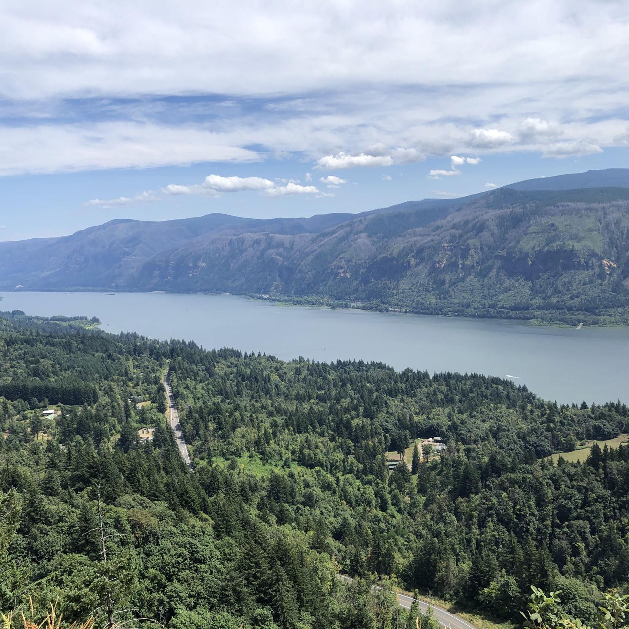
Road cycling in Washougal truly feels like riding at the western gateway to the Columbia River Gorge National Scenic Area. You'll find yourself surrounded by dramatic cliffs, lush forests, and expansive views of the Columbia River, with the Washougal River winding through the landscape. The terrain is wonderfully varied, from moderate loops near natural preserves like Steigerwald Lake to challenging climbs into the foothills of the Cascades. It's a region that rewards every pedal stroke with stunning scenery.
If you only do one ride, make it the Bridge of the Gods Ride, a challenging 62.1 miles (100.0 km) route that delivers extensive Columbia River Gorge views and is a firm favorite among local road cyclists. For something a bit less demanding but still incredibly rewarding, the Chanticleer Point – Crown Point loop from Troutdale offers a moderate 21.5 miles (34.7 km) through forested areas with more stunning river vistas. With over 450 road cyclists having explored Washougal's varied terrain using komoot, you're in good company. Start exploring your next adventure today!
Last updated: May 31, 2026
48
riders
100.0km
04:19
1,570m
1,570m
Hard road ride. Very good fitness required. Mostly well-paved surfaces and easy to ride.
5.0
(2)
14
riders
70.2km
02:57
1,150m
1,150m
Hard road ride. Very good fitness required. Mostly well-paved surfaces and easy to ride.

5.0
(1)
38
riders
34.7km
01:46
450m
450m
Moderate road ride. Good fitness required. Mostly well-paved surfaces and easy to ride.
5.0
(1)
31
riders
52.8km
02:28
420m
420m
Moderate road ride. Good fitness required. Some segments of this route may be unpaved and difficult to ride.
18
riders
41.1km
01:46
240m
240m
Easy road ride. Great for any fitness level. Mostly well-paved surfaces and easy to ride.
Get access to more routes and recommendations from other explorers.
Already have an account?
Our route recommendations are based on thousands of hikes, rides, and runs completed by other people on komoot.
Start today with a free account
Your next adventure awaits.
Popular around Washougal

Tips from the Community

The river is visible through the trees as you ride down the historic highway. The Sandy River begins at Reid Glacier on Mount Hood, and travels 56 miles to reach its confluence with the Columbia.
0
0

Round Lake Upper Dam in Camas holds back Round Lake and Lacamas Lake in Lacamas Park. It was built in 1883 for a paper mill; the wooden dam was replaced by a concrete and steel structure in 1935, which raised the lake level by about 12 feet. Today, this area is popular for fishing rainbow and brown trout, bluegill, and bass, while hikers and picnickers have access to benches, grills, and restrooms.
1
0
Round Lakes Upper Dam is an old dam that was built to provide power for a paper mill. There is currently a project in the works to create a fish passage.
0
0
Camas Heritage Park is on the south-east end of the popular Heritage Park trailhead, a 6.9-mile heavily trafficked out-and-back trail along Lacamas Lake. The trail is accessible year-round and welcomes dogs on leashes. The other trailhead is located on NE Goodwin Road in Camas. If you plan to swim, check for algae bloom updates here: https://www.cityofcamas.us/parksrec/page/heritage-park
0
0
The Sandy River Bridge, also known as the Troutdale Bridge of the East Historic Columbia River Highway Bridge, provides bikers with a separate lane away from dangerous traffic, offering a scenic view of the Sandy River. Construction began in 1912 as part of the Columbia River Highway project. Before the bridge, locals used Stark Street or a small ferry, which at one point had a mishap in 1912, when a large auto miscalculated its approach into the ferry and drove into the Sandy River.
1
0

Round Lake sits to the southeast of the larger Lacamas Lake. There's a park with picnic and grilling areas, as well as a trail that goes completely around the lake.
0
0

At Lacamas Lake, you can breathe in pine-scented air as you follow peaceful Heritage Trails. Surrounded by mature trees, this scenic lake is the perfect spot for kayaking and admiring nature. The park's well maintained landscape features beautiful ferns, water lilies, and wildflowers.
0
0

The Sandy River is a 56-mile river that flows into the Columbia River. The river starts at the Reid Glacier south of Mount Hood.
0
0
Frequently Asked Questions
How many road cycling routes are available around Washougal?
There are nearly 20 road cycling routes around Washougal, offering diverse experiences from moderate loops to challenging climbs. These routes are highly rated by the komoot community, with an average score of 4.2 stars from over 15 reviews.
What kind of terrain can I expect on road cycling routes in Washougal?
Road cycling routes in Washougal feature a variety of terrain, primarily characterized by the stunning Columbia River Gorge with its dramatic cliffs and lush forests. You'll find well-paved surfaces along the expansive Columbia River, scenic stretches near the Washougal River, and areas bordering natural preserves like Steigerwald Lake and Washougal Oaks Natural Area Preserve. Expect moderate to significant elevation changes on many routes.
Are there road cycling routes suitable for beginners in Washougal?
While many routes in Washougal are moderate to difficult, there are a few easier options available. These routes typically feature less elevation gain and shorter distances, making them suitable for those new to road cycling or looking for a more relaxed ride.
What are some challenging road cycling routes in the Washougal area?
For experienced road cyclists seeking a challenge, routes like the Bridge of the Gods Ride (62.1 miles with over 5,000 feet of elevation gain) offer extensive views of the Columbia River Gorge. Another difficult option is the Sandy River Loop, a 43.6-mile path winding through varied landscapes. The Dabney State Recreation Area – Chanticleer Point loop from Multnomah County is also a challenging 44.9-mile trail with significant climbs.
What scenic viewpoints or natural features can I see while road cycling in Washougal?
Road cycling in Washougal offers numerous scenic views, especially along the Columbia River Gorge. You can expect dramatic cliffs, lush forests, and the expansive Columbia River. Specific highlights include Crown Point, which offers panoramic vistas. Routes also pass by natural areas like Steigerwald Lake National Wildlife Refuge and the Washougal Oaks Natural Area Preserve, showcasing diverse ecosystems.
Are there any waterfalls accessible or visible from road cycling routes?
Yes, the Washougal area, particularly within the Columbia River Gorge, is known for its waterfalls. While cycling, you might catch glimpses or be near areas with waterfalls. Notable waterfalls in the vicinity include those at Guy W. Talbot State Park, Latourell Falls, and Shepperd's Dell Falls, which are popular attractions in the region.
Are there any family-friendly road cycling options in Washougal?
While many road cycling routes in Washougal involve significant distances and elevation, the region offers other family-friendly cycling opportunities. For instance, Hamllik Park features a Bike and Pump Skills Course, and the Washougal Waterfront Park & Trail provides a 12-foot-wide cement trail along the Columbia River, suitable for a relaxed family ride. For more information on local trails, you can visit visitwashougal.com.
What is the best time of year for road cycling in Washougal?
The best time for road cycling in Washougal is generally during the spring, summer, and early autumn months. During these seasons, the weather is typically mild, and the scenic beauty of the Columbia River Gorge and surrounding natural areas is at its peak. Winter can bring colder temperatures and rain, which might make some routes less enjoyable.
Are there any circular road cycling routes around Washougal?
Yes, many of the road cycling routes around Washougal are designed as loops, allowing you to start and end at the same point. An example of a moderate loop is the Round Lake – Lacamas Lake loop from Camas, which is about 33 miles long. These circular routes are convenient for exploring the region without needing to retrace your path.
Where can I find parking for road cycling routes in Washougal?
Parking availability varies by route. Many routes start from or pass through areas with public parking, such as parks or designated trailheads. For routes that begin in or near Washougal, you can often find parking in city parks or public lots. It's advisable to check the specific route details on komoot for recommended starting points and parking information.
Are there places to stop for food or drinks along the road cycling routes?
While specific cafes or pubs directly on every route may vary, Washougal and nearby towns like Camas offer various options for food and drinks. Many routes pass through or near these communities, providing opportunities to refuel. It's a good idea to plan your stops in advance or carry sufficient provisions, especially on longer routes that venture into more rural areas.
What are some notable natural areas that road cyclists can appreciate in Washougal?
Road cyclists in Washougal can appreciate several significant natural areas. The routes often provide views of the Columbia River Gorge National Scenic Area, with its dramatic landscapes. You'll also find roads near the Steigerwald Lake National Wildlife Refuge, known for its wetlands and riparian woodlands, and the Washougal Oaks Natural Area Preserve, which protects a unique Garry oak woodland. The Washougal River itself offers forested views and adds to the scenic beauty.
Most popular routes around Washougal
Most popular attractions around Washougal

Get inspired with the komoot mobile app


Explore more
Browse the best Road cycling routes in other regions.
