The best walks and hikes around Poulsbo
4.6
(12)
161
hikers
21
hikes
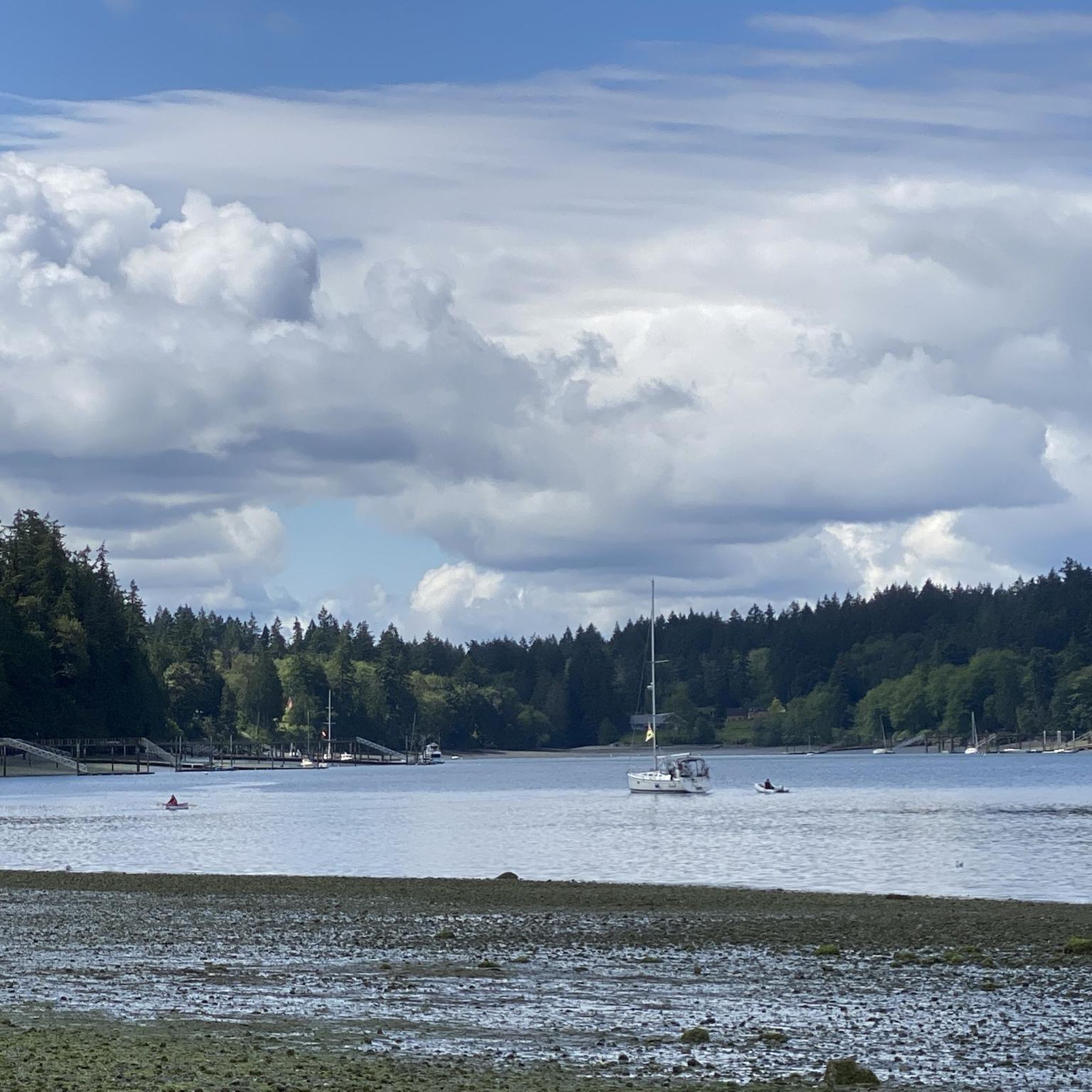
Hiking around Poulsbo offers access to diverse landscapes on the Kitsap Peninsula, characterized by lush inland forests and coastal environments. The region features views of the Olympic Mountains and, on clear days, Mount Rainier. Trails often wind through towering fir, maple, and cedar trees, and along Liberty Bay, estuaries, and creeks. This provides varied terrain from gentle paths to routes with moderate elevation gain.
Best hiking trails around Poulsbo
- The most popular hiking route is Battle Point Park and Grand Forest loops — Bainbridge Island, a 6.6 miles (10.6 km) trail that takes 2 hours 50 minutes to complete. This route combines forest paths with open parkland.
- Another top favourite among local hikers is Grand Forest East – Grand Forest West loop from Bainbridge Island, an easy 4.0 miles (6.5 km) path. This loop leads through dense woodlands, offering a serene forest experience.
- Local hikers also love the Grand Forest loops from Miller Road Northeast — Bainbridge Island, a 3.2 miles (5.2 km) trail leading through mature forests, often completed in about 1 hour 25 minutes.
- Hiking around Poulsbo is defined by dense woodlands, coastal views, and varied terrain. The network offers options for different ability levels, from easy strolls to moderate forest loops.
- The routes in Poulsbo are highly rated by the komoot community with an average score of 4.5 stars from over 10 reviews. More than 115 hikers have used komoot to explore Poulsbo's varied terrain.
Last updated: June 25, 2026
19
hikers
3.20km
00:49
10m
10m
If you're looking for a peaceful, easy stroll on Bainbridge Island, the Battle Point Trail delivers a delightful experience. This 2.0-mile (3.2 km) loop is mostly flat, with only 38 feet (11 metres) of elevation gain, making it a perfect 49-minute hike for all ages and abilities. You'll wander through lush forests of Douglas firs and western red cedars, past serene ponds and wetlands, and even cross a short boardwalk section. It's a fantastic spot to enjoy nature without a strenuous climb.
Accessing the Battle Point Trail is straightforward, with ample parking and accessible facilities at Battle Point Park. The park is well-equipped with restrooms and paved paths, ensuring a comfortable visit for everyone. You won't need any permits to enjoy this trail, and it's a great option for a casual walk any time of year, though spring and early summer bring particularly vibrant wetland wildlife.
Beyond its natural beauty, Battle Point Park holds historical significance as a former World War II naval radio transmission station. The trail also offers unique features like the Edwin E. Ritchie Observatory, located about 0.31 miles (0.5 km) in, providing a glimpse into the night sky. For families, a large playground and sports fields are situated around the 0.62-mile (1 km) mark, adding to the park's appeal as a versatile recreational hub.
5.0
(2)
9
hikers
5.39km
01:28
80m
80m
The Spine Line, Ravine Run, White Horse, and Boundary Trails Loop offers an easy hiking experience through dense forests of Douglas fir and western red cedar. You'll enjoy a serene environment, winding along a route that covers 3.4 miles (5.4 km) with a gentle elevation gain of 253 feet (77 metres). The "Ravine Run" section is a highlight, featuring a picturesque ravine and a charming wooden bridge over a babbling brook. This loop typically takes around 1 hour and 27 minutes to complete, making it a perfect short outing.
Planning your visit to this loop is straightforward. You will find parking readily available at the trailhead, located within North Kitsap Heritage Park. There are no specific warnings about closures or permits mentioned for this route, making it a convenient choice for a spontaneous outdoor adventure. This trail is generally accessible, so you can enjoy it without much prior planning.
As you hike, you can expect a diverse experience, with sections that offer panoramic views of the surrounding forest. On clear days, you might even spot the Olympic Mountains in the distance. The final stretch of the trail is particularly beautiful in autumn, when the foliage bursts with vibrant colors, adding to the scenic appeal of your journey.

Sign up for free
1
hikers
7.70km
02:08
140m
130m
The Olympic Resource G1900 and 1700 Loop offers a peaceful journey through the dense, moss-draped forests of the Olympic Peninsula. You'll follow forest roads that wind past towering Douglas firs and western hemlocks, providing a quiet, immersive experience in nature. While not a dramatic mountain trek, the route's charm lies in its serene woodland atmosphere, particularly as you pass through sections reminiscent of Port Gamble Forest Heritage Park.
This moderate 4.8-mile (7.7 km) hiking loop has a manageable 447 feet (136 metres) of elevation gain, taking about 2 hours and 7 minutes to complete. Since it utilizes forest roads, conditions can vary; always check Motor Vehicle Use Maps for the Olympic National Forest for current access and potential closures. Be prepared for varying road surfaces and carry essentials, as cell service can be unreliable in these more secluded areas.
Opting for less-trafficked forest roads like the G1900 and 1700 can provide a welcome escape from crowds, offering a chance for solitude and wildlife spotting. The region is known for Roosevelt Elk and Black Tail Deer, adding to the natural appeal. This route is a great way to experience the Olympic National Forest's diverse ecosystem without committing to a strenuous mountain ascent.
1
hikers
3.48km
00:57
50m
50m
The Hyperspace, Valley, and Ridge Loop offers an easy 2.2-mile (3.5 km) hike through a pleasant mix of forest environments. You will gain 171 feet (52 metres) over approximately 56 minutes, making it a perfect quick outing. As you hike, you'll experience varied scenery, from the narrow, almost enclosed sections of the Hyper Space Trail to more open views from the Ridgetrail. The route then descends into the quieter, denser vegetation of the Valleytrail, providing a refreshing walk. This easy loop is ideal for a quick escape into nature.
You can easily access the trail with parking available at designated trailheads within Port Gamble Forest Heritage Park. No special permits or fees are usually needed for day hiking on these routes, making it a hassle-free option. Before you head out, always check local park advisories for any temporary closures or changing conditions. This ensures you have the most up-to-date information for your visit. The trail is suitable for a quick morning or afternoon walk.
This route is a great way to experience the diverse terrain of Port Gamble Forest Heritage Park. It cleverly combines sections of the Hyper Space Trail, Valleytrail, and Ridgetrail into one cohesive loop. You get to see different aspects of the park's natural beauty in a single, manageable journey. It's a good example of how the park offers varied experiences for hikers.
969m
00:16
0m
30m
Discover the Poulsbo Wilderness Trail, an easy 0.6-mile (1.0 km) hike that offers a tranquil escape right in the heart of Poulsbo. You will gain only 4 feet (1 metres) in elevation, making it a gentle walk that takes about 15 minutes to complete. The route winds through dense forests filled with towering evergreens, creating a secluded atmosphere, and you will find small bridges crossing Dog Fish Creek as it flows alongside much of the path.
When planning your visit, remember that the trail is generally accessible for all skill levels, but it is a rugged dirt path. It can become muddy or
Get access to more routes and recommendations from other explorers.
Sign up for free
Already have an account?
Our route recommendations are based on thousands of hikes, rides, and runs completed by other people on komoot.
Start today with a free account
Your next adventure awaits.
Login or Signup

Tips from the Community

Port Gamble Forest Heritage Park is a 3,493-acre county park, making it the largest in Kitsap County. The park features miles of old service roads and trails, making it a popular spot for mountain bikers, trail runners, equestrians, and hikers.
0
0

Battle Point Park is a window into history, a haven for outdoor adventures, and a gateway to the unique charm of Bainbridge Island. So, discover the hidden wonders of this captivating waterfront spot!
1
0

The park, which spans 90.3 acres and includes two ponds, a jogging trail, two soccer fields, three softball fields, a pony area, a picnic shelter, two tennis courts, playgrounds, two basketball courts shared with a roller hockey court, a large children's play structure, garden plots, a disc golf course, and the Park District maintenance shop and offices, is largely open space. Gymnastics classes and camps are held in the recently restored Transmitter Building. The covered picnic shelter is popular, so call the Park District customer service line at 206-842-2302 to make a reservation.
0
0
Frequently Asked Questions
What types of landscapes can I expect to see while hiking around Poulsbo?
Hiking around Poulsbo offers a diverse range of landscapes, from lush inland forests with towering fir, maple, and cedar trees to scenic coastal environments along Liberty Bay. You'll often find trails winding through these woodlands, with opportunities to enjoy picturesque views of the Olympic Mountains and even Mount Rainier on clear days. Estuaries and creeks, like those found at Poulsbo Fish Park, also provide unique natural features and wildlife viewing.
Are there many easy hiking options available near Poulsbo?
Yes, the Poulsbo area is well-suited for easy hikes. The komoot community has identified 11 easy routes out of a total of 12 listed tours. Many trails offer gentle paths through forests or along the waterfront, making them accessible for various fitness levels. For example, the Grand Forest East – Grand Forest West loop from Bainbridge Island is an easy 6.5 km path through dense woodlands.
What do other hikers enjoy most about the trails near Poulsbo?
The trails around Poulsbo are highly rated by the komoot community, with an average score of 4.5 stars from over 10 reviews. Hikers frequently praise the serene forest experiences, the diverse terrain that includes both woodlands and coastal views, and the well-maintained paths. The opportunity to immerse oneself in nature, even close to downtown areas, is a common highlight.
Are there any trails suitable for families with children?
Many of the trails around Poulsbo are family-friendly, particularly those with easier grades and interesting features. Poulsbo Fish Park, for instance, offers various loops with boardwalks, ponds, and interpretive signage, making it an engaging option for children. The Grand Forest trails on Bainbridge Island, such as the Grand Forest West loop, provide shaded paths through towering trees, perfect for a nature walk with the family.
Can I find circular hiking routes in the Poulsbo area?
Yes, there are several excellent circular routes available. Many of the trails on Bainbridge Island, which are easily accessible from Poulsbo, are designed as loops. Examples include the Grand Forest loops from Miller Road Northeast and the Battle Point Park and Grand Forest loops, offering varied distances and scenery.
Are there any notable landmarks or attractions along the hiking trails?
Yes, several trails offer access to interesting landmarks and natural features. For example, the Fairy Dell lookout and Battle Point Park loop on Bainbridge Island provides views and access to Battle Point Park. The Grand Forest areas, including Grand Forest West, are attractions in themselves, known for their towering trees and serene atmosphere. Poulsbo Fish Park also features public art and wildlife viewing platforms.
What is the best time of year to go hiking near Poulsbo?
The Poulsbo area offers enjoyable hiking year-round, but each season has its unique charm. Spring brings wildflowers and lush greenery, while fall showcases vibrant foliage in the forests. Summer provides warm, sunny days perfect for coastal walks and forest shade. Even winter hiking can be pleasant, with the evergreen forests offering a peaceful, quiet experience, though some trails might be muddy.
Are there any trails with views of the Olympic Mountains or Mount Rainier?
Yes, many hiking areas around Poulsbo offer stunning views of the surrounding mountains. The town's location on the Kitsap Peninsula provides excellent vantage points for both the Olympic Mountains to the west and the majestic Mount Rainier to the southeast. Trails along Liberty Bay and in higher elevation sections of parks like Kitsap Memorial State Park often feature these breathtaking backdrops.
Are there any dog-friendly hiking trails in the Poulsbo area?
Many trails in the Poulsbo area are dog-friendly, allowing you to bring your leashed companion. The Grand Forest trails on Bainbridge Island are popular choices for dog walkers, offering ample space and natural surroundings. It's always a good idea to check specific park regulations before heading out, but generally, the region welcomes responsible dog owners.
Where can I find information about parking or public transport for trailheads?
While specific parking details vary by trailhead, many popular hiking spots like Poulsbo Fish Park and the Grand Forest areas on Bainbridge Island offer designated parking lots. For public transport, options might be more limited for direct trailhead access, especially for trails outside of downtown Poulsbo. For more detailed information on local transportation and parking, you might find resources on the Visit Poulsbo hiking page helpful.
Are there any trails that are wheelchair accessible?
Poulsbo Fish Park is known for its accessibility, featuring trails along the Liberty Bay Estuary that are mostly boardwalk or packed gravel, making them suitable for wheelchairs and strollers. While not all trails in the region are fully accessible, this park provides an excellent option for those seeking an inclusive outdoor experience.
What kind of wildlife might I encounter on the trails?
The diverse ecosystems around Poulsbo support a variety of wildlife. Along coastal trails and estuaries, particularly at Poulsbo Fish Park, you might spot marine wildlife like harbor seals and various bird species. In the dense forests, keep an eye out for local birds, small mammals, and occasionally deer. The region's natural beauty makes it a great spot for wildlife observation.
Most popular routes around Poulsbo
Most popular attractions around Poulsbo

Get inspired with the komoot mobile app


Explore more
Browse the best Hikes in other regions.
