The best road cycling routes around Madison Heights
5.0
(1)
170
riders
28
rides
Road cycling around Madison Heights, Michigan, is characterized by a generally flat landscape, making it accessible for various skill levels. The city features urban park trails and benefits from its proximity to broader regional greenways in the Metro Detroit area. While local parks offer paved paths for shorter rides, the primary appeal for dedicated road cyclists comes from connecting to the wider network of regional trails. This area provides a mix of urban and suburban cycling experiences.
Best road cycling routes around Madison Heights
- The most popular road cycling route in the region is a longer ride, such as the Onion Mountain Overlook – Peaks of Otter Lodge loop from Lynchburg, a 84.6 miles (136.2 km) trail that takes 7 hours 32 minutes to complete. This route features significant elevation gain, making it suitable for experienced cyclists.
- Another top favourite among local road cyclists is the James River – Hollins Mill Park loop from Lynchburg, a moderate 22.5 miles (36.2 km) path. This route offers a balanced ride with varied terrain and scenic views along the river.
- Local road cyclists also love the James River Overlook – Loveworks Sign loop from Lynchburg, a 37.8 miles (60.8 km) trail leading through diverse landscapes, often completed in about 2 hours 57 minutes.
- Road cycling around Madison Heights is defined by urban park trails, connections to regional greenways, and a predominantly flat terrain. The network offers options for different ability levels, from casual rides within parks to longer excursions on regional paths.
- The routes in Madison Heights are highly rated by the komoot community with an average score of 5.0 stars from over 3 reviews. More than 200 road cyclists have used komoot to explore Madison Heights's varied terrain.
Last updated: July 2, 2026
39
riders
136km
07:32
2,360m
2,360m
Hard road ride. Very good fitness required. Mostly well-paved surfaces and easy to ride.
17
riders
Moderate road ride. Great for any fitness level. Some segments of this route may be unpaved and difficult to ride.

Sign up for free
12
riders
36.2km
01:44
430m
420m
Moderate road ride. Good fitness required. Mostly well-paved surfaces and easy to ride.
11
riders
63.5km
03:06
710m
710m
Moderate road ride. Good fitness required. Mostly well-paved surfaces and easy to ride.
6
riders
101km
05:18
1,220m
1,220m
Hard road ride. Very good fitness required. Some segments of this route may be unpaved and difficult to ride.
Get access to more routes and recommendations from other explorers.
Sign up for free
Already have an account?
Our route recommendations are based on thousands of hikes, rides, and runs completed by other people on komoot.
Start today with a free account
Your next adventure awaits.
Login or Signup
Popular around Madison Heights


Tips from the Community

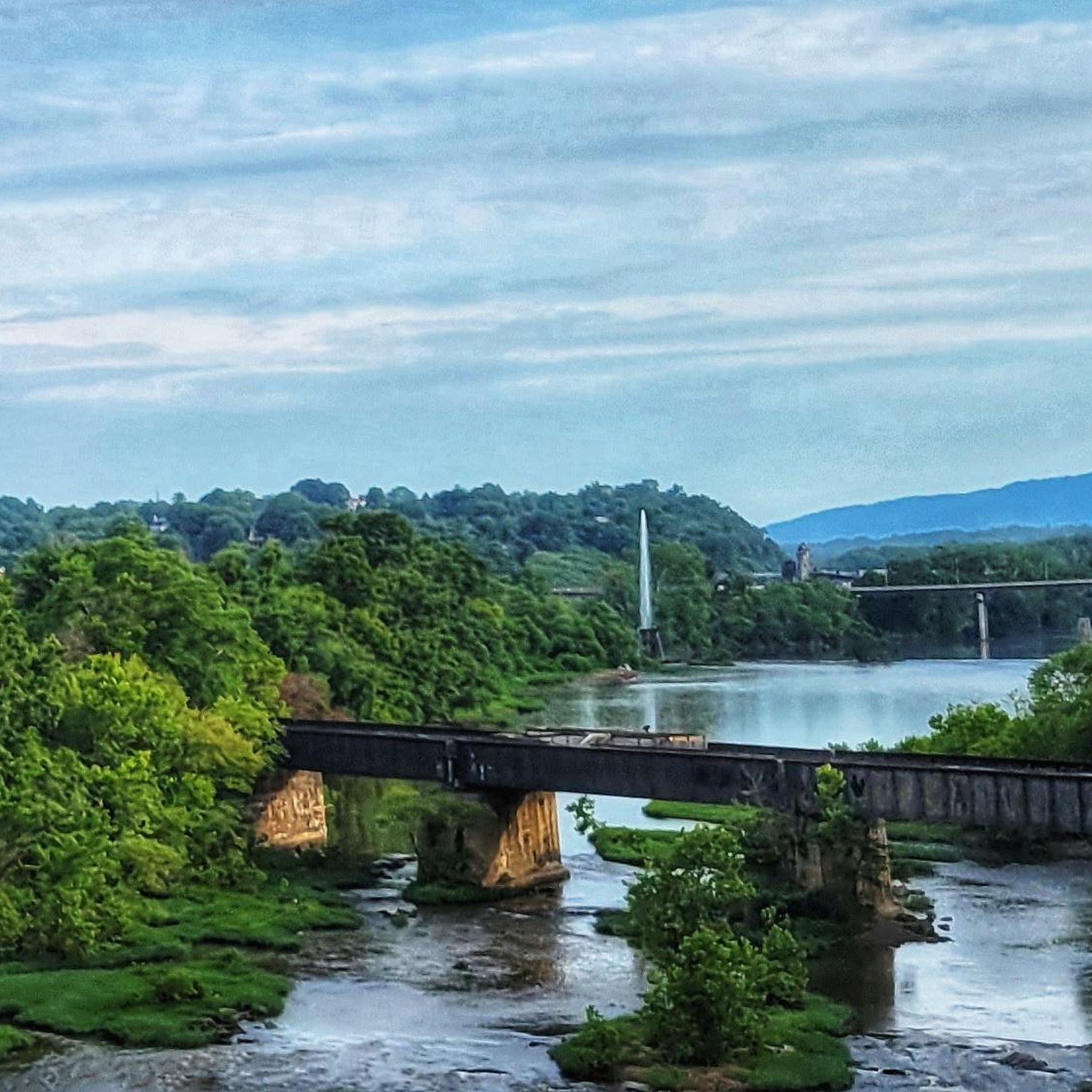
This spot on a nice bridge provides a stunning view of the James River, offering an unobstructed view of the water. It's a great place for a quick break, taking a few pictures, and continuing on your way.
0
0
This trail meanders along the James River through parks and urban river fronts on a nicely paved path, attracting hikers, runners, and bikers.
0
0

Bluffwalk, a series of walkways, overlooks, trails, and staircases, unfolds Lynchburg's distinctive terrain and architecture. This blend of art, views, experiences, and culture invites frequent visits, promising the discovery of something new each time.
0
0
In downtown along Percival's Island Trail, spot the LOVE sculpture between the parking lot and the pedestrian bridge. Capture a good view and enjoy a delightful ride along the ultimate urban/scenic RiverWalk trail.
0
0
A beloved destination, this park offers ample shade from large trees, ideal picnic spots, fishing access, and picturesque views of Blackwater Creek and the historic Hollins Mill Dam. Explore biking and walking trails, a lush open field, and public picnic tables.
0
0

Abbott Lake is located on the property of Peaks of Otter Lodge. There is a footpath point around the lake and a bunch of other trails leaving from the property. If you aren't looking to make a full stop, you can actually see the lake from the road as you ride by.
0
0
One of the more unique overlooks on the parkway in this part of Virginia, Thunder Ridge Overlook can be found at Milepost 74 on the Blue Ridge Parkway. It peers over the Arnold Valley and offers views to the south of Thunder Ridge, which the Appalachian Trail traverses on its way towards the state of North Carolina.
0
0
The Terrapin Mountain Overlook is located at Milepost 72.6 on the Blue Ridge Parkway and offers views of Terrapin Mountain, which runs parallel to the parkway. This gives you a view of the spine from the face-side. There are a lot of overlooks on the parkway in this area.
0
0
Frequently Asked Questions
What kind of terrain can I expect for road cycling around Madison Heights?
Road cycling around Madison Heights is characterized by a generally flat landscape, making it accessible for various skill levels. While local parks offer paved paths for shorter rides, the primary appeal for dedicated road cyclists comes from connecting to a broader network of regional trails in the Metro Detroit area. The terrain in Oakland County, where Madison Heights is located, is mostly flat, providing easy riding for many fitness levels.
Are there many road cycling routes available in the Madison Heights area?
Yes, komoot offers a selection of road cycling routes around Madison Heights. There are 28 routes in total, with 5 easy, 18 moderate, and 5 difficult options, catering to a range of experience levels.
What are some popular longer road cycling routes near Madison Heights?
For those seeking a longer challenge, the Onion Mountain Overlook – Peaks of Otter Lodge loop from Lynchburg is a popular choice, covering 84.6 miles (136.2 km) with significant elevation gain. Another favorite is the James River Overlook – Loveworks Sign loop from Lynchburg, a 37.8-mile (60.8 km) trail through diverse landscapes.
Are there any moderate road cycling routes for a balanced ride?
Absolutely. The James River – Hollins Mill Park loop from Lynchburg is a moderate 22.5-mile (36.2 km) path that offers a balanced ride with varied terrain and scenic views along the river. Another moderate option is the Hollins Mill Park – Loveworks Sign loop from Lynchburg, which spans 63.8 km.
What kind of natural features or landmarks can I expect to see while cycling?
While Madison Heights itself offers urban park trails, its proximity to regional trails provides access to diverse scenery. You can explore areas like the Clinton River Park Trail winding along the Clinton River, or the Detroit RiverWalk with views of the Detroit River and city skyline. Within Madison Heights, parks like Red Oaks Nature Center offer natural settings, and Civic Center Park features trails and picnic areas.
Are there family-friendly road cycling options in Madison Heights?
Yes, Madison Heights has several parks with paved paths suitable for shorter rides and family outings. Red Oaks Nature Center features a 1.3-mile paved trail, and Rosie's Park has a 1-mile jogging/walking trail. These provide accessible green spaces for casual recreation.
What do other road cyclists think about the routes in Madison Heights?
The routes in Madison Heights are highly rated by the komoot community, with an average score of 5.0 stars from over 3 reviews. More than 200 road cyclists have used komoot to explore the area's varied terrain, often praising the accessibility and connection to broader regional greenways.
What is the best time of year for road cycling in Madison Heights?
Road cycling is popular in and around Madison Heights, particularly during July and August when the weather is generally warm and favorable. The flat terrain makes it enjoyable for most of the year, though winter conditions would require appropriate gear and caution.
Are there any loop road cycling trails near Madison Heights?
Yes, many of the routes in the broader region are designed as loops. Examples include the James River Overlook – James River Heritage Trail loop from Lynchburg, a moderate 18.1 km ride, and the longer Onion Mountain Overlook – Peaks of Otter Lodge loop from Lynchburg.
Where can I find parking for road cycling routes in Madison Heights?
Many of the local parks in Madison Heights, such as Red Oaks Nature Center, Green Acres Park, Rosie's Park, and Civic Center Park, offer parking facilities. For regional trails like the Clinton River Park Trail or Dequindre Cut Greenway, specific trailheads often have designated parking areas. It's advisable to check the starting point of your chosen route for parking information.
Are there options for advanced road cyclists looking for a challenge?
Yes, while the immediate Madison Heights area is generally flat, the region offers routes with significant elevation for advanced cyclists. The Onion Mountain Overlook – Peaks of Otter Lodge loop from Lynchburg, for instance, is classified as difficult due to its length and substantial elevation gain, providing a demanding ride.
Can I connect to larger regional trail systems from Madison Heights?
Yes, Madison Heights benefits from its proximity to larger regional trail systems in the Metro Detroit area. These include the Clinton River Park Trail, the Dequindre Cut Greenway, and the Detroit RiverWalk, offering extensive paved paths for longer rides and varied scenery.
Most popular routes around Madison Heights

Get inspired with the komoot mobile app


