The best walks and hikes around West Valley City
4.6
(58)
989
hikers
72
hikes
Hiking around West Valley City is characterized by its geographical position between the Oquirrh Mountains to the west and the Wasatch Range to the east. The terrain encompasses paved urban paths and provides access to mountain trails within nearby canyons. The Jordan River flows through the area, creating a natural corridor with scenic views and riparian ecosystems. This offers a combination of accessible city walks and routes with significant elevation changes.
Best hiking trails around West Valley City
- The most popular hiking route is Utah State Capitol – Memory Grove Park loop from Gallivan Plaza, a 6.7 miles (10.8 km) trail that takes 3 hours 10 minutes to complete. This route combines city landmarks with park paths and includes a notable section of elevation gain.
- Another top favourite among local hikers is Walden Park to Cottonwood Park via Jordan River Parkway — Murray, Utah, an easy 2.1 miles (3.4 km) path. This is a mostly flat, paved trail that follows the Jordan River.
- Local hikers also love the Mountain View Corridor Trail — Kearns, a 3.1 miles (4.9 km) trail leading through a developed corridor, often completed in about 1 hour 20 minutes.
- Hiking around West Valley City is defined by extensive paved parkway systems, urban park loops, and access to the canyons of the Wasatch and Oquirrh mountains. The network of trails offers options for different ability levels.
- The routes in West Valley City are highly rated by the komoot community with an average score of 4.6 stars from over 40 reviews. More than 800 hikers have used komoot to explore West Valley City's varied terrain.
Last updated: October 10, 2026
5.0
(1)
10
hikers
3.65km
00:56
20m
20m
The Valley Regional Park Loop offers a delightful escape into nature, winding through magnificent oak woodlands and alongside a seasonal creek. You'll experience varied terrain, from the smooth, paved Valley of the Moon Trail to more rugged unpaved paths that climb into hillsides, revealing stunning viewpoints of the Sonoma Valley. In spring, the park bursts with colorful wildflowers like poppies and lupine, making it a particularly picturesque time for a visit.
This easy hiking route is incredibly accessible, covering 2.3 miles (3.7 km) with a minimal 56 feet (17 metres) of elevation gain, and can be completed in about 56 minutes. The park features accessible picnic areas and an off-leash dog park, making it a great option for family friendly hikes and dog friendly trails. While the main trail is paved and suitable for all, some unpaved sections offer a bit more challenge with uneven ground and gentle climbs.
Sonoma Valley Regional Park is notable for its ecological significance and its role as part of the Sonoma Valley Wildlife Corridor. It also provides a unique opportunity to witness nature's resilience, showcasing a landscape regenerating from the 2017 wildfires with much of its oak canopy still intact. This diverse trail system caters to a wide range of hikers, from those seeking easy strolls to those looking for slightly more technical sections.
2.89km
00:44
0m
0m
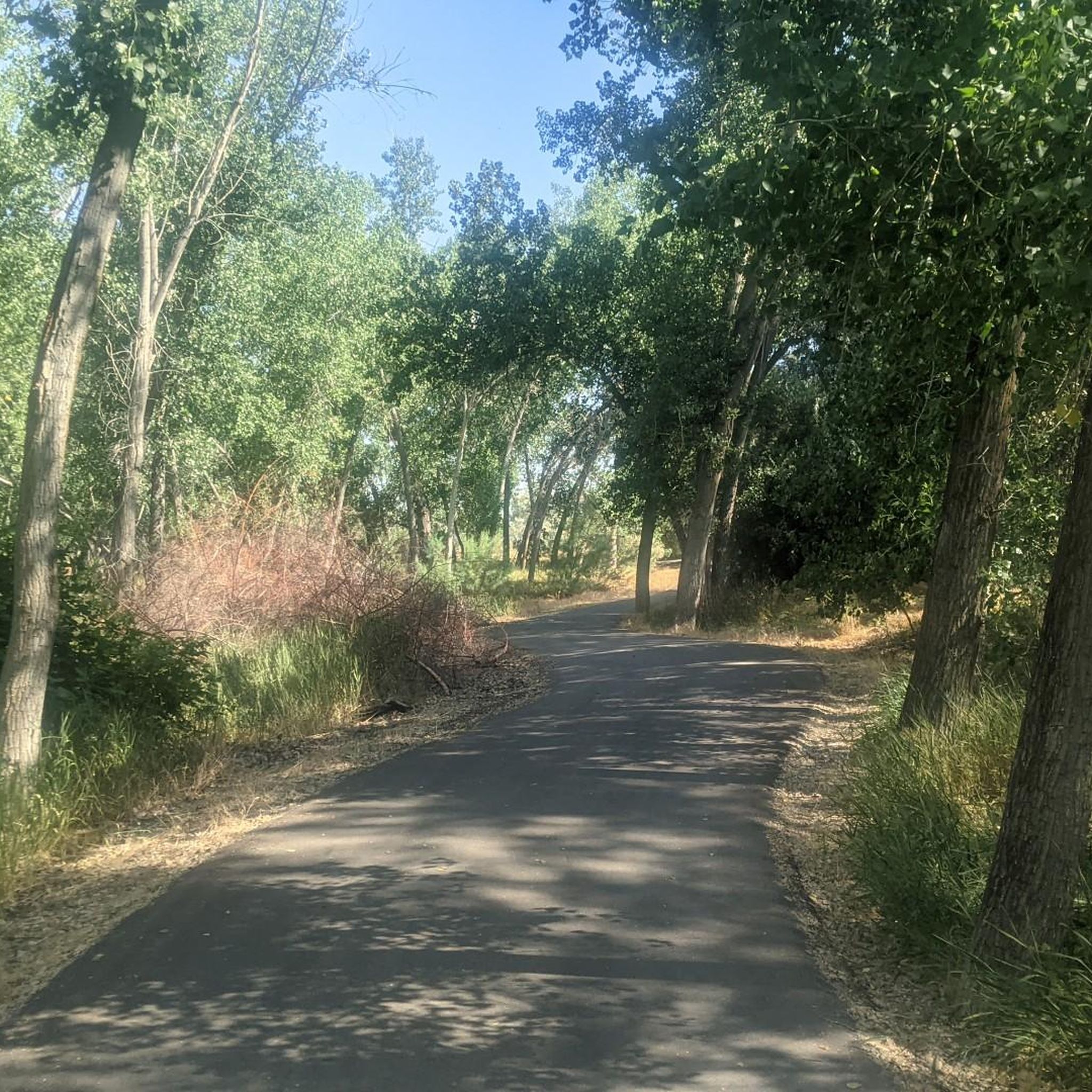
This segment of the Jordan River Parkway Trail offers a delightful, paved pathway that hugs the river, providing a refreshing urban green space. You'll find yourself strolling past General Holm Park and crossing the Pioneer Crossing Suspension Bridge, enjoying the gentle flow of the water and the surrounding parkland. It's a fantastic option for a quick nature fix without leaving the city.
Planning your visit to this easy 1.8-mile (2.9 km) route, which takes about 43 minutes to complete with a mere 3 feet (1 meter) of elevation gain, is simple. Parking is generally available near the trailhead, making it convenient for a spontaneous outing. This trail is suitable for year-round enjoyment, though a morning or evening walk can be particularly pleasant.
The Jordan River Parkway Trail is a vital green corridor, part of a much longer system that connects Utah Lake to the Great Salt Lake. It's renowned for its accessibility, making nature available to a vast urban population, and serves as an important habitat for various bird species and other wildlife, despite its urban setting.

3.38km
00:52
10m
10m
The Little Confluence Nature Trail offers a delightful, easy escape into nature right in Murray, Utah. You'll wander through restored wetlands and alongside the Jordan River, enjoying views of native cottonwood and willow trees, and perhaps spotting some local birdlife like ducks or orioles. The trail itself is a mix of gravel, dirt, and paved sections, leading you to the tranquil confluence of Little Cottonwood Creek and the Jordan River, making for a pleasant 2.1-mile (3.4 km) journey with only 38 feet (12 metres) of elevation gain, typically taking around 51 minutes.
Planning your visit is straightforward, with convenient parking available at Arrowhead Park and the Kennecott Nature Center. This route is very dog-friendly, provided your furry friend stays on a leash. As part of the larger Jordan River Parkway system, it offers easy connections and features amenities like a boat ramp and a picnic pavilion, perfect for a longer outing.
This trail is a testament to successful restoration efforts, transforming the area into a thriving ecological spot with removed invasive species and enhanced native vegetation. Beyond the abundant birdwatching opportunities, keep an eye out for beavers and muskrats, which have been observed in the area. Interpretive signage along the path provides fascinating insights into the local wildlife and conservation efforts, adding an educational layer to your easy hike.
705m
00:11
0m
0m
Explore the easy 0.4-mile International Peace Gardens Loop in Salt Lake City, a flat, paved path through diverse international gardens and a
62.8km
16:22
410m
470m
Hike the Mountain View Corridor Trail, a difficult 39.0-mile route in Utah, offering urban views framed by mountains and a significant worko
Get access to more routes and recommendations from other explorers.
Already have an account?
Our route recommendations are based on thousands of hikes, rides, and runs completed by other people on komoot.
Start today with a free account
Your next adventure awaits.

Tips from the Community

Nice view of the Jordan River. As the name suggests, the Jordan River Parkway follows the path of the river and gives you great views of the water at various points.
0
0

Easily accessible from Jordan River Parkway Trail, this small family-friend park is a good spot for a quick stop during your ride. It features open green spaces, picnic areas, and a playground.
1
0

Short wooden suspension bridge. This is just off the Jordan River trail and interesting to stop and see. Bikes must be walked on the bridge.
0
0
Starting at California Ave and heading south, the Mountain View Corridor has a bike path running adjacent to it. The path is paved and separated by a fence from the highway. It’s a great way to north/south on the western edge of Salt Lake County.
0
0

They only maintain the garden from May 1st through September 30th but it’s a cool garden.
1
0
Frequently Asked Questions
Are there easy, family-friendly hikes near West Valley City?
Yes, there are many options suitable for families. The Germania Park loop via Little Confluence Nature Trail is a very flat, 2-mile (3.3 km) walk that's great for all fitness levels. For a slightly longer but still easy outing, the Walden Park to Cottonwood Park section of the Jordan River Parkway is a paved, scenic choice.
Can I bring my dog on the trails?
Dog policies vary by trail and canyon. Many trails in the Wasatch Mountains have restrictions to protect the watershed. However, places like Millcreek Canyon are very popular with dog owners, offering designated on-leash and off-leash days. Always check the specific regulations for the trail you plan to hike before you go.
Are there any paved trails suitable for walking or running?
Absolutely. The area has an excellent network of paved paths. The Jordan River Parkway Trail is an extensive system offering miles of flat, scenic routes along the river. Another great option is the Mountain View Corridor Trail, a 3.1-mile (5 km) section known for its fantastic views of the Wasatch mountains.
Which hikes offer the best views of the valley?
For panoramic views, the Ensign Peak Trail is a local favorite. It's a short but steep hike that rewards you with a stunning overlook of Salt Lake City and the entire valley, especially at sunset. Another option is the Living Room Lookout Trail, which features unique sandstone formations and great city views.
What are some of the most difficult hikes in the area?
For experienced hikers seeking a challenge, the Wasatch Range offers several strenuous climbs. The trail to Mount Olympus is famously steep and demanding, gaining nearly 4,800 feet in elevation. Other difficult but rewarding hikes include the steep ascent to Lake Blanche and the West Face route up Grandeur Peak.
Are there any waterfall hikes near West Valley City?
Yes, the hike to Lower Bell's Canyon Falls is a popular choice. It's a moderately challenging 5.5-mile out-and-back trail that follows a beautiful stream, leading to a waterfall. The trail is located in Little Cottonwood Canyon, a short drive from West Valley City.
What kind of hiking is available in the Oquirrh Mountains?
The Oquirrh Mountains to the west offer a more rugged and less crowded hiking experience. Popular access points like Butterfield Canyon and Yellow Fork Canyon lead to trails through forests of conifers and aspens. Hikes range from relatively easy 4-mile round trips from the Butterfield Canyon summit to challenging ascents of peaks like Flat Top Mountain.
Are there any good circular walks or loop trails?
Yes, you can find several enjoyable loop trails. The Utah State Capitol – Memory Grove Park loop is a 6.7-mile (10.8 km) route that combines city sights with serene park paths. For a longer urban exploration, the 5.2-mile (8.3 km) Temple Square and Capital loop is another great moderate option.
How many hiking trails are there around West Valley City?
There are over 50 curated hiking routes to explore around West Valley City on komoot, ranging from easy paved paths to moderate mountain trails. The majority of these are rated as easy, making the area very accessible for casual walkers and families.
What do other hikers enjoy about the trails near West Valley City?
The area is highly regarded by the komoot community, with an average rating of 4.7 stars. Hikers often praise the incredible variety, from the accessible, paved parkway trails with mountain backdrops to the rugged, challenging climbs available in the nearby Wasatch and Oquirrh ranges.
When is the best time of year to hike around West Valley City?
Hiking is possible year-round, but the best seasons are typically late spring, summer, and fall. Summer is ideal for high-elevation trails in the Wasatch and Oquirrh mountains when they are free of snow. Spring brings vibrant wildflowers, while fall offers stunning foliage, especially in canyons with aspen groves. Lower elevation and paved trails can be enjoyed throughout the year.
Most popular attractions around West Valley City

Get inspired with the komoot mobile app


Explore more
Browse the best Hikes in other regions.
