The best running trails around Washington Terrace
5.0
(2)
404
runners
55
runs
If you've ever tried to plan jogging around Washington Terrace, you know how quickly the options can feel overwhelming. With so many trails, it's tough to tell which routes are genuinely worth your time and effort, and which are just filler. That's where komoot comes in. Our community has mapped, run, and reviewed these routes, and we've sifted through the dozens of options to bring you a curated shortlist of the very best, saving you the guesswork.
Jogging around Washington Terrace feels like a blend of scenic river corridors and accessible green spaces. You'll find everything from flat, paved paths along the Weber and Ogden Rivers to more challenging climbs into canyon landscapes. The distant mountain views are a constant, beautiful backdrop, and routes range from easy loops to difficult trails with significant elevation gain. While many trails are year-round, spring and fall offer particularly pleasant mild temperatures for exploring.
If you only do one, make it the Waterfall – Malans Peak Halfway Viewpoint loop from Weber State University. This difficult 13.4 miles (21.5 km) route offers significant elevation gain and truly spectacular canyon views, making it a big payoff for your effort. For something a bit more accessible, the Running loop from Weber State University is a moderate 3.1 miles (5.0 km) that’s perfect for a quick, urban-adjacent run. Dive in and discover why more than 300 runners have already explored Washington Terrace with komoot.
Last updated: June 1, 2026
5.0
(2)
10
runners
4.98km
00:33
100m
100m
This popular jogging route offers a refreshing escape right from the Weber State University campus, winding through diverse terrain. You'll experience a mix of paved and dirt paths, with sections meandering through groves of Gambel oak and juniper trees. The trail provides excellent views of Stewart Stadium and the majestic Ben Lomond, especially in the morning sun, making it a scenic running route near Weber State University.
Accessing the trail is easy, as it starts directly from the university campus, offering convenient parking for running trails near Weber State University. The route is accessible year-round, so you can enjoy it in any season. While rated moderate, it's generally considered suitable for all skill levels, making it a great option for beginner jogging routes near Weber State University.
Beyond just a run, this loop is part of an educational trail system, incorporating elements like the Discovery Loop's interpretive science stations. These stations provide insights into the local geology, biology, and wildlife of the Wasatch Front. It's a unique way to combine your workout with learning about the natural environment, and it also connects to other regional trails like the Bonneville Shoreline Trail.
13
runners
15.8km
01:44
40m
40m
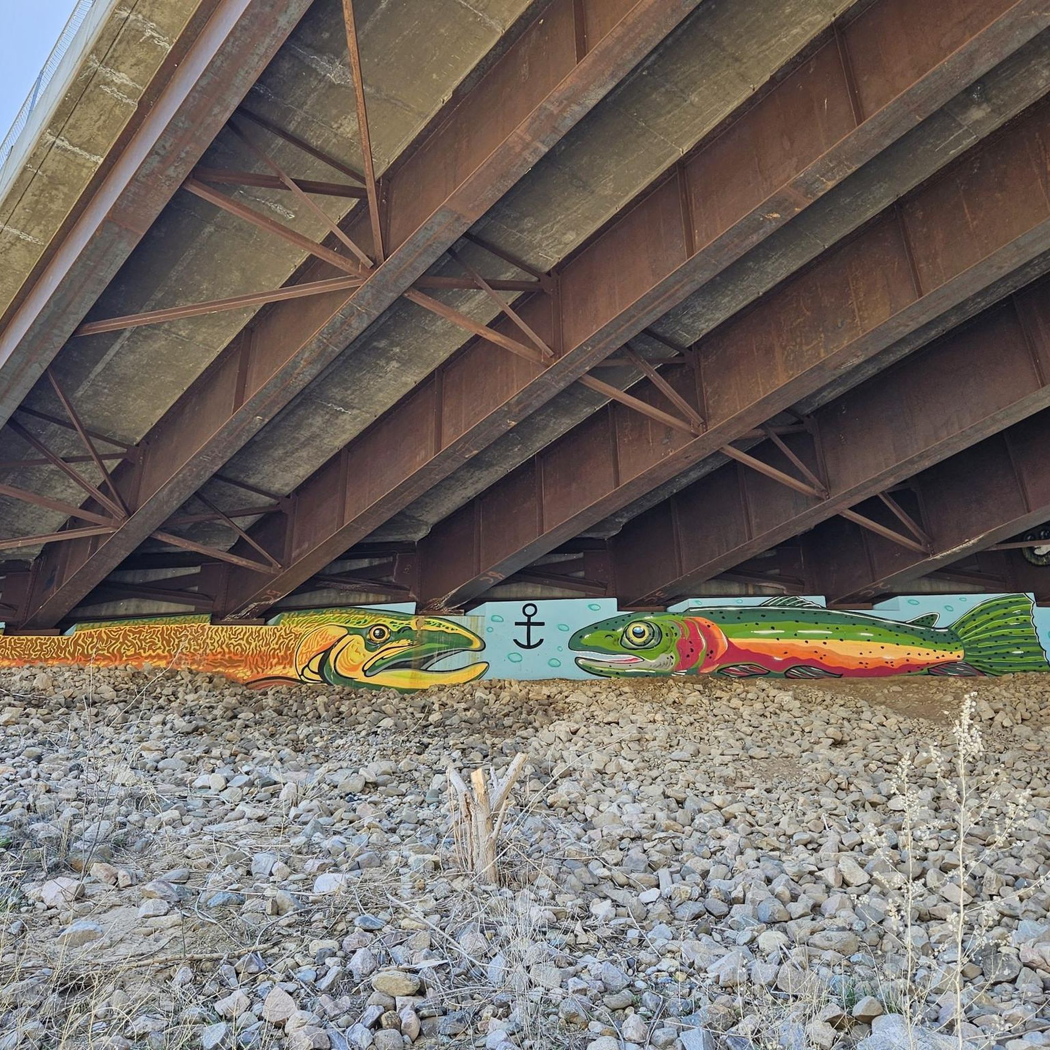
The Pretty artwork under the bridge loop from Roy offers a distinctive jogging experience, transforming a long run into an outdoor art gallery. You'll follow the paved Lansing River Trail, enjoying scenic views of the Grand River and Red Cedar River, while encountering vibrant murals and installations. Look for Amadeus Roy's 'Odyssey on the River' under the I-496 bridge, a highlight of the ArtPath exhibition, alongside other dynamic sculptures and colorful murals by artists like Brian Whitfield.
This route is a substantial 9.8-mile (15.8 km) jogging loop with a difficult rating, involving 129 feet (39 metres) of elevation gain and taking approximately 1 hour and 44 minutes. While the trail is mostly flat and paved, some sections may require attention due to maintenance needs. It's best suited for joggers seeking a longer, engaging run with cultural appeal, and it's generally accessible with various parking options along the trail.
What truly sets this trail apart is its integration with the ArtPath exhibition, turning a regular jog into an immersive cultural journey. The artwork, often inspired by local history and the natural surroundings, adds a unique layer to the experience. This trail is a fantastic way to explore the local art installations under bridges and through parks, offering a different perspective on the Roy jogging area trails.

Sign up for free
13
runners
21.5km
03:11
1,010m
1,010m
Embark on a demanding journey through diverse terrain on the Waterfall – Malans Peak Halfway Viewpoint loop, a popular jogging route that starts near Weber State University. You'll navigate shaded canyon paths, encounter the impressive 300-foot Malan's Waterfall, and push through steep ascents to reach the Halfway Viewpoint, which offers sweeping vistas of the Ogden Valley and the Great Salt Lake. This trail is a true test of endurance, rewarding your efforts with stunning natural beauty.
Access to this difficult 13.4-mile (21.5 km) loop, which involves 3319 feet (1012 metres) of elevation gain and takes about 3 hours and 10 minutes, is typically from trailheads like 27th or 29th Street in Ogden. The path is generally easy to follow, but expect uneven ground and some stream crossings. Be mindful of snakes, especially near the Halfway Viewpoint, and consider visiting in spring for wildflowers or autumn for fall colors.
Beyond the physical challenge, this route offers a glimpse into local history; Malans Peak is named after Bartholomew "Tim" Malan, who once operated a resort in the basin. The trail's consistent steepness makes it a favorite for experienced trail runners and is even part of the Trails Foundation of Northern Utah's Peak Challenge, highlighting its reputation as a significant workout in the region.
17
runners
26.4km
02:44
50m
50m
The Weber River Parkway – Ogden River loop from South Ogden offers a fantastic long-distance jogging experience, winding through urban greenbelts and lush riparian zones. You'll follow the curves of both the Weber and Ogden Rivers, enjoying picturesque views and the chance to spot local wildlife like deer and various bird species. The trail is mostly paved, with some gravel sections, and passes by points of interest such as the Ogden Nature Center and Fort Buenaventura Park, providing a refreshing escape into nature.
This route is rated difficult primarily due to its length of 16.4 miles (26.4 km), which takes approximately 2 hours and 43 minutes to complete, rather than challenging terrain. With only 178 feet (54 metres) of elevation gain, it's a great option for experienced joggers looking for a sustained effort on a relatively flat surface. Be mindful that some underpasses might have water pooling after heavy rains or during high runoff periods.
This interconnected trail system is a significant part of the larger Centennial Trail, offering excellent connectivity for extended runs and walks. It's known for its accessibility, welcoming joggers, walkers, and cyclists, and is also dog-friendly. The historical significance of the Weber River and the natural beauty of the riverbanks, especially vibrant with wildflowers in spring and summer, make this a notable natural feature among jogging trails in South Ogden Utah.
13
runners
19.2km
02:00
40m
40m
Hard run. Very good fitness required. Mostly paved surfaces. Suitable for all skill levels.
Get access to more routes and recommendations from other explorers.
Sign up for free
Already have an account?
Our route recommendations are based on thousands of hikes, rides, and runs completed by other people on komoot.
Start today with a free account
Your next adventure awaits.
Login or Signup



Tips from the Community

A great park that includes a couple of features including an engineered kayak wave. This has a convenient exit ramp for getting out of the water. Public Restrooms are just slightly down the road where there is also a bowery to eat, etc.
0
0
This is a great option for a walk and even bringing fishing equipment. You have access to the pond as well as the river. The path is getting a little older, so be prepared for bumps and cracks, but still in decent condition. A great location to take a break for 30 minutes or even a few hours.
0
0

Access path with your feet in the water
0
0

Weber River Parkway is a paved trail running alongside the beautiful Weber River in West Ogden. The trail goes through several parks including Fort Buenaventura. To the north, the parkway connects to Ogden River Parkway heading east. To the south, it becomes South Weber River Drive.
0
0

The 21st Street Pond in Ogden also goes by the name Goode Ski Lake. The path around the lake is popular for walking and fishing, but it serves as a great connector trail if you're on your bike, too.
0
0

There's a loop trail around this pond that you can share with walkers and cyclists; it's also a nice connector for linking up with other nearby trails.
0
0
The 21st Street Pond in Ogden also goes by the name Goode Ski Lake. The path around the lake is popular for walking and fishing, but it serves as a great connector trail if you're on your bike, too.
0
0
Frequently Asked Questions
How many running routes are available in Washington Terrace?
Washington Terrace offers a wide variety of running experiences, with over 50 routes available for jogging. These routes cater to different preferences, including easy loops, moderate paths, and challenging trails.
What types of terrain can I expect on jogging routes around Washington Terrace?
You'll find a diverse range of terrain for running in Washington Terrace. Many routes feature well-maintained paved paths, especially along the scenic river parkways like the Weber River Parkway and Ogden River Parkway. You can also find trails through green spaces, around ponds, and more challenging routes with significant elevation gain through canyon landscapes.
Are there easy running routes suitable for beginners or a relaxed jog?
Yes, Washington Terrace has several easy running routes perfect for beginners or those looking for a relaxed jog. There are at least 4 easy routes available, often found in local parks or along flatter sections of the river parkways. Victory Park, for instance, offers well-designed trails suitable for a gentle run.
What are some challenging running trails in the Washington Terrace area?
For those seeking a challenge, Washington Terrace offers numerous difficult running trails. One option is the Waterfall loop from Weber State University, which spans nearly 10 miles (15.9 km) and features over 700 meters of elevation gain. Another challenging route is the Pretty artwork under the bridge loop from Washington Terrace, a 13.2-mile (21.3 km) route with notable elevation changes.
Are there any scenic running routes that pass by water features or natural attractions?
Absolutely! The area is rich with scenic routes along water. The Weber River Parkway and Ogden River Parkway offer picturesque runs alongside the rivers. You can also enjoy a scenic jog around the 21st Street Pond (Goode Ski Lake), which is known for birding and fishing, providing a tranquil natural setting.
What do other runners say about the jogging routes in Washington Terrace?
The running routes in Washington Terrace are highly regarded by the komoot community, boasting an average rating of 5.0 stars. Runners often praise the natural beauty, well-maintained pathways, and the variety of terrain that allows for different running experiences, from serene park loops to challenging river and canyon trails.
Are there any dog-friendly running trails in Washington Terrace?
Many of the trails and parkways in and around Washington Terrace are dog-friendly, making it a great place to run with your canine companion. The Weber River Parkway and Ogden River Parkway are popular choices for runners with dogs. Always ensure your dog is on a leash and follow local regulations regarding pet waste.
Which running routes are suitable for families with children?
For families, Victory Park is an excellent choice, offering well-designed trails and a playground. The paved paths around the 21st Street Pond are also suitable for families, providing a flat and scenic environment. These locations offer a safe and enjoyable experience for all ages.
Are there any specific landmarks or points of interest I can see while running?
Yes, several routes offer interesting sights. The Weber River Parkway and Ogden River Parkway not only provide natural beauty but also pass through various parks. The 21st Street Pond is a notable spot for birdwatching. For a more urban experience, some routes might take you near the Ogden City Center.
Are there running routes with good parking access in Washington Terrace?
Many popular running spots in Washington Terrace offer convenient parking. Victory Park, for example, has a dedicated parking lot. The various access points along the Weber River Parkway and Ogden River Parkway also typically have parking available, making it easy to start your run.
Can I access running trails in Washington Terrace using public transport?
While specific public transport access varies by trail, Washington Terrace and the surrounding Ogden area are served by public transportation. It's advisable to check local bus routes and schedules to find the most convenient stops near your desired running trail, especially for routes along the major parkways which often have stops nearby.
Most popular attractions around Washington Terrace

Get inspired with the komoot mobile app


Explore more
Browse the best Running Trails & Routes in other regions.
