The best running trails around Uintah
5.0
(2)
467
runners
40
runs
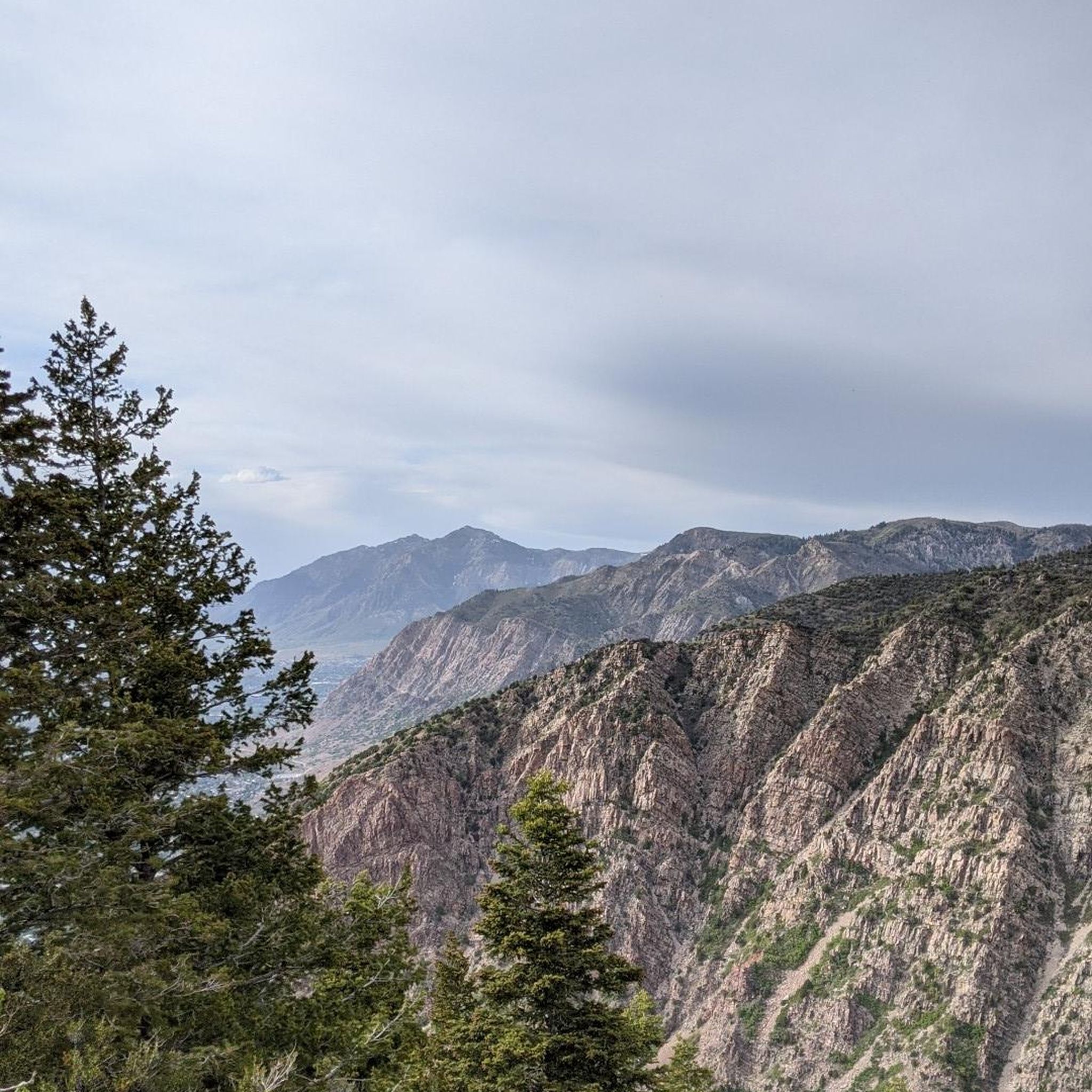
Jogging routes around Uintah traverse a diverse landscape, from high-altitude mountain wilderness to rolling sagebrush plains. The region is characterized by the Uinta Mountains, the highest range in Utah, featuring alpine environments and numerous natural lakes. Runners can experience varied terrain, including forested mountains and dramatic rock formations carved by ancient geological events. This blend of high desert and mountainous environments offers a wide range of running experiences.
Best jogging routes around Uintah
- The most popular jogging route is Bonneville…
Last updated: October 15, 2026
5
runners
5.07km
00:43
200m
200m
Hard run. Good fitness required. Sure-footedness, sturdy shoes and alpine experience required.
15
runners
21.5km
03:11
1,010m
1,010m
Hard run. Very good fitness required. Mostly paved surfaces. Suitable for all skill levels.

11
runners
21.3km
02:15
170m
170m
Hard run. Very good fitness required. Mostly paved surfaces. Suitable for all skill levels.
5
runners
Hard run. Very good fitness required. Mostly paved surfaces. Suitable for all skill levels.
6
runners
4.87km
00:38
90m
90m
Easy run. Great for any fitness level. Mostly paved surfaces. Suitable for all skill levels.
Get access to more routes and recommendations from other explorers.
Already have an account?
Our route recommendations are based on thousands of hikes, rides, and runs completed by other people on komoot.
Start today with a free account
Your next adventure awaits.



Tips from the Community

A great park that includes a couple of features including an engineered kayak wave. This has a convenient exit ramp for getting out of the water. Public Restrooms are just slightly down the road where there is also a bowery to eat, etc.
0
0
This is a great option for a walk and even bringing fishing equipment. You have access to the pond as well as the river. The path is getting a little older, so be prepared for bumps and cracks, but still in decent condition. A great location to take a break for 30 minutes or even a few hours.
0
0

Access path with your feet in the water
0
0

Weber River Parkway is a paved trail running alongside the beautiful Weber River in West Ogden. The trail goes through several parks including Fort Buenaventura. To the north, the parkway connects to Ogden River Parkway heading east. To the south, it becomes South Weber River Drive.
0
0

The 21st Street Pond in Ogden also goes by the name Goode Ski Lake. The path around the lake is popular for walking and fishing, but it serves as a great connector trail if you're on your bike, too.
0
0

The Bonneville Shoreline Trail is a trail system in Utah, that follows the ancient shoreline of Lake Bonneville. With a total length of over 280 miles, this section in Layton is just a very small part of the multi-use trail. The marked section passes multiple little creeks and leads through beautiful landscape.
0
0

There's a loop trail around this pond that you can share with walkers and cyclists; it's also a nice connector for linking up with other nearby trails.
0
0
The 21st Street Pond in Ogden also goes by the name Goode Ski Lake. The path around the lake is popular for walking and fishing, but it serves as a great connector trail if you're on your bike, too.
0
0
Frequently Asked Questions
How many running trails are available in Uintah?
Uintah offers a wide selection of running routes, with over 40 trails available for various skill levels. These include easy paths, moderate runs, and challenging climbs through diverse landscapes.
What kind of terrain can I expect on running routes in Uintah?
Jogging routes in Uintah feature incredibly diverse terrain. You can expect everything from high-altitude alpine environments in the Uinta Mountains to rolling sagebrush plains, forested mountains, and dramatic rock formations. The region offers a blend of high desert and mountainous running experiences.
Are there running routes suitable for beginners in Uintah?
Yes, Uintah has several easy running routes perfect for beginners. For example, the Kays Creek Parkway and Hobbs Reservoir Loop is an easy 2.8-mile path offering a scenic run with gentle gradients.
What are the best times of year for jogging in Uintah?
The best times for jogging in Uintah are generally spring, summer, and fall, when trails are clear of snow and temperatures are pleasant. High-altitude trails in the Uinta Mountains are typically accessible from late spring through early fall. Winter running is possible, but conditions can be challenging, especially at higher elevations.
Are there any challenging running trails for experienced runners?
Absolutely. Uintah is home to many challenging trails, particularly in the Uinta Mountains. Routes like the Bonneville Shoreline Loop offer varied terrain with significant elevation gain. For a true wilderness experience, the High Uinta Wilderness provides strenuous and remote options, with trails often above 10,000 feet.
Are there any scenic viewpoints or natural landmarks along the running trails?
Yes, Uintah's trails are rich with scenic viewpoints and natural landmarks. You can find dramatic rock formations, pristine alpine lakes, and panoramic mountain vistas. The Bonneville Shoreline Trail is known for its views, and the region's geological history provides stunning backdrops for your run.
Can I find running routes that pass by waterfalls in Uintah?
Yes, you can find trails that lead to beautiful waterfalls. The Adams Canyon Waterfall is a notable natural attraction in the area, offering a rewarding destination for a run or hike.
Are there trails that offer views of lakes or rivers?
Many running routes in Uintah feature stunning views of lakes and rivers. The Uinta Mountains alone boast over 1,000 natural lakes, and the Green River carves impressive canyons. The 21st Street Pond (Goode Ski Lake) is another beautiful spot you might encounter on a run.
Are there family-friendly jogging routes in Uintah?
Yes, Uintah offers several family-friendly jogging routes. These typically feature gentler gradients and well-maintained paths, making them suitable for all ages. Uintah City Park also provides a peaceful retreat with accessible paths for a relaxed family run.
Can I bring my dog on the running trails in Uintah?
Many trails in Uintah are dog-friendly, but it's always best to check specific trail regulations before heading out. Always ensure your dog is on a leash and that you clean up after them to preserve the natural environment for everyone.
Are there circular running routes available in Uintah?
Yes, Uintah features numerous circular running routes. For instance, the East Mountain Wilderness Park loop from Antelope Drive Park-and-Ride Lot is a popular 12-mile circular trail that takes you through beautiful wilderness parkland.
Is parking available near the running trails in Uintah?
Parking is generally available near many of Uintah's running trails, especially at trailheads and designated access points. For routes like the East Mountain Wilderness Park loop, there are specific park-and-ride lots designed for trail access.
What makes Uintah a unique destination for trail running?
Uintah's uniqueness for trail running stems from its combination of high-altitude mountain wilderness, diverse geological formations, and extensive trail systems. It's the only major east-west oriented mountain range in the contiguous U.S., offering pristine alpine environments, over 1,000 natural lakes, and the opportunity for solitude amidst breathtaking scenery.
What do other runners say about the trails in Uintah?
The running routes in Uintah are highly rated by the komoot community, with an average score of 5.0 stars from over 3 reviews. Runners often praise the varied terrain, the stunning natural beauty, and the wide range of options available for different ability levels.
Most popular routes around Uintah
Most popular attractions around Uintah

Get inspired with the komoot mobile app


Explore more
Browse the best Running Trails & Routes in other regions.
