The best walks and hikes around South Ogden
4.5
(25)
415
hikers
48
hikes
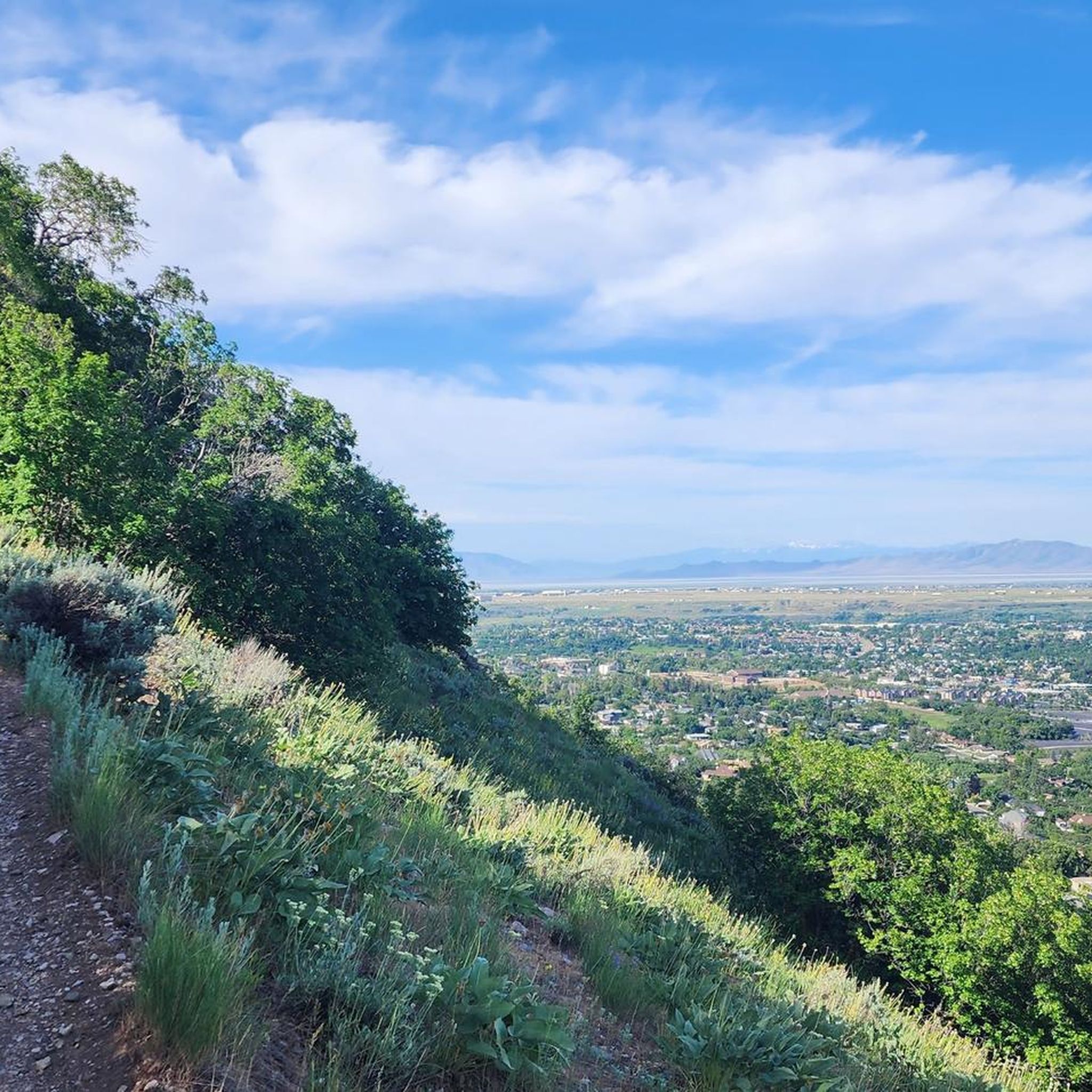
Hiking around South Ogden is characterized by its location at the foot of the Wasatch Mountains. The terrain primarily consists of trails that ascend into canyons, often following creeks and passing through scrub oak and maple trees. Routes range from accessible paths near the city to more strenuous ascents into the Uinta-Wasatch-Cache National Forest. The area offers a variety of options for hikers exploring its diverse natural landscape.
Best hiking trails around South Ogden
- The most popular hiking route is Waterfall Canyon Trail, a 1.6 miles (2.6 km) trail that takes around 1 hour 8 minutes to complete. The route involves a steady climb that leads to a 200-foot waterfall.
- Another top favourite among local hikers is Gib's Loop Trail, a moderate 5.2 miles (8.4 km) path. This route features diverse scenery and varied terrain.
- Local hikers also love the Weber River Parkway Trail, a 3.0 miles (4.8 km) trail leading through riverine landscapes, often completed in about 1 hour 13 minutes.
- Hiking around South Ogden is defined by canyon ascents, creek-side paths, and trails leading to mountain viewpoints. The trail network provides options for different ability levels, from moderate canyon hikes to longer river routes.
- The routes in South Ogden are highly rated by the komoot community with an average score of 4.3 stars from over 20 reviews. More than 300 hikers have used komoot to explore South Ogden's varied terrain.
Last updated: June 28, 2026
1
hikers
2.64km
01:08
350m
10m
The Waterfall Canyon Trail near Ogden, Utah, offers a dynamic hiking experience, transitioning from a wide path to a steep, rocky ascent. You'll wind through scrub oak forests and past exposed rock formations, with stunning views of the Ogden Valley unfolding as you climb. The highlight is undoubtedly the powerful 200-foot waterfall, a majestic sight that transforms with the seasons, from a roaring cascade in spring to a frozen curtain in winter.
This moderate 1.6-mile (2.6 km) out-and-back route involves a significant 1154 feet (352 metres) of elevation gain, taking about 1 hour and 8 minutes to complete. The final quarter-mile requires some rugged scrambling over rocks, so wear appropriate hiking footwear. It's a popular trail, especially on weekends, so consider an early start to enjoy a more peaceful experience.
What makes this trail particularly notable is its impressive waterfall, a powerful natural display accessible year-round. Its proximity to Ogden and the rewarding views of the city and surrounding mountains contribute to its appeal, making it a well-loved spot for a quick, impactful escape into nature. The trail is often considered suitable for families with older children who are comfortable with a challenging climb.
3
hikers
8.42km
02:24
170m
220m
The Gib's Loop Trail offers a delightful journey through varied landscapes, from shaded forest paths to open meadows, with views that occasionally peek over a golf course. You'll find a true highlight about 1.2 miles in at Waterfall Canyon, where a refreshing cascade provides a perfect spot to pause and enjoy nature. The terrain is a mix of dirt, rock, and gravel, making for an engaging experience that feels like a proper hike without being overly demanding.
Planning your visit is straightforward, as the trailhead is located near Mount Ogden Park, which even has a playground and restrooms. Leashed dogs are welcome, and recent improvements like new signage make navigation easy. This trail is suitable for families and offers a moderate challenge, making it a great choice for a morning or afternoon outing.
This route is notable for honoring Gilbert "Gib" Wallace, who dedicated years to surveying and building many trails along the Ogden hillside. It also connects with the Bonneville Shoreline Trail, offering options for longer adventures if you're feeling ambitious. Keep an eye out for local wildlife like deer and various bird species, especially during the quieter times of day.

Sign up for free
4.81km
01:13
0m
20m
The Weber River Parkway Trail offers a refreshing urban greenbelt experience, following the scenic Weber River. You'll enjoy views of native plants, cottonwoods, and willows, with opportunities for wildlife spotting, including various birds and waterfowl. This easy 3.0-mile (4.8 km) route has a minimal 7 feet (2 metres) of elevation gain and takes about 1 hours and 12 minutes, making it a perfect, gentle escape.
This multi-use trail is highly accessible, with well-maintained paved and gravel sections suitable for walking, running, biking, and even wheelchairs or strollers. While you might encounter some noise from nearby roads, the trail provides a pleasant outdoor experience. Dog owners should remember to keep pets leashed and clean up after them. Spring and summer are particularly vibrant times to visit, with wildflowers in full bloom.
Historically significant, the Weber River was vital to Native American tribes and early settlers, with informational plaques along the trail providing insights into this rich past. The trail also connects to the Ogden River Parkway, creating a longer continuous system, and passes by points of interest like the Ogden Nature Center and Fort Buenaventura Park, making it a crucial recreational asset in the region.
968m
00:15
10m
10m
The Glassman Pond Trail offers a delightful, easy 0.6-mile (1.0 km) loop around its namesake pond, perfect for a quick nature fix. You'll enjoy a serene walk through wooded areas, spotting native Utah flora like sagebrush and juniper, with the tranquil pond often adorned with lily pads as the central scenic feature. Despite its minimal 18 feet (5 metres) of elevation gain, some parts can be uneven or muddy, so sturdy footwear is a good idea for this 15-minute hike.
Planning your visit is straightforward, with ample parking and picnic tables available at Glassman Pond Park. While one access point involves a 26-foot staircase, a flatter alternative is available, making it accessible for all. Dogs are welcome to join you on the trail, provided they are kept on a leash, ensuring a pleasant experience for everyone.
Beyond being a lovely hiking spot, Glassman Pond is a well-known fishing destination, stocked with rainbow trout, bluegill, and largemouth bass, complete with multiple fishing docks. The area also holds historical significance as a vital water source for indigenous peoples and early settlers, with remnants of old irrigation systems still visible near the trail.
86.8km
22:00
180m
190m
The Weber River Parkway Trail offers an expansive journey through a vital urban green space, following the winding course of the Weber River. You'll experience a mix of paved and gravel terrain, often feeling immersed in nature with cottonwoods, willows, and wildflowers lining the path, and opportunities to spot local wildlife. Despite its impressive length of 54.0 miles (86.8 km) and a 22-hour estimated duration, the trail features a modest 598 feet (182 metres) of elevation gain, making it a long-distance trek rather than a challenging climb.
Planning your visit is straightforward, with multiple trailheads providing convenient parking access along the route. The trail is designed for multi-use, welcoming walkers, runners, and cyclists, and is generally accessible for wheelchairs and strollers. While mostly flat, there is one moderately steep section near Ogden, so be prepared for that. Sturdy footwear is recommended, especially after rain, as some parts can become uneven or muddy.
This trail stands out as a crucial recreational asset, providing a tranquil natural escape within the urban landscape. You can explore historical sites like Fort Buenaventura Park or visit the Ogden Nature Center, both located near the trail. Informational plaques along the way detail the historical significance of the Weber River, adding a layer of context to your long-distance adventure.
Get access to more routes and recommendations from other explorers.
Sign up for free
Already have an account?
Our route recommendations are based on thousands of hikes, rides, and runs completed by other people on komoot.
Start today with a free account
Your next adventure awaits.
Login or Signup



Tips from the Community

A great park that includes a couple of features including an engineered kayak wave. This has a convenient exit ramp for getting out of the water. Public Restrooms are just slightly down the road where there is also a bowery to eat, etc.
0
0
Great place to escape in an urban environment. Several spots for fishing.
1
0

Access path with your feet in the water
0
0

Exquisite waterfall at the end of Waterfall Canyon Trail. Visit here and make a stop for beautiful views before heading back to the trailhead. Rocks surrounding the waterfall are loose so don't attempt to climb the surrounding rocks.
0
0
Frequently Asked Questions
Are there any easy hikes suitable for beginners in South Ogden?
Yes, the area offers several easier options. For a very gentle and accessible walk, the paved loop around Beus Pond is ideal for birdwatching and a peaceful stroll. The trails within the South Ogden Nature Park also provide unpaved but relatively flat paths perfect for those new to hiking.
Can I find any hikes with waterfalls near South Ogden?
The region is well-known for its waterfall hikes. While the most famous trail leads to a 200-foot cascade in Waterfall Canyon, you can also find other impressive falls. The Ogden Canyon Waterfall is a notable feature, easily accessible right off the road just into the canyon, offering a rewarding sight without a strenuous trek.
Are dogs allowed on the hiking trails?
Many trails in the Uinta-Wasatch-Cache National Forest surrounding South Ogden are dog-friendly, but they must typically be kept on a leash. Watershed areas may have stricter regulations. Always check the specific rules for the trail you plan to hike and be prepared to clean up after your pet.
What are some good family-friendly hiking options?
For a family outing, the South Ogden Nature Park is a great choice, featuring playgrounds and easy walking trails. Another excellent spot is Beus Pond, with its flat, paved loop that is perfect for strollers and little legs, offering plenty of ducks and other birds to see.
Are there any paved walking trails in the area?
Yes, if you're looking for a paved surface for walking, running, or cycling, the Ogden River Parkway Trail is a highly regarded local favorite. It offers beautiful scenery along the river without the rugged terrain of a mountain hike.
What is the best time of year to hike around South Ogden?
Late spring through fall is the ideal time for hiking in the Wasatch Mountains. Spring offers lush greenery and flowing creeks, summer provides access to higher elevations, and fall showcases spectacular foliage, especially the vibrant maples and oaks. Winter hiking is possible at lower elevations with proper gear like microspikes, but higher trails are often snow-covered and may have avalanche risks.
What should I pack for a day hike in the Wasatch Mountains?
For a day hike, it's essential to bring plenty of water, especially in the dry Utah climate. Also pack snacks, a map or navigation device, sun protection (hat, sunscreen), and a first-aid kit. Weather can change quickly in the mountains, so wearing layers and carrying a light rain jacket is always a good idea. Sturdy hiking shoes are a must for the rocky and uneven terrain.
Are there any circular or loop hikes available?
Yes, you can find some enjoyable loop trails. For a moderately challenging option with great views, consider the Hidden Valley & Taylor Canyon Trail loop. This route offers a varied experience through the Uinta-Wasatch-Cache National Forest.
Which trails are known for following a creek?
Many local trails follow scenic creeks up the canyons. The Burch Creek Trail is a prime example, closely following the creek and offering a shaded, cooler hike with the pleasant sound of running water. Be prepared for several stream crossings on this route.
What are the trailheads like? Is parking available?
Most popular trails have designated trailheads with parking. For example, the 29th Street Trailhead and the Beus Canyon Trailhead are well-established starting points. However, parking can fill up quickly, especially on weekends, so arriving early is recommended.
What kind of elevation gain should I expect on the trails?
The elevation gain varies significantly. You can find nearly flat paths like those at Beus Pond, while canyon trails typically involve moderate, steady climbing. For a serious challenge, routes like the Mount Ogden via Beus Canyon Trail feature over 4,200 feet (1,300 m) of elevation gain, demanding a high level of fitness.
How do komoot users rate the hiking in South Ogden?
The hiking routes around South Ogden are highly rated by the komoot community, with an average score of 4.4 out of 5 stars. Hikers often praise the stunning canyon scenery, the challenge of the mountain ascents, and the accessibility of the trails from the city.
Most popular attractions around South Ogden

Get inspired with the komoot mobile app


Explore more
Browse the best Hikes in other regions.
