The best walks and hikes around Lago Vista
5.0
(3)
38
hikers
11
hikes
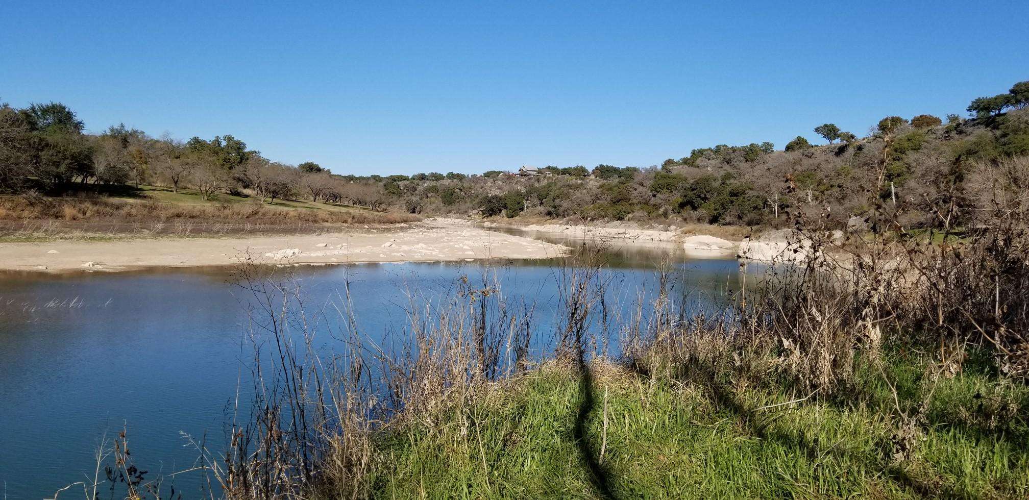
Hiking around Lago Vista offers routes through the Texas Hill Country, characterized by limestone cliffs, dense wooded areas, and open grasslands. The region's trails are situated near the northern shores of Lake Travis, providing a mix of lakeside paths and routes within nature reserves like the Balcones Canyonlands National Wildlife Refuge. The terrain varies from gentle park loops to more rugged, natural surface trails with moderate elevation changes across the rolling hills of the Edwards Plateau. The Colorado River also contributes to the scenic beauty, with many trails offering lake and river vistas.
Best hiking trails around Lago Vista
- The most popular hiking route is Lakeway City Park Trail, a 1.5 miles (2.4 km) trail that takes 38 minutes to complete. This route offers diverse scenery, including paved and natural paths, a butterfly garden, and scenic views of Lake Travis.
- Another top favourite among local hikers is Cactus Rocks Trail, an easy 1.2 miles (1.9 km) path. This trail moves through varied refuge landscapes, including wooded sections and open areas.
- Local hikers also love the Mount Lakeway Trail, a 3.0 miles (4.9 km) trail leading through the Lakeway area, often completed in about 1 hour 24 minutes.
- Hiking around Lago Vista is defined by lakeside paths, trails through protected wildlife habitats, and routes across rolling Hill Country terrain. The trail network provides options for both easy walks and more moderate hikes.
- The routes in Lago Vista are highly rated by the komoot community with an average score of 5.0 stars from over 3 reviews. More than 30 hikers have used komoot to explore Lago Vista's varied terrain.
Last updated: June 25, 2026
6
hikers
2.44km
00:38
10m
20m
The Lakeway City Park Trail offers a delightful and accessible outdoor experience, winding through 64 acres of parkland with a mix of paved and natural paths. You'll enjoy scenic views of Lake Travis, discover a tranquil butterfly garden, and pass through a vibrant wildflower meadow, making it a visually rewarding easy hike. This 1.5-mile (2.4 km) route features a gentle 43 feet (13 metres) of elevation gain and takes about 37 minutes to complete, perfect for a quick nature fix.
Planning your visit is straightforward, as the park is well-maintained and offers ample parking. The trails are dog-friendly, allowing leashed pets to join you on your adventure. Don't miss the unique Burton C. Barnes waterfall along the natural Challenge Trail, and take advantage of the fitness stations if you're looking to add some extra activity to your walk. The park's amenities, including playgrounds and picnic areas, make it a versatile spot for families.
Lakeway City Park stands out for its blend of natural beauty and recreational facilities, providing a peaceful escape from urban life. Beyond the trails, you might spot local wildlife like cardinals and egrets, especially in the shaded areas. The park's commitment to maintaining both easy paved loops and more rugged natural paths ensures there's something for various activity levels, all within a beautiful setting.
3
hikers
1.92km
00:31
20m
30m
Step onto the Cactus Rocks Trail for an easy hike that guides you through a landscape transitioning from cedar-covered sections to rolling areas featuring diverse oak trees. Keep an eye out for the trail's unique namesake: cacti growing directly from large limestone boulders. This route covers 1.2 miles (1.9 km) with an elevation gain of 63 feet (19 metres), making it a quick adventure you can complete in about 30 minutes.
Planning your visit is straightforward, as parking is typically available at the trailhead, ensuring easy access for your hiking trip. You can also find interpretive trail guides there, which will help you learn more about the area's geology and wildlife as you explore. Since it is an easy route, it is suitable for most hikers looking for a short outdoor experience.
Located within the Balcones Canyonlands National Wildlife Refuge, the Cactus Rocks Trail is part of a protected habitat, making it an excellent spot for birdwatching. You might even catch a glimpse of endangered species like the Golden-cheeked Warbler or the Black-capped Vireo. For those seeking more expansive views, consider combining this route with the nearby Vista Knoll Trail, which offers scenic vistas of Lake Travis and the surrounding hill country.

Sign up for free
1
hikers
4.86km
01:24
120m
110m
The Mount Lakeway Trail, nestled in the Lakeway Canyonlands, is a dynamic hiking route that offers a significant workout despite its 3.0-mile (4.9 km) length. You'll navigate steep inclines, rocky sections, and technical switchbacks, with almost no flat ground, making it feel like a constant climb or descent. The reward for your effort is a stunning lookout point near the summit, providing expansive views of Lake Travis and the surrounding Texas Hill Country, complete with wildflower meadows and diverse wildlife.
Planning your visit is straightforward, as the trail is well-maintained and clearly marked, part of a larger system. While the Komoot difficulty is easy, the 397 feet (121 metres) of elevation gain over a short distance means you'll want appropriate hiking shoes; trekking poles can also be beneficial. Dogs are welcome on a leash, but be aware that some sections can get slick after rain. It's a great option for a relatively quick, yet challenging, outdoor escape.
Beyond the physical challenge, the Mount Lakeway Trail is notable for its unique
1
hikers
2.62km
00:41
10m
30m
The Hamilton Greenbelt Trail in Lakeway, Texas, offers a refreshing escape into nature, blending wide, accessible paths with more rugged singletrack sections. You will wander through lush, shaded woodlands, enjoying the sounds of Hurst and Yaupon Creeks, and discover charming waterfalls, including a notable "circular waterfall." The trail's diverse Hamilton Greenbelt Trail terrain and scenic views make it a local favorite, culminating in picturesque glimpses of Lake Travis at its furthest points.
Accessing the Hamilton Greenbelt Trail is easy, with a well-equipped trailhead at Lohman's Crossing providing ample parking, restrooms, and even a free purified water dispenser. This easy 1.6-mile (2.6 km) hike, with a modest 43 feet (13 metres) of elevation gain, takes approximately 41 minutes, making it suitable for all ages and abilities. The significant tree cover ensures a comfortable experience even on warmer days, making it a great option for a quick outdoor adventure.
What truly sets this trail apart is its versatility and natural features. Beyond the waterfalls and creek access, the greenbelt boasts a dedicated bird blind with an identification chart, perfect for wildlife spotting. The network of trails allows you to choose your adventure, from a leisurely stroll to a slightly more challenging exploration of the primitive sections, making it a truly family friendly destination.
2.81km
00:45
40m
40m
The Rough Hollow Lakeside Greenbelt Trail offers an enjoyable hike through wooded paths and canyon gullies, featuring varied terrain and professionally built sections with berms and rollers. You'll cross three creeks and be treated to lush foliage, particularly vibrant in late fall and early spring. The real reward, however, is the great view of Lake Travis that awaits you, especially as you near the end of the route. Keep an eye out for deer, which are commonly sighted in the area.
This popular, beginner-friendly trail is an easy 1.7-mile (2.8 km) hike with a gentle 115 feet (35 metres) of elevation gain, taking about 45 minutes to complete. It's a fantastic option for families or anyone new to hiking, offering a quick and accessible outdoor experience. The trail is part of the Rough Hollow community, and you'll find QR codes on signs to help you navigate.
What makes this trail stand out is its professional construction, ensuring a smooth flow for hikers and mountain bikers. It also serves as a convenient gateway to the wider Canyonlands trail network, allowing you to extend your adventure onto more challenging paths like the Peninsula Pass Trail if you're looking for a longer outing. The integration with the natural landscape of the Texas Hill Country makes it a notable local gem.
Get access to more routes and recommendations from other explorers.
Sign up for free
Already have an account?
Our route recommendations are based on thousands of hikes, rides, and runs completed by other people on komoot.
Start today with a free account
Your next adventure awaits.
Login or Signup
Popular around Lago Vista



Frequently Asked Questions
Are there many dog-friendly hiking trails near Lago Vista?
Yes, many parks in the area welcome dogs on a leash. For a moderately challenging hike with your dog, consider the Rosenbush Loop — Pace Bend Park. However, be aware that dogs are not permitted on the trails at Balcones Canyonlands National Wildlife Refuge to protect the wildlife. Always check park-specific rules before you go.
What are some good hiking trails for beginners or families?
For an easy, family-friendly walk, the Veteran's Memorial Park loop is a great choice. It's a short, paved path that's suitable for all skill levels. Another option is the Turnback Canyon Trail, which is a shorter path with a peaceful tree canopy and small stream crossings.
Are there any challenging hikes in the Lago Vista area?
While most trails are moderate, you can find a good challenge at River Place Nature Trail. It's well-known for its significant elevation changes and numerous steps, offering a strenuous workout. Similarly, the trails at Warbler Vista, such as the Quarry Canyon Trail, are described as rugged and offer a medium-difficulty climb with rewarding views.
Can I find trails with waterfalls near Lago Vista?
Yes, the River Place Nature Trail is a popular destination known for its picturesque waterfalls, especially after recent rainfall. The trail follows a river through a forested canyon, providing several opportunities to see small falls and cascades.
What are the hiking trails like in Balcones Canyonlands National Wildlife Refuge?
The refuge offers a serene hiking experience focused on nature and wildlife observation. The trails, such as those on the Doeskin Ranch unit, are known for being exceptionally quiet and well-maintained. They wind through diverse Hill Country landscapes, including wooded canyons and open grasslands, making it a prime location for birdwatching.
Which hikes offer the best views of Lake Travis?
Pace Bend Park is an excellent choice for lake views, as its trails run along the park's perimeter with cliffs overlooking Lake Travis. You can also find beautiful vistas of the lake and surrounding valley from some trails within the Balcones Canyonlands National Wildlife Refuge, particularly from the Rimrock Trail.
Are there any free hiking trails in the Lago Vista area?
Yes, you can hike for free at Balcones Canyonlands National Wildlife Refuge, which offers several trails with no entrance fee. Many other parks in the region, such as those managed by Travis County Parks, may require a day-use fee, so it's always a good idea to check the specific park's website for current information on fees and hours.
What should I pack for a day hike around Lago Vista?
It's essential to bring plenty of water, especially during the hot Texas summers. Wear sturdy hiking shoes for the rocky and uneven terrain. Sun protection, including a hat, sunglasses, and sunscreen, is crucial. It's also wise to pack insect repellent and a small first-aid kit. Since many trails have limited shade, plan your hike for the cooler parts of the day.
What do other hikers enjoy most about the trails around Lago Vista?
The area is highly rated by the komoot community. Reviewers often praise the diverse scenery, from the lakeside cliffs at Pace Bend Park to the quiet, wooded canyons of the Balcones Canyonlands. The opportunity for wildlife and bird watching is another frequently mentioned highlight.
How does hiking in Lago Vista compare to Austin?
Lago Vista offers a quieter, more nature-focused hiking experience centered around Lake Travis and large nature preserves like Balcones Canyonlands. While Austin has excellent urban trails like the Barton Creek Greenbelt, Lago Vista's routes often feel more remote and provide a greater sense of immersion in the Texas Hill Country landscape.
What is the best time of year for hiking in Lago Vista?
The best seasons for hiking are fall, winter, and spring, when temperatures are cooler and more comfortable. Spring is particularly beautiful, with native wildflowers blooming throughout the region, especially in areas like Muleshoe Bend. Summer hikes are possible but should be done early in the morning to avoid the intense midday heat.
Most popular routes around Lago Vista
Most popular attractions around Lago Vista

Get inspired with the komoot mobile app


Explore more
Browse the best Hikes in other regions.
