The best road cycling routes around Parker
4.9
(52)
3,244
riders
120
rides
Road cycling around Parker is characterized by its varied terrain, offering routes that traverse rolling hills and waterways. The region is situated at an elevation of 5,869 feet, providing views of surrounding landscapes, including the Rocky Mountains and the Continental Divide on clear days. Natural features such as bluffs, riparian areas, pine groves, and grasslands contribute to the visual environment. The Cherry Creek Trail is a notable paved trail system that winds through the area.
Best road cycling routes around…
Last updated: July 2, 2026
21
riders
91.3km
04:12
880m
880m
The Hunts Lake & Batson Mill loop offers a unique road cycling experience, blending natural beauty with a touch of adventure. As you pedal, you'll be treated to scenic viewpoints,…
13
riders
57.0km
02:37
500m
500m
Embark on the South Saluda River and Swamp Rabbit Trail Loop, a moderate road cycling adventure spanning 35.4 miles (57.0 km). You will experience a diverse landscape, from the flat,…

Sign up for free
6
riders
87.3km
03:58
780m
780m
The Greenville to Tall Pines Wildlife Management Area via Hunts Lake route offers a moderate road cycling experience through northern Greenville County. You will cover 54.3 miles (87.3 km) and…
6
riders
22.9km
00:56
110m
110m
Embark on an easy road cycling adventure along the Swamp Rabbit Trail Loop, a 14.2-mile (22.9 km) route that offers a pleasant mix of urban and natural environments. You will…
48
riders
20.2km
00:51
80m
80m
Easy road ride. Great for any fitness level. Mostly well-paved surfaces and easy to ride.
Get access to more routes and recommendations from other explorers.
Sign up for free
Already have an account?
Our route recommendations are based on thousands of hikes, rides, and runs completed by other people on komoot.
Start today with a free account
Your next adventure awaits.
Login or Signup

Tips from the Community

This scenic river is a popular trout fishing spot. It may be tempting to take a dip to cool off on a hot day; however, keep in mind that the water can be very cold, even during summer.
0
0

Opened in May 2022, Greenville's Unity Park, located along the Rabbit Swamp Trail, features cutting-edge playgrounds, a 4,100-square-foot splash pad, green spaces, covered picnic tables, and a 10,000-square-foot welcome center. The 60-acre park includes basketball courts, a historic baseball field from 1925, and three bridges spanning the Reedy River. Visit unityparkgreenville.com/1843/Unity-Park.
0
0

Frank's Corner is where the Lakeview Link and the Swamp Rabbit Trail meet, south of Berea. Frank's Corner is marked by a bronze statue of a toddler riding a bike, representing joy of getting outside on the Swap Rabbit Trail.
0
0
Cone Mill Pond is just off the Swamp Rabbit Trail. This is a nice spot to be on the lookout for birds and animals as you ride along the path.
0
0

Tall Pines Wildlife Management Area in South Carolina spans over 8,000 acres of diverse ecosystems. Featuring pine forests, wetlands, and open fields, it's a haven for wildlife and offers opportunities for hunting, birdwatching, and nature appreciation in a tranquil, natural setting.
0
0

The stone foundation and old water wheel are all that remain of Batson Mill. Local reports are that the mill was still standing in 2000 but demolished shortly after. The mill was operational from the mid/late 1800s through the 1930s.
0
0

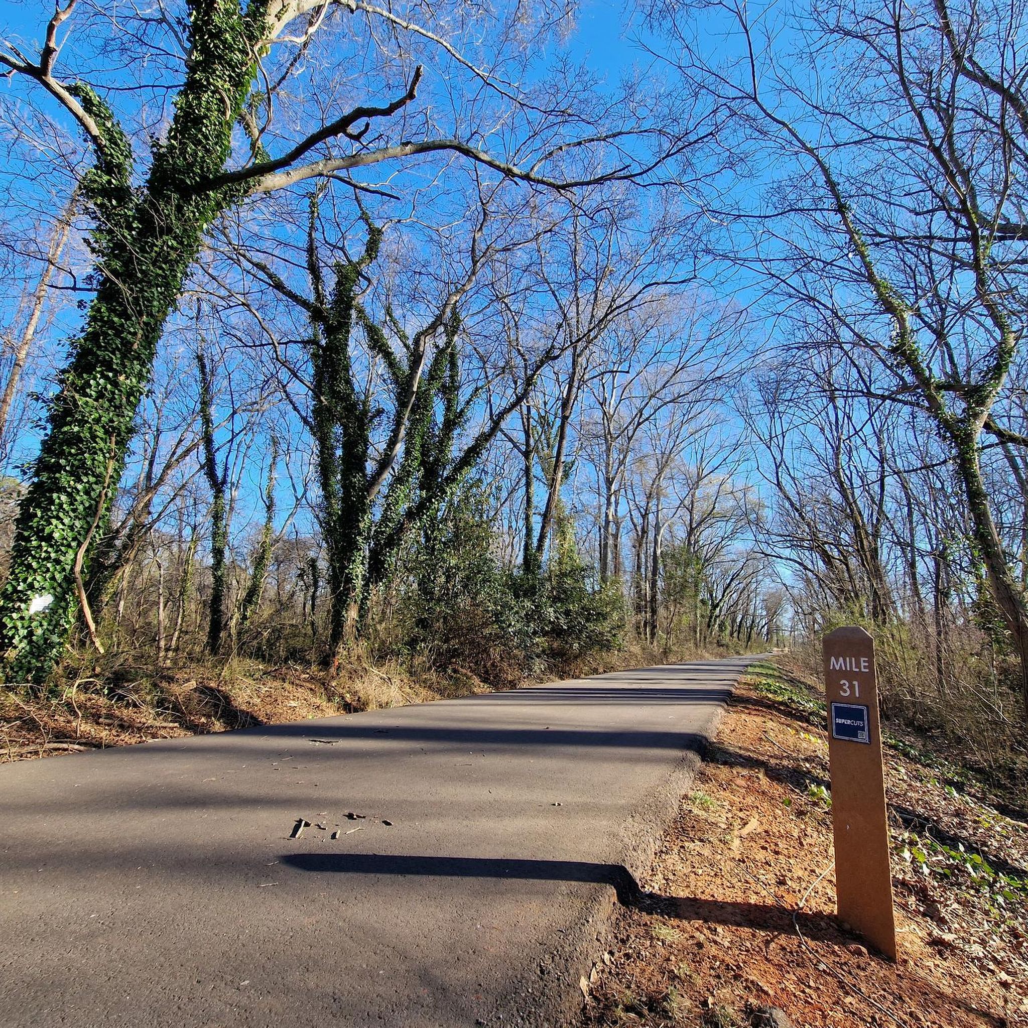
The Swamp Rabbit Trail, a 22-mile Greenway, meanders along the Reedy River and former railroad corridors, elegantly linking Travelers Rest and Greenville. Ideal for walking and cycling, it offers picturesque views and a delightful journey.
0
0
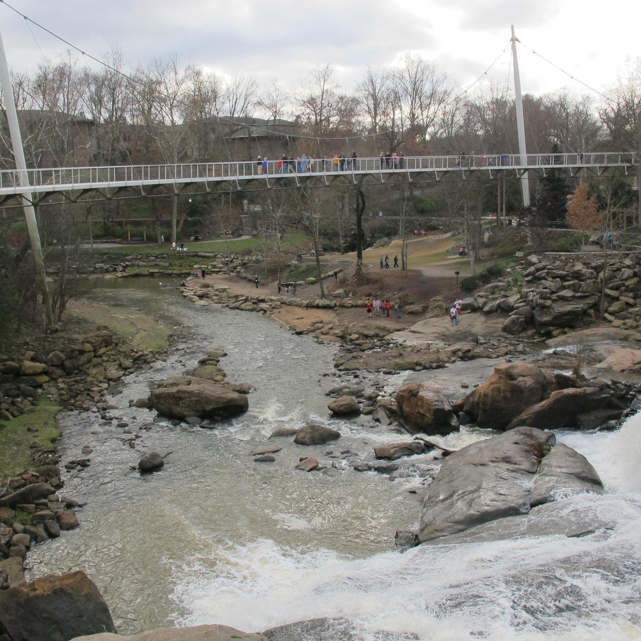
In the heart of Greenville, the Reedy River descends in a stunning waterfall. Once an industrial hub, it became “Falls Park on the Reedy” in the '60s. The elegant Liberty Bridge arches over the river, offering a breathtaking view of this natural wonder.
0
0
Frequently Asked Questions
How many road cycling routes are available around Parker?
There are over 140 road cycling routes available around Parker, offering a wide variety of options for different skill levels and preferences.
What are the general characteristics of road cycling routes in Parker?
Road cycling around Parker is known for its varied terrain, featuring rolling hills and routes that traverse waterways. The area is situated at an elevation of 5,869 feet, providing scenic views of the surrounding landscapes, including the Rocky Mountains and the Continental Divide on clear days. You'll encounter natural features like bluffs, riparian areas, pine groves, and grasslands.
What do other cyclists say about road cycling in Parker?
The road cycling routes in Parker are highly rated by the komoot community, with an average score of 4.5 stars from over 29 reviews. Cyclists often praise the diverse terrain and the scenic views of the surrounding landscapes.
Are there road cycling routes suitable for beginners or families in Parker?
Yes, Parker offers routes suitable for various abilities. There are 34 easy routes, including the Swamp Rabbit Trail Loop, which is 14.2 miles (22.9 km) long with minimal elevation gain, making it a great option for beginners or families.
Are there challenging road cycling routes in Parker?
Yes, for those seeking a challenge, Parker has 36 difficult road cycling routes. These routes often feature significant elevation gain, such as the Hunts Lake & Batson Mill loop from Greenville, which includes over 880 meters of ascent over 56.7 miles (91.3 km).
What kind of landscapes can I expect to see while road cycling in Parker?
While road cycling in Parker, you can expect to see diverse landscapes including rolling hills, meandering waterways, and bluffs with native grass, pine, scrub oak, and rock outcroppings. The area also features riparian zones, shrub-covered hillsides, pine groves, and natural grasslands. On clear days, you'll enjoy panoramic views of downtown Denver, the Foothills, and the majestic Rocky Mountains, including the Continental Divide.
Are there any circular road cycling routes in Parker?
Yes, many road cycling routes in Parker are designed as loops. A popular moderate option is the South Saluda River and Swamp Rabbit Trail Loop, which covers 35.4 miles (57.0 km) and offers a mix of river views and trail sections.
What are some notable natural features or viewpoints along road cycling routes in Parker?
Road cycling routes in Parker offer views of the Cherry Creek, which winds through the area. You can also find viewpoints like the Conestee Nature Preserve Viewpoint. The region's elevation provides vistas of the Rocky Mountains and the Continental Divide.
Are there any places to stop for refreshments or explore near the road cycling routes?
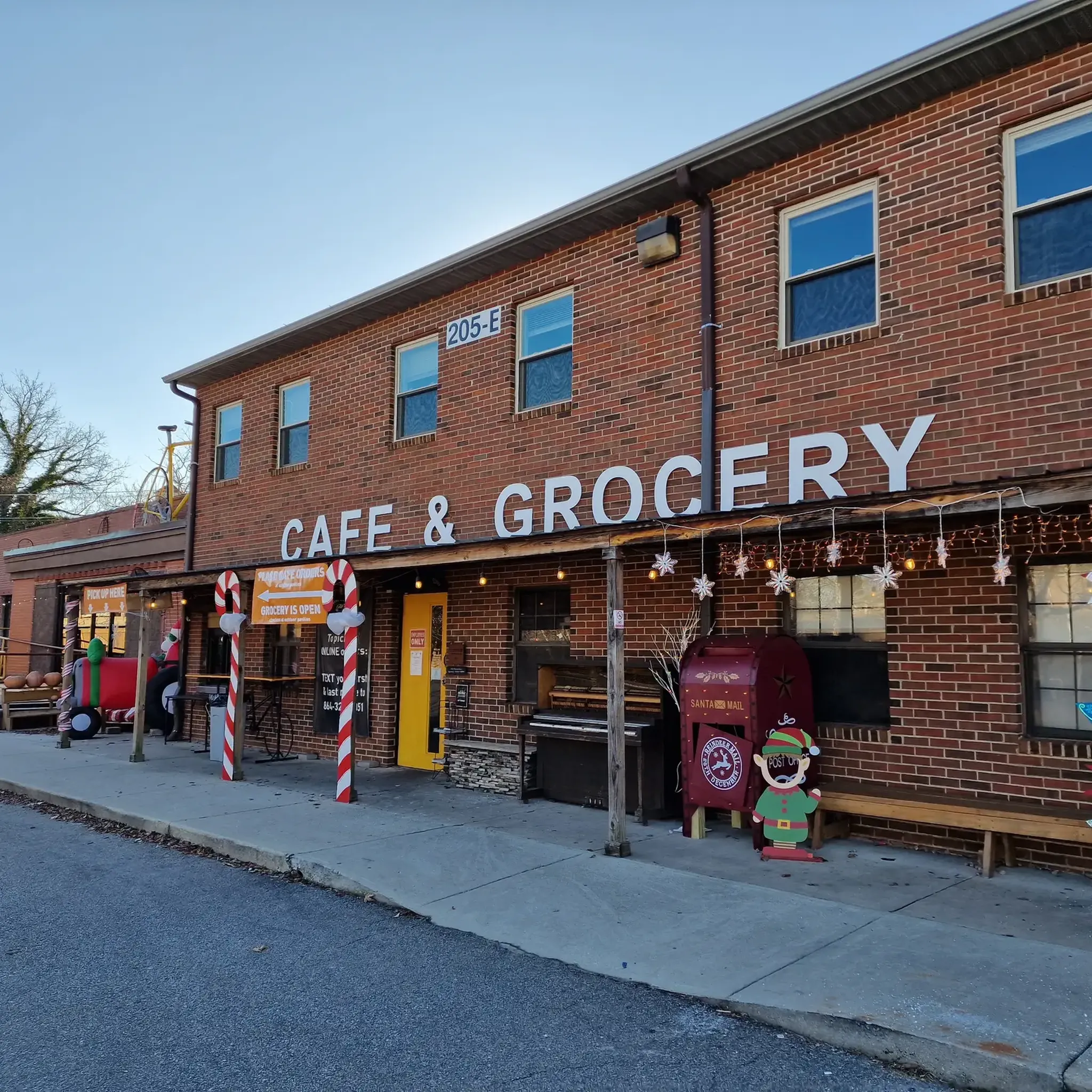
Yes, some routes pass by or are near places where you can stop. For example, the Swamp Rabbit Cafe & Grocery is a popular spot that cyclists can visit. You might also find other attractions like Liberty Bridge at Falls Park or Falls Park.
What is the best time of year for road cycling in Parker?
Parker's climate allows for road cycling through much of the year, though the best times are typically spring and fall when temperatures are mild. The higher elevation means clear views are common, but it also means checking the weather forecast is advisable, especially for potential winter conditions.
Are there routes with significant elevation gain for training?
Absolutely. Many routes in Parker feature considerable elevation gain, making them ideal for training. The Third Presbyterian Church – Paris Mountain loop from Greenville, for instance, includes nearly 800 meters of ascent over 25.5 miles (41.0 km).
Can I find routes that combine natural scenery with points of interest?
Yes, routes like the Greenville to Tall Pines Wildlife Management Area via Hunts Lake offer varied landscapes. You can also find routes near attractions such as Lake Placid Dam or the Wyche Pavilion, allowing you to combine your ride with exploring local landmarks.
Most popular attractions around Parker

Get inspired with the komoot mobile app


Explore more
Browse the best Road cycling routes in other regions.
