The best road cycling routes around Pawtucket
4.5
(114)
1,641
riders
181
rides
Road cycling routes around Pawtucket feature access to scenic greenways, parks, and historical waterways. The region is characterized by relatively flat terrain along river corridors, with some gentle elevation changes. Key natural features include the Ten Mile River, Blackstone River, and Seekonk River, which define many of the cycling paths. These routes provide an urban escape while connecting to broader regional networks.
Best road cycling routes around Pawtucket
- The most popular road cycling route is Blackstone River Bikeway – Blackstone…
Last updated: July 12, 2026
5.0
(1)
33
riders
31.2km
01:22
220m
220m
Easy road ride. Great for any fitness level. Mostly well-paved surfaces and easy to ride.
15
riders
Moderate road ride. Good fitness required. Mostly well-paved surfaces and easy to ride.

Sign up for free
13
riders
37.5km
01:36
190m
190m
Moderate road ride. Great for any fitness level. Some segments of this route may be unpaved and difficult to ride.
8
riders
25.8km
01:04
160m
160m
Easy road ride. Great for any fitness level. Mostly well-paved surfaces and easy to ride.
8
riders
14.1km
00:38
90m
90m
Easy road ride. Great for any fitness level. Mostly well-paved surfaces and easy to ride.
Get access to more routes and recommendations from other explorers.
Sign up for free
Already have an account?
Our route recommendations are based on thousands of hikes, rides, and runs completed by other people on komoot.
Start today with a free account
Your next adventure awaits.
Login or Signup


Tips from the Community

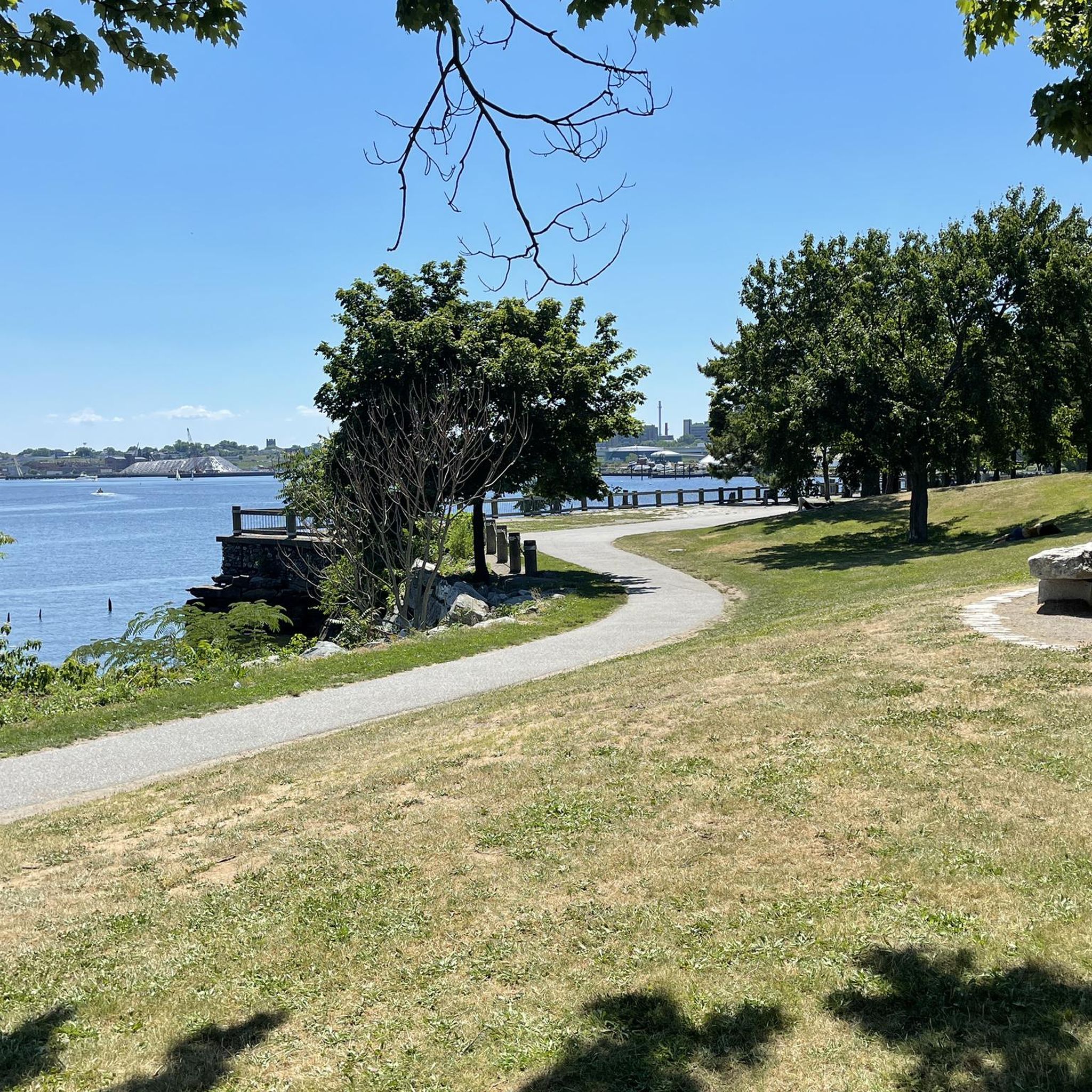
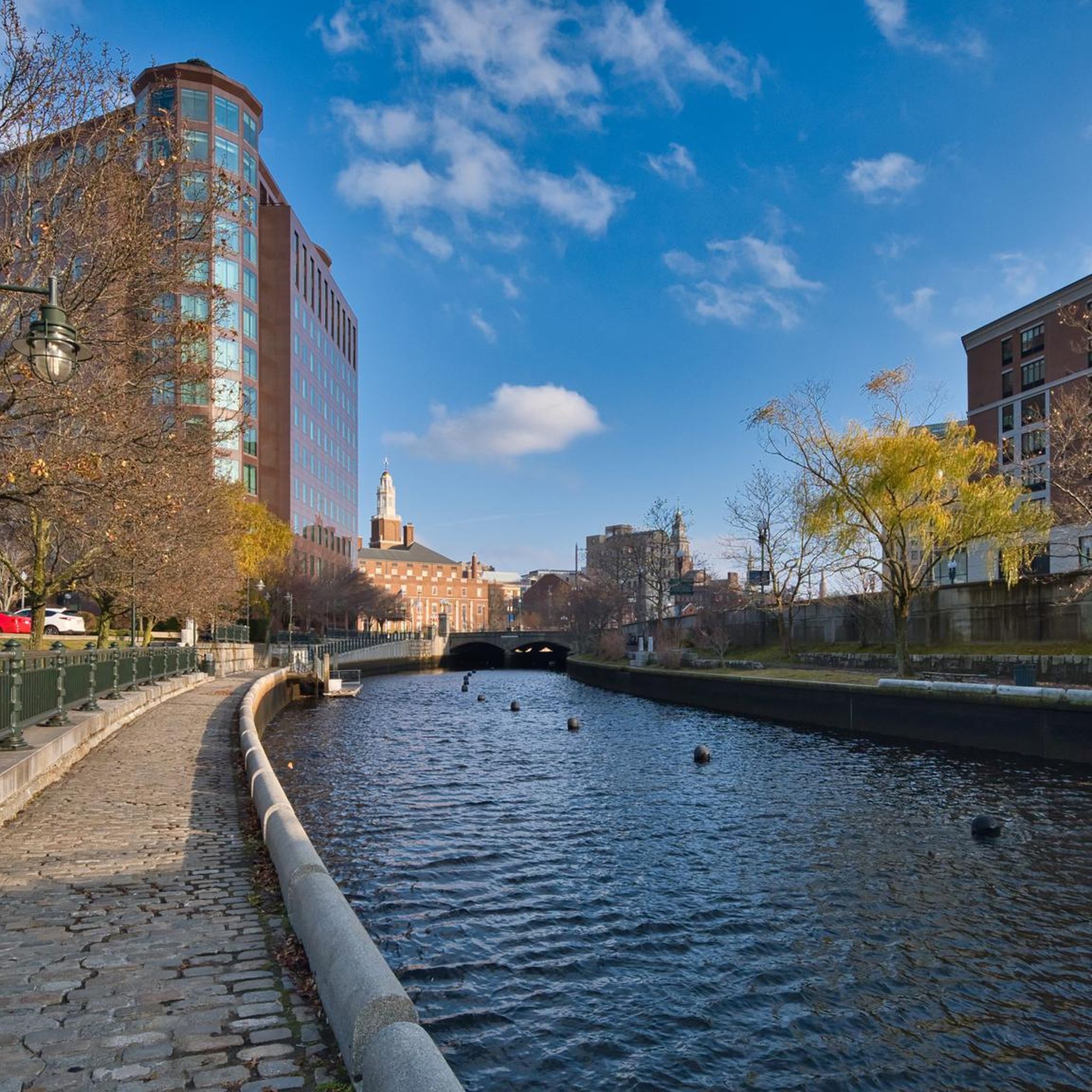
A nice scenic spot along the Providence River
0
0

This part of the bike path that follows the Blackstone River is becoming more and more peaceful and offers many opportunities for rest that allow you to appreciate the tranquility of the place.
0
0

You get great views of the viaduct from below from the trailhead and East Coast Greenway. The viaduct was built in the mid-1930s and is notable for its open spandrel design. The spandrel is the space between the arch and the road, which here is hollowed out to form many more smaller arches.
0
0

India Point Park spans 18 acres and is a gem in the city's heart, with beautiful trees and picturesque walking paths. Situated along the 3,600-foot shoreline where the Seekonk and Providence Rivers converge and widen into Narragansett Bay, it provides the only public access to this broad and stunning stretch of the Bay shoreline.
0
0

The Blackstone River Multi-Use Trail offers a scenic way to explore the Blackstone Valley by bike or on foot. Spanning over 24 miles, with plans to extend to 48 miles, this trail is popular for recreational users and commuters, passing beautiful river views, historic mills, and wildlife. It’s Rhode Island’s second-longest bikeway, with portions running through Cumberland and Woonsocket, following the historic Blackstone Canal and crossing the Blackstone River a few times.
1
0

This is the main trailhead for the start of the Blackstone River Bikeway in Woonsocket. Although the whole Blackstone River Bikeway technically connects Worcester, Massachusetts to Providence, Rhode Island, the Woonsocket to Central Falls section is the only part on a completely dedicated bike path. At the trailhead there is a large parking lot with river views.
0
0
This part of the bike path that follows the Blackstone River is becoming more and more peaceful and offers many opportunities for rest that allow you to appreciate the tranquility of the place.
0
0
Frequently Asked Questions
What kind of terrain can I expect on road cycling routes around Pawtucket?
Road cycling routes in Pawtucket are generally characterized by relatively flat terrain, especially along river corridors like the Ten Mile, Blackstone, and Seekonk Rivers. You'll find mostly paved surfaces with some gentle elevation changes, making them suitable for various skill levels.
Are there easy road cycling routes suitable for beginners or casual riders?
Yes, Pawtucket offers several easy road cycling routes. For instance, the East Bay Bike Path – Seekonk River Road loop from Brown Stadium is an easy 14.8-mile path that provides scenic maritime views. Many of the 59 easy routes available are perfect for a relaxed ride.
What scenic views or landmarks can I expect to see along the routes?
Many routes follow the Blackstone and Seekonk Rivers, offering picturesque views. You can also explore areas near India Point Park or Waterplace Park. The Blackstone River Bikeway, for example, traces the Blackstone River, passing historical sites and natural features like waterfalls. Slater Memorial Park also offers an oasis of greenery and scenic vistas.
Are there options for longer road cycling routes in the Pawtucket area?
Absolutely. For those seeking longer rides, the Blackstone River Bikeway – Blackstone River Bikeway loop from South Attleboro is a notable option, covering 38.4 miles. This route provides an extensive journey along the Blackstone River, connecting to broader regional networks.
How challenging are the road cycling routes in Pawtucket?
Pawtucket offers a range of difficulties. Out of 178 total routes, 59 are classified as easy, 113 as moderate, and 6 as difficult. This means you can find everything from flat, leisurely rides along greenways to more challenging routes with greater elevation gain, such as the Blackstone River Bikeway loop with over 350 meters of ascent.
Are there any circular road cycling routes available?
Yes, many of the road cycling routes around Pawtucket are designed as loops, allowing you to start and end at the same point. Examples include the Mrs Skipper loop from South Attleboro and the Jacobs Hill loop from Seekonk Sanctuary, providing convenient round trips.
What do other road cyclists enjoy most about road cycling in Pawtucket?
The road cycling routes in Pawtucket are highly rated by the komoot community, with an average score of 4.5 stars from over 60 reviews. Cyclists often praise the scenic greenways, the historical waterways, and the well-maintained river paths that offer an urban escape while connecting to broader regional networks.
Are there family-friendly road cycling options in Pawtucket?
Yes, the relatively flat greenways and paved paths are ideal for families. Slater Memorial Park, for example, features meandering trails suitable for biking, and the Ten Mile River Greenway offers a 6-mile paved route that is great for various skill levels, including families.
When is the best time of year to go road cycling in Pawtucket?
The spring, summer, and fall months generally offer the most pleasant conditions for road cycling in Pawtucket. During these seasons, you can enjoy comfortable temperatures and the full beauty of the natural landscapes along the rivers and greenways.
How can I find more information about parks and recreational facilities in Pawtucket?
For more details on local parks and recreational facilities, including those that might offer access points or amenities for cyclists, you can visit the official Pawtucket city website: pawtucketri.gov/parks-and-recreation/playgrounds-courts-and-parks/.
Are there any routes that connect to larger regional bike paths?
Yes, Pawtucket's location provides excellent connectivity to broader regional networks. The Blackstone River Greenway, for instance, offers a 19.5-mile section in Rhode Island and is part of the East Coast Greenway. The East Bay Bike Path is another significant route, providing 14.3 miles of scenic riding with maritime views, also part of the larger East Coast Greenway.
Most popular routes around Pawtucket
Most popular attractions around Pawtucket

Get inspired with the komoot mobile app


Explore more
Browse the best Road cycling routes in other regions.
