The best road cycling routes around Columbia
4.8
(8)
315
riders
35
rides
Road cycling routes around Columbia offer a diverse landscape for cyclists, characterized by riverfront paths, county parks, and scenic lake areas. The region features a mix of gentle terrain and routes with moderate elevation changes, suitable for various skill levels. Cyclists can explore areas like Chickies Rock County Park and the White Cliffs of Conoy, providing natural beauty alongside historical railway bridges. This combination of natural features and established pathways makes Columbia a notable destination for road biking.
Best road…
Last updated: October 15, 2026
5.0
(1)
83
riders
31.4km
01:27
140m
140m
Moderate road ride. Great for any fitness level. Some segments of this route may be unpaved and difficult to ride.
5.0
(1)
47
riders
Moderate road ride. Great for any fitness level. Some segments of this route may be unpaved and difficult to ride.

13
riders
16.8km
00:44
30m
30m
Easy road ride. Great for any fitness level. Mostly well-paved surfaces and easy to ride.
12
riders
68.3km
02:50
250m
250m
Moderate road ride. Good fitness required. Some segments of this route may be unpaved and difficult to ride.
4.5
(2)
7
riders
38.9km
01:43
280m
280m
Easy road ride. Great for any fitness level. Mostly well-paved surfaces and easy to ride.
Get access to more routes and recommendations from other explorers.
Already have an account?
Our route recommendations are based on thousands of hikes, rides, and runs completed by other people on komoot.
Start today with a free account
Your next adventure awaits.
Popular around Columbia

Tips from the Community

Here the bike path crosses scenic Chiques Creek. You can see the remnants of the Hiestand Saw Mill and Dam on the northwest side of the river.
0
0

The Chickies Rock Overlook Trail begins at a trailhead off of Chickies Hill Road and is a straightforward, packed trail to a great overlook. The trail runs along the remains of an old trolley line from the early 1900s which once led tourists to the overlook. It is a pretty popular spot, so be prepared to encounter other walkers, hikers and runners along the way and come early if you are hoping for a little solitude on the trail.
0
0

The Northwest Lancaster County River Trail is a multiuse trail that follows the Susquehanna River. It is fully paved and passes through farmland and woods. From the path there are great views of the river.
0
0

While the Susquehanna river trail is beautiful, parts of it can be muddy/flooded and sometimes impassable after heavy rain.
0
0

Waterville Bridge spans Swatara Creek, offering picturesque views of the water below. The bridge's architecture enhances the scenic beauty, creating a charming spot to appreciate the tranquil flow of Swatara Creek and the natural surroundings.
0
0

The White Cliffs of Conoy are a must-see. They sit nearly 30 feet above the riverbank and are the residue of a local limestone and dolomite quarry in the 1800's. The cliffs afford grand views of the Susquehanna River.
0
0
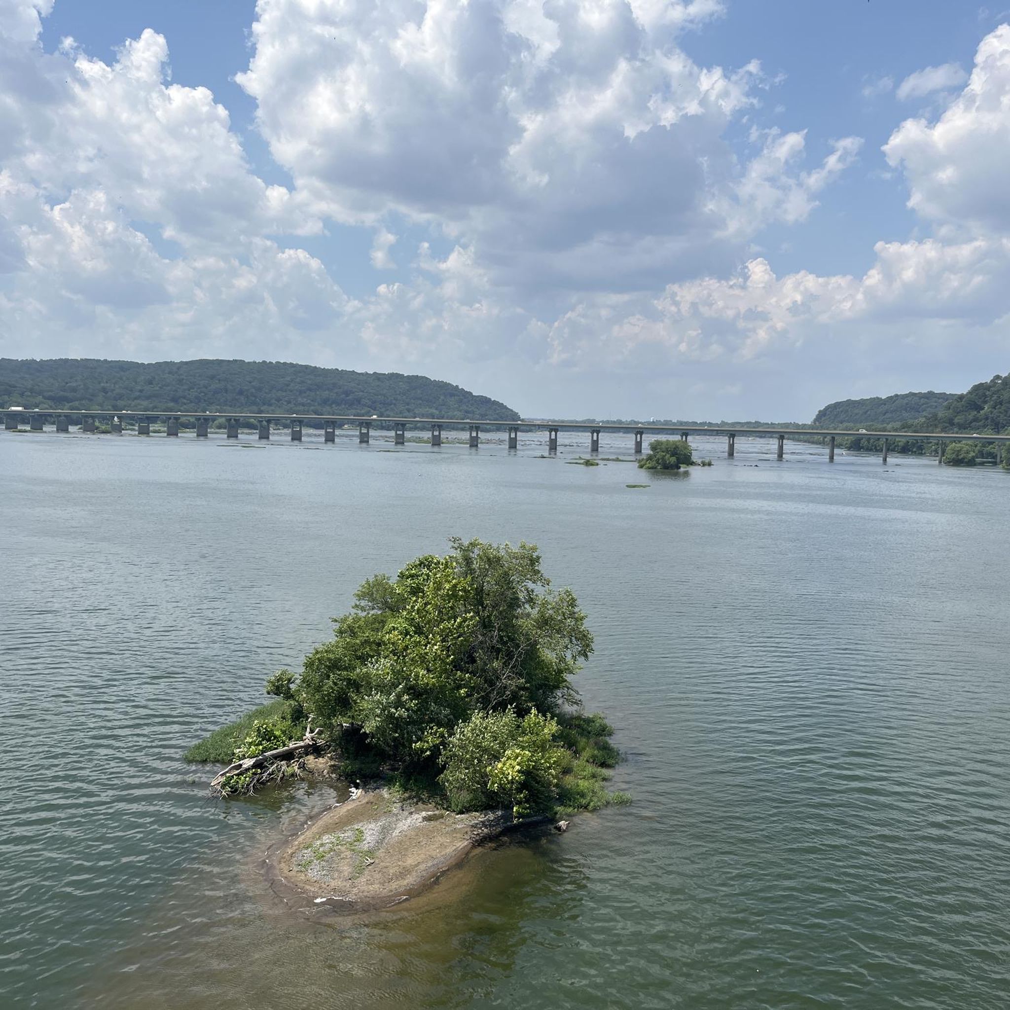
Chickies Rock County Park is a park on the banks of the Susquehanna River. There are multiple view points in the park that give a great vista of the river and woodlands on its bank. Northwest Lancaster County River Trail runs through the park.
0
0
The Northwest Lancaster County River Trail is a multiuse trail that follows the Susquehanna River. It is fully paved and passes through farmland and woods. From the path there are great views of the river.
0
0
Frequently Asked Questions
How many road cycling routes are available around Columbia?
There are over 29 road cycling routes around Columbia, offering a diverse range of experiences for cyclists. These routes are highly rated by the komoot community, with an average score of 4.6 stars.
What is the general difficulty level of road cycling routes in Columbia?
The road cycling routes in Columbia cater to various skill levels. You'll find 10 easy routes, 18 moderate routes, and 1 more challenging option, ensuring there's something for everyone.
What kind of terrain can I expect on road cycling routes in Columbia?
Road cycling in Columbia is characterized by riverfront paths, county parks, and scenic lake areas. Routes feature a mix of gentle terrain and some with moderate elevation changes, providing varied landscapes to explore.
Are there loop road cycling routes available in Columbia?
Yes, many of the road cycling routes in Columbia are designed as loops. For example, the White Cliffs of Conoy – Chickies Rock County Park loop from Columbia is a popular option, as is the Safe Harbor Railroad Bridge – Old Trolley Line Bridge loop from Columbia.
What scenic views or landmarks can I see while road cycling around Columbia?
While cycling around Columbia, you can enjoy natural beauty and historical sites. Routes often pass by the Susquehanna River, offering views from places like Chickies Rock. You can also explore areas like Chickies Rock County Park and historical railway bridges, such as the Safe Harbor Railroad Bridge and the Old Trolley Line Bridge.
Are there any waterfalls along the road cycling routes in Columbia?
Yes, you might encounter natural features like the Mann's Run Waterfall, which is located near some of the cycling areas around Columbia.
Is parking available near the road cycling trailheads in Columbia?
While specific parking details vary by trailhead, many county parks and popular cycling areas around Columbia typically offer designated parking facilities for visitors. It's advisable to check specific route details for the most accurate information.
Can I access road cycling routes in Columbia using public transport?
Public transport options with bike access can vary depending on the specific route and local transit services. For routes closer to urban centers, some public transport might accommodate bicycles, but it's best to verify with local transit authorities for current policies and schedules.
Are there family-friendly road cycling paths in Columbia?
Yes, Columbia offers several easy and moderate routes that are suitable for families. These often feature gentler terrain and scenic paths through parks or along riverfronts, providing a pleasant experience for all ages.
What is the best season for road biking in Columbia?
The best season for road biking in Columbia generally depends on personal preference, but spring and fall often offer the most comfortable temperatures and pleasant conditions for cycling. Summers can be warm, while winters are typically milder but can still have cooler days.
Are there cafes or pubs near the road cycling routes in Columbia?
Many popular cycling areas and towns around Columbia have local cafes and pubs where you can refuel or relax. While specific establishments aren't listed for every route, you'll often find options in nearby communities.
What are some longer distance road cycling routes in Columbia?
For those looking for longer rides, routes like the Lake Placida loop from Mount Joy covers approximately 26.7 miles (42.9 km), and the White Cliffs of Conoy – Chickies Rock County Park loop from Columbia is about 25.6 miles (41.2 km), offering substantial distances for road cyclists.
What do other road cyclists say about the routes in Columbia?
The road cycling routes in Columbia are highly regarded by the komoot community, holding an impressive average rating of 4.6 out of 5 stars from over 9 reviews. Cyclists often praise the diverse landscapes, including riverfront paths and county parks, and the well-maintained trails that make for an enjoyable ride.
Most popular attractions around Columbia

Get inspired with the komoot mobile app


Explore more
Browse the best Road cycling routes in other regions.
