The best walks and hikes around Lincoln
5.0
(2)
19
hikers
15
hikes
Hiking around Lincoln offers an extensive trail system, diverse natural landscapes, and numerous parks. The region features floodplain forests, tallgrass prairies, and woodlands, alongside converted railway corridors. These environments provide varied scenery and ecological experiences for hikers, with terrain characterized by moderate elevation changes and well-maintained paths. The city's commitment to developing green spaces ensures accessible options for outdoor activity.
Best hiking trails around Lincoln
- The most popular hiking route is Pet Haven and Rainbow Garden Trail Loop, a…
Last updated: July 2, 2026
2
hikers
6.85km
01:57
140m
160m
Easy hike. Great for any fitness level. Easily-accessible paths. Suitable for all skill levels.
1
hikers
16.0km
04:05
50m
50m
Moderate hike. Good fitness required. Easily-accessible paths. Suitable for all skill levels.

Sign up for free
4.60km
01:10
10m
10m
Easy hike. Great for any fitness level. Easily-accessible paths. Suitable for all skill levels.
4.40km
01:13
110m
40m
Easy hike. Great for any fitness level. Easily-accessible paths. Suitable for all skill levels.
2.64km
00:42
30m
30m
Easy hike. Great for any fitness level. Easily-accessible paths. Suitable for all skill levels.
Get access to more routes and recommendations from other explorers.
Sign up for free
Already have an account?
Our route recommendations are based on thousands of hikes, rides, and runs completed by other people on komoot.
Start today with a free account
Your next adventure awaits.
Login or Signup


Tips from the Community

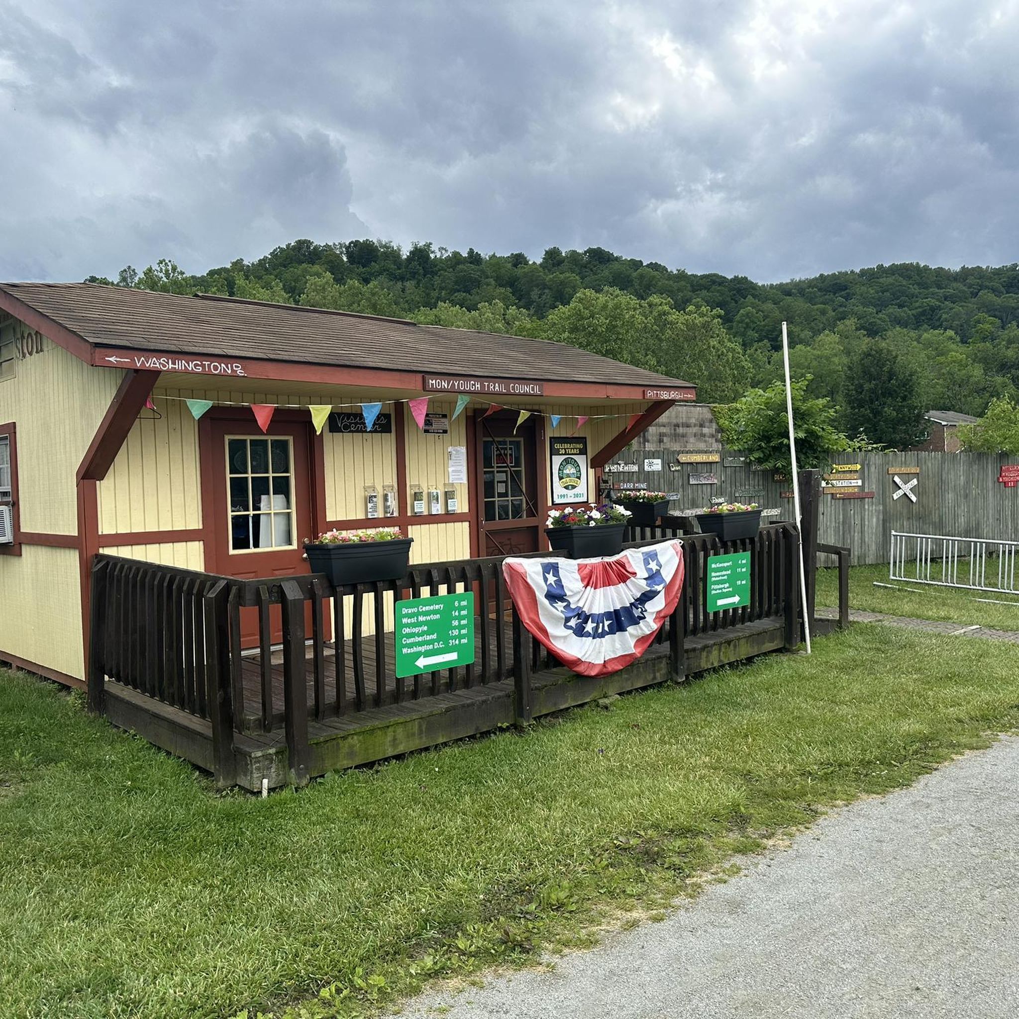
Bathrooms, well water station, campgrounds & Shelter , free wood, bike repair station.
0
0
Cute little town, but watch out for people Sitting on trail during baseball games
0
0
This is a good place to take a break on a hot day, as the waterfall produces cold wind. DO NOT DRINK this water, It is from an acid mine and the red-orange color comes from iron and rust.
1
0

S THE WATERFALL Demonstrating acid mnine drainage The water here is acid and iron-rich, coming up to the surface from underground mines, stairung the-rocks ruspred. Acid mine drainage (AMID) is a major source of water pollution. Cause of extensive stream environmental damage. The Ocean Coal Company, a subsidiaries of Bevind- White Coal Company Philadelphia, PA, esaiblished several mines in this region including, in 1900, Ocean No. 2. It is purported that drainage from ocean No. 2 is the chief cause of the Red Waterfall Why is it acidic and full of iron? Hundreds of millions of years ago, the massive Pittsburgh Coal Seam formed underneath parts of Pennsylvania, West Virginia, and Ohiờ from ancient swamp plants. Sand, silts, shells, and other -matter were deposited and made a rock seal over the carbon-rich vegetation, This rock contained the mineral "pyrite," made of iron and sulfur Coal mining exposes pyrite to oxygen and ground water causing the formation of sulfuric acid and a number of red, orange, and yellow compound s. AMD occurs when this mine water seeps, or in this-case, bursts out into Streams. The yellow sulfur can be seen in the shale near coal seams. GRESCHIN DASSAGE SPONSORED BY: Southwestern PA Heritage Breservation- Commission Allegheny Trail Alliances Regional Trail Corpofation For moterinformation. www.gaptrail.org
0
0
its just a cemetery. i was riding for distance. and needed this place to keep the route on the GAP trail.
1
0

The Red Waterfall is one of the main highlights on the GAP between West Newton and McKeesport. The falls gets its name from the water that has been colored red by nearby underground coal mines, which has made the water acidic and iron-rich water.
0
0
The Buena Vista Trailhead is one of many trailheads onto the GAP. At this one, there is parking, potable water, and restrooms.
0
0
The Dravo Hiker-Biker Campground is one of several hiker-biker campgrounds along the GAP. There is a large grassy area to put your tent, fire rings, picnic tables, and drinkable water.
0
0
Frequently Asked Questions
How many hiking trails are there in Lincoln?
Lincoln boasts an extensive network of over 150 miles of interconnected trails, including paved and crushed limestone paths. This guide features 8 specific hiking routes that explore various parts of this system, from conservation areas to parklands.
What are the difficulty levels of hikes in Lincoln?
The hiking trails around Lincoln offer a range of difficulty levels. This guide includes 3 easy routes, 4 moderate routes, and 1 difficult route, ensuring options for various fitness levels and preferences.
Are there family-friendly hiking options in Lincoln?
Yes, Lincoln offers several family-friendly hiking options, particularly within its extensive park system. Trails like the Montour Trail from Clairton to Jefferson Hills are rated as easy, providing accessible paths suitable for families. Pioneers Park also features 8 miles of trails through diverse landscapes, often with exhibit animals like bison and elk, which can be engaging for children.
Are the hiking trails in Lincoln dog-friendly?
Many of Lincoln's trails, especially those in Wilderness Park and other natural areas, are generally dog-friendly. It's always recommended to keep dogs on a leash and to check specific park regulations before heading out. The extensive network of paths provides ample space for you and your canine companion to explore.
What natural features or viewpoints can I expect to see along the trails?
Lincoln's hiking trails traverse diverse natural features, including dense woodlands, winding creeks, wetland areas, and tallgrass prairies. You can also find interesting landmarks such as the McKeesport Connecting Railroad Bridge and the unique Red Waterfall. For a unique perspective, consider the View of Phantom’s Revenge at Kennywood Park.
Are there circular hiking routes available?
Yes, there are several circular hiking routes in Lincoln. For example, the White Oak Park loop offers a moderate 5.2-mile (8.4 km) circular path through parkland. Another option is the Round Hill Park loop — Elizabeth, Pennsylvania, an easy 3.4-mile (5.5 km) route.
When is the best time of year to hike in Lincoln?
The best time to hike in Lincoln is typically during spring and fall when the weather is mild and the natural scenery is vibrant. Spring brings blooming wildflowers, while autumn offers beautiful foliage. Summer can be pleasant, but it's advisable to hike early in the morning or late afternoon to avoid the midday heat. Winter hiking is also possible on many trails, especially the paved or crushed limestone paths, though conditions may vary.
Is parking available at trailheads?
Given Lincoln's extensive urban trail system and well-maintained parks, parking is generally available at or near most major trailheads and park entrances. Wilderness Park, Pioneers Park, and Holmes Lake Park all offer designated parking areas for visitors accessing their trail networks.
Can I reach hiking trails by public transport?
Lincoln's public transport system, StarTran, serves various parts of the city, and some routes may offer access to areas near trailheads, particularly for urban parks and trails. For specific routes, it's best to check the StarTran bus schedules and maps to plan your journey to the desired hiking location.
What do other hikers enjoy the most about hiking in Lincoln?
The hiking experience in Lincoln is highly rated by the komoot community, with an average score of 5.0 stars. Reviewers often praise the diverse terrain, from woodlands to former railway corridors, and the well-maintained paths that make the trails accessible and enjoyable for various activities.
Are there any historical sites or landmarks along the trails?
Yes, some trails pass by or are near historical sites. For instance, the Great Allegheny Passage from Sutersville to Buena Vista follows a former railway corridor, which itself is a historical feature. Additionally, you can find the Dravo Cemetery as a nearby point of interest.
What kind of wildlife can I expect to see while hiking?
Lincoln's diverse natural environments, including woodlands, wetlands, and prairies, support a variety of wildlife. In parks like Pioneers Park, you can see exhibit animals such as bison, elk, and white-tailed deer. Wilderness Park is also a conservation area known for birdwatching and other animal species native to the region's ecosystems.
Most popular routes around Lincoln
Most popular attractions around Lincoln

Get inspired with the komoot mobile app


Explore more
Browse the best Hikes in other regions.
