The best cycling routes around Santa Clara
4.8
(33)
700
riders
77
rides
Touring cycling routes around Santa Clara offer a diverse landscape, blending urban convenience with natural features. The region features an extensive network of paved paths, dedicated bike lanes, and creek trails, providing accessible routes for various skill levels. Cyclists can explore flat, suburban trails alongside waterways, as well as portions of the San Francisco Bay shoreline. The broader county also includes challenging mountain ascents for more experienced riders.
Best touring cycling routes around Santa Clara
- The most popular touring cycling…
Last updated: June 25, 2026
5.0
(5)
53
riders
43.9km
02:33
120m
120m
Moderate bike ride. Good fitness required. Mostly paved surfaces. Suitable for all skill levels.
8.85km
00:33
20m
20m
Easy bike ride. Great for any fitness level. Mostly paved surfaces. Suitable for all skill levels.

Sign up for free
5.0
(6)
66
riders
25.0km
01:26
70m
70m
Easy bike ride. Great for any fitness level. Mostly paved surfaces. Suitable for all skill levels.
4.5
(2)
8
riders
Easy bike ride. Great for any fitness level. Mostly paved surfaces. Suitable for all skill levels.
8
riders
20.7km
01:13
40m
40m
Easy bike ride. Great for any fitness level. Mostly paved surfaces. Suitable for all skill levels.
Get access to more routes and recommendations from other explorers.
Sign up for free
Already have an account?
Our route recommendations are based on thousands of hikes, rides, and runs completed by other people on komoot.
Start today with a free account
Your next adventure awaits.
Login or Signup
Popular around Santa Clara

Tips from the Community


Duck Island is one of two little islands within this pond, which is part of the waterways of Alton Baker Park. This park is Eugene’s largest developed park. The park, created in 1959, is home to dozens of recreational features and facilities. From this peaceful vantage point close to the water, you can watch the ducks go about their daily routine of coming and going to the island they have effectively named.
0
0

The DeFazio Bridge is a pedestrian and bicycle bridge named after Congressman Peter DeFazio of Oregon. It showcases quite interesting and unique architecture with a modernist interpretation of the classic suspension bridge and serves as one of the main connecting arteries between downtown Eugene and Coburg Road. The DeFazio Bridge also serves as the main crossing between Alton Baker Park and downtown Eugene, increasing access to the park. It stretches across the Willamette River, connecting Alton Baker Park on the east side with Autzen Stadium and the University of Oregon campus on the west side. The bridge is an important link in the extensive system of bicycle and pedestrian paths that traverse Eugene and the surrounding area. It is heavily used by students, visitors to Alton Baker Park, and residents of nearby neighborhoods. The bridge also offers breathtaking views of the Willamette River, Autzen Stadium and the surrounding natural beauty of the area. In addition to its practical and functional purposes, the DeFazio Bridge is also a beloved landmark and a symbol of Eugene's commitment to sustainable transportation and outdoor recreation.
0
0
Duck Island is one of two little islands within this pond, which is part of the waterways of Alton Baker Park. This park is Eugene’s largest developed park. The park, created in 1959, is home to dozens of recreational features and facilities. From this peaceful vantage point close to the water, you can watch the ducks go about their daily routine of coming and going to the island they have effectively named.
0
0

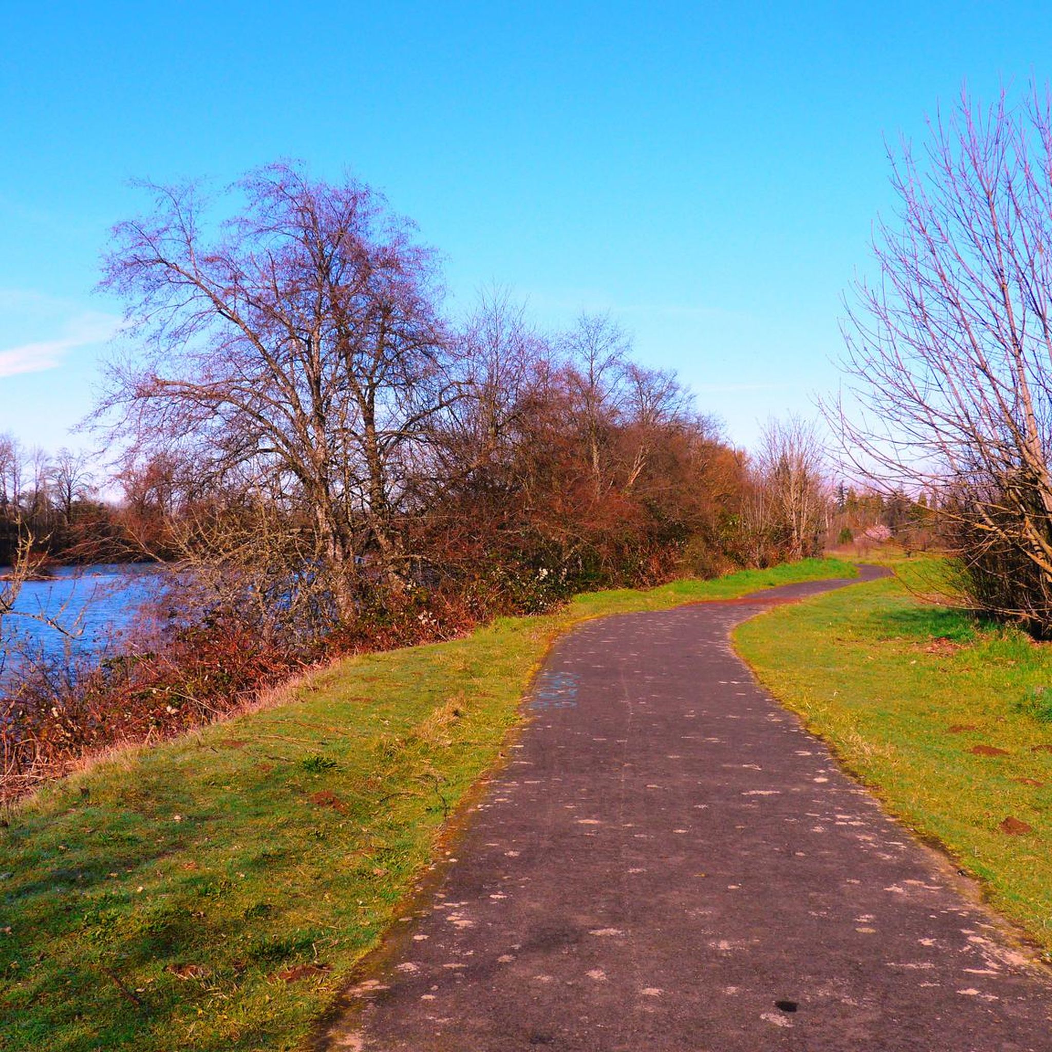
This path, a haven for cyclists, hugs the Willamette River's western edge. A well-paved trail, it unveils Eugene's downtown charm, with nearby parks like Skinner Butte and Owen Rose Garden. Bridges abound for easy crossings, ample parking, and minor road connections seamlessly link the trail.
0
0
A splendid, inviting park spanning around 45 acres. Abundant open areas, picnic spots, and play areas amidst grand trees. Conveniently near downtown. Your tranquil oasis awaits!
0
0
5th Street Public Market is the area's premier destination. Here you can experience a collection of local charming shops, restaurants, tasting rooms and eateries alongside two upscale boutique hotels. Stroll through the courtyard. Hear the splashing sounds of the fountain. Drink local wines (highly recommended) and maybe meet up with friends.
0
0

The Willamette River is 187 miles in length and lies entirely in northwestern Oregon. The main stem of the Willamette River runs through Eugene - Springfield, which has a variety of parks, bike paths and foot bridges near both downtowns making the river very accessible.
1
0
Frequently Asked Questions
How many touring cycling routes are available in Santa Clara?
There are over 70 touring cycling routes in Santa Clara, offering a wide range of options for different skill levels and preferences. You'll find everything from easy, flat paths to more challenging mountain ascents.
What types of touring cycling routes can I find in Santa Clara?
Santa Clara boasts a diverse network of cycling routes. You can explore extensive paved paths, dedicated bike lanes, and scenic creek trails. The region also offers portions of the San Francisco Bay shoreline for picturesque rides, and for experienced cyclists, challenging mountain climbs like Mount Hamilton and Mount Umunhum are available in the broader county.
Are there easy touring cycling routes suitable for beginners or families in Santa Clara?
Yes, Santa Clara has numerous easy routes perfect for beginners and families. Many of the 39 easy routes follow flat, dedicated paths along waterways, such as sections of the Guadalupe River Trail or the San Tomas Aquino Creek Trail, providing a pleasant and safe cycling experience.
Where can I find challenging touring cycling routes in Santa Clara?
For experienced riders seeking a challenge, the broader Santa Clara County area offers significant climbs. Mount Hamilton is a popular and demanding ascent, and Mount Umunhum provides another difficult climb with panoramic views. These routes offer substantial elevation gains and rewarding vistas.
What are some notable trails or paths for touring cyclists in Santa Clara?
Key trails include the Guadalupe River Trail, a 12.7-mile paved path connecting various parts of San Jose, and the San Tomas Aquino Creek Trail, which offers glimpses of high-tech firms and attractions like Levi Stadium. Portions of the San Francisco Bay Trail are also accessible, providing scenic rides along the bay shoreline.
What can I see or explore along the touring cycling routes in Santa Clara?
Many routes offer a blend of natural beauty and urban attractions. Along the Guadalupe River Trail, you can access parks and historical sites. The San Tomas Aquino Creek Trail passes by tech campuses and entertainment venues. Routes can also extend to neighboring cities like Cupertino, Saratoga, and Los Gatos, offering access to iconic landmarks like Apple Park or Stanford University, and even local wineries.
Are there any loop touring cycling routes in Santa Clara?
Yes, Santa Clara offers various loop routes, allowing cyclists to start and end at the same point. While specific named loops from the provided data are not within Santa Clara, the extensive trail network, including connections to the Bay Trail and various creek trails, allows for the creation of many circular touring routes tailored to different distances and difficulties.
What is the best time of year for touring cycling in Santa Clara?
Santa Clara benefits from pleasant weather year-round, making it suitable for touring cycling in most seasons. Spring and fall generally offer the most comfortable temperatures, while summers are warm and dry. Winters are mild, allowing for cycling, though occasional rain may occur.
What do other touring cyclists say about the routes in Santa Clara?
The touring cycling routes in Santa Clara are highly regarded by the komoot community, with an average score of 4.7 stars from over 20 reviews. Cyclists often praise the extensive, well-maintained trail network and the diverse scenery, which blends urban convenience with natural beauty.
Is public transport accessible near touring cycling trails in Santa Clara?
Santa Clara's location in Silicon Valley means many trails are well-integrated with urban areas, often making them accessible via public transport options. Cyclists can check local VTA (Santa Clara Valley Transportation Authority) bus and light rail services for routes that accommodate bikes and provide access to trailheads.
Where can I find parking for touring cycling trails in Santa Clara?
Many popular trailheads and parks in Santa Clara offer designated parking areas for visitors. For example, parks along the Guadalupe River Trail or near sections of the San Tomas Aquino Creek Trail typically have parking facilities. It's advisable to check specific park or trailhead information for parking availability before your ride.
Can I combine touring cycling with other activities in Santa Clara?
Absolutely. Santa Clara's diverse landscape and proximity to various attractions make it easy to combine cycling with other activities. You can enjoy birdwatching along the Guadalupe River Trail, explore boutique shops in Los Gatos after a ride on the Los Gatos Creek Trail, or visit museums and historical sites in downtown San Jose, which is accessible via the trail network.
Are there any long-distance touring cycling options from Santa Clara?
Yes, Santa Clara's extensive trail network connects to longer regional systems. Portions of the San Francisco Bay Trail, which is planned to be over 500 miles, are accessible from Santa Clara, offering opportunities for extended rides along the bay shoreline and connecting to other cities in the Bay Area. You can find more information about the Bay Trail on the Bay Trail interactive map.
Most popular routes around Santa Clara
Most popular attractions around Santa Clara

Get inspired with the komoot mobile app


Explore more
Browse the best Cycling routes in other regions.
