The best MTB trails around Oatfield
53
riders
7
rides
Mountain biking around Oatfield, an unincorporated community in Clackamas County, Oregon, offers access to diverse natural landscapes within the Portland metropolitan area. The region is characterized by its proximity to major rivers like the Willamette and Clackamas, as well as natural areas such as Tryon Creek and Mount Talbert Nature Park. While dedicated mountain bike trails are often found in areas near Oatfield, the surroundings provide opportunities to explore varied terrain, including wooded paths and urban waterfronts.
Best mountain bike…
Last updated: August 21, 2026
33
riders
Moderate mountain bike ride. Good fitness required. Suitable for all skill levels.
9
riders
Moderate mountain bike ride. Good fitness required. Suitable for all skill levels.

Sign up for free
3
riders
36.6km
02:09
360m
360m
Moderate mountain bike ride. Good fitness required. Suitable for all skill levels.
2
riders
Hard mountain bike ride. Good fitness required. Advanced riding skills necessary. Some portions of the route may require you to push your bike.
2
riders
7.04km
00:49
250m
250m
Easy mountain bike ride. Great for any fitness level. Suitable for all skill levels.
Get access to more routes and recommendations from other explorers.
Sign up for free
Already have an account?
Our route recommendations are based on thousands of hikes, rides, and runs completed by other people on komoot.
Start today with a free account
Your next adventure awaits.
Login or Signup
Tips from the Community

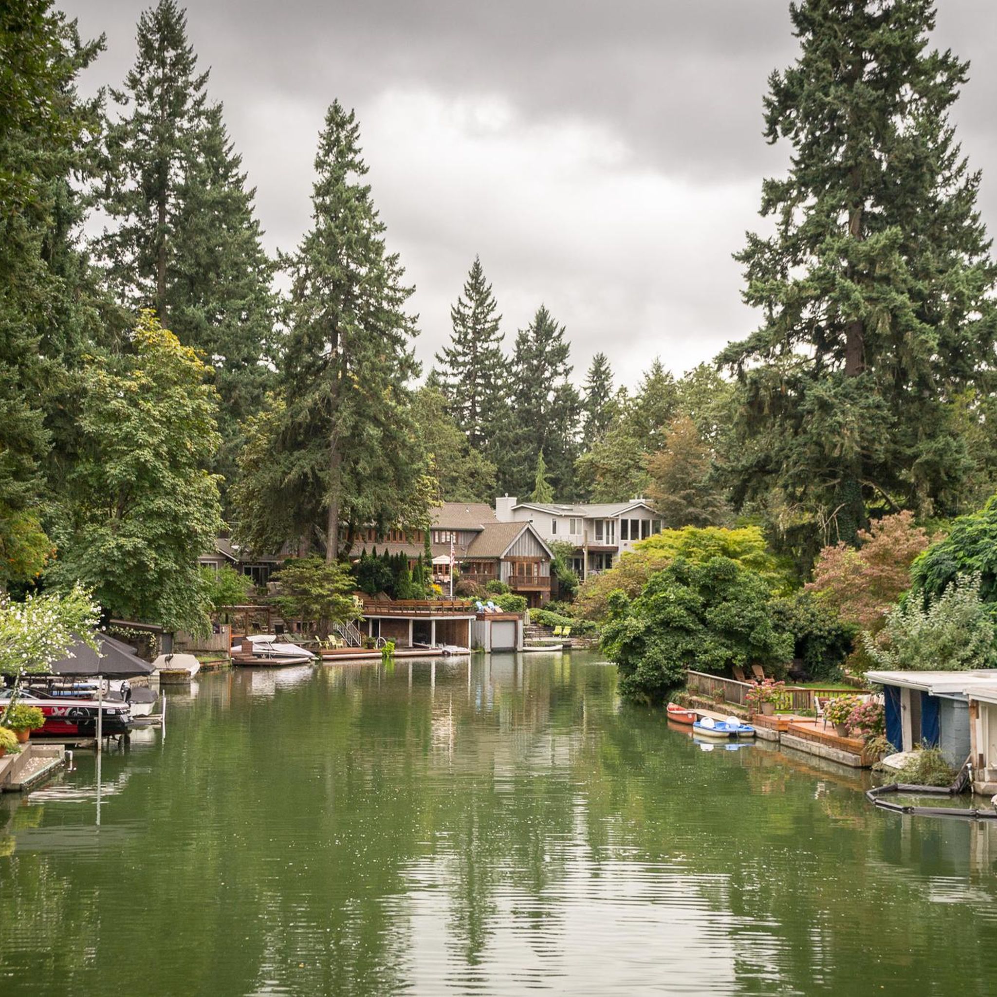
Great views of the Wilamette river and nice shade on a hot day.
0
0

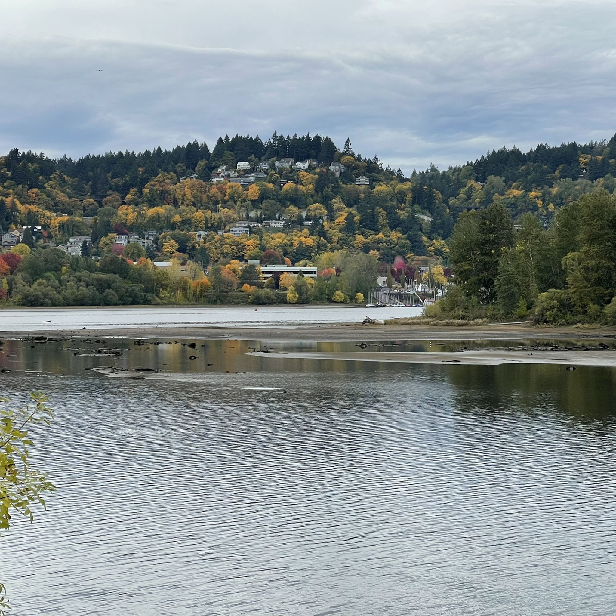
At this point on the Willamette River Greenway Trail, there are great views of the river. It is definitely worth taking a short break and enjoy the wonder views.
0
0
The Willamette Greenway Trail is a 5.5 mile long trail that follows the Willamette. The trail is a mix of path and sidewalks, and passes through both private and public lands and has great views of the river. It also connects several nearby parks.
0
0
Clackamette Cove is a small lake off of Clackamas River. The Clackamas River Trail runs right along the banks of the lake. It is definitely worth taking a break somewhere along the lake to enjoy the views.
0
0


The Broadway Bridge was built in 1913. It was originally black, but was repainted red in 1963.
1
0

This trailhead marks a popular route for hikers in the area. It is .3 miles from the Wild Cherry Trail, .9 miles to the Dogwood Trail and 1.4 miles to the Alder Trail. If you head west, all of these connector trails reach the Wildwood Trail, which offers ample opportunities to create loop variations. It is important to note that parking is limited, especially on the weekends.
0
0

Built in 1910, the Hawthorne Bridge spans 3,552 feet across the Willamette River with four lanes and is a key part of the city's bike culture. The bridge gives passage to over 30,000 vehicles daily, including 800 TriMet buses, along with more than 8,000 cyclists. During rush hour, bikes can outnumber cars. The wide sidewalks offer great views of the river and skyline. As the oldest vertical-lift bridge in the U.S. and Portland's oldest highway bridge, it was added to the National Register of Historic Places in 2012.
0
0
Frequently Asked Questions
How many mountain bike trails are available around Oatfield?
There are 5 mountain bike trails documented around Oatfield on komoot, offering a variety of experiences for different skill levels.
What are the difficulty levels of mountain bike trails near Oatfield?
The trails around Oatfield cater to various skill levels. You'll find 2 easy routes, 2 moderate routes, and 1 difficult route, providing options for beginners to more experienced riders.
Are there any easy mountain bike trails suitable for beginners or families?
Yes, there are easy mountain bike trails perfect for beginners or families. An example is the Fanno Creek Trail – Fanno Creek Trail loop from Metzger, which is 16.7 miles (26.9 km) long and follows Fanno Creek through suburban and natural areas. Another easy option is the Veterans Creek Natural Area loop from Southeast Flavel Street.
Can I find challenging or advanced mountain bike routes in the Oatfield area?
For a more challenging ride, consider the Eastbank Esplanade – Wintler Park loop from Southeast 17th Avenue & Holgate Boulevard. This 34.7 miles (55.8 km) route is rated as difficult and leads through urban waterfronts and parklands.
Are the mountain bike trails around Oatfield dog-friendly?
While specific trail regulations for dogs can vary, many natural areas and parks in the Portland metropolitan area, which includes Oatfield, generally allow dogs on trails if they are leashed. It's always best to check local signage or park websites for the most current rules before heading out with your dog.
What kind of natural attractions or landmarks can I see while mountain biking near Oatfield?
The area around Oatfield offers several natural attractions. You can explore the Clackamas River, part of the National Wild and Scenic River System, or the Willamette River waterfront. Other notable spots include Mount Talbert Nature Park with its wooded trails, and various viewpoints like Council Crest.
Are there mountain bike trails that are loop routes?
Yes, many of the mountain bike routes around Oatfield are designed as loops. Examples include the Northwest Leif Erikson Drive – Eastbank Esplanade loop from Southeast Division Street, the Fanno Creek Trail – Fanno Creek Trail loop from Metzger, and the Willamette River view – Sellwood Bridge loop from Southeast 17th Avenue & Rhine Street.
Is public transport an option to reach mountain bike trails near Oatfield?
Oatfield is situated within the Portland metropolitan area, which has a public transport system (TriMet). While some trailheads might be accessible via bus or MAX light rail, direct access to all mountain biking specific trails may require a combination of public transport and a short ride or walk. Planning your route with TriMet's trip planner is recommended.
When is the best time of year to go mountain biking around Oatfield?
Oregon's weather can be quite varied. Generally, late spring through early fall (May to October) offers the most favorable conditions for mountain biking, with drier trails and milder temperatures. However, some trails, especially those with paved or gravel sections, might be rideable year-round, weather permitting.
Are there less crowded mountain bike trails available for a quieter experience?
While Oatfield itself is not a primary mountain biking hub, some of the local trails, especially those within smaller nature parks or less-known loops, might offer a quieter experience compared to more popular regional destinations. Exploring routes like the Veterans Creek Natural Area loop from Southeast Flavel Street could provide a more serene ride.
Where can I find amenities like cafes or pubs near the mountain bike trails?
Given Oatfield's location within the Portland metropolitan area, you'll find numerous cafes, pubs, and restaurants in nearby communities and along urban sections of routes. Trails that pass through or near urban areas, such as those along the Willamette River or through neighborhoods, will offer more opportunities for amenities.
What are some of the longer mountain bike routes available?
For longer rides, consider the Northwest Leif Erikson Drive – Eastbank Esplanade loop from Southeast Division Street, which spans 36.5 miles (58.8 km). Another substantial option is the Eastbank Esplanade – Wintler Park loop from Southeast 17th Avenue & Holgate Boulevard, covering 34.7 miles (55.8 km).
What makes Oatfield a unique place for mountain biking compared to other regions in Oregon?
Oatfield offers a unique blend of urban and natural mountain biking experiences due to its location within the Portland metropolitan area. While not a dedicated mountain biking destination like Oakridge, Oregon, it provides access to riverfront paths, urban greenways, and natural areas like Tryon Creek and Mount Talbert Nature Park. This allows for rides that combine cityscapes with natural beauty, often along the Willamette and Clackamas Rivers.
Most popular routes around Oatfield
Most popular attractions around Oatfield

Get inspired with the komoot mobile app


Explore more
Browse the best MTB trails in other regions.
