The best running trails around Cherokee
67
runners
3
runs
Jogging around Cherokee, North Carolina, offers a diverse landscape characterized by the Appalachian Mountains, dense forests, and winding river valleys. The region features varied terrain, from gentle riverside paths to challenging mountain ascents. Runners can expect routes that traverse woodlands, follow waterways, and provide elevation changes suitable for different fitness levels. This area is known for its natural beauty, providing a scenic backdrop for outdoor activity.
Best jogging routes around Cherokee
- The most popular jogging route is Oconaluftee River Trail…
Last updated: June 25, 2026
14
runners
Moderate run. Good fitness required. Mostly paved surfaces. Suitable for all skill levels.
13
runners
21.3km
03:33
1,320m
1,320m
Hard run. Very good fitness required. Mostly paved surfaces. Suitable for all skill levels.

Sign up for free
12
runners
11.9km
02:03
790m
790m
Hard run. Very good fitness required. Mostly paved surfaces. Suitable for all skill levels.
12
runners
4.97km
00:36
10m
10m
Easy run. Great for any fitness level. Mostly paved surfaces. Suitable for all skill levels.
7
runners
9.77km
01:24
400m
400m
Hard run. Very good fitness required. Mostly paved surfaces. Suitable for all skill levels.
Our route recommendations are based on thousands of hikes, rides, and runs completed by other people on komoot.
Start today with a free account
Your next adventure awaits.
Login or Signup
Popular around Cherokee
Tips from the Community

My wife and I just completed this hike and it was roughly ~7 miles. Towards the end of the trail you’ll come to a clearing and on your left there’s small trail that leads to the nice perch where you can see 360 degrees! We are a bit skeptical on the Komoot difficulty and athletic ability as walking up to the summit is loose rock so sure-footedness is a must. We brought a gallon of water and 3 mres. We ended up with about a half-a-gallon left of water and ate the snacks of the mre! Side note: not a lot of tucked away places to make peepee! 5/5 hike!!
0
0

Bradley Fork Trail follows a scenic stream through forest in the Great Smoky Mountains. This section of the trail has easy terrain, with few rocky sections, and has some small waterfalls on the way. It also connects to backcountry campsites, making it a good option for overnight trips.
0
0

The Pinnacle, with an elevation of 5,008 feet, boasts stunning 360° views of the Jackson County valley. It is a fantastic reward for your hike, where you can stand on this stunning perch and soak up the sun. It's the perfect spot to take a break and capture some memorable photos before heading down the challenging rocky terrain to continue your journey.
2
0

As the gateway to GSMNP from the North Carolina side, the Oconaluftee Visitor Center serves as the main entrance to GSMNP. It's an information center staffed daily except for Christmas. You'll be able to find information about the history in the Smokies from natives to early European settlers. Next to that you'll find the usual visitor center things: maps, merchandise, a bookstore, and a gift shop.
2
0


Beautiful river valley with lots of rhododendron trees.
3
0
Frequently Asked Questions
Are there easy running routes suitable for beginners in Cherokee?
Yes, Cherokee offers several easy running paths. A great option for beginners is the Oconaluftee River Trail loop from Ravensford. This 3.1-mile (5.0 km) route is flat and follows the tranquil Oconaluftee River, providing a pleasant and accessible experience.
What are some challenging running trails for advanced runners in the Cherokee area?
For advanced runners seeking a challenge, Cherokee's mountainous terrain provides excellent options. The The Pinnacle – Blackrock Mountain loop from Pinnacle Park Tour is a difficult 13.2-mile (21.3 km) trail with significant elevation gain. Another demanding route is the Bradley Fork Trail loop from Smokemont, which is 6.1 miles (9.8 km) with moderate climbs through forested areas.
Are there any running routes in Cherokee that feature waterfalls or scenic viewpoints?
Absolutely! Many trails in the Cherokee area offer stunning natural beauty. While not exclusively a running route, the Tom Branch Falls – Indian Creek Falls loop from Deep Creek is a longer, difficult route that passes by beautiful waterfalls like Tom Branch Falls and Indian Creek Falls. For scenic viewpoints, the region's mountain trails often provide expansive vistas of the Appalachian landscape, such as those found along the routes near Blackrock Mountain.
What is the typical length of jogging routes available around Cherokee?
The jogging routes around Cherokee vary significantly in length to suit different preferences. You can find shorter, easy loops like the Oconaluftee River Trail loop at 3.1 miles (5.0 km), up to longer, more challenging runs such as The Pinnacle – Blackrock Mountain loop, which spans 13.2 miles (21.3 km).
Are there any circular jogging routes in Cherokee?
Yes, many of the popular jogging routes in Cherokee are designed as loops, offering a continuous scenic experience without retracing your steps. Examples include the easy Oconaluftee River Trail loop from Ravensford and the more challenging Bradley Fork Trail loop from Smokemont.
What kind of terrain can I expect on jogging trails in Cherokee?
Jogging in Cherokee offers a diverse range of terrain. You'll find everything from gentle, flat riverside paths, such as those along the Oconaluftee River, to challenging mountain trails with significant elevation changes and winding paths through dense woodlands. The region is characterized by the Appalachian Mountains, dense forests, and river valleys.
What do other runners enjoy most about jogging in Cherokee?
The komoot community frequently praises the natural beauty and varied terrain of Cherokee's running routes. Runners particularly enjoy the tranquil riverside paths, the challenge of mountain ascents, and the scenic backdrop of the Appalachian Mountains. The region offers options for all fitness levels, from easy strolls to demanding workouts.
Are there any specific landmarks or points of interest I can explore near the jogging routes?
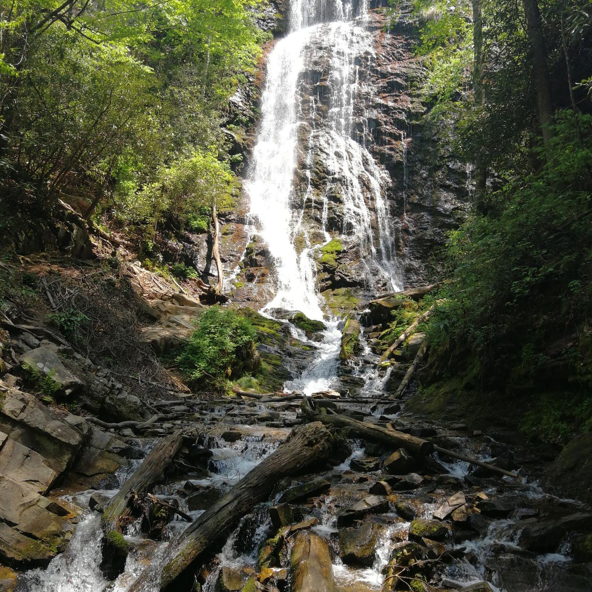
Yes, the Cherokee area is rich with natural landmarks. Many routes are close to or pass by notable features. For instance, the region is home to several beautiful waterfalls like Mingo Falls, Juney Whank Falls, and the aforementioned Tom Branch and Indian Creek Falls. You might also encounter scenic overlooks such as the Oconaluftee River Overlook.
How many jogging routes are covered in the Cherokee guide?
This guide highlights 4 top running trails around Cherokee, but the komoot community has explored over 50 routes in the area, offering a wide selection for different preferences and skill levels.
What are the best times of year for running in Cherokee, considering weather conditions?
Cherokee offers excellent running conditions for much of the year. Spring and fall are particularly popular due to mild temperatures and vibrant foliage. Summers can be warm and humid, especially in lower elevations, while winters can bring colder temperatures and occasional snow, particularly on higher mountain trails. Always check local weather forecasts before heading out.
Are there any jogging routes in Cherokee that are suitable for families with children?
For families looking for a gentle outing, the Oconaluftee River Trail loop from Ravensford is an excellent choice. Its flat, easy terrain along the river makes it suitable for all ages, providing a pleasant and accessible experience for a family jog or walk.
Can I bring my dog on the jogging trails in Cherokee?
Many trails within the Great Smoky Mountains National Park, which borders Cherokee, have specific regulations regarding dogs. Generally, dogs are permitted on paved trails like the Oconaluftee River Trail and the Gatlinburg Trail. However, they are typically not allowed on unpaved hiking trails to protect wildlife and ensure visitor safety. Always check specific trail regulations before bringing your dog.
Most popular routes around Cherokee
Most popular attractions around Cherokee

Get inspired with the komoot mobile app


