The best cycling routes around Maggie Valley
8
riders
5
rides
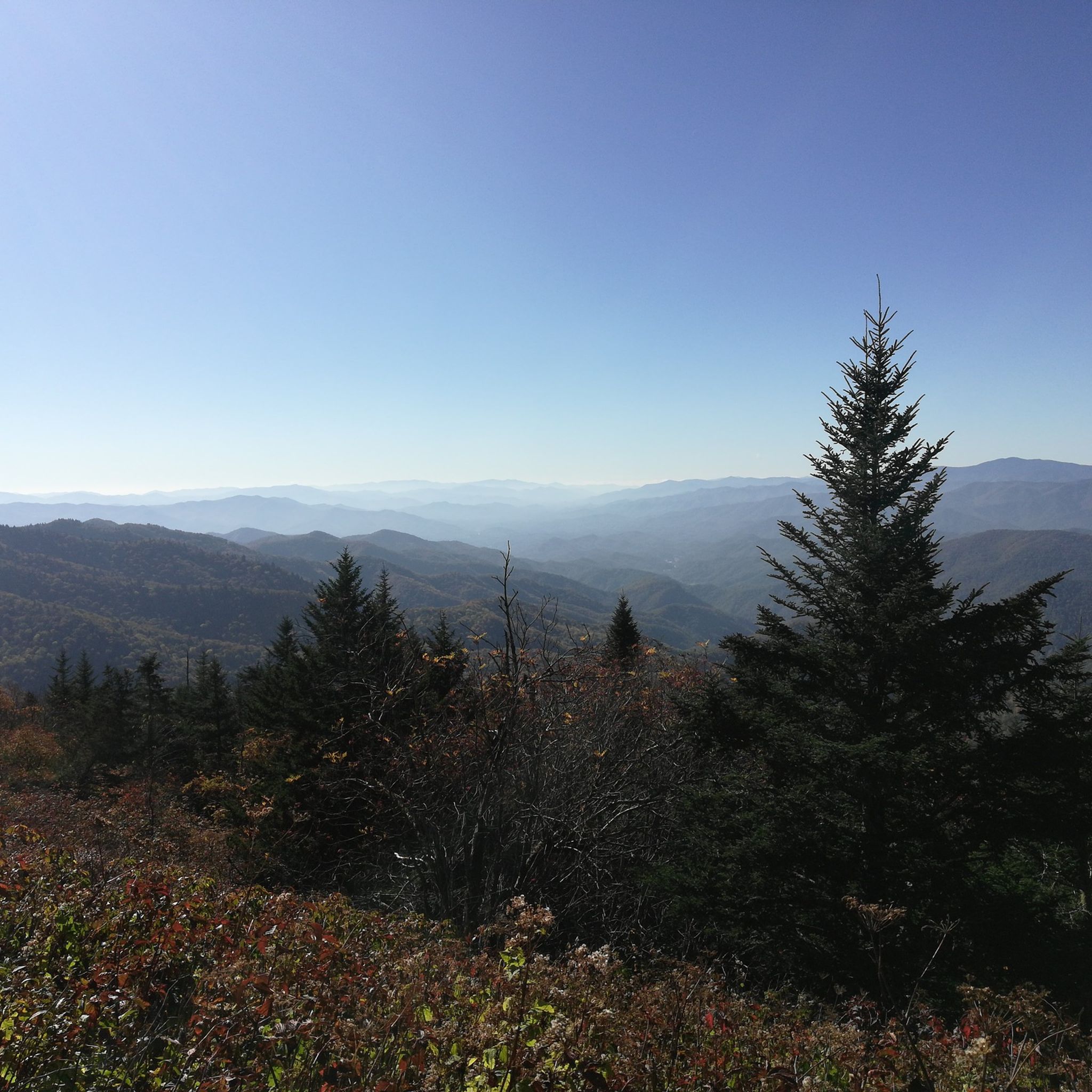
Touring cycling routes around Maggie Valley traverse the mountainous terrain of Western North Carolina, characterized by high elevations and dense forests. The region features numerous overlooks and passes, offering varied gradients for cyclists. Roads often follow natural contours, providing a mix of climbs and descents. This area is part of the Blue Ridge Mountains, known for its Appalachian landscapes.
Best touring cycling routes around Maggie Valley
- The most popular touring cycling route is Mountains-to-Sea Trail: Segment 2, a 18.8 miles (30.2 km) trail that takes 2 hours 26 minutes to complete. This difficult route features significant elevation gain through forested mountain passes.
- Another top favourite among local touring cyclists is Balsam Gap Overlook to Richland Balsam Overlook, a difficult 21.9 miles (35.3 km) path. This route offers views from high mountain overlooks and challenging ascents.
- Local touring cyclists also love the Richland Balsam loop, a 49.3 miles (79.3 km) trail leading through high mountain terrain, often completed in about 5 hours 57 minutes.
- Touring cycling around Maggie Valley is defined by mountain passes, scenic overlooks, and dense woodlands. The network offers options for different ability levels, from easy trails to difficult climbs.
- The guide includes highly-rated routes that showcase the best of the region's landscape. More than a few touring cyclists have used komoot to explore Maggie Valley's varied terrain.
Last updated: June 24, 2026
5
riders
30.2km
02:26
920m
920m
The Mountains-to-Sea Trail: Segment 2 offers a rugged and challenging experience through the Blue Ridge Parkway, showcasing a rich variety of Southern Appalachian plant communities. You will traverse spruce-fir forests and rhododendron thickets, enjoying continuous scenic views, including four-state vistas from Waterrock Knob, which is the highest point on this segment at 6,292 feet. This difficult route spans 18.8 miles (30.2 km) with an elevation gain of 3020 feet (920 metres), typically taking around 2 hours and 26 minutes to complete.
Planning your visit requires careful consideration, as this segment is rated strenuous for hiking and backpacking, demanding a high level of physical fitness due to significant elevation changes and challenging trail conditions. It is one of the least accessible parts of the Mountains-to-Sea Trail, with long stretches lacking road crossings and opportunities to resupply. Be aware that winter travel can be particularly difficult because of Blue Ridge Parkway closures, so check conditions before you go.
While listed for touring cycling, it is important to note that bicycles are generally prohibited on most of the natural surface sections of this segment. If you are seeking a cross-state cycling journey, consider the North Carolina Department of Transportation's on-road NC Bicycle Route 2 as an alternative. This segment is best appreciated as a demanding hike through one of the world's most biodiverse regions.
2
riders
35.3km
02:51
1,080m
1,080m
Embark on a challenging touring bicycle ride from Balsam Gap Overlook to Richland Balsam Overlook, covering 21.9 miles (35.3 km) with a significant elevation gain of 3540 feet (1079 metres). This difficult route, estimated to take about 2 hours and 51 minutes, leads you through high-elevation mountain landscapes. You will cycle past northern forest scenery, featuring red spruce and Fraser fir trees, offering panoramic vistas of the southern Appalachians, including the Cowees, Nantahalas, and Plott balsams, before reaching the Richland Balsam Overlook.
When planning your visit, remember that the Blue Ridge Parkway is paved but lacks dedicated bike lanes, so you will share the road with motorists. Be aware of narrow shoulders and grades typically ranging between 6% and 8%. Lights are essential for visibility and safety when passing through tunnels. Always exercise caution while touring cycling this route, especially given the shared road conditions.
This route takes you to the highest point on the entire Blue Ridge Parkway, making it a notable achievement for any touring cyclist. The journey offers a unique perspective of the region's natural environment, showcasing the distinct high-altitude ecosystem. It is an excellent option if you are looking for a demanding ride with rewarding views and a sense of accomplishment at a significant landmark.

Sign up for free
1
riders
11.4km
00:57
380m
380m
Embark on a touring bicycle ride along the Blue Ridge Parkway, offering continuous views of the Appalachian Mountains. This moderate 7.1-mile (11.4 km) route, with its 1240 feet (378 metres) of elevation gain, takes you through dense forests and past rolling hills. You can expect to complete the journey in about 57 minutes, culminating at Waterrock Knob Overlook for expansive 360-degree vistas. Along the way, keep an eye out for other scenic spots like Woolyback Overlook, adding to the picturesque experience.
When planning your ride, remember that touring cycling is permitted only on the paved roadway of the Blue Ridge Parkway; unpaved trails are off-limits for bikes. Temperatures at higher elevations like Waterrock Knob can be significantly cooler, so dressing in layers is a good idea. A visitor center at Waterrock Knob provides seasonal restrooms and picnic tables, offering convenient amenities for your stop. Consider starting your ride earlier in the day to make the most of the views and avoid potential afternoon crowds.
This route leads you to one of the highest points on the Blue Ridge Parkway, making it a notable destination for cyclists seeking elevation. The journey provides a unique perspective of the region's geology and diverse ecosystems as you ascend. Waterrock Knob is well-known for its panoramic views, allowing you to appreciate the vastness of the surrounding mountain ranges. It stands out as a rewarding climb with a spectacular payoff at the summit.
79.3km
05:58
1,920m
1,910m
Embark on the Richland Balsam loop, a difficult touring cycling route that challenges you with 49.3 miles (79.3 km) and a significant 6292 feet (1918 metres) of elevation gain. This demanding ride, estimated to take 5 hours and 57 minutes, winds through high-elevation spruce-fir forests, offering a distinct, fragrant atmosphere. You will be rewarded with expansive, panoramic mountain views across the southern Appalachians, including the Cowees, Nantahalas, and Plott Balsams, with the Richland Balsam Overlook marking a key highlight.
Planning your visit requires acknowledging the challenging nature of this route; it is best suited for experienced cyclists with a good level of fitness. This section of the Blue Ridge Parkway often experiences closures during winter months due to snow and ice, so it is essential to check conditions before you set out. Ensure your bike is in top condition and you are prepared for sustained climbs.
Located within Pisgah National Forest, the Richland Balsam loop offers a unique opportunity to cycle the highest point on the entire Blue Ridge Parkway. This elevation contributes to the distinct alpine-like environment and the sweeping vistas you will encounter. The route provides a memorable experience for those seeking a rigorous touring cycling adventure in a truly scenic setting.
4.73km
00:23
150m
150m
Embark on an easy touring cycling adventure along Mountains-to-Sea Trail: Segment 1, offering a quick yet rewarding ride through the Blue Ridge Parkway. You'll cover 2.9 miles (4.7 km) with a gentle elevation gain of 484 feet (148 metres), typically taking just 23 minutes. As you pedal, enjoy pleasant views of forested hillsides leading towards the notable Soco Gap. The route provides a refreshing glimpse into the natural beauty of this iconic mountain range, perfect for a short outing.
This touring cycling route is designed to be short and easily accessible for cyclists. While the broader Mountains-to-Sea Trail has sections unsuitable for bikes, this particular Komoot tour is specifically tailored for cycling. Before you head out, always check local conditions, especially for any Blue Ridge Parkway road closures that might occur due to weather. Planning ahead ensures a smooth and enjoyable experience on the trail.
This segment offers a convenient way to experience a taste of the Blue Ridge Parkway's natural beauty. It highlights the scenic vistas around Soco Gap, providing a rewarding view of the surrounding mountains. The route serves as an excellent introduction to the region's charm, allowing you to immerse yourself in the landscape without committing to a longer journey.
Our route recommendations are based on thousands of hikes, rides, and runs completed by other people on komoot.
Start today with a free account
Your next adventure awaits.
Login or Signup
Popular around Maggie Valley

Tips from the Community


Grassy Ridge Mine Overlook is located at Milepost 436.8 on the Blue Ridge Parkway and was named after an old mine from the 1800s and early 1900s that was located just below the overlook. The viewpoint looks over the forests and foothills of Sylva. The Mountains-to-Sea Trail can be accessed from this parking lot, making it an even more popular pull-off.
0
0
At an elevation of 5,580 feet and at Milepost 433.3 on the Blue Ridge Parkway, Roy Taylor Forest Overlook offers a couple different views. There is a view from the parking area that has recently been improved by the forest service (tree removal), and there is also a short paved path to a wooden observation deck.
0
0
Grassy Ridge Mine Overlook is located at Milepost 436.8 on the Blue Ridge Parkway and was named after an old mine from the 1800s and early 1900s that was located just below the overlook. The viewpoint looks over the forests and foothills of Sylva. The Mountains-to-Sea Trail can be accessed from this parking lot, making it an even more popular pull-off.
0
0
The Steestachee Bald View is an official overlook on the Blue Ridge Parkway at Milepost 438.9. The "bald" isn't so bald anymore, but there are still some great views of the surrounding mountains and valleys. If you look closely, you can even see the parkway off in the distance on the side of one of the mountains.
0
0
The Cove Field Ridge Overlook is located at Milepost 439.4 on the Blue Ridge Parkway and offers just a window view of the mountains with trees blocking other parts of the viewpoint. For this reason, a lot of people skip by this overlook. This view is great if you are able to get the window-view to yourself.
0
0
Located at Milepost 441.4 on the Blue Ridge Parkway, the Standing Rock Overlook is named for the giant upright bolder right next to the parking area. There is also a view of the valley through a break in the trees.
0
0
You can find the Woodfin Valley Overlook at Milepost 446 on the Blue Ridge Parkway. Unfortunately, tall trees are blocking the views of the actual valley, but you can still see a bunch of the ridges and nearby mountains.
0
0
Frequently Asked Questions
How many touring cycling routes are available in Maggie Valley?
There are 5 touring cycling routes detailed in this guide for Maggie Valley, offering a variety of experiences for different skill levels.
Are there easy touring cycling routes for beginners or families?
Yes, there is at least one easy touring cycling route. The Mountains-to-Sea Trail: Segment 1 is an easy 4.7 km (2.9 miles) path, suitable for those looking for a less strenuous ride.
What challenging touring cycling routes are available for experienced riders?
For experienced riders seeking a challenge, routes like Richland Balsam loop offer significant elevation gain over 79.3 km (49.3 miles). Another difficult option is Mountains-to-Sea Trail: Segment 2, which covers 30.2 km (18.8 miles) through forested mountain passes.
Which touring cycling routes offer the best scenic views in Maggie Valley?
Many routes in Maggie Valley offer stunning views due to the mountainous terrain. The Balsam Gap Overlook to Richland Balsam Overlook route is particularly noted for its high mountain overlooks and challenging ascents, providing expansive vistas. You can also find viewpoints like Lickstone Ridge Overlook and Yellow Face Overlook along various paths.
Are there any circular touring cycling routes in Maggie Valley?
Yes, the Richland Balsam loop is a prominent circular route. It's a long and challenging ride, covering 79.3 km (49.3 miles) through high mountain terrain.
What kind of terrain can I expect on touring cycling routes around Maggie Valley?
The terrain around Maggie Valley is predominantly mountainous, characterized by high elevations, dense forests, and numerous overlooks. Routes often follow natural contours, providing a mix of climbs and descents, typical of the Blue Ridge Mountains.
What natural attractions can I see along the touring cycling routes?
Along the routes, you can encounter several natural attractions. Highlights include the Waterrock Knob Summit and the beautiful Soco Falls. Many routes also pass by scenic viewpoints like Standing Rock Overlook.
When is the best time of year for touring cycling in Maggie Valley?
The best time for touring cycling in Maggie Valley is typically during the spring and fall months when temperatures are milder and the scenery is vibrant with wildflowers or autumn foliage. Summer can also be pleasant, though it may be warmer, while winter can bring colder temperatures and potential snow at higher elevations.
Are there any moderate touring cycling routes for intermediate riders?
Yes, for intermediate riders, the Waterrock Knob from Thunderstruck Overlook route is a moderate option. It covers 11.4 km (7.1 miles) and offers a balanced challenge with rewarding views.
What makes Maggie Valley a unique destination for touring cyclists?
Maggie Valley stands out for its location within the Blue Ridge Mountains, offering touring cyclists a unique blend of high-elevation rides, dense Appalachian forests, and numerous scenic overlooks. The varied gradients and natural contours of the roads provide diverse cycling experiences, from challenging climbs to enjoyable descents.
What should I consider regarding weather and gear for touring cycling in Maggie Valley?
Given the mountainous environment, weather can change quickly. It's advisable to pack layers, even in warmer months, and be prepared for potential rain. Higher elevations can be cooler than the valley floor. Always check the forecast before heading out.
Most popular routes around Maggie Valley
Most popular attractions around Maggie Valley

Get inspired with the komoot mobile app


Explore more
Browse the best Cycling routes in other regions.
