The best running trails around Hendersonville
5.0
(4)
142
runners
14
runs
Jogging around Hendersonville offers a diverse range of natural landscapes, from well-maintained greenways to challenging mountain and forest trails. The region is characterized by its extensive network of paved paths, scenic parks, and varied terrain, providing options for all fitness levels. Runners can explore routes winding through wetlands, alongside creeks, and into the surrounding mountains, which feature significant elevation changes.
Best jogging routes around Hendersonville
- The most popular jogging route is Oklawaha Greenway, a 6.5 miles (10.4 km) trail…
Last updated: October 18, 2026
5.0
(2)
30
runners
10.4km
01:05
40m
40m
The Oklawaha Greenway provides a serene escape on a paved path, perfect for a leisurely jog or stroll through Hendersonville's natural beauty. As you move along the 10-foot-wide asphalt, you'll…
8
runners
5.88km
00:41
180m
180m
Big Glassy and Little Glassy Trail Loop is a moderate 3.7-mile jogging route with 595 feet of gain, offering panoramic views of the Blue Rid

3
runners
4.55km
00:28
0m
0m
The Cane Creek Greenway offers a delightful escape into nature, winding through a mix of shady forests and open farmland. You'll follow the gentle curves of Cane Creek, enjoying the…
23
runners
4.62km
00:28
10m
0m
Easy run. Great for any fitness level. Mostly paved surfaces. Suitable for all skill levels.
13
runners
6.43km
00:40
40m
40m
Moderate run. Good fitness required. Mostly paved surfaces. Suitable for all skill levels.
Get access to more routes and recommendations from other explorers.
Already have an account?
Our route recommendations are based on thousands of hikes, rides, and runs completed by other people on komoot.
Start today with a free account
Your next adventure awaits.

Tips from the Community

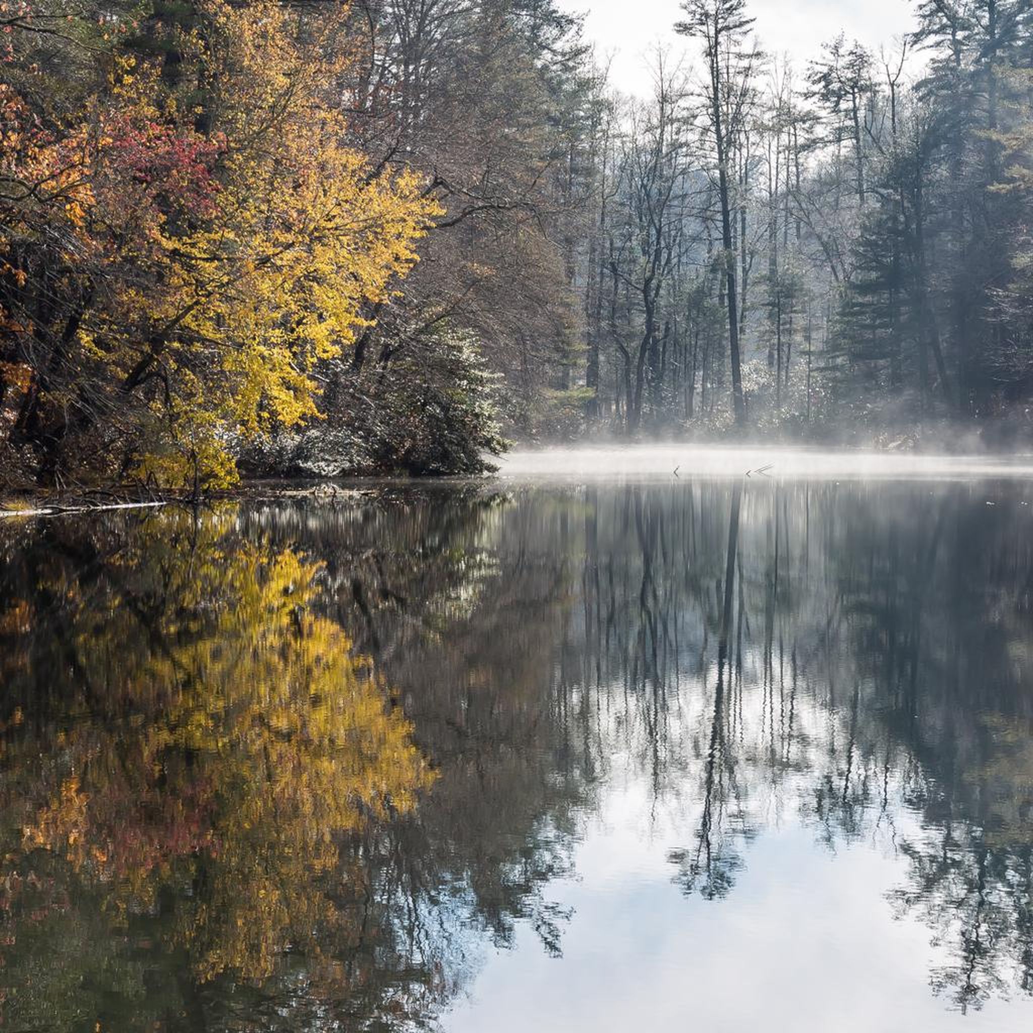
Front Lake is a small reservoir at the entrance to the Carl Sandburg Home National Historic Site and the trailhead for Memminger Trail. The reservoir is sometimes drained for maintenance, but it is a sight when it is full.
0
0
Front Lake is a small reservoir at the entrance to the Carl Sandburg Home National Historic Site and the trailhead for Memminger Trail. The reservoir is sometimes drained for maintenance, but it is a sight when it is full. If you run the Memminger Trail to the south from here, it crosses over Memminger Creek, which is running down from the lake.
0
0
This section of trail follows along Cane Creek. It is forested the entire way and feels more like a nature trail than the walking path around the sporting fields at Bill Moore Community Park. You pass an old, abandoned car that is beyond rusting in the woods, and the trail dead ends on the bank of Cane Creek.
0
0
The Oklawaha Greenway in Hendersonville, North Carolina, is a completely paved path open to bikers, runners, and walkers. The path follows along a creek for the majority of the trail while passing parks and crossing bridges. This is a really popular trail that has great signage, multiple trailheads, and access to other trails along the way.
0
0
Glassy, or Glassy Mountain (not to be confused with its neighbor Little Glassy Mountain), is a 2,783-foot peak situated in the Carl Sandburg Home National Historic Site in Flat Rock, North Carolina. The trail accessing the peak is well-maintained and easy to follow, and the summit itself is an awesome viewpoint.
0
0
Frequently Asked Questions
What types of running trails can I find in Hendersonville?
Hendersonville offers a diverse range of running trails. You'll find well-maintained greenways like the Oklawaha Greenway, which is paved and accessible, winding through wetlands and forests. There are also trails within parks such as Jackson Park and The Park at Flat Rock, and more challenging mountain and forest trails in areas like DuPont State Recreational Forest and Bearwallow Mountain for those seeking varied terrain and significant elevation changes.
Are there easy running routes suitable for beginners or casual joggers?
Yes, Hendersonville has several easy running routes perfect for beginners or those looking for a relaxed jog. The Cane Creek Greenway is an excellent option, offering scenic views over 2.8 miles. The Oklawaha Greenway is also largely flat and paved, making it very accessible. Many park trails, such as those in Jackson Park, also provide easy, well-maintained paths.
Can I find challenging running routes with significant elevation changes?
Absolutely. For experienced runners seeking a challenge, the Hendersonville area provides mountain and forest trails with notable elevation changes. The Big Glassy and Little Glassy Trail Loop at the Carl Sandburg Home National Historic Site is a moderate path with significant climbs. Further afield, DuPont State Recreational Forest and Bearwallow Mountain offer more strenuous trails with varied terrain and rewarding views.
Are there any running routes that feature waterfalls?
Yes, if you're willing to venture slightly outside the immediate Hendersonville urban area, DuPont State Recreational Forest is renowned for its spectacular waterfalls. While primarily a hiking destination, its extensive network of trails and roads, including those leading to Hooker Falls, Triple Falls, and High Falls, can be explored by runners seeking a scenic and challenging experience.
What scenic viewpoints or landmarks can I see along the running trails?
Many running routes in Hendersonville offer beautiful scenery and points of interest. The Big Glassy and Little Glassy Trail Loop provides views from the Carl Sandburg Home National Historic Site, and you can even see descendants of Mrs. Sandburg's champion dairy goat herd. Bearwallow Mountain offers trails with 360-degree views of area landmarks. The Oklawaha Greenway is known for drawing a wide variety of birds, wildflowers, and small mammals.
Are there family-friendly jogging paths in Hendersonville?
Hendersonville is great for family outings. The paved greenways, such as the Cane Creek Greenway and the Oklawaha Greenway, are ideal for families, offering flat, accessible surfaces. Parks like Jackson Park and The Park at Flat Rock also feature easy walking trails that are suitable for all ages and provide open spaces for children to enjoy.
Can I bring my dog on the running trails in Hendersonville?
Many trails and greenways in Hendersonville are dog-friendly, provided your pet is on a leash. The Oklawaha Greenway and Cane Creek Greenway are popular choices for runners with dogs. Always check specific park or trail regulations before heading out, but generally, the area welcomes leashed dogs on its outdoor paths.
Are there circular running routes available?
Yes, several routes in the area offer a circular experience. The Big Glassy and Little Glassy Trail Loop is a popular option. You can also find loop variations on the greenways, such as the Oklawaha Greenway loop from Henderson County, which provides a good distance without retracing your steps.
Where can I find parking near the running trails?
Parking is generally available at the trailheads of major greenways and parks. The Oklawaha Greenway, for instance, has multiple trailheads with parking facilities, including at Jackson Park, Patton Park, and Berkeley Park. Parks like The Park at Flat Rock and Veterans Park also offer dedicated parking areas for trail access.
What do other runners say about the trails in Hendersonville?
The running trails in Hendersonville are highly rated by the komoot community, with an average score of 5.0 stars from 4 reviews. Over 170 runners have used komoot to explore the area's varied terrain, often praising the well-maintained paths, scenic views, and the diversity of options from easy greenways to more challenging mountain trails.
How many running routes are available in Hendersonville?
There are over 15 running routes available around Hendersonville, catering to various preferences and fitness levels. These include easy greenway paths, moderate park trails, and more difficult mountain routes.
Are there running routes along water features?
Yes, many routes in Hendersonville incorporate water features. The Oklawaha Greenway follows Mud Creek for a significant portion, offering serene views. The Cane Creek Greenway also provides scenic views of its namesake creek. While not directly for running, the nearby Old Hickory Lake offers a scenic backdrop and surrounding nature trails for outdoor activities.
What is the best time of year for running in Hendersonville?
Hendersonville offers pleasant running conditions throughout much of the year. Spring and fall are particularly popular due to mild temperatures and beautiful foliage. Summer mornings are also great, though afternoons can be warm and humid. Winter running is possible, but some higher elevation trails might have icy patches, so checking conditions is advisable.
Most popular attractions around Hendersonville

Get inspired with the komoot mobile app


Explore more
Browse the best Running Trails & Routes in other regions.
