The best cycling routes around Wrightsville Beach
4.6
(13)
110
riders
15
rides
Touring cycling routes around Wrightsville Beach are characterized by a coastal environment with diverse waterways, including the Intracoastal Waterway, Banks Channel, and the Atlantic Ocean. The terrain is generally flat, making it suitable for various cycling abilities. The region features a mix of dedicated paved multi-use trails and scenic roads, often passing through salt marshes and offering views of the water.
Best touring cycling routes around Wrightsville Beach
- The most popular touring cycling route is Gary Shell Cross-City Trail, a 24.1 miles (38.7 km) trail that takes 2 hours 12 minutes to complete. This moderate route connects downtown Wilmington to Wrightsville Beach, offering a mix of urban and natural scenery.
- Another top favourite among local touring cyclists is Bradley Creek Pond – Wrightsville Beach loop from University of North Carolina at Wilmington, an easy 14.7 miles (23.7 km) path. This loop explores the area around Bradley Creek Pond and Wrightsville Beach.
- Local touring cyclists also love the Wrightsville Beach loop from Wrightsville Beach, a 6.7 miles (10.7 km) trail leading through the heart of Wrightsville Beach, often completed in about 40 minutes.
- Touring cycling around Wrightsville Beach is defined by coastal paths, scenic waterways, and paved multi-use trails. The network offers options for different ability levels, from easy loops to longer routes.
- The routes in Wrightsville Beach are highly rated by the komoot community with an average score of 3.98 stars from over 14 reviews. More than 80 touring cyclists have used komoot to explore Wrightsville Beach's varied terrain.
Last updated: July 2, 2026
4.0
(1)
2
riders
38.7km
02:13
70m
70m
The Gary Shell Cross-City Trail is a touring cycling route that gives you a real feel for Wilmington, blending urban exploration with natural green spaces. You'll ride through diverse scenery, from the wooded paths of Halyburton Park to the bustling streets near the UNCW campus, and even catch glimpses of Bradley Creek Pond. It's a mixed bag of dedicated paths and city navigation, offering a varied experience for those who enjoy seeing different facets of a city by bike.
Planning your ride means being ready for a moderate challenge, not from steep climbs, but from navigating urban environments. The 24.1 miles (38.7 km) route, with its gentle 239 feet (73 metres) of elevation gain, takes about 2 hours and 12 minutes. You'll encounter frequent road crossings and some sections where the trail shares space with traffic, so staying alert is key. Parking is available at parks along the way, and you can find amenities like restrooms and bike repair stations.
This trail is a significant part of Wilmington's alternative transportation network, connecting numerous parks, the university, and various commercial spots. It's also part of the larger East Coast Greenway, making it a piece of a much grander cycling vision. The route's variety, from quiet park sections to lively commercial zones, ensures you won't get bored, and it's a great way to access destinations like Wrightsville Beach without always being on dedicated trails.
4.7
(3)
15
riders
Easy bike ride. Great for any fitness level. Mostly paved surfaces. Suitable for all skill levels.

Sign up for free
5.0
(2)
16
riders
29.3km
01:42
50m
50m
The Bradley Creek Pond loop offers a delightful touring cycling experience through Wilmington's coastal landscapes. You'll pedal along mostly flat, paved surfaces, enjoying picturesque coastal scenery, marshlands, and waterways. The tranquil Bradley Creek Pond itself provides a serene spot to pause and take in the views, making this an ideal route for a relaxed outing.
This easy 18.2-mile (29.3 km) ride, with a minimal 169 feet (51 metres) of elevation gain, typically takes about 1 hour and 41 minutes. While generally smooth, be cautious of the section along Oleander Drive (US 76) crossing Bradley Creek, which can have heavy traffic. An alternative via Greenville Avenue is suggested to bypass this busy area.
This loop is part of Wilmington's extensive cycling network, often intersecting with the historic River to the Sea Bikeway. This connection allows you to explore both natural beauty and historical aspects of the region, following the path of the old trolley line that once linked downtown Wilmington to Wrightsville Beach.
5.0
(1)
12
riders
10.7km
00:40
10m
10m
Easy bike ride. Great for any fitness level. Mostly paved surfaces. Suitable for all skill levels.
5.0
(1)
9
riders
This touring bicycle route offers a delightful spin through Wrightsville Beach's coastal scenery, taking you past diverse waterways and serene salt marshes. You'll enjoy views of the Intracoastal Waterway, Banks Channel, and the Atlantic Ocean, with the tranquil Bradley Creek Pond providing a peaceful interlude. The largely flat, paved terrain makes for a smooth and enjoyable ride, blending urban and natural landscapes.
Planning your visit is straightforward, as the Wrightsville Beach area is known for being bike-friendly with designated lanes. While specific parking isn't detailed, you'll find options around the beach, though arriving early is always a good idea, especially during busy seasons. The route is popular with local cyclists, so consider an early start for a more relaxed experience.
This easy 14.1-mile (22.6 km) loop, with only 112 feet (34 metres) of elevation gain, can be completed in about 1 hour and 18 minutes, making it an excellent choice for beginner cyclists or families. It's part of a broader network of paths, offering a taste of the region's cycling potential and showcasing the picturesque coastal environment around Bradley Creek Pond.
Get access to more routes and recommendations from other explorers.
Sign up for free
Already have an account?
Our route recommendations are based on thousands of hikes, rides, and runs completed by other people on komoot.
Start today with a free account
Your next adventure awaits.
Login or Signup
Popular around Wrightsville Beach


Tips from the Community

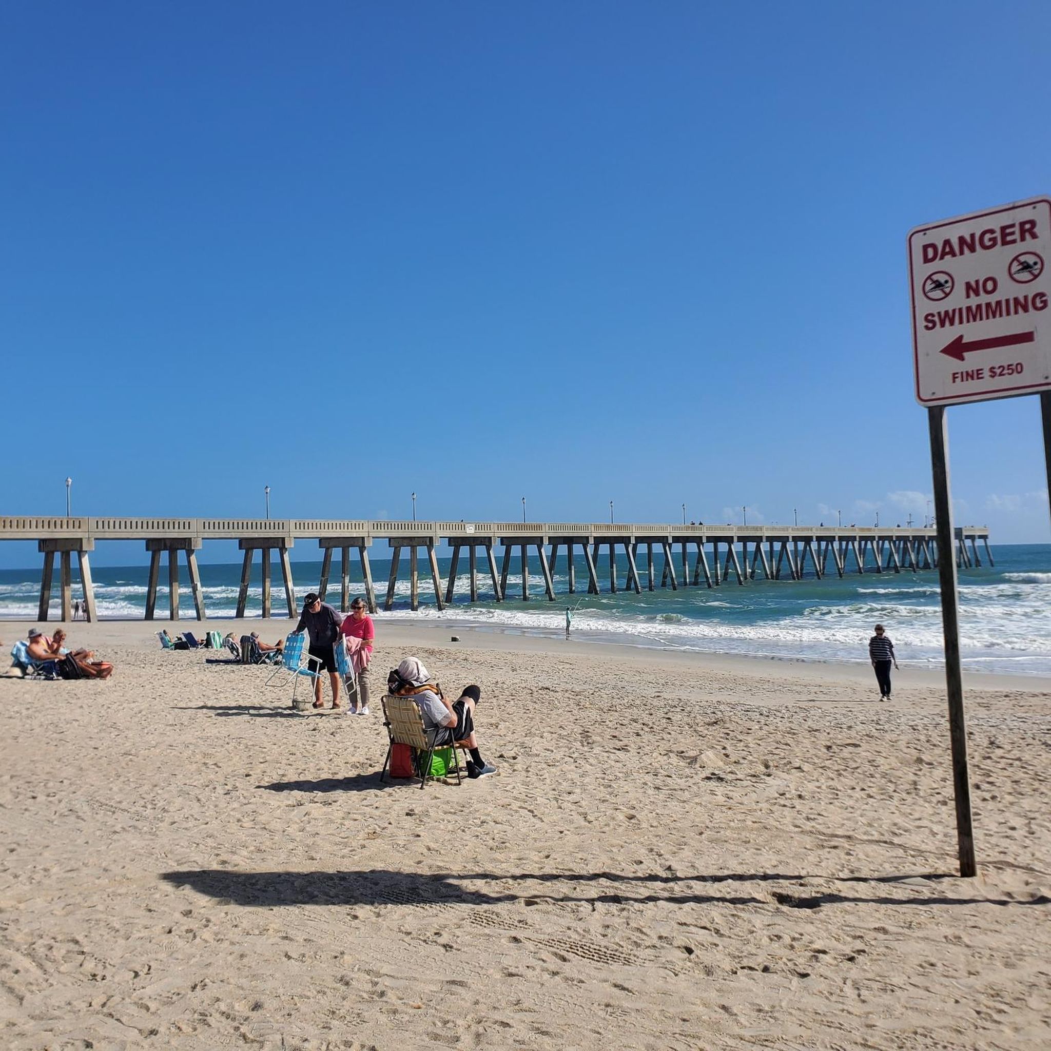
Wrightsville Beach is one of the most popular beaches in North Carolina. It is known for its clean, wide beach area and for the many events that happen throughout the year.
0
0
Bradley Creek Pond is a small body of water along Bradley Creek. The East Coast Greenway passes right along the banks of the water, so it is a good spot for a quick break.
0
0
Halyburton Park is a beautiful 60-acre park. The park is mostly undeveloped, but has several different paved trails that take you through the rolling sandhills.
1
0
Frequently Asked Questions
How many touring cycling routes are available around Wrightsville Beach?
There are 14 touring cycling routes around Wrightsville Beach listed on komoot, offering a variety of experiences for cyclists. Most of these, 11 routes, are rated as easy, with 3 moderate options available.
What types of terrain can I expect on touring cycling routes in Wrightsville Beach?
The terrain around Wrightsville Beach is generally flat, making it suitable for various cycling abilities. Routes often feature a mix of dedicated paved multi-use trails and scenic roads, passing through coastal environments, salt marshes, and offering views of the Intracoastal Waterway, Banks Channel, and the Atlantic Ocean.
Are there any family-friendly cycling routes in Wrightsville Beach?
Yes, many routes are suitable for families due to the flat terrain and presence of dedicated multi-use paths. A great option is the Wrightsville Beach loop from Wrightsville Beach, which is 6.7 miles (10.7 km) and leads through the heart of Wrightsville Beach, often completed in about 40 minutes. The Loop, a 2.45-mile paved trail, is also excellent for all skill levels.
Where can I find longer cycling routes for a more extended ride?
For a longer ride, consider the Gary Shell Cross-City Trail. This moderate 24.1-mile (38.7 km) route connects downtown Wilmington to Wrightsville Beach, offering a mix of urban and natural scenery. Another option is the Bradley Creek Pond loop from 41st St (SB) & Oleander Dr, an easy 29.3 km (18.2 miles) path.
Are there any circular cycling routes available?
Yes, several routes are circular. The Bradley Creek Pond – Wrightsville Beach loop from University of North Carolina at Wilmington is an easy 14.7-mile (23.7 km) path exploring the area. Another is the Wrightsville Beach – Bradley Creek Pond loop from Wrightsville Beach, an easy 22.6 km (14 miles) route.
What are some scenic viewpoints or natural features to look out for while cycling?
Wrightsville Beach offers continuous views of the Intracoastal Waterway, Banks Channel, and salt marshes, especially along 'The Loop' and Causeway Drive. You'll also find pristine sandy beaches and the Atlantic Ocean. The River to Sea Bikeway passes through various parks, offering a mix of urban and natural scenery.
What do other touring cyclists say about the routes in Wrightsville Beach?
The routes in Wrightsville Beach are highly rated by the komoot community, with an average score of nearly 4 stars from 14 reviews. Cyclists often praise the coastal paths, scenic waterways, and well-maintained paved multi-use trails that define the area's cycling experience.
Are there any specific attractions or landmarks near the cycling routes?
Beyond the scenic waterways, you can explore Airlie Gardens, located across the bridge from Wrightsville Beach, featuring historic gardens and a 500-year-old oak. Johnnie Mercers Fishing Pier is a prominent landmark offering great views. Wrightsville Beach Park also serves as a central hub for outdoor activities.
What is the best season for biking in Wrightsville Beach?
Wrightsville Beach is an excellent destination for outdoor activities year-round. Its coastal environment provides pleasant conditions for cycling, though it's always wise to check local weather forecasts, especially during summer months for heat and potential afternoon showers, or during hurricane season (June-November).
Are there any restrictions for cycling on the beach strand?
Yes, biking is restricted on the beach strand itself between 9 AM and 6 PM from April 1 to October 1. However, dedicated paths like 'The Loop' and roads like North Lumina Avenue provide ample cycling opportunities with coastal views.
Where can I park to access the bike trails in Wrightsville Beach?
Wrightsville Beach Park is a central hub and a good starting point for 'The Loop', offering parking facilities. For routes connecting to Wilmington, consider parking options near the start of the River to Sea Bikeway (Cross-City Trail) in Wilmington, such as near Wade Park or Halyburton Park, and cycling towards the beach.
Most popular routes around Wrightsville Beach

Get inspired with the komoot mobile app


Explore more
Browse the best Cycling routes in other regions.
