The best walks and hikes around North Tonawanda
4.7
(4)
34
hikers
15
hikes
Hiking around North Tonawanda, New York, offers diverse natural landscapes shaped by its location along the Niagara River and the Erie Canal. The region features a network of accessible paths through wetland preserves, state parks, and waterfront areas. These landscapes provide varied terrain for outdoor activities, including easy walking trails and multi-use paths. The area is characterized by riverfront paths, canal-side trails, and wetland ecosystems.
Best hiking trails in North Tonawanda
- The most popular hiking route is Ellicott Creek Trailway…
Last updated: October 10, 2026
9.99km
02:31
20m
20m
Moderate hike. Good fitness required. Easily-accessible paths. Suitable for all skill levels.
3.14km
00:47
0m
0m
Easy hike. Great for any fitness level. Easily-accessible paths. Suitable for all skill levels.

5.38km
01:22
10m
10m
Easy hike. Great for any fitness level. Easily-accessible paths. Suitable for all skill levels.
8
hikers
6.70km
01:41
10m
10m
Easy hike. Great for any fitness level. Easily-accessible paths. Suitable for all skill levels.
4
hikers
8.36km
02:07
10m
10m
Moderate hike. Good fitness required. Easily-accessible paths. Suitable for all skill levels.
Get access to more routes and recommendations from other explorers.
Already have an account?
Our route recommendations are based on thousands of hikes, rides, and runs completed by other people on komoot.
Start today with a free account
Your next adventure awaits.
Popular around North Tonawanda
Tips from the Community

This little point looks out over the outlet of Tonawanda Creek, where it first merges into the Little River and then, together, the two waters merge into the Tonawanda Channel of the Niagara River. From here you have your choice of two different riverwalks: The Eerie Canalway Trail to the east, which runs upstream along Tonawanda Creek; and the Shoreline Trail which runs southwest along the Niagara River.
0
0

Very near one end of the Empire State Trail, this repair station will help you get your bike right before you set off on your adventure. Or, to fix up anything that needs a tune up after finishing a tour.
0
0
This 1.2-mile-long riverside park is popular for bikers, but that's just a tithe on the activity you can see here: People-watching opportunities include rollerblades, boaters, waterskiers, sunbathers, fisher, birdwatchers and many more.
0
0

The Buckhorn Island Trail is the main trail through Buckhorn Island State Park. It runs right along the banks of the Tonawanda Channel, so you get great views of the river.
0
0
The Shoreline Trail is a paved, 8-mile trail that is part of the Empire State Trail. It follows along the Niagara River and is completely off-road.
0
0
Isle View Park is a 1.2 mile-long park along the Niagara River. It is popular with cyclists, walkers and runners. The park has great views of the river, and has benches and picnic areas to enjoy the view.
0
0

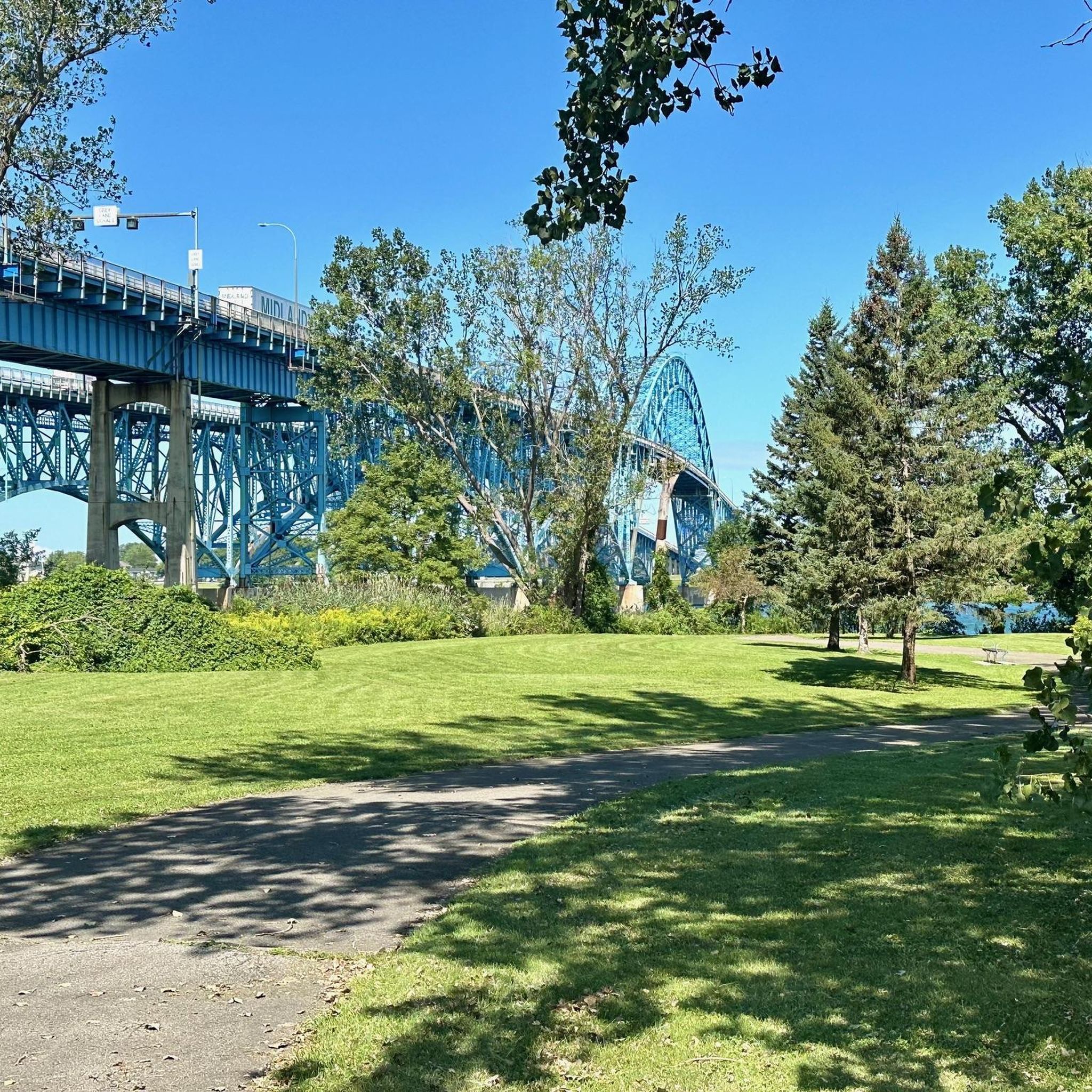
Though both of the Grand Island Bridges look like they were built in 1930, actually the northbound traffic bridge is nearly 30 years younger, being built in 1963, while the 1935 southbound traffic bridge is 30 years older. The second bridge was built to maintain the original aesthetic.
0
0

The Ellicott Creek Trailway Park is located in the town of Tonawanda. It offers beautiful hiking trails through lush forests, meadows and along the streams Ellicott Creek and Tonawanda Creek.
1
0
Frequently Asked Questions
How many hiking trails are available around North Tonawanda?
There are 13 hiking routes around North Tonawanda, offering a variety of experiences. The majority, 9 of them, are considered easy, while 4 are moderate, making the area accessible for various fitness levels.
Are there any easy hiking trails suitable for beginners or families in North Tonawanda?
Yes, North Tonawanda is well-suited for easy hikes. Many trails feature accessible paths, such as the Ellicott Creek Trailway Park loop, which is an easy 3.1-mile route. Another great option is the Buckhorn Island Trail — Buckhorn Island State Park, an easy 4.2-mile path with scenic views.
What kind of natural landscapes can I expect to see while hiking in North Tonawanda?
Hiking in North Tonawanda offers diverse natural features, primarily influenced by its location along the Niagara River and the Erie Canal. You'll find riverfront paths, canal-side trails, and wetland preserves. Areas like the North Tonawanda Audubon Nature Preserve / Klydel Wetlands showcase a unique natural habitat with mature oak forests, old-growth trees, and a variety of wildflowers.
Can I spot wildlife on the trails in North Tonawanda?
Absolutely. The North Tonawanda Audubon Nature Preserve / Klydel Wetlands is a significant natural asset, providing vital habitat for a variety of wildlife. Hikers often encounter mammals, numerous bird species like Wood Thrushes and Eastern-Screech Owls, reptiles, amphibians, and invertebrates.
Are there any circular hiking routes in the area?
Yes, for those who prefer loop trails, the Ellicott Creek Trailway Park loop is a popular choice. This 3.1-mile easy route allows you to start and end at the same point, offering a convenient hiking experience.
Are there any trails built on former railroad beds in North Tonawanda?
Yes, the Tonawanda Rails-to-Trails offers a unique recreational experience. This 3.9-mile trail, built on a former railroad bed, is composed of two segments and is great for walking, biking, and exploring the area's history.
What do other hikers enjoy most about the trails in North Tonawanda?
The trails in North Tonawanda are highly rated by the komoot community, with an average score of 4.7 stars. Hikers frequently praise the accessible paths, scenic views along the Niagara River, and the diverse natural settings found in the wetland preserves and waterfront parks.
Are there any parks or attractions near the hiking trails in North Tonawanda?
Yes, several parks and attractions are close to the hiking areas. For instance, Gratwick-Riverside Park offers scenic walking paths along the Niagara River, and Ellicott Island Park provides easy hiking opportunities. You can also find points of interest like the South Grand Island Bridge or facilities like Uncle G's Icecream nearby.
Are there any trails that offer views of the Niagara River?
Absolutely. The Buckhorn Island Trail — Buckhorn Island State Park provides excellent opportunities to be amidst the Niagara River as it flows towards Niagara Falls, offering scenic views. Gratwick-Riverside Park also features walking paths along the river.
What is the longest moderate trail available for hiking in North Tonawanda?
For a longer moderate hike, the Shoreline Trail — Tonawanda is a great option. This trail spans 5.2 miles (8.4 km) and leads through waterfront areas, typically taking about 2 hours and 6 minutes to complete.
Are there any trails suitable for activities other than just hiking?
Many trails in North Tonawanda are multi-use. For example, the Ellicott Creek Trailway Park offers an asphalt path popular for biking, walking, running, and rollerblading. Ellicott Creek itself also provides access for kayaking and canoeing.
Most popular routes around North Tonawanda
Most popular attractions around North Tonawanda

Get inspired with the komoot mobile app


Explore more
Browse the best Hikes in other regions.
