The best road cycling routes around Sandia Heights
4.3
(14)
559
riders
27
rides
Road cycling routes around Sandia Heights offer diverse terrain at the base of the towering Sandia Mountains. The region features significant elevation changes, from the high desert of the Sandia Foothills Open Space to the higher elevations of the mountains. Road cyclists can experience routes with varied vegetation zones, including piñon-juniper and ponderosa forests, providing a dynamic cycling environment. The area is characterized by its dramatic mountain backdrop and sweeping views of the Rio Grande Valley.
Best road cycling routes…
Last updated: July 10, 2026
50
riders
Hard road ride. Very good fitness required. Mostly well-paved surfaces and easy to ride.
4.0
(1)
42
riders
Moderate road ride. Good fitness required. Some segments of this route may be unpaved and difficult to ride.

Sign up for free
4.0
(3)
35
riders
28.6km
01:22
310m
310m
Moderate road ride. Good fitness required. Mostly well-paved surfaces and easy to ride.
4.5
(2)
41
riders
Moderate road ride. Good fitness required. Some segments of this route may be unpaved and difficult to ride.
13
riders
22.5km
01:03
210m
210m
Easy road ride. Great for any fitness level. Mostly well-paved surfaces and easy to ride.
Get access to more routes and recommendations from other explorers.
Sign up for free
Already have an account?
Our route recommendations are based on thousands of hikes, rides, and runs completed by other people on komoot.
Start today with a free account
Your next adventure awaits.
Login or Signup

Tips from the Community

I agree with Alex although I would add that because of it's popularity, road bike riders who enjoy riding at a faster pace, get out there early in the morning. By 10am there are a lot of people on a 6ft wide trail and some don't keep an eye out for cyclist. I find Fri and Sun mornings most agreeable for steady cruising
0
0

Lynnwood Park in Albuquerque, NM, is a small neighborhood park with open green spaces, picnic tables, and a playground, making it a family-friendly destination. There is a paved walking path through the park, with nice views of the nearby Sandia Mountains.
0
0

The Rio Grande Nature Center State Park is a 38-acre urban wildlife preserve established in 1982, with about two-thirds dedicated to wildlife habitat. It features indoor and outdoor viewing areas, a native plant garden, a pollinator garden, and trails to the Rio Grande and Bosque. There are picnic tables along the trails, making it an ideal spot for nature lovers, and a great learning place for families with small children.
0
0

This multi-use trail stretches for 16 miles along the Rio Grande. You'll have numerous chances to enjoy views of the river and the nearby mountains. Stay alert, as you might encounter bikes and horses using the trail as well.
0
0
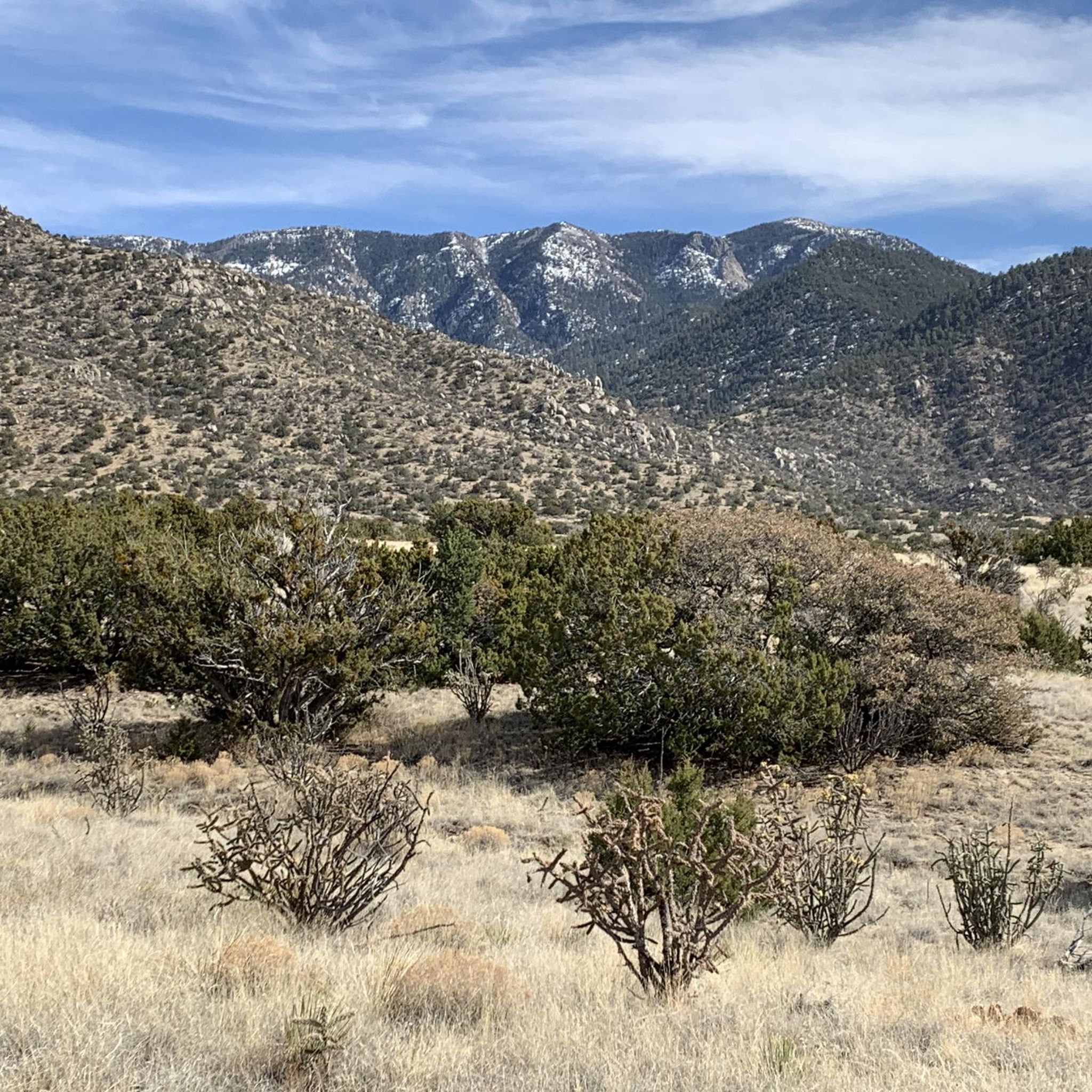
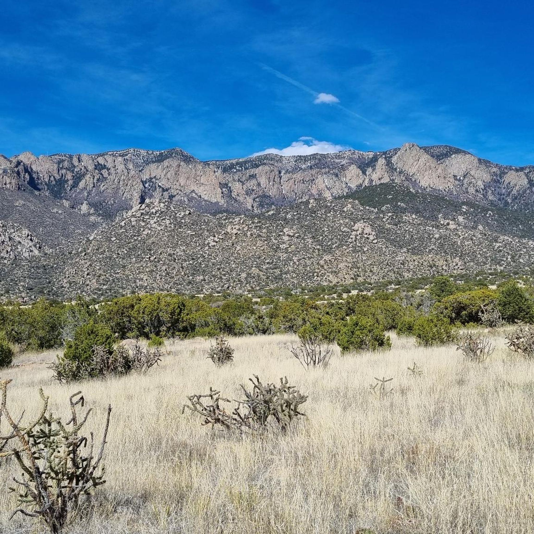
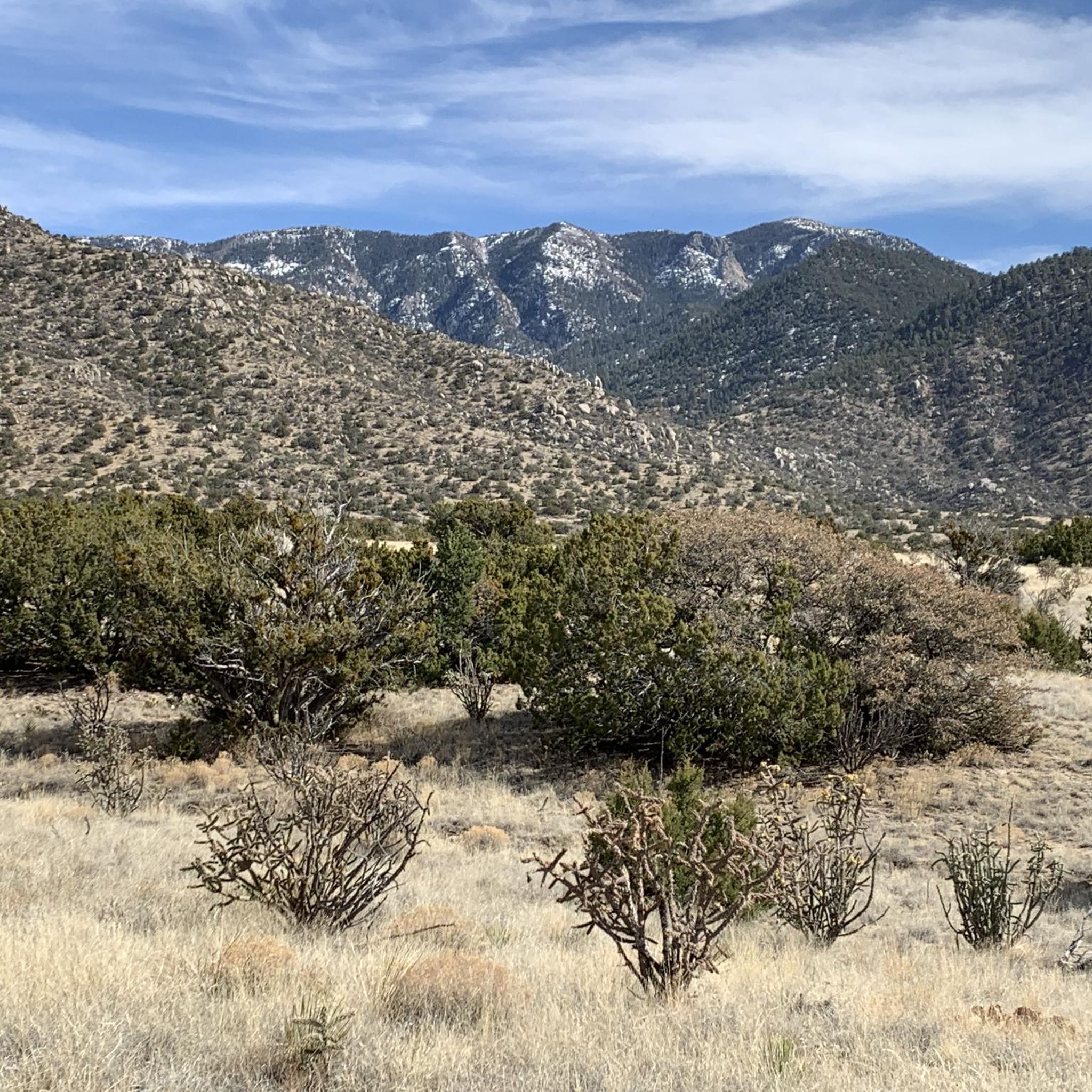
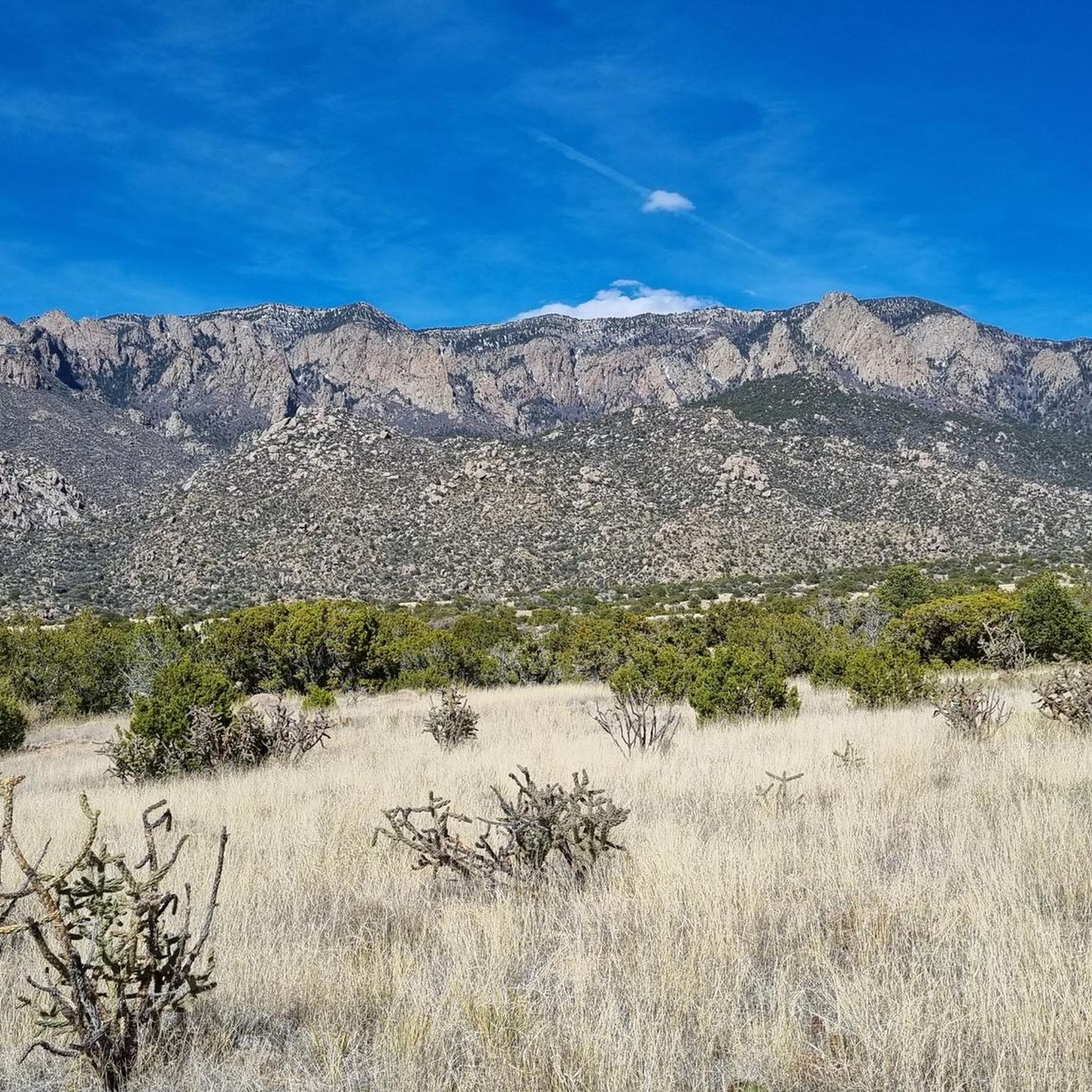
Sandia Foothills Open Space spans 2560 acres at the base of the Sandia Mountains. It is a desert wonderland with plenty of opportunities for hikers, runners and mountain bikers to enjoy the outdoors without heading too far from the city. There are multiple trails and steeply sloped hills to explore dotted with wildflowers, prickly pear cacti, and cane cholla amidst the juniper and piñon trees.
0
0

This bridge runs across busy Tramway Boulevard, giving you ready access to the nearby Tramway Trail. That bike path, in turn, offers great views of the lower Sandia Mountains.
0
0

The Paseo del Bosque Trail is Albuquerque's popular 16-mile multi-use trail, running through the Rio Grande's cottonwood bosque from the north to the south of the metro area. The trail is paved, uninterrupted by roads, and features parking and access points in a few locations. Along the way, visitors can enjoy public art at Tingley Beach, Central Avenue, and other locations, as well as the Rio Grande Nature Center and the National Hispanic Cultural Center. The trail is ideal for biking, walking, and birdwatching, offering a great escape with restrooms and picnic areas along the trail.
1
0

There is parking available at the Albuquerque Open Spaces parking lot off of Alameda or park at Bachechi Nature Center's lot off of Rio Grande Boulevard.
0
0
Frequently Asked Questions
What kind of terrain can I expect when road cycling in Sandia Heights?
Road cycling in Sandia Heights offers a diverse range of terrain, from the high desert of the Sandia Foothills Open Space to challenging mountain ascents. You'll encounter significant elevation changes, passing through varied vegetation zones including piñon-juniper at lower elevations and ponderosa, aspen, and spruce forests higher up. Many routes provide sweeping views of the Rio Grande Valley to the west and the dramatic Sandia Mountains to the east.
How many road cycling routes are available around Sandia Heights?
There are nearly 20 road cycling routes available around Sandia Heights, catering to various skill levels. These routes have been explored by over 300 road cyclists using komoot, with an average rating of 4.5 stars.
Are there any easy or beginner-friendly road cycling routes in Sandia Heights?
Yes, there are several easy routes suitable for beginners. For instance, the Deer in the Bushes loop from Osuna Elementary School is an easy 17.8-mile (28.6 km) trail that takes you through the lower foothills, typically completed in about 1 hour 19 minutes.
What are some challenging or long-distance road cycling routes in the area?
For a more challenging experience, consider the Sandia Foothills Open Space – Bridge over Tramway Blvd. NE loop from South Domingo Baca Arroyo. This difficult route spans 87.3 miles (140.5 km) with over 1,000 meters of elevation gain, offering a significant test for advanced cyclists. The iconic Sandia Crest climb, while not a specific komoot route in the guide, is also a demanding ascent offering nearly 5,000 feet of elevation gain.
Are there any loop routes for road cycling in Sandia Heights?
Yes, many routes in Sandia Heights are designed as loops. A popular moderate option is the Paseo del Bosque Trail loop from Sandia Peak Aerial Tramway Parking, which is 36.2 miles (58.2 km) long and offers views of the Rio Grande Valley and the Sandia Mountains.
What can I see along the road cycling routes in Sandia Heights?
Road cycling routes in Sandia Heights offer numerous scenic views and points of interest. You can enjoy panoramic views of the city of Albuquerque, the Rio Grande Valley, and the majestic Sandia Mountains. Notable attractions include the historic Kiwanis Cabin, the impressive Sandia Peak Aerial Tramway, and various viewpoints like Sunset View from Sandia Crest.
Is the Sandia Crest Scenic Byway suitable for road cycling?
Yes, the Sandia Crest Scenic Byway (NM14 and NM536) is a highly regarded and challenging road cycling route. It offers a scenic and demanding ascent to Sandia Crest, with nearly 5,000 feet of elevation gain. Cyclists experience significant temperature drops and pass through multiple vegetation zones, with panoramic views at the summit. The road is generally in good condition.
What is the best time of year for road biking in Sandia Heights?
The Sandia Heights area offers good road cycling conditions for much of the year. However, due to the significant elevation changes, temperatures can vary greatly. The higher elevations, like the Sandia Crest, can be 20 to 30 degrees Fahrenheit cooler than Albuquerque. Spring and fall generally offer pleasant temperatures, while summer mornings are often ideal before the heat of the day. Winter can bring snow to higher elevations, making those routes inaccessible.
Are there any cafes or places to stop along the road cycling routes?
While specific cafes directly on all routes are not guaranteed, many routes are accessible from Sandia Heights, which has various amenities. The area around the base of the mountains and connecting to Albuquerque offers options for refreshments. It's always advisable to carry sufficient water and snacks, especially on longer or more remote routes.
What are the parking options for road cyclists in Sandia Heights?
Parking is available at various trailheads and access points around Sandia Heights. For example, the Paseo del Bosque Trail loop can be accessed from the Sandia Peak Aerial Tramway Parking. Other routes may start from areas like the FR 333 Trailhead or Osuna Elementary School, which typically have parking facilities. Always check local signage for parking regulations.
What do other road cyclists enjoy most about road cycling in Sandia Heights?
The road cycling experience in Sandia Heights is highly rated by the komoot community, with an average score of 4.5 stars. Reviewers often praise the challenging mountain ascents, the scenic byways, and the diverse routes through the high desert foothills. The breathtaking views of the Sandia Mountains and the Rio Grande Valley are frequently highlighted as a major draw.
Is public transportation available to access road cycling routes in Sandia Heights?
While direct public transportation specifically for road bike trails in Sandia Heights might be limited, the area is generally accessible. For information on public transport options within Albuquerque that could connect to the Sandia Heights area, it's best to consult local transit authority websites.
Most popular attractions around Sandia Heights

Get inspired with the komoot mobile app


Explore more
Browse the best Road cycling routes in other regions.
