The best walks and hikes around Somersworth
5.0
(5)
72
hikers
32
hikes
Hiking around Somersworth, New Hampshire, features a network of trails primarily along the Salmon Falls River, offering scenic riverside paths. The region includes various parks and recreation areas such as Malley Farm and Mast Point Dam, which provide access to these waterways. Willand Pond Park also contributes to the local trail system, extending into neighboring areas. The terrain generally consists of gentle gradients suitable for varied outdoor activities.
Best hiking trails around Somersworth
- The most popular hiking route is Dover Community Trail — Dover, New Hampshire, a moderate 8.3 miles (13.4 km) trail that takes 3 hours 28 minutes to complete. This route offers a longer path connecting Somersworth to Dover.
- Another top favourite among local hikers is Swasey Hill loop — Rocky Hills Preserve-Eliot Town Forest — South Berwick, an easy 3.3 miles (5.3 km) path. This trail winds through forested areas, providing a tranquil experience.
- Local hikers also love the River Run and Bridal Path loop — Vaughan Woods State Park — South Berwick, a 1.5 miles (2.4 km) trail leading through Vaughan Woods State Park, often completed in about 38 minutes.
- Hiking around Somersworth is defined by riverside paths along the Salmon Falls River, trails through local parks, and routes around ponds. The network offers options for different ability levels, from easy strolls to moderate hikes.
- The routes in Somersworth are highly rated by the komoot community with an average score of 5.0 stars from over 1 review. More than 10 hikers have used komoot to explore Somersworth's varied terrain.
Last updated: October 10, 2026
5.0
(1)
6
hikers
2.24km
00:36
30m
30m
The Isinglass and Watson's Way Loop offers a serene escape into nature, tracing the banks of the Isinglass River through shaded woodlands. You'll enjoy continuous river views and the peaceful ambiance of mixed forests, with the highlight being the beautiful Locke Falls and other smaller cascades. The terrain is largely gentle, making it an accessible and rewarding experience for hikers of all levels.
Planning your visit is straightforward, as the Mount Isinglass Recreation Area is open year-round, allowing for seasonal enjoyment from vibrant autumn leaves to snowy winter scenes. Trailhead maps are available to guide you, and the route is notably family-friendly and dog-friendly, with no permits or fees required. It's a great option for a quick, refreshing outing.
This loop stands out for its blend of natural beauty and historical elements, including old granite structures from former railroads that add character to the landscape. Despite being near a landfill, the area is meticulously maintained, preserving its natural charm and making it a popular choice for those seeking an easy 1.4-mile (2.2 km) hike with just 97 feet (29 metres) of elevation gain, typically completed in about 36 minutes.
2
hikers
3.61km
00:56
10m
30m
The Dover Community Trail offers a delightful mix of urban and natural landscapes, perfect for a relaxed outing. You'll find yourself strolling along the Cochecho River, enjoying scenic views and the peaceful sounds of flowing water, with sections of packed earth and gravel underfoot. The route also features a unique educational element, the Voyage Mark II Solar System Exhibit, making your 2.2-mile (3.6 km) hike with just 18 feet (5 meters) of elevation gain an engaging experience.
Accessing the trail is simple, with convenient parking available at the Transportation Center and the Fisher Street Trailhead. This easy route is suitable for all ages and is dog-friendly, allowing leashed pets to join you. Expect to spend around 55 minutes completing the trail, making it an ideal choice for a short, accessible walk any time of day.
What truly sets this trail apart is its blend of history and science; it largely follows a former railroad bed and hosts the first New England installation of the Voyage Mark II Solar System Exhibit. This unique feature transforms a simple walk into an interactive journey through our solar system, making the Dover Community Trail a standout option among local trails for families and those seeking a bit more than just a scenic stroll.

2.01km
00:31
10m
10m
The Willand Pond Trail offers a delightful, easy stroll around a scenic 66-acre pond, perfect for a quick escape into nature. This 1.2-mile (2.0 km) hiking route is mostly flat, with only 26 feet (8 metres) of elevation gain, taking about 30 minutes to complete. You'll follow a wide dirt path, enjoying tree-lined views and keeping an eye out for local wildlife like geese and herons, though be aware that some sections can get muddy.
This trail is incredibly family friendly and accessible, with parts suitable for strollers and wheelchairs. It's also a popular spot for other activities; you can bring your dog (on a leash), go fishing, or even enjoy cross-country skiing and ice skating in winter. Located conveniently between Dover and Somersworth, it's an easy destination for a casual outdoor adventure.
Historically, Willand Pond was a lively recreational hub with an arcade and dance halls, accessible by trolley. Today, it's transformed into a peaceful natural oasis, offering a quiet retreat from nearby busy highways. Along the path, you'll find picnic areas, fitness stations, and a low elements rope course, adding to its appeal as a community resource.
5.0
(1)
4
hikers
13.4km
03:29
80m
80m
Hike the moderate 8.3-mile Dover Community Trail, featuring river views, a solar system exhibit, and diverse terrain in New Hampshire.
5.0
(2)
11
hikers
Easy hike. Great for any fitness level. Easily-accessible paths. Suitable for all skill levels.
Get access to more routes and recommendations from other explorers.
Already have an account?
Our route recommendations are based on thousands of hikes, rides, and runs completed by other people on komoot.
Start today with a free account
Your next adventure awaits.


Tips from the Community

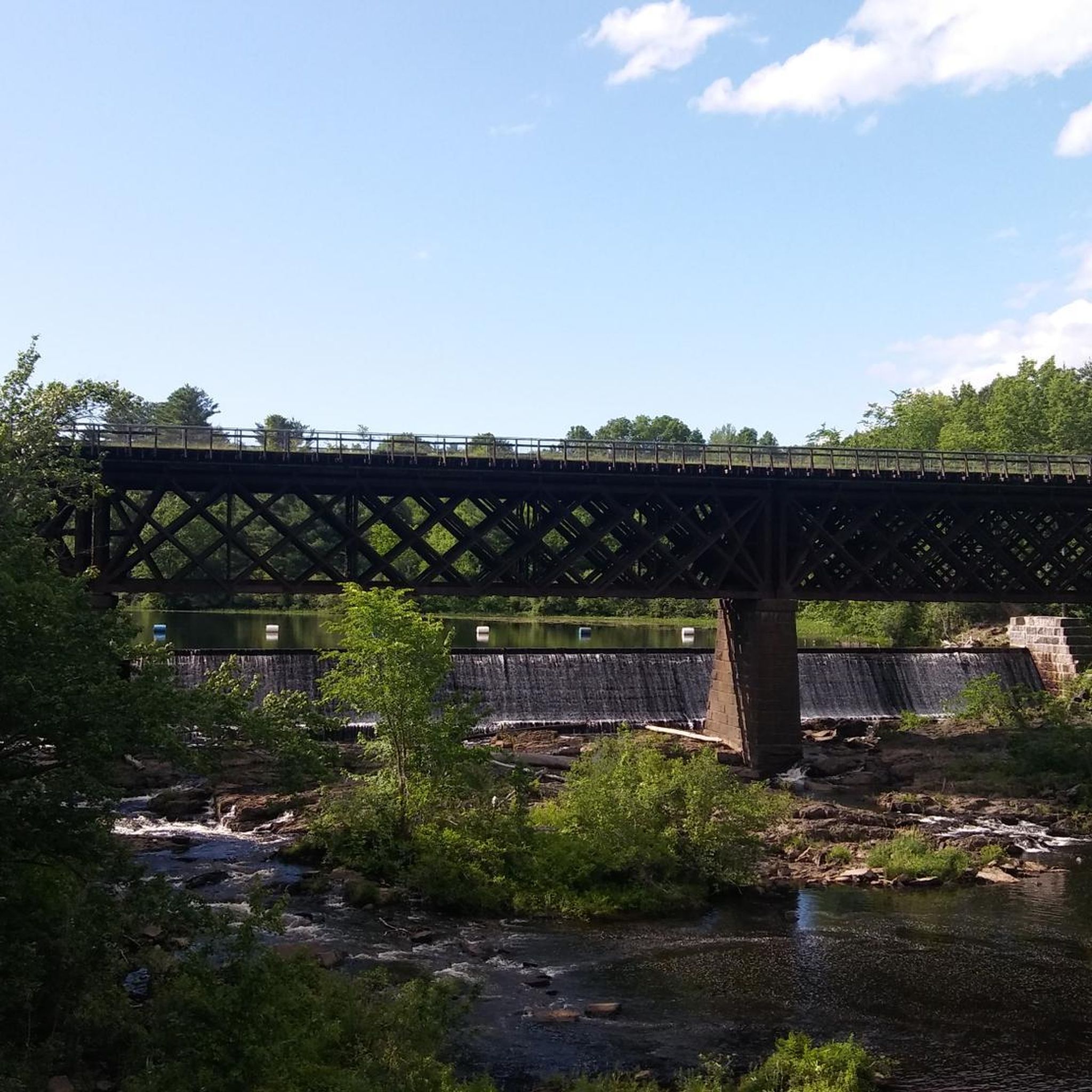
The Vaughan Woods State Park is open everyday from 6 a.m. to 8 p.m. The park is 165 acres of pine and hemlock forest, and it has the Salmon Falls River to the west.
0
0

Vaughan Woods State Park offers a diverse range of hiking trails for both leisurely strolls and more strenuous workouts. The trails are well-marked through a mixed-growth forest with plenty of wildlife, including rabbits, squirrels, coyotes, and more. The two primary trails are: the River Run Trail (0.8 miles) follows the Salmon Falls River, and the Bridle Path Trail (0.7 miles) descends steeply to the river, surrounded by old-growth pine and hemlock trees. Other paths run to and from these trails including the Shady Stroll, which has some steeper sections. Remember to wear sturdy shoes, be cautious of slippery conditions, and take precautions against ticks. Vaughan Woods State Park is also a prime location for snowshoeing and cross-country skiing in the winter.
0
0
Vaughan Woods State Park offers a diverse range of hiking trails for both leisurely strolls and more strenuous workouts. The trails are well-marked through a mixed-growth forest with plenty of wildlife, including rabbits, squirrels, coyotes, and more. The two primary trails are: the River Run Trail (0.8 miles) follows the Salmon Falls River, and the Bridle Path Trail (0.7 miles) descends steeply to the river, surrounded by old-growth pine and hemlock trees. Other paths run to and from these trails including the Shady Stroll, which has some steeper sections. Remember to wear sturdy shoes, be cautious of slippery conditions, and take precautions against ticks. Vaughan Woods State Park is also a prime location for snowshoeing and cross-country skiing in the winter.
0
0
Vaughan Woods State Park offers a diverse range of hiking trails for both leisurely strolls and more strenuous workouts. The trails are well-marked through a mixed-growth forest with plenty of wildlife, including rabbits, squirrels, coyotes, and more. The two primary trails are: the River Run Trail (0.8 miles) follows the Salmon Falls River, and the Bridle Path Trail (0.7 miles) descends steeply to the river, surrounded by old-growth pine and hemlock trees. Other paths run to and from these trails including the Shady Stroll, which has some steeper sections. Remember to wear sturdy shoes, be cautious of slippery conditions, and take precautions against ticks. Vaughan Woods State Park is also a prime location for snowshoeing and cross-country skiing in the winter.
0
0

The Dover Community Trail is a wonderful multiuse trail that runs through Dover. The surface varies from crushed gravel to pavement. The trail passes through woodland and urban areas, and it crosses several bridges.
0
0
Frequently Asked Questions
How many hiking trails are available in Somersworth?
Somersworth offers a diverse network of over a dozen hiking routes. These trails primarily follow the scenic Salmon Falls River and wind through local parks and recreation areas, providing various options for outdoor enthusiasts.
What is the general difficulty of hiking trails in Somersworth?
The hiking trails in Somersworth are predominantly easy, with 14 out of 16 routes classified as such. There are also 2 moderate trails available. The terrain generally features gentle gradients, making it accessible for a wide range of hikers.
Are there family-friendly hiking options in Somersworth?
Yes, Somersworth is well-suited for family outings. Many trails, particularly those in local parks like Willand Pond Park and the Riverwalk, offer easy, flat paths ideal for all ages. These areas provide pleasant strolls along the Salmon Falls River and around natural features.
Are dogs allowed on the hiking trails in Somersworth?
Many trails in Somersworth and the surrounding area are dog-friendly. The Riverwalk and Willand Pond Park are popular spots for walking dogs. Nearby, Vaughan Woods State Park also welcomes dogs, offering a great option for a longer outing with your canine companion.
What kind of natural features or landmarks can I expect to see while hiking in Somersworth?
Hiking in Somersworth often features scenic views of the Salmon Falls River, which is a prominent natural feature throughout the area. Trails like those at Mast Point Dam Recreation Area offer peaceful riverside walks. You can also explore forested areas and ponds, such as those found around Willand Pond Park. Notable landmarks include the Salmon Falls River Bridge and the expansive Vaughan Woods State Park.
Are there any circular hiking routes in the Somersworth area?
Yes, there are several circular routes available. For instance, the Swasey Hill loop offers an easy 3.3-mile (5.3 km) path through forested areas. Another option is the River Run and Bridal Path loop in Vaughan Woods State Park, which is a shorter 1.5-mile (2.4 km) trail.
What is the best time of year to hike in Somersworth?
Somersworth offers pleasant hiking experiences throughout much of the year. The fall is particularly appealing when the vibrant foliage lines the Salmon Falls River, creating picturesque scenery. Spring and summer also provide good conditions for enjoying the riverside paths and park trails.
Where can I find parking for hiking trails in Somersworth?
Parking is generally available at the various recreation areas and parks throughout Somersworth. Locations like Malley Farm Recreation Area, Mast Point Dam Recreation Area, and Willand Pond Park typically offer designated parking for trail access.
Are there any longer hiking trails that connect Somersworth to neighboring towns?
Yes, the Dover Community Trail is a moderate 8.3-mile (13.4 km) route that provides a longer path connecting Somersworth to Dover, offering an extended hiking experience.
What do other hikers enjoy most about hiking in Somersworth?
The hiking routes in Somersworth are highly rated by the komoot community, with an average score of 5.0 stars. Reviewers often praise the peaceful riverside paths, the tranquil forested areas, and the accessibility of the trails for various activity levels.
Are there any trails suitable for beginners in Somersworth?
Absolutely. Somersworth has many easy trails perfect for beginners. The Riverwalk offers a leisurely stroll along the Salmon Falls River, and the trails within Willand Pond Park are also gentle and well-suited for those new to hiking or looking for a relaxed walk.
Most popular attractions around Somersworth

Get inspired with the komoot mobile app


Explore more
Browse the best Hikes in other regions.
