The best walks and hikes around Minden
4.6
(9)
191
hikers
15
hikes
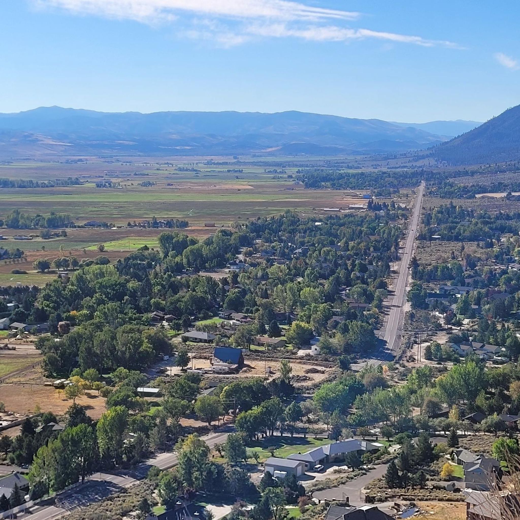
Hiking around Minden offers access to the trails of the Humboldt-Toiyabe National Forest and the Carson Valley. The region's terrain is defined by forested canyons, mountain paths with significant elevation gain, and gentler routes through wildlife areas. These varied landscapes provide a range of hiking experiences near the Nevada-California border.
Best hiking trails around Minden
- The most popular hiking route is Tahoe Rim Trail: Kingsbury South to Star Lake, a 8.8 miles (14.2 km) trail that takes 4 hours 18 minutes to complete. This route features significant elevation gain through varied terrain.
- Another top favourite among local hikers is Genoa Loop, a moderate 6.2 miles (10.0 km) path. The trail offers views of the surrounding landscape and climbs through the Genoa area.
- Local hikers also love the Genoa Loop Trail, a 2.7 miles (4.3 km) trail leading through the Genoa area, often completed in about 1 hour 33 minutes.
- Hiking around Minden is defined by mountain trails in the Humboldt-Toiyabe National Forest and routes through high-desert canyons. The trail network provides options for both moderate climbs and easier walks suitable for a range of fitness levels.
- The routes in Minden are highly rated by the komoot community with an average score of 4.7 stars from over 10 reviews. More than 190 hikers have used komoot to explore Minden's varied terrain.
Last updated: June 24, 2026
5.0
(1)
8
hikers
14.2km
04:18
670m
160m
This segment of the Tahoe Rim Trail from Kingsbury South to Star Lake offers a truly spectacular high-alpine experience, taking you through dense forests of ancient red firs and white pines before opening up to expansive views. You'll navigate challenging granite steps and technical terrain, with rock benches and tight switchbacks, all leading to the serene Star Lake nestled beneath Freel Peak. The journey provides phenomenal panoramic vistas of the Carson Valley and South Lake Tahoe, making the effort well worth it for the scenery alone.
Planning your visit means heading to the trailhead accessible from Kingsbury Grade South, right by the Stagecoach chairlift. This 8.8-mile (14.2 km) hike, rated moderate, involves a substantial 2188 feet (667 metres) of elevation gain and typically takes around 4 hours and 18 minutes. Remember that while dogs are welcome on leash, campfires are prohibited at Star Lake, and you'll need to treat any water you collect from natural sources.
This particular section of the Tahoe Rim Trail is notable for reaching some of the highest elevations along the entire route, offering a unique perspective of the Tahoe Basin. Star Lake itself, a key highlight, is not only a beautiful turnaround point but also a popular camping spot, providing a tranquil escape at over 9,000 feet. The trail's demanding nature makes it ideal for hikers seeking a significant physical challenge paired with immense natural beauty.
3
hikers
4.31km
01:33
370m
40m
The Genoa Loop Trail offers a rewarding hike through diverse terrain, treating you to expansive views of the Carson Valley and the Sierra Mountains. You'll navigate an uneven, natural path with rock creek crossings and numerous switchbacks, including a challenging 1-mile section with tight turns and steep drop-offs. Keep an eye out for Genoa Falls and enjoy excellent vistas looking down into the historic town of Genoa, making this a journey through both natural beauty and local charm.
Planning your visit to this moderate 2.7-mile (4.3 km) loop, which involves 1226 feet (374 metres) of elevation gain and takes about 1 hour and 32 minutes, means preparing for a good workout. The trail is dog-friendly, so your leashed companion can join. A significant portion of the route, about 1.4 miles, weaves directly through the town of Genoa, offering a unique blend of wilderness and town exploration. Be ready for steep sections and some demanding parts, especially if you're new to hiking.
This trail is a classic component of the broader Genoa Trail System, known for its varied landscapes from forested areas to open vistas. Beyond the physical challenge, you might spot wildlife like mule deer, black bears, and various birds. The dramatic drop-offs and switchbacks in Genoa Canyon are a defining feature, providing both a physical test and spectacular views, making it a notable choice among Genoa hiking trails for those seeking both adventure and scenery.

Sign up for free
2
hikers
9.98km
03:10
490m
210m
The Genoa Loop offers a fantastic blend of forest immersion and expansive views, making it a standout in the Carson Valley. You'll navigate a mix of dirt and rocky singletrack, winding through fragrant pine forests and past diverse plant life, with the highlight being the stunning panoramic overlooks of the valley and the distant Pine Nut Range. Keep an eye out for the small but charming Genoa Falls, a refreshing spot along the way, as the trail follows a creek and offers glimpses of the meandering Carson River.
This moderate hike covers 6.2 miles (10.0 km) with 1611 feet (491 metres) of elevation gain, typically taking around 3 hours and 10 minutes to complete. It's a multi-use trail, so expect to share it with mountain bikers and equestrians in some sections. The trail is dog-friendly, but remember to keep your canine companion leashed in residential areas. No permits or fees are required, and the trail is easily accessed from the historic town of Genoa, making it convenient for a day trip.
Part of the larger Genoa Trail System, this loop is notable for its accessibility and the dramatic landscape along the eastern face of the Carson Range. While generally moderate, some sections, particularly in lower Genoa Canyon, feature narrow passages and tight switchbacks, requiring sure-footedness. The trail's elevation means snow can linger into late spring, so check conditions if you're planning an early season adventure.
3.63km
01:08
210m
40m
Embark on an easy hiking route from Boulder Lodge to Van Sickle Trail via the Tahoe Rim Trail, covering 2.3 miles (3.6 km) with an elevation gain of 677 feet (206 metres). You can expect to complete this journey in about 1 hour and 8 minutes. The trail begins with gentle sections winding through boulder outcroppings and dense forested areas filled with towering pines, gradually becoming steeper as you ascend through mixed alpine forestlands and unique granite gardens. As you climb, you will catch glimpses of Lake Tahoe through the trees, eventually opening up to expansive views of the lake, Mount Tallac, and the casinos of South Lake Tahoe.
Planning your visit is straightforward, as the Van Sickle Trail is easily accessible and located just a short walk from the Stateline, Nevada casinos. While vehicle access to some trailheads might be seasonal, you can generally access the trail on foot year-round from sunrise to sunset. Parking is conveniently available at Van Sickle Bi-State Park, making it simple to start your adventure. Consider visiting in spring to see small waterfalls fed by snowmelt, or in fall when golden aspens add vibrant color to the scenery.
This trail offers a rewarding escape into nature within Van Sickle Bi-State Park, known for its diverse terrain and scenic beauty. Beyond the stunning lake views, the route showcases the unique geology of the area with its granite formations and varied forest ecosystems. The trail's proximity to Stateline also makes it a popular choice for those looking to combine outdoor activity with other regional attractions, providing a quick yet immersive experience in the Tahoe basin.
2.01km
00:39
100m
80m
Start your hike on the Kingsbury South/Stagecoach Access trail, an easy route that takes you through pleasant forest surroundings. You will cover 1.2 miles (2.0 km) with a gentle elevation gain of 317 feet (97 metres), making it a quick outdoor escape. The path winds near the base of the Stagecoach chairlift, offering a serene atmosphere as you walk. Expect to complete this enjoyable journey in about 38 minutes, perfect for a brief nature immersion.
Accessing the Kingsbury South/Stagecoach Access trailhead is straightforward, with parking generally available for your convenience. This easy hike is suitable for most hikers, offering a simple way to enjoy the outdoors. Before heading out, it is always wise to check local conditions, particularly during spring or fall. This helps you stay informed about any potential trail closures or advisories that might affect your visit.
This route primarily serves as a valuable access point, connecting you directly to the extensive Tahoe Rim Trail network. It offers a convenient starting point if you are looking to embark on longer adventures within the Lake Tahoe Basin Management Unit. The trail provides a pleasant taste of the region's natural beauty, making it a great gateway to more expansive explorations.
Get access to more routes and recommendations from other explorers.
Sign up for free
Already have an account?
Our route recommendations are based on thousands of hikes, rides, and runs completed by other people on komoot.
Start today with a free account
Your next adventure awaits.
Login or Signup
Popular around Minden

Tips from the Community

Prime Lake Tahoe overlook spot along the Rim Trail
0
0

At this junction, you'll find the entrance to the Van Sickle Trail. You can either continue on the Tahoe Rim Trail or head towards Van Sickle State Park from here. It's an enjoyable downhill ride, but be aware that the trail is heavily frequented by hikers. Exercise caution as you descend.
0
0

It is a very pretty alpine lake, nestled at the base of the three towering peaks of Freel Peak (3,305 meters), Jobs Sister (3,299 meters) and Jobs Peak (3,233 meters). If there is not too much wind, the rocks and trees that surround it are almost perfectly reflected in its waters. A nice spot!
0
0
Choose to continue on the Tahoe Rim Trail or head back to Van Sickle State Park from this junction. Continuing on the Tahoe Rim Trail, you'll encounter ski resorts and lifts along the way.
0
0

Great place for a water break and to take in the view of Tahoe through the trees before continuing on your ride.
0
0

It is a very pretty alpine lake, nestled at the base of the three towering peaks of Freel Peak (3,305 meters), Jobs Sister (3,299 meters) and Jobs Peak (3,233 meters). If there is not too much wind, the rocks and trees that surround it are almost perfectly reflected in its waters. A nice spot!
0
0
At Monument Pass the three trails meet to descend in separate drainages.
0
0
Frequently Asked Questions
Are there any easy, family-friendly hikes near Minden?
Yes, for a gentle walk that's suitable for the whole family, the Hiking loop from Genoa is a great option. It's a relatively flat and short route, making it accessible for hikers of all ages and fitness levels.
Can I take my dog on the trails around Minden?
Many trails in the Minden area, particularly within the Humboldt-Toiyabe National Forest, are welcoming to dogs, though they should generally be kept on a leash. The Fay Canyon Wildlife Area via Fay Luther Trail is a good choice for a longer walk with your canine companion. Always check specific regulations for the area you plan to hike in.
Are there any hikes with waterfalls near Minden?
Yes, you can find waterfalls in the region. The Genoa Canyon Waterfalls – Humboldt Toyabe National Forest trail leads you through a canyon to see seasonal waterfalls. The flow can vary depending on the time of year and recent snowmelt.
What are the trails like in the Carson Valley area?
The trails in the Carson Valley and around Minden offer a lot of variety. You'll find everything from gentle paths through wildlife areas to challenging mountain trails with significant elevation gain in the Humboldt-Toiyabe National Forest. The landscape is typically defined by forested canyons and high-desert scenery.
Are there any challenging day hikes for experienced hikers?
For those seeking a more strenuous hike, the Lake Tahoe view – Castle Rock loop from Summit Village offers a rewarding challenge. This route involves a significant climb of over 470 meters, but your effort is rewarded with fantastic views of Lake Tahoe.
What do other hikers think of the trails around Minden?
The hiking routes around Minden are highly regarded by the komoot community, with an average rating of 4.6 stars. Hikers often praise the stunning views of the Sierra Nevada and the Carson Valley, as well as the variety of trails available.
How many hiking trails are there to choose from near Minden?
There are several curated hiking routes available around Minden, ranging from easy to moderate difficulty. The area offers a good selection of trails primarily through the Humboldt-Toiyabe National Forest and Carson Valley.
What is the best time of year to hike near Minden?
Spring and autumn are generally the best times to hike around Minden. These seasons offer pleasant temperatures, avoiding the summer heat and winter snow at higher elevations. Spring brings blooming wildflowers, while autumn provides comfortable hiking conditions and beautiful colors.
Are there any good circular hikes available?
Yes, many of the best routes are loops, allowing you to enjoy a varied journey without retracing your steps. A great example of a moderate circular trail is the Hiking loop from Summit Village, which takes you on a scenic tour with rewarding views.
What kind of scenery can I expect on the trails?
The scenery is diverse. You can expect trails that wind through forested canyons, paths that open up to expansive views of the Carson Valley, and high-elevation routes that look out towards Lake Tahoe. The Humboldt-Toiyabe National Forest provides a classic Sierra Nevada landscape.
Most popular routes around Minden
Most popular attractions around Minden

Get inspired with the komoot mobile app


Explore more
Browse the best Hikes in other regions.
