The best road cycling routes around Mattapoisett Center
5.0
(6)
138
riders
24
rides
Road cycling routes around Mattapoisett Center feature a diverse landscape, combining coastal scenery with river valleys and extensive rail trail systems. The region is characterized by its position on Buzzards Bay, offering views of the water and access to natural preserves like the Mattapoisett River Reserve and Nasketucket Bay State Reservation. Terrain includes flat, paved rail trails, wooded sections, and roads that traverse wetlands and open fields. The area provides varied road cycling experiences with generally low to moderate elevation…
Last updated: July 12, 2026
5.0
(1)
16
riders
40.4km
01:41
140m
140m
Easy road ride. Great for any fitness level. Mostly well-paved surfaces and easy to ride.
5.0
(1)
17
riders
30.6km
01:31
130m
130m
Moderate road ride. Great for any fitness level. Some segments of this route may be unpaved and difficult to ride.

Sign up for free
7
riders
79.1km
03:26
280m
280m
Moderate road ride. Good fitness required. Some segments of this route may be unpaved and difficult to ride.
5.0
(1)
16
riders
31.8km
01:24
110m
110m
Moderate road ride. Great for any fitness level. Some segments of this route may be unpaved and difficult to ride.
5
riders
32.1km
01:25
100m
100m
Easy road ride. Great for any fitness level. Mostly well-paved surfaces and easy to ride.
Get access to more routes and recommendations from other explorers.
Sign up for free
Already have an account?
Our route recommendations are based on thousands of hikes, rides, and runs completed by other people on komoot.
Start today with a free account
Your next adventure awaits.
Login or Signup
Popular around Mattapoisett Center


Tips from the Community

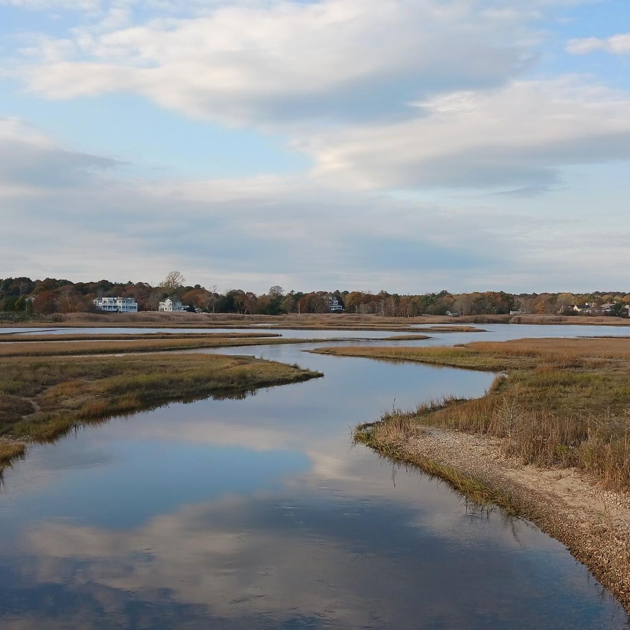
Great view of the Nasketucket Creek from the Phoenix Rail Trail. The creek leads out to Buzzard's Bay and has beautiful wetlands surrounding it.
0
0
Phoenix Rail Trail is a flat, paved trail that runs from Fairhaven to Mattapoisett. The trail is 4.5 miles long and runs through forests, marshes, and some suburban neighborhoods.
0
0

Munro Water Front is a small grassy area with trees and benches. Looking over Mattapoisett harbor and beyond, it makes a great spot for a mid ride break, with plenty of shade, a sea breeze, and lovely views.
0
0
As you traverse the East Coast Greenway, the view of Nasketucket Creek unfolds like a tranquil painting. Lush greenery lines the creek's banks, framing its gentle flow. Wildlife may be spotted amidst the serene waters, offering a peaceful retreat for cyclists along this scenic route.
0
0
Fort Phoenix in Fairhaven, Massachusetts, has safeguarded the region since its construction in 1775. Initially erected as a colonial defense against British forces, it played a crucial role in the American Revolution. Over time, it evolved into a cherished historic site, symbolizing the area's resilience and patriotic heritage.
0
0

Sometimes known as South Meadow Brook Pond, the reservoir is a popular place to fish for largemouth bass. Meadow Street passes along the southern edge of the water, offering up glimpses of the lake through the trees and across a meadow.
0
0
Main Street passes over Tremont Mill Pond, a small water body just outside the town of Wareham. The Weweantic River passes through the pond and there are lovely views of the water on both sides of the street.
0
0
Frequently Asked Questions
What kind of terrain can I expect on road cycling routes around Mattapoisett Center?
Road cycling routes in Mattapoisett Center offer a diverse landscape, blending coastal scenery with river valleys and extensive rail trail systems. You'll find flat, paved rail trails, wooded sections, and roads that traverse wetlands and open fields. The area generally features low to moderate elevation changes, making it accessible for various fitness levels.
Are there easy road cycling routes suitable for beginners in Mattapoisett Center?
Yes, Mattapoisett Center offers several easy road cycling routes. For instance, the Eel Pond – Nasketucket Creek loop from Rochester is an easy 40.4 km path, showcasing natural waterways and wetlands. Another easy option is the Nasketucket Creek – Eel Pond loop from Nasketucket Bay State Reservation, which covers 20.1 km.
What are some longer road cycling routes for more experienced riders?
For those seeking longer rides, Mattapoisett Center has several moderate routes. The Tremont Mill Pond – Savery Avenue loop from Mattapoisett is a 79.7 km trail, while the Apponagansett Beach – View of Westport Point loop from New Bedford covers 76.7 km, offering coastal views and varied landscapes.
What natural features or landmarks can I see along the road cycling routes?
Many routes offer scenic views of the region's natural beauty. You can pass by the Nasketucket Creek, the Weweantic River at Horseshoe Mill, or enjoy coastal vistas of Buzzards Bay. The Mattapoisett River Bridge, part of the Phoenix Rail Trail, also provides picturesque views.
Are there any dedicated bike paths or rail trails in Mattapoisett Center?
Yes, Mattapoisett is known for its excellent rail trail system. The Mattapoisett Rail Trail offers a flat, paved path through lush forests and connects seamlessly with Fairhaven's Phoenix Bike Trail, providing a combined 6 miles of safe, scenic routes away from major traffic. These are part of the larger South Coast Bikeway.
What do other road cyclists enjoy the most about road cycling in Mattapoisett Center?
The road cycling routes in Mattapoisett Center are highly rated by the komoot community, with an average score of 4.8 stars from 7 reviews. Cyclists often praise the diverse terrain, from coastal paths to river valleys and dedicated rail trails, as well as the opportunities to experience the region's natural beauty.
Can I find routes that offer views of the coast or water?
Absolutely. Situated on Buzzards Bay, Mattapoisett offers numerous routes with picturesque coastal views. You can enjoy views of the surrounding waters from areas like Ned's Point Lighthouse (though not publicly accessible) or along routes that pass by Apponagansett Beach and Eel Pond.
Are there any specific attractions or points of interest accessible by bike?
Yes, several points of interest are easily accessible. You can cycle past the Mattapoisett River Bridge on the Phoenix Rail Trail, or explore areas near the Fort Phoenix Beach Reservation in Fairhaven. The New Bedford Swing Bridge is another notable structure you might encounter on longer routes.
How many road cycling routes are available around Mattapoisett Center?
There are over 20 road cycling routes available around Mattapoisett Center, catering to various skill levels. This includes 11 easy routes and 10 moderate routes, ensuring options for both casual riders and those looking for a challenge.
What is the best time of year to go road cycling in Mattapoisett Center?
Mattapoisett Center offers pleasant road cycling conditions for much of the year. Spring and fall typically provide comfortable temperatures and beautiful scenery. Summer is also popular, especially for coastal rides, though it can be warmer. Always check local weather forecasts before heading out.
Are there any routes that explore the Mattapoisett River Reserve or Nasketucket Bay State Reservation?
Yes, the region's routes often incorporate or pass near these significant natural assets. The Mattapoisett River Reserve, with its forests and freshwater wetlands, and Nasketucket Bay State Reservation, featuring wooded trails and a rocky shoreline, contribute to the diverse landscapes you'll experience on many rides.
Most popular attractions around Mattapoisett Center

Get inspired with the komoot mobile app


Explore more
Browse the best Road cycling routes in other regions.
