Routes

Planner

Features

Updates

App

Login or Signup

Get the App

Login or Signup

Routes
Hikes
United States
Maryland
Baltimore County

Cockeysville

The best walks and hikes around Cockeysville

4.6

(19)

457

hikers

18

hikes

Hiking around Cockeysville offers diverse natural landscapes, including dense forests, rolling hills, and scenic reservoirs. The area features well-maintained trail systems, such as historical rail trails, providing varied terrain for outdoor activities. Topography includes gentle slopes and varied landscapes, contributing to engaging hiking experiences.

Best hiking trails around Cockeysville

  • The most popular hiking route is Merryman's Mill Trail Loop, a 5.2 miles (8.4 km) trail that takes 2 hours 15 minutes to complete, winding through forested areas with varied elevation.
  • Another top favourite among local hikers is Fire Road, an easy 2.8 miles (4.5 km) path. This route offers a straightforward walk through natural surroundings, suitable for a quicker outing.
  • Local hikers also love the Phoenix Loop, a 4.6 miles (7.4 km) trail leading through woodlands and open spaces, often completed in about 2 hours 1 minute.
  • Hiking around Cockeysville is defined by dense woodlands, rolling hills, and historical rail trails. The network offers options for different ability levels, from easy walks to moderate climbs.
  • The routes in Cockeysville are highly rated by the komoot community with an average score of 4.6 stars from over 20 reviews. More than 400 hikers have used komoot to explore Cockeysville's varied terrain.

Last updated: June 24, 2026

3.0

(1)

8

hikers

#1.

Merryman's Mill Trail Loop

8.39km

02:16

110m

110m

Embark on the Merryman's Mill Trail Loop for a moderate hike spanning 5.2 miles (8.4 km) with an elevation gain of 358 feet (109 metres). This route typically takes around 2 hours and 15 minutes to complete, offering a diverse experience through varied terrain. You will find yourself on soft dirt paths and occasional rocky sections, winding through peaceful forests and alongside rivers, with picturesque views of Loch Raven Reservoir.

When planning your visit, you can usually find parking on the north side of Dulaney Valley Road. Be aware that a section of Loch Raven Drive is closed to vehicles on weekends, which creates more space for those walking, running, or biking. This makes weekend mornings a popular time to explore the area, so plan accordingly.

The trail is situated within the Loch Raven Reservoir Cooperative Wildlife Management Area, providing a rich natural setting. As you hike, keep an eye out for charming waterfalls, such as one located near the reservoir, which enhance the scenic beauty of your journey. The route also features sections that form natural leafy tunnels, adding to the immersive forest experience.

Navigate with device

Send to Phone

Save

Moderate

2

hikers

4.55km

01:19

120m

100m

Hike the easy Fire Road trail, a 2.8-mile (4.5 km) route with 396 feet (121 metres) of elevation gain in Loch Raven Reservoir.

Easy
guide_signup
Let us show you the way with the komoot mobile app
With a free komoot account, you can easily find, customize, and navigate endless outdoor adventures.

Sign up for free

7.43km

02:01

100m

110m

The Phoenix Loop offers a delightful blend of easy rail trail and natural woodland paths, making it a popular choice for a moderate hike. You'll enjoy the smooth gravel of the Torrey C. Brown Rail Trail before venturing into more forested sections, culminating in the serene beauty of Bluetooth Falls. This 4.6-mile (7.4 km) circular walk, with its 328 feet (100 metres) of elevation gain, is perfect for a two-hour outing, providing a refreshing escape into nature.

Planning your visit to the Phoenix Loop is straightforward; the trailhead is easily accessible in Baltimore County, Cockeysville. While parking is usually available, consider an early start on busy days to ensure a spot. The trail is enjoyable in all seasons, but spring and autumn provide the most pleasant weather and scenic backdrops, making it the best time to hike Phoenix Loop. Remember to bring water, especially if you're hiking during warmer periods.

This trail stands out as a family-friendly Phoenix Loop hiking option, offering a gentle introduction to the region's natural beauty. Its moderate difficulty and varied terrain, from open rail trail to wooded paths, ensure an engaging experience for most hikers. The presence of Bluetooth Falls adds a unique natural feature, making it a memorable route within the local trail network.

Moderate

5.59km

01:33

100m

120m

The Sherwood Trail offers a delightful, easy hike through a serene woodland environment, perfect for a quick escape into nature. You'll cover 3.5 miles (5.6 km) with a modest 323 feet (98 metres) of elevation gain, making it a comfortable journey that typically takes about 1 hour and 33 minutes. Expect to wander beneath a green canopy, enjoying the peaceful atmosphere of the forest.

This trail is conveniently located in Cockeysville, Maryland, providing easy access for a refreshing outdoor activity. Parking is generally available at the trailhead, and it's a good idea to arrive earlier on weekends to secure a spot. The trail is suitable for year-round enjoyment, though spring and fall offer particularly pleasant temperatures and vibrant scenery.

While the Komoot data doesn't specify unique features for this particular Sherwood Trail, similar trails in suburban settings often feature well-maintained paths and a surprising sense of wilderness despite their proximity to populated areas. It's a great choice for families, dog walkers, or anyone seeking a gentle, accessible hike to unwind and reconnect with nature.

Easy

15

hikers

If you're looking for a truly accessible and scenic outing in Baltimore County, the Torrey C. Brown Rail Trail is a fantastic choice. This easy 3.9-mile (6.2 km) section, with a minimal 273 feet (83 metres) of elevation gain, offers a pleasant walk that takes about 1 hour and 40 minutes. You'll wander through shaded deciduous forests, often alongside the tranquil Gunpowder River, and might even spot some local wildlife like deer or various bird species. The smooth crushed stone surface makes for comfortable walking, suitable for nearly all abilities.

Planning your visit is straightforward, as the trail is well-equipped with amenities like benches and restrooms at various access points. Parking is available at multiple trailheads along its route, so you can pick the most convenient starting point. While enjoyable year-round, the extensive tree cover makes it a great option for warm days, and the autumn colors are particularly vibrant. It's an ideal spot for a relaxed hike with family or friends.

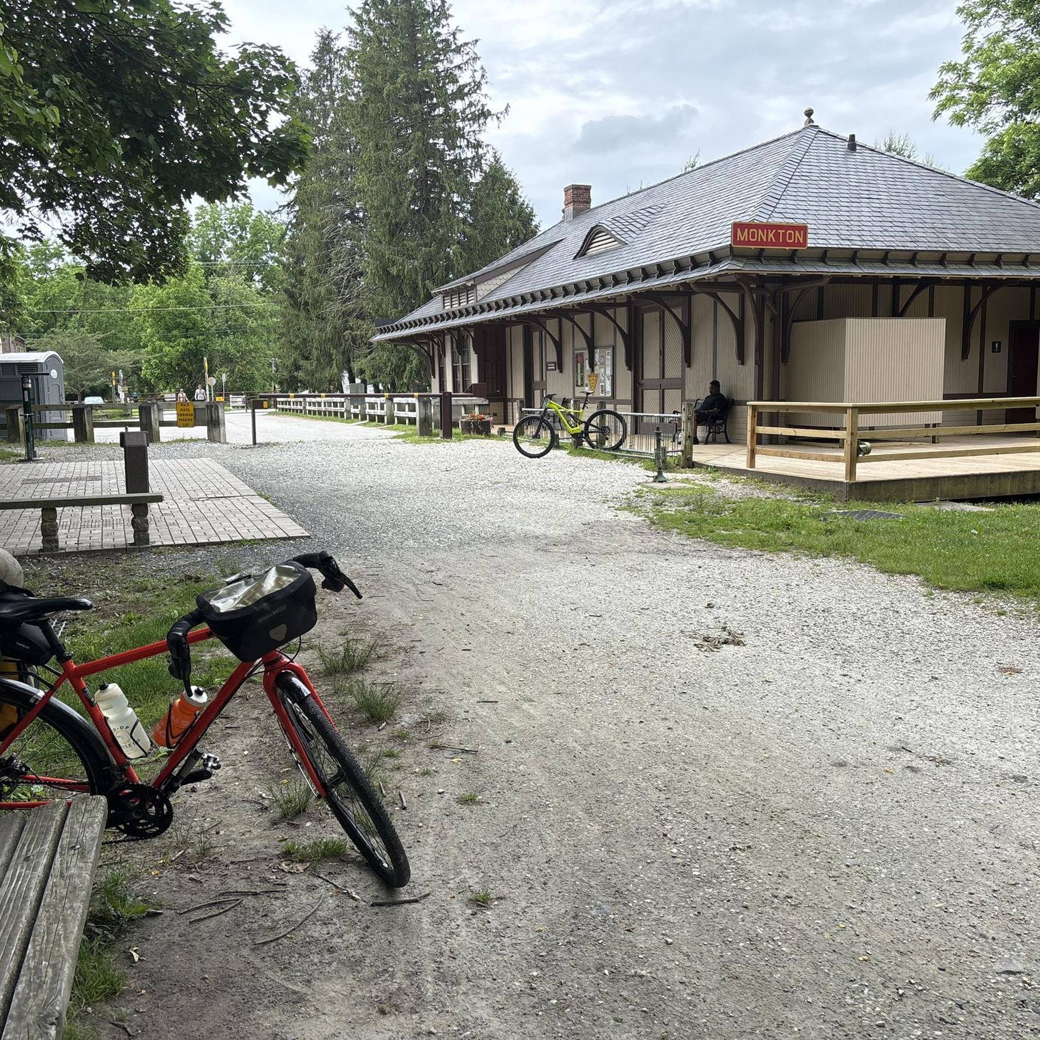
Historically significant, the Torrey C. Brown Rail Trail follows the abandoned Northern Central Railway line, one of America's oldest rail-trails. You can explore landmarks like the restored 1898 Monkton Train Station, which now serves as a museum and ranger station. The trail also connects seamlessly with Pennsylvania's Heritage Rail Trail County Park, offering opportunities for longer adventures, and is part of the vast East Coast Greenway system.

Easy
Sign up for free to see 14 more hikes around Cockeysville.

Get access to more routes and recommendations from other explorers.

Sign up for free

Already have an account?

Our route recommendations are based on thousands of hikes, rides, and runs completed by other people on komoot.

Start today with a free account

Your next adventure awaits.

Login or Signup
Popular around Cockeysville

Running Trails around Cockeysville

Cycling around Cockeysville

Road Cycling Routes around Cockeysville

Gravel biking around Cockeysville

Tips from the Community

Andrew
August 12, 2024, Torrey C. Brown Rail Trail (Gravel)

Mostly fine gravel trail with limited road crossings heading up to and beyond the PA state line. Very popular on the weekends and mostly shaded by overhead trees. Multiple places on the trail will provide access to water and bathrooms.

0

0

The Torrey C. Brown Rail Trail is a 20-mile trail that follows the former Northern Central Railway and stretches from Northern Baltimore to the Pennsylvania state line. It's a great trail for runners, hikers, cyclists, and horseback riders.

0

0

Zachary
February 19, 2024, Warren Trailhead

There is roadside parking here and access to the Loch Raven trail system on both sides of Warren Road. The singletrack trails are beautiful and exploring the side paths is a great way to avoid trail traffic in more popular seasons.

0

0

Zachary
February 19, 2024, Little waterfall

The trail crosses the creek here on an elevated stone outcrop from which the water cascades down a series of small falls until it spills into Loch Raven.

0

0

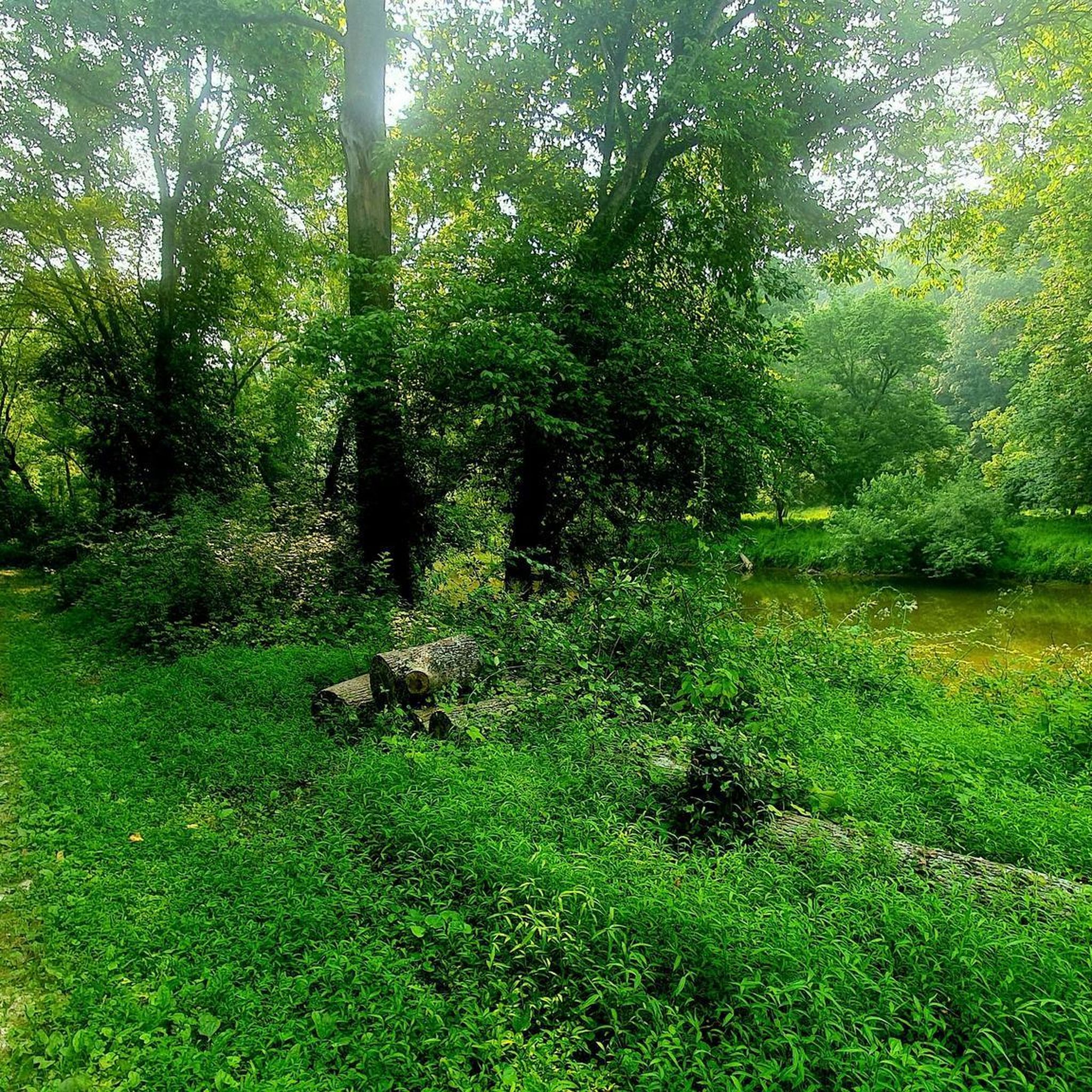
This section of the Torrey C. Brown Rail Trail passes the town of Phoenix. The multi-use gravel trail leads through green nature, woodlands, and offers great views of the nearby Gunpowder Falls River.

0

0

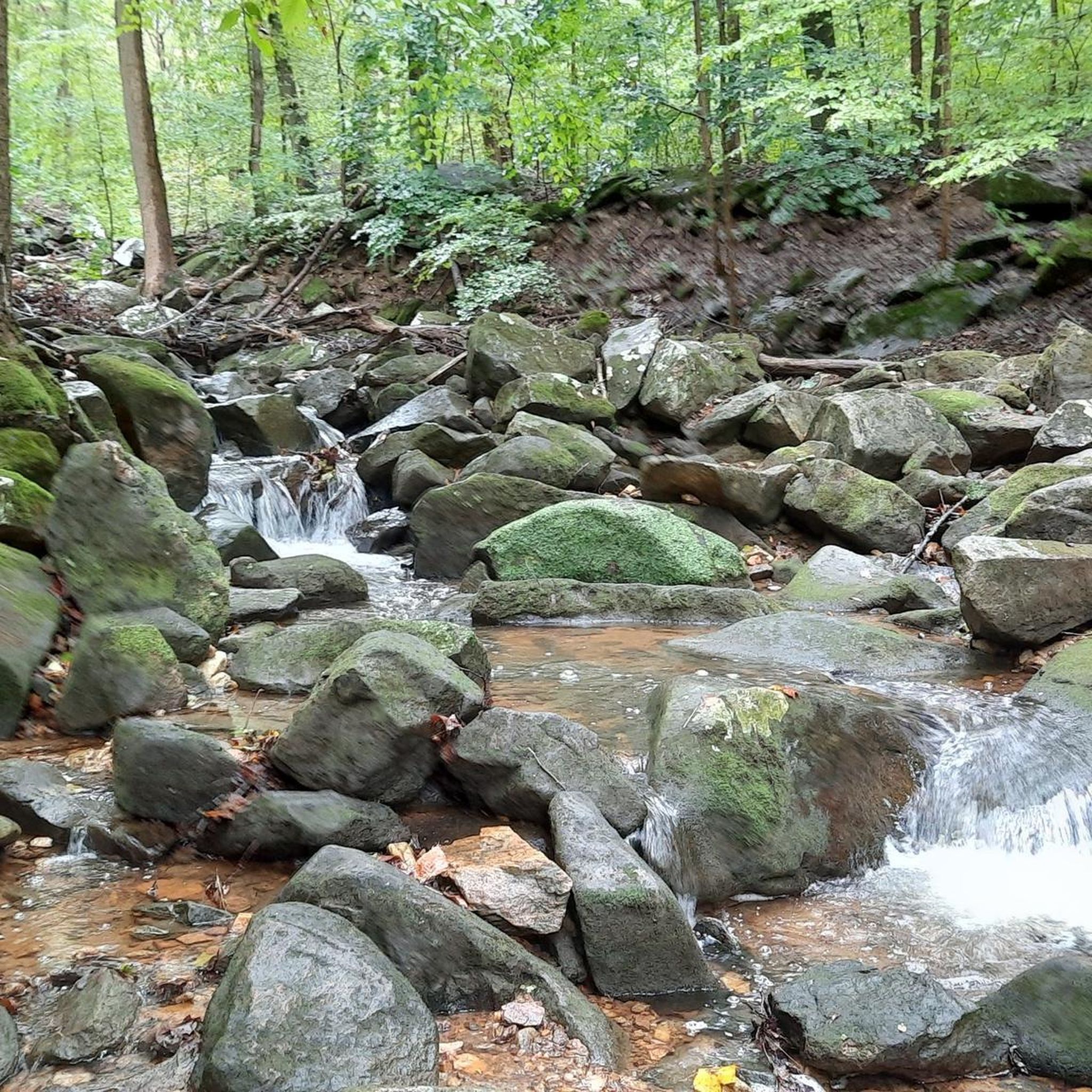
A little creek flowing over a series of little drops before entering the Loch Raven reservoir.

0

0

Frequently Asked Questions

How many hiking trails are available in Cockeysville?

Cockeysville offers a good selection of routes, with over 18 hiking trails documented on komoot. These range from easy walks to more moderate climbs, catering to various skill levels.

Are there easy hiking trails suitable for beginners in Cockeysville?

Yes, Cockeysville has several easy trails perfect for beginners or those seeking a relaxed walk. For instance, the Fire Road is an easy 2.8-mile path that offers a straightforward walk through natural surroundings. Another great option is the Sherwood Trail, which is also considered easy.

What are some family-friendly hiking options in Cockeysville?

For families, Oregon Ridge Park is an excellent choice, offering diverse scenery with forests, meadows, and a lake, including shorter loop trails. Cromwell Valley Park, just a short drive away, also features nature trails through stream valleys and meadows, ideal for easy family hikes and bird watching.

Are there any loop hikes in the Cockeysville area?

Yes, you can find several loop hikes. A popular option is the Merryman's Mill Trail Loop, which is a 5.2-mile route winding through forested areas. The Phoenix Loop is another great choice, covering 4.6 miles through woodlands and open spaces.

What kind of views can I expect on hikes around Cockeysville?

Cockeysville's trails offer diverse views, from dense woodlands and rolling hills to scenic reservoirs. Oregon Ridge Park is known for its panoramic views, while trails around Loch Raven Reservoir provide beautiful water vistas and tall trees. The Torrey C. Brown Rail Trail offers scenic views through green nature and woodlands, often running alongside the Gunpowder Falls River.

Are the hiking trails in Cockeysville dog-friendly?

Many parks and trails in the Cockeysville area, including Oregon Ridge Park and the Torrey C. Brown Rail Trail, are generally dog-friendly. However, it's always recommended to check specific park regulations or trail signage for the most current rules regarding pets, and always keep dogs on a leash.

What are some notable landmarks or attractions to see while hiking in Cockeysville?

While hiking, you can explore several interesting points. The Torrey C. Brown Rail Trail itself is a historical landmark, following a former railway. Along this trail, you might encounter the Monkton Train Station. The Loch Raven Reservoir and Loch Raven Wildlife Area offer natural beauty, and the Gunpowder Falls Bridge is another point of interest.

Is there parking available at the trailheads in Cockeysville?

Most major parks and trail systems in the Cockeysville area, such as Oregon Ridge Park and access points for the Torrey C. Brown Rail Trail, provide designated parking areas for hikers. It's advisable to check specific park websites or trail guides for detailed parking information before your visit.

What do other hikers enjoy most about hiking in Cockeysville?

The hiking experiences in Cockeysville are highly rated by the komoot community, with an average score of 4.6 stars from over 20 reviews. Hikers often praise the diverse natural beauty, including dense woodlands and scenic reservoirs, as well as the well-maintained trail systems that offer options for various ability levels.

What is the best time of year to go hiking in Cockeysville?

Cockeysville offers enjoyable hiking throughout the year. Spring brings lush greenery and blooming wildflowers, while autumn showcases vibrant fall foliage. Summer is popular for its warm weather, though shaded trails are preferred. Winter hiking can be beautiful, especially after a fresh snowfall, but always check trail conditions.

Are there any paved trails suitable for walking or cycling in Cockeysville?

Yes, the Torrey C. Brown Rail Trail is a nearly 20-mile multi-use trail with a flat, crushed-stone path, making it accessible for hikers, runners, cyclists, and even horseback riders. It's an excellent option for those looking for a smoother, less rugged walking surface.

Most popular routes around Cockeysville

Running Trails around Cockeysville

Most popular attractions around Cockeysville

Places to see

Store rating

Get inspired with the komoot mobile app

With a free komoot account, you can easily find, customize, and navigate endless outdoor adventures.

or

Join komoot Now

Store rating

Explore more

Browse the best Hikes in other regions.

CatonsvillePatapsco Valley State Park Glen Artney AreaRandallstownGunpowder Falls State ParkArbutusPatapsco Valley State Park Hilton AreaPatapsco Valley State Park Belle Grove AreaMiddle RiverLochearnRossvilleWoodlawnOverleaGunpowder Falls State Park Lost Lake AreaPatapsco Valley State Park Gray'S Mill AreaGunpowder Falls State Park Hereford AreaPatapsco Valley State Park Pickall AreaMilford MillGunpowder Falls State Park Sweathouse AreaBowleys QuartersGarrisonHamptonReisterstownEdgemerePatapsco Valley State Park Rockhaven AreaGunpowder Falls State Park Graham Memorial Park AreaEssexGunpowder Falls State Park Central AreaGunpowder Falls State Park Hammerman AreaPikesvilleOwings MillsParkvillePatapsco Valley State Park Alberton AreaGunpowder Falls State Park Pleasantville AreaCarneyWhite MarshTowsonDundalkPatapsco Valley State Park Woodstock AreaRosedaleKingsvilleHoneygoHoneygo Run Regional ParkGunpowder Falls State Park Franklintown AreaPerry HallPatapsco Valley State Park Horse Farm AreaMays ChapelGunpowder Falls State Park Springdale AreaGunpowder Falls State Park Jerusalem Mill AreaLansdowneTimoniumLuthervilleBaltimore HighlandsNorth Point State Park

Nearby adventure guides

Things to Do in Baltimore County

background

Get ready to conquer new peaks

Sign up for Free

Explore
RoutesRoute plannerFeaturesHikesMTB TrailsRoad cycling routesBikepackingSitemap
Download the app
Follow Us on Socials

© komoot GmbH

Privacy Policy