The best running trails around Sierra de Alcubierre
4.0
(2)
17
runners
6
runs
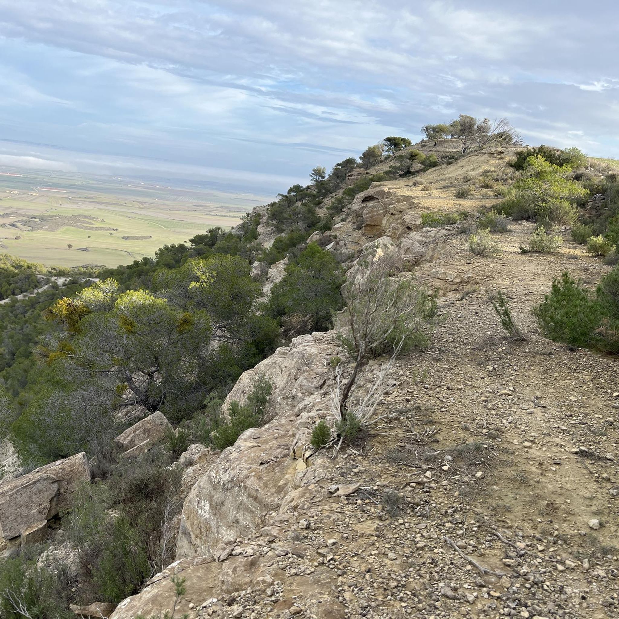
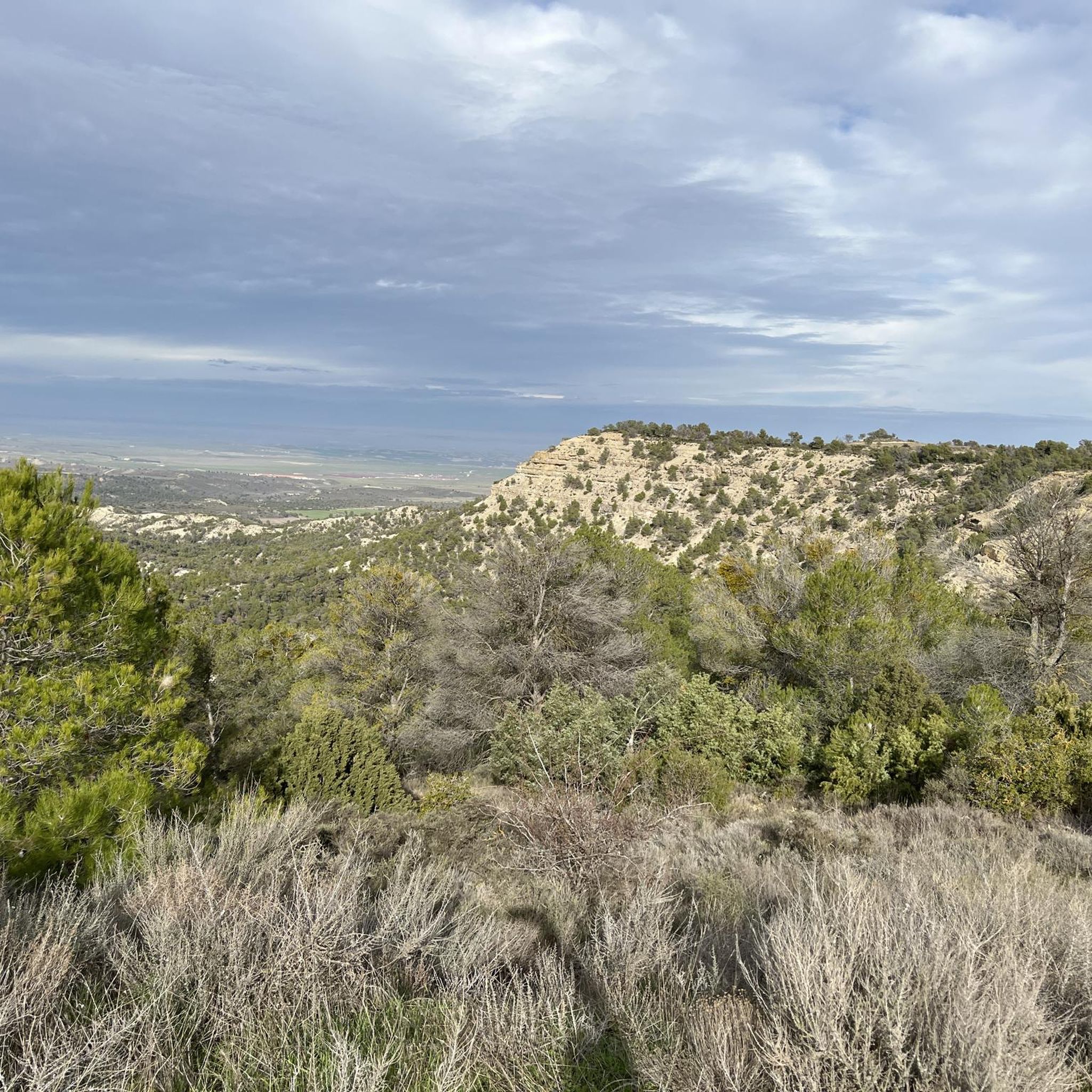
Jogging around Sierra de Alcubierre offers a diverse landscape characterized by arid steppes, ravines, and characteristic badlands in the eastern Monegros comarca. The region features significant summits like Monte Oscuro (822 m) and San Caprasio (811 m), alongside lower peaks and pine forests. This varied topography provides natural elevation changes and uneven surfaces, ideal for trail runners.
Best jogging routes around Sierra de Alcubierre
- The most popular jogging route is San Caprasio Trail – San Caprasio Viewpoint loop from Barranco…
Last updated: June 28, 2026
3.0
(1)
6
runners
17.1km
02:12
380m
380m
Hard run. Very good fitness required. Mostly paved surfaces. Suitable for all skill levels.
20.3km
02:31
330m
330m
Hard run. Very good fitness required. Mostly paved surfaces. Suitable for all skill levels.

Sign up for free
5.0
(1)
4
runners
12.7km
01:35
260m
260m
Moderate run. Good fitness required. Mostly paved surfaces. Suitable for all skill levels.
3
runners
18.6km
02:20
310m
310m
Hard run. Very good fitness required. Mostly paved surfaces. Suitable for all skill levels.
4
runners
12.5km
01:34
280m
280m
Moderate run. Good fitness required. Mostly paved surfaces. Suitable for all skill levels.
Our route recommendations are based on thousands of hikes, rides, and runs completed by other people on komoot.
Start today with a free account
Your next adventure awaits.
Login or Signup
Popular around Sierra de Alcubierre

Tips from the Community

It's a small sanctuary located high in the mountains (at an altitude of approximately 860 m), popular with hikers and cyclists. From there, there are spectacular views of the Monegros mountains, the mountains, and, on clear days, even the Pyrenees. It's one of the most iconic spots on the mountain bike routes in the area.
0
0

A magical place! Magnificent views and peaks of the Ruta de los Miradores
0
0
This is where the Ruta de los Miradores really begins – a wonderful mountain road for MTB and gravel bikes.
0
0

A group of natural caves located on the slopes of Mount San Caprasio, associated with ancient pastoral, hermitage, and possibly even pre-Christian uses. Some were used as shelters for shepherds or anchorites, and local tradition links them to the primitive cult that gave rise to the hermitage. Relatively easy to access from the track or the hermitage, they are a curious place to explore on foot, with views of the Ésera Valley and an utterly silent environment. They add a mystical and ancestral touch to any route in the area.
0
0
A rural shrine located on a hill outside Alcolea de Cinca, dedicated to the Virgin of the Sabina, the local patron saint. A simple and beloved building, it's surrounded by pine and juniper trees, overlooking the Cinca River and the Monegros mountains. It's a popular stop for pilgrimages and processions, and an ideal stop on mountain biking or gravel routes in the area. It's located in a peaceful setting, accessible by dirt track from the village.
0
0
A natural viewpoint on a hill near Monzón offers excellent views of the Cinca River valley, the agricultural plain, and, on clear days, the Pyrenees. This is an ideal spot to stop, take photos, or rest during a mountain bike or gravel ride through the Cinca Medio. This peaceful setting is accessible via rural trails and connected to other points of interest such as the La Maza Refuge, Cabezo de Rodén, and Laguna de la Mediana.
0
0


Much nicer to look at than the photos suggest. Very nice track to get there.
1
0
Frequently Asked Questions
What kind of terrain can I expect on running routes in Sierra de Alcubierre?
The Sierra de Alcubierre offers a diverse landscape for runners, characterized by arid steppes, ravines, and distinctive badlands, particularly in the eastern Monegros comarca. You'll encounter natural elevation changes and uneven surfaces, making it ideal for trail running. Some routes also feature pine forests and sabina trees, providing shaded sections and varied scenery.
Are there running routes for all skill levels in Sierra de Alcubierre?
Yes, the region caters to various fitness levels. While many routes are considered difficult, such as the San Caprasio Trail – San Caprasio Viewpoint loop from Barranco Rubio, there are also moderate options available. The diverse topography ensures that both beginners and experienced trail runners can find suitable challenges.
What natural features and landmarks can I see while running in Sierra de Alcubierre?
Runners can enjoy significant summits like Monte Oscuro (822 m) and San Caprasio (811 m), offering panoramic views. The region also features lower peaks, pine forests, and the unique badlands of the Monegros. Notable viewpoints include Enebro Peak, and you might encounter trails like the Route of the Viewpoints.
Are there any historical sites along the running trails in Sierra de Alcubierre?
Yes, the region has historical significance, particularly related to the Spanish Civil War. The 'Orwell Route' (Ruta Orwell) allows runners to pass by reconstructed fortifications and trenches, offering a unique historical dimension to your run. Additionally, the San Caprasio Caves, historically used by shepherds or hermits, add an exploratory element to routes in that area.
Is parking available at the trailheads in Sierra de Alcubierre?
While specific parking areas for each trailhead are not detailed, the region is generally accessible for outdoor activities. It is advisable to check local information for specific starting points like Farlete or Leciñena to confirm parking availability before your run.
Can I reach the running routes in Sierra de Alcubierre using public transport?
Information regarding direct public transport access to specific trailheads in Sierra de Alcubierre is limited. The region is situated between the provinces of Zaragoza and Huesca, and while towns may have bus services, reaching remote trail starting points might require private transportation.
Are permits required for running on trails in Sierra de Alcubierre?
Generally, permits are not required for running on the established trails in Sierra de Alcubierre. However, it's always good practice to respect local regulations and private property, especially when venturing off marked paths.
What is the best time of year for running in Sierra de Alcubierre?
The diverse terrain and varied climate mean that spring and autumn are often ideal for running, offering milder temperatures. Summer can be hot, especially in the arid Monegros sections, while winter might bring cooler conditions. Always check the weather forecast and prepare accordingly for your chosen season.
Are there any circular running routes in Sierra de Alcubierre?
Yes, there are several circular running routes. For example, the San Caprasio Circular Trail from Farlete is a challenging 17.1 km loop. Another option is the Desierto de Monegros – circular trail running to the Cartuja de Nuestra Señora de las Fuentes, a moderate 5.2 km route.
What do other runners enjoy most about jogging in Sierra de Alcubierre?
The running routes in Sierra de Alcubierre are highly rated by the komoot community, with an average score of 4.0 stars. Runners often praise the varied terrain, the challenging elevation changes, and the immersive natural beauty, including sweeping views of the Ésera Valley and distant Pyrenean peaks.
How many running routes are available in Sierra de Alcubierre?
There are several running routes documented in Sierra de Alcubierre, with a total of 6 routes featured in this guide. These routes offer a range of distances and difficulties for you to explore.
Are there any long-distance running options in Sierra de Alcubierre?
Yes, if you're looking for longer runs, routes like the Monegrillo Viewpoints Trail cover over 20 km, providing a significant challenge for endurance runners. The Running loop from Leciñena is also a substantial option at over 18 km.
Most popular routes around Sierra de Alcubierre
Most popular attractions around Sierra de Alcubierre

Get inspired with the komoot mobile app


Explore more
Browse the best Running Trails & Routes in other regions.
