The best walks and hikes around Wast Water
4.5
(2950)
32,858
hikers
33
hikes
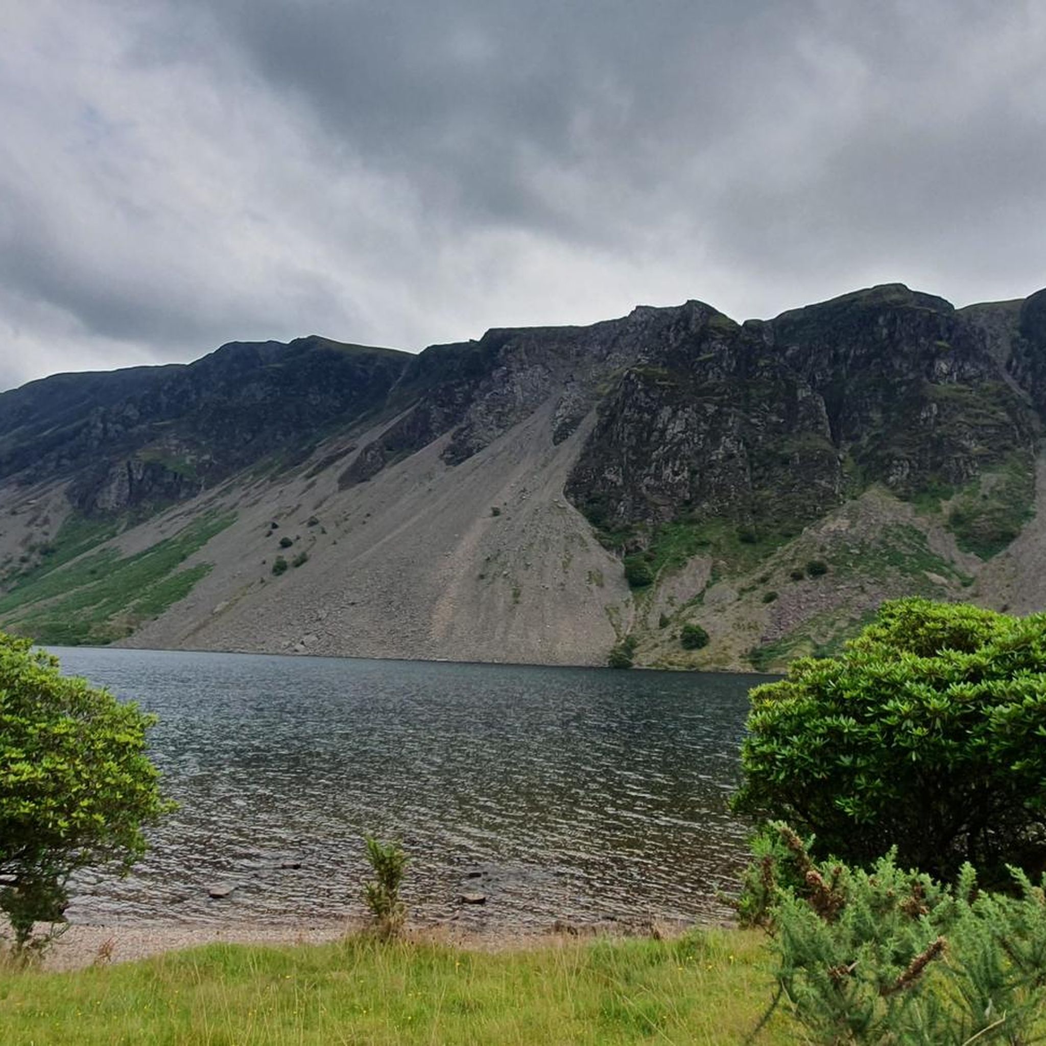
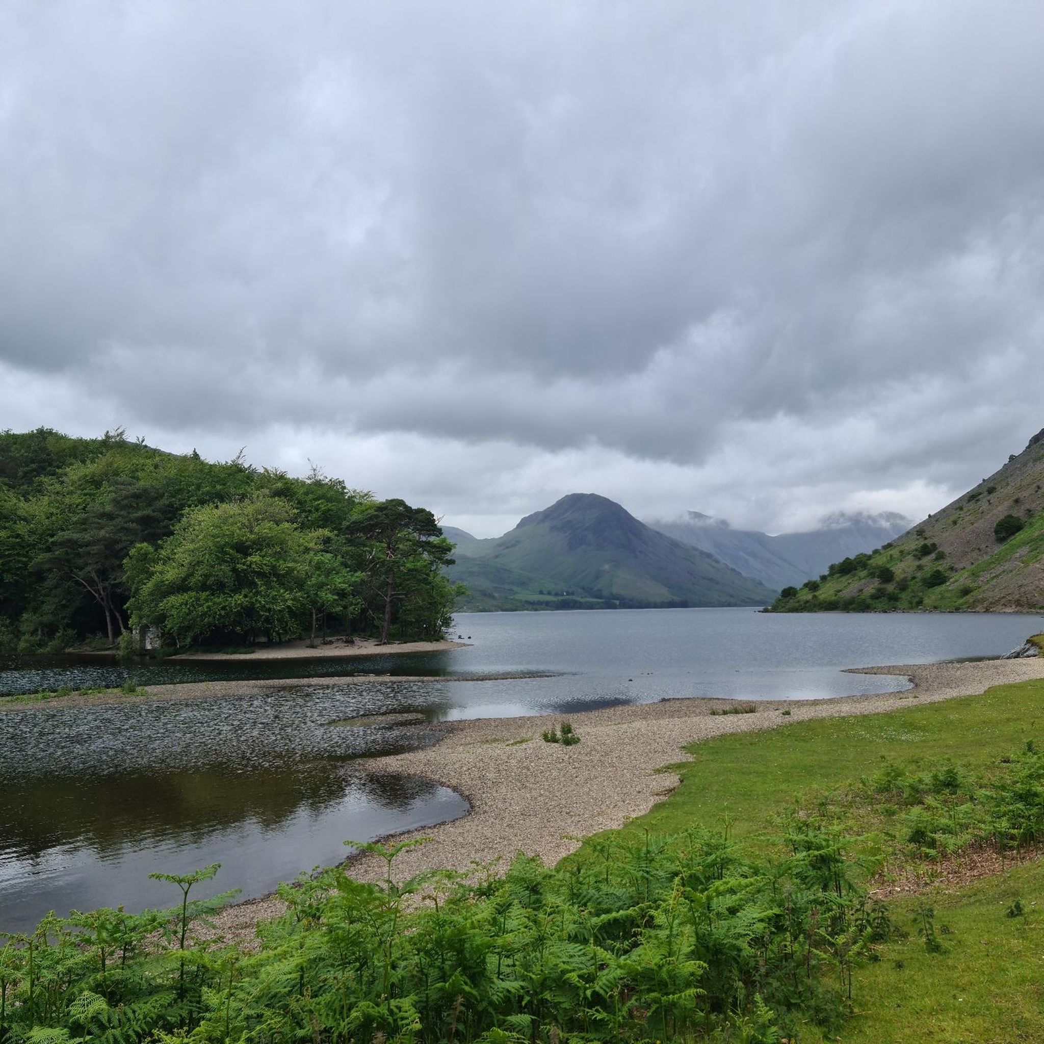
Hikes around Wast Water explore the landscape surrounding England's deepest lake, situated in the Wasdale Valley. The region is characterized by the dramatic scree slopes that descend to the water's edge and the high fells of the Lake District, including Scafell Pike, England's highest mountain. The terrain offers a mix of lakeside paths and challenging mountain ascents.
Best hiking trails around Wast Water
- The most popular hiking route is View of Wast Water – View of Wast Water loop from Boot, a 8.3 mile (13.3 km) trail that takes about 5 hours 50 minutes to complete. This is a demanding hike with significant elevation gain, offering panoramic views of the lake and surrounding fells.
- Another top favourite among local hiking enthusiasts is Wast Water – The Mill Café loop from Wasdale, a moderate 5.6 mile (9.0 km) path. This route provides a more accessible option with minimal elevation, following paths closer to the lake.
- Local hiking enthusiasts also love the Wast Water – Seatallan summit loop from Wasdale, a 6.9 mile (11.2 km) trail leading through open fellside to the summit of Seatallan, often completed in about 4 hours 10 minutes.
- Hiking around Wast Water is defined by challenging mountain ascents, lakeside paths, and routes across open fells. The trail network provides options for various ability levels, from demanding climbs to more moderate walks.
- The routes in Wast Water are highly rated by the komoot community with an average score of 4.5 stars from over 750 reviews. More than 7,800 hikers have used komoot to explore Wast Water's varied terrain.
Last updated: June 25, 2026
4.7
(55)
200
hikers
9.16km
02:27
110m
110m
Moderate hike. Good fitness required. Easily-accessible paths. Suitable for all skill levels.
4.6
(24)
243
hikers
11.2km
04:12
620m
620m
Moderate hike. Good fitness required. Mostly accessible paths. Sure-footedness required.

Sign up for free
3.5
(15)
81
hikers
12.0km
03:14
110m
110m
Hard hike. Good fitness required. Sure-footedness, sturdy shoes and alpine experience required.
4.5
(2)
40
hikers
25.2km
09:41
1,350m
1,350m
Hard hike. Very good fitness required. Mostly accessible paths. Sure-footedness required.
5.0
(2)
51
hikers
Easy hike. Great for any fitness level. Easily-accessible paths. Suitable for all skill levels.
Get access to more routes and recommendations from other explorers.
Sign up for free
Already have an account?
Our route recommendations are based on thousands of hikes, rides, and runs completed by other people on komoot.
Start today with a free account
Your next adventure awaits.
Login or Signup

Tips from the Community

Absolutely impossible for this to be Ennerdale Water.. it’s Wast Water
0
0

Plenty of space but no overnights
0
0

My first long hike. The views are amazing. Bare in mind if the route says fitness level expert it really is required. I have ignored that and the route took nearly 2 hours longer than it should. Also pulled a muscle on my hip on one of the climbs so the descent and the rest of the route was in pure pain but made it to the end. 11/10 will go again.
0
0

Glade How 440m P9 (1443ft) (DoBIH Hill ID: 3774) [JNSA N/a ] Lake District National Park Definitive List summit. County of Cumberland Definitive List summit.
0
0
Buckbarrow 423m P4 (1388ft) (DoBIH Hill ID: 2497) [JNSA N/a] Lake District National Park Definitive List summit. County of Cumberland Definitive List summit. Kent List Summit.
0
0


The amazing view of wastwater some roadside parking and few car parks along the road
0
0

Excellent views of the ridge to come from the base. This route up via Bell Rib is a steep Grade 1 scramble and care should be exercised especially in winter conditions.
0
0
More Information
FAQs about hiking around Wast Water
-
What types of hiking trails can I find around Wast Water?
The trails around Wast Water, located in Copeland, offer a mix of experiences from demanding ascents to moderate loops. You can explore challenging routes offering panoramic views or choose more relaxed paths near the lake. -
Are there hiking options for all skill levels near Wast Water?
Yes, Wast Water provides a range of hiking difficulties. You'll find challenging routes like the "View of Wast Water" loop for experienced hikers, as well as moderate options such as the "Wast Water – The Mill Café" loop or the "Wast Water – Seatallan Summit" loop. -
What are some popular hiking routes in the Wast Water area?
Popular routes include the challenging View of Wast Water – View of Wast Water loop from Boot, the moderate Wast Water – The Mill Café loop from Boot, and the scenic Wast Water – Seatallan Summit loop from Boot, which offers expansive views. -
What scenic features can I expect on hikes around Wast Water?
Hikes around Wast Water often feature stunning panoramic views of the lake itself and the surrounding fells. Many routes, like the journey to Seatallan Summit, provide expansive vistas of the Cumbrian landscape. -
How long do hikes around Wast Water typically take?
Hike durations vary, with options ranging from about 2 hours 25 minutes for moderate loops up to nearly 6 hours for more challenging and longer trails.
Frequently Asked Questions
Where can I park for hikes around Wast Water?
The main starting point for many hikes, especially the ascent to Scafell Pike, is Wasdale Head, which has parking facilities. Another option is the National Trust car park near the lake. These car parks can fill up very quickly, particularly on weekends and during peak season, so it's highly recommended to arrive early to secure a spot.
Are there any easy, family-friendly walks in the area?
Yes, while the area is known for its challenging peaks, there are gentler options suitable for families. The southern end of the lake near Nether Wasdale offers more relaxed paths. For a specific route, the View of Ennerdale Water loop from Wasdale is a short, easy walk that provides a taste of the scenery without significant climbing.
What are the most challenging hikes starting from Wasdale Head?
Wasdale Head is the gateway to some of England's most demanding mountain hikes. The ascent of Scafell Pike, the country's highest peak, is the most famous challenge. Other strenuous but rewarding climbs include routes up the iconic fells of Great Gable and Pillar. These are full-day mountain excursions requiring a high level of fitness, experience, and navigation skills.
How difficult is the walk along the Wast Water Screes?
Traversing the scree path along the southeastern shore of Wast Water is very challenging and should not be underestimated. The path consists of loose, unstable rocks and boulders, requiring excellent balance, concentration, and sturdy footwear. It is not a simple lakeside stroll and is generally recommended only for experienced and confident hikers.
Are dogs allowed on the trails around Wast Water?
Dogs are welcome on most public footpaths around Wast Water. However, you will be walking through farmland with livestock, so it is crucial to keep your dog on a lead at all times. The terrain on higher fells can be rocky and demanding, so ensure your dog is fit enough for the chosen route. After your walk, you can find dog-friendly pubs in and around Nether Wasdale.
What do other hikers think of the trails around Wast Water?
The region is highly regarded by the komoot community, with an average rating of 4.5 stars from over 750 reviews. Hikers frequently praise the dramatic, breathtaking scenery, especially the views of the lake from the surrounding fells and the raw beauty of the scree slopes.
Are there any circular walks available?
Yes, there are several excellent circular routes. For a demanding, high-level loop with fantastic views, consider the View of Wast Water – View of Wast Water loop from Boot. This 8.3-mile (13.3 km) hike involves significant ascent and is a great way to experience the dramatic landscape of the fells overlooking the lake.
Can I get food and drink near Wast Water?
Yes. The famous Wasdale Head Inn at the northern end of the lake is a historic and popular spot for hikers to get refreshments after a climb. The nearby village of Nether Wasdale also has friendly pubs. For a walk that incorporates a cafe stop, you could try the Wast Water – The Mill Café loop from Wasdale.
How many hiking trails are there around Wast Water?
There is a wide variety of trails to explore, with over 30 curated hiking routes available on komoot. These range from challenging ascents of high fells like Scafell Pike to more moderate lakeside paths and gentle valley walks, offering options for all ability levels.
What should I pack for a hike in Wasdale?
The weather in Wasdale can change rapidly. Essential items include waterproof and windproof clothing, multiple warm layers, and sturdy, broken-in hiking boots. For mountain routes, a map, compass, and GPS device are crucial. Always carry enough food and water for your planned route, plus extra for emergencies. Sunscreen is also advisable, as there is little shade on the high fells.
Is it possible to walk all the way around the lake?
A full circular walk around Wast Water is possible but it is a long and challenging undertaking of around 8 miles (13 km). The main difficulty is the section along the screes, which is a rough and unstable path over boulders. The Wast Water – View of Wast Water loop from Wast Water covers a significant portion of the lakeside, but a full loop requires careful planning.
Are there any unique activities besides hiking?
Yes, for a memorable and unique experience, you can try alpaca trekking. The highly-regarded Wastwater Alpaca Trekking offers guided walks with alpacas along the shores of the lake, providing a completely different way to enjoy the stunning scenery.
Most popular routes around Wast Water
Most popular attractions around Wast Water

Get inspired with the komoot mobile app


Explore more
Browse the best Hikes in other regions.
