The best walks and hikes around Elter Water
4.6
(13838)
113,015
hikers
935
hikes
Hiking around Elter Water offers varied terrain in the heart of the Lake District. The region is characterized by the lake itself, surrounding fells, and river valleys featuring waterfalls. Trails often pass through woodlands and open landscapes, providing views of the Cumbrian mountains. The area includes accessible paths along the water's edge and more challenging ascents to hill summits.
Best hiking trails around Elter Water
- The most popular hiking route is Slater's Bridge – Cathedral Cavern loop from Lakes, a 4.7 miles (7.6 km) trail that takes 2 hours 14 minutes to complete. This moderate route explores historical quarry sites and a notable stone bridge.
- Another top favourite among local hikers is Elter Water – Skelwith Force loop from Lakes, an easy 4.0 miles (6.5 km) path. This route offers gentle gradients along the lake shore and passes the Skelwith Force waterfall.
- Local hikers also love the Loughrigg Fell summit – Loughrigg Summit loop from Skelwith, a 4.2 miles (6.7 km) trail leading through open fellside, often completed in about 2 hours 15 minutes.
- Hiking around Elter Water is defined by lake shore paths, river valleys with waterfalls, and ascents to fells, offering panoramic views. The network offers options for different ability levels, from easy family friendly walks Elter Water to more challenging hikes near Elter Water.
- The routes in Elter Water are highly rated by the komoot community with an average score of 4.6 stars from over 11,000 reviews. More than 100,000 hikers have used komoot to explore Elter Water's varied terrain.
Last updated: September 28, 2026
4.8
(16)
119
hikers
13.8km
04:30
510m
510m
Moderate hike. Good fitness required. Mostly accessible paths. Sure-footedness required.
4.9
(11)
76
hikers
6.81km
02:17
290m
290m
Moderate hike. Good fitness required. Mostly accessible paths. Sure-footedness required.

4.1
(12)
102
hikers
18.0km
04:55
280m
280m
Moderate hike. Good fitness required. Easily-accessible paths. Suitable for all skill levels.
4.9
(25)
268
hikers
13.2km
04:05
450m
440m
Moderate hike. Good fitness required. Easily-accessible paths. Suitable for all skill levels.
4.7
(51)
887
hikers
6.04km
01:36
60m
60m
Easy hike. Great for any fitness level. Easily-accessible paths. Suitable for all skill levels.
Get access to more routes and recommendations from other explorers.
Already have an account?
Our route recommendations are based on thousands of hikes, rides, and runs completed by other people on komoot.
Start today with a free account
Your next adventure awaits.


Tips from the Community

Elterwater is a gorgeous village and an excellent basecamp for all manner of adventures in the Lakes, particularly for likes of Loughrigg and the iconic fells above Langdale. It's also conveniently placed on the route of the Cumbria Way long-distance trail. The village has a range of accommodation options, including a hostel and cottages. The Britannia Inn also has beds and serves great pub food.
0
0


It feels a bit strange to walk between two high walls built with slate. They are witnesses to the former busy activity in the quarries.
10
0
Great Langdale is a spectacular, U-shaped glacial valley in the heart of the Lake District National Park, renowned for its dramatic fells, waterfalls, and world-class hiking trails. Dominated by the iconic Langdale Pikes, it is the ultimate playground for outdoor enthusiasts.
6
0
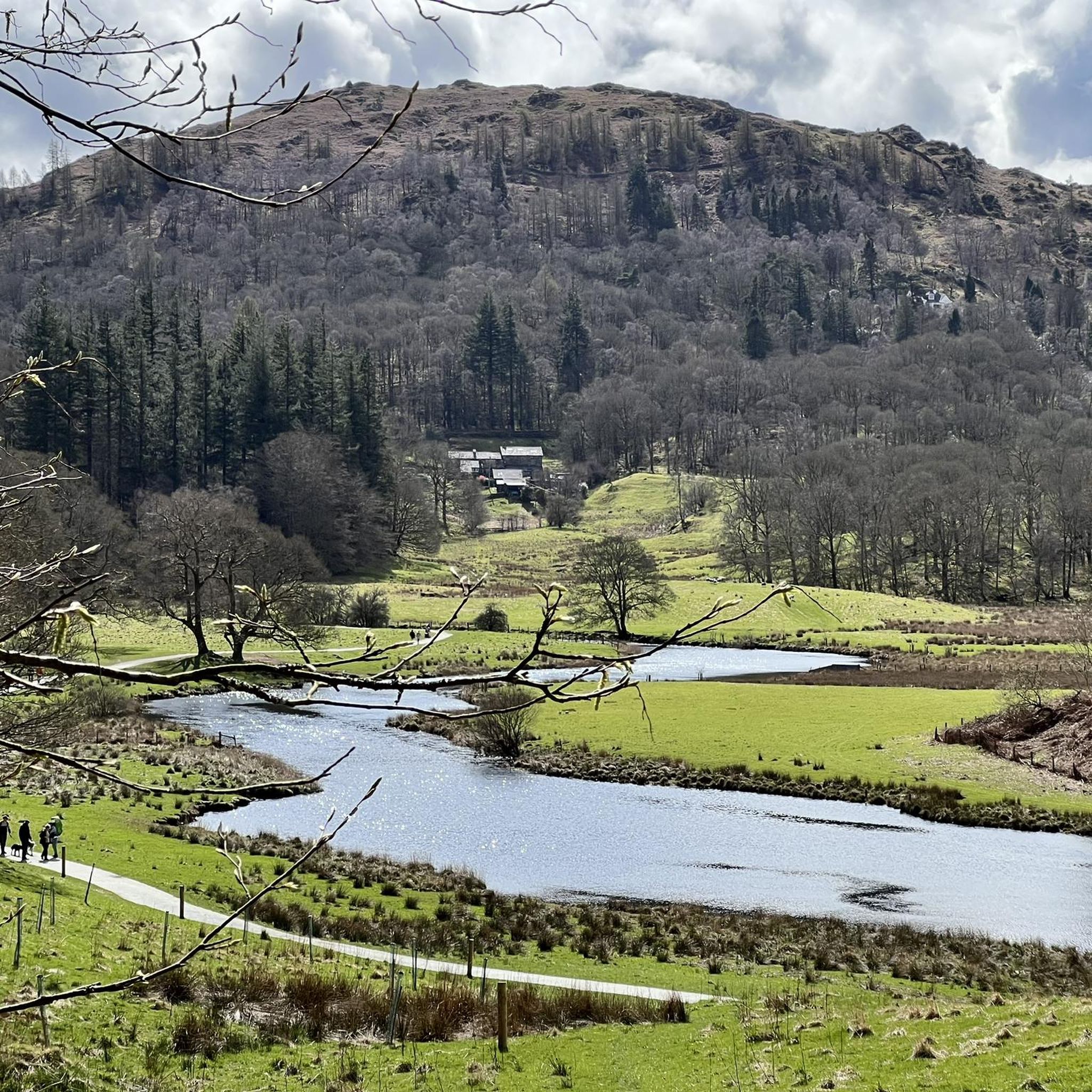
Very beautiful green hiking environment.
8
0
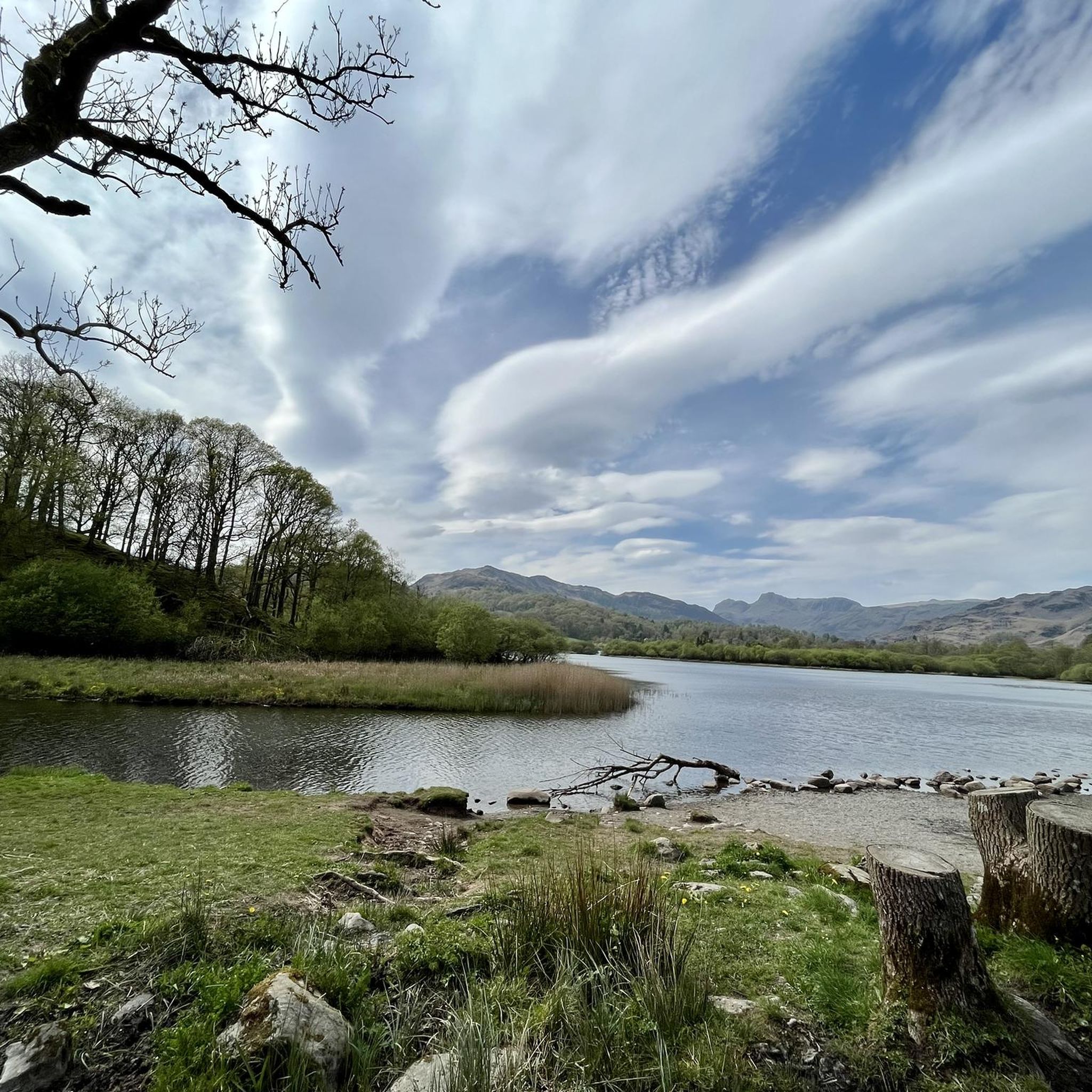
Here you have a beautiful view of the Langdale Pikes. Enjoy it.
10
0

Lingmoor Fell is a 469-meter (1,540-foot) Wainwright near Blea Tarn. If you are coming up from there, it is a good stiff climb of over 200 metres, but the views are worth it. The views out over Blea Tarn and the Langdale valley are super nice. The Langdale Pikes, in particular, look magnificent from here.
0
0

Famous local open water swim spot - tread carefully if you want to avoid the sheep shit
0
0
Frequently Asked Questions
How many hiking trails are available around Elter Water?
There are over 900 hiking routes recorded around Elter Water on komoot, offering a wide variety of options for all skill levels. This includes nearly 300 easy routes, over 400 moderate trails, and more than 200 challenging hikes.
Are there easy, family-friendly walks around Elter Water?
Yes, Elter Water is excellent for family-friendly walks. Many paths along the lake shore are relatively flat and accessible. A great option is the Elter Water – Skelwith Force loop from Lakes, an easy 4.0 miles (6.5 km) path with gentle gradients that passes the scenic Skelwith Force waterfall.
Can I bring my dog on the trails around Elter Water?
Most trails around Elter Water are dog-friendly, but it's important to keep dogs on a lead, especially near livestock and during ground-nesting bird season. Always follow the Countryside Code. Many local pubs also welcome well-behaved dogs.
Are there any circular walks around Elter Water?
Yes, many of the most popular routes around Elter Water are circular, allowing you to start and finish at the same point. The Elterwater Village – Elterwater Bridge loop from Lakes is a pleasant circular option, offering views of the village and the river.
What are some challenging hikes near Elter Water?
For those seeking a challenge, the fells surrounding Elter Water offer more strenuous ascents. The Loughrigg Fell summit – Loughrigg Summit loop from Skelwith is a difficult 4.2 miles (6.7 km) trail that leads through open fellside, providing panoramic views from the summit.
Are there any waterfalls to see on the hikes?
Yes, the region's river valleys are home to beautiful waterfalls. Skelwith Force is easily accessible on the Elter Water – Skelwith Force loop from Lakes. For a more extensive waterfall experience, consider the Stickle Tarn – Stickle Ghyll Waterfalls loop from Lakes, which features the impressive Stickle Ghyll cascades.
Where can I park when visiting Elter Water?
Parking is available in and around Elterwater village, as well as at nearby popular starting points like Skelwith Bridge. Be aware that parking areas can fill up quickly, especially during peak season, so arriving early is recommended.
Are there pubs or cafes near Elter Water for after a hike?
Yes, Elterwater village and nearby Skelwith Bridge offer welcoming pubs and cafes where you can refuel after your hike. These establishments often provide traditional Lakeland fare and a cozy atmosphere.
What is the best time of year to hike around Elter Water?
Elter Water is beautiful year-round, but the best time for hiking is generally spring through autumn (April to October) when the weather is milder and days are longer. Winter walks can be stunning, but require appropriate gear for potentially icy or snowy conditions.
What should I wear for hiking in Elter Water?
Layered clothing is always recommended due to the changeable Lakeland weather. Waterproof and windproof outer layers are essential, along with sturdy hiking boots. Even on shorter walks, carrying water, snacks, and a map or GPS device is advisable.
Is wild swimming permitted in Elter Water?
Wild swimming is a popular activity in the Lake District. While Elter Water is generally considered suitable for swimming, always exercise caution. Check water quality, be aware of cold water shock, and ensure you have a safe entry and exit point. Respect private land and local regulations.
What do other hikers enjoy most about Elter Water?
The area is highly rated by the komoot community, with an average score of 4.6 stars from over 11,000 reviews. Reviewers often praise the varied terrain, from tranquil lake shores to challenging fell ascents, and the stunning views of the Cumbrian mountains.
What are some notable landmarks or points of interest along the trails?
Beyond the natural beauty of the lake and fells, trails often pass by historical sites. The Slater's Bridge – Cathedral Cavern loop from Lakes explores historical quarry sites and features the iconic Slater's Bridge, a unique stone bridge, and the impressive Cathedral Cavern.
Most popular routes around Elter Water

Get inspired with the komoot mobile app


Explore more
Browse the best Hikes in other regions.
