The best road cycling routes around Lough Inagh
4.4
(11)
182
riders
3
rides
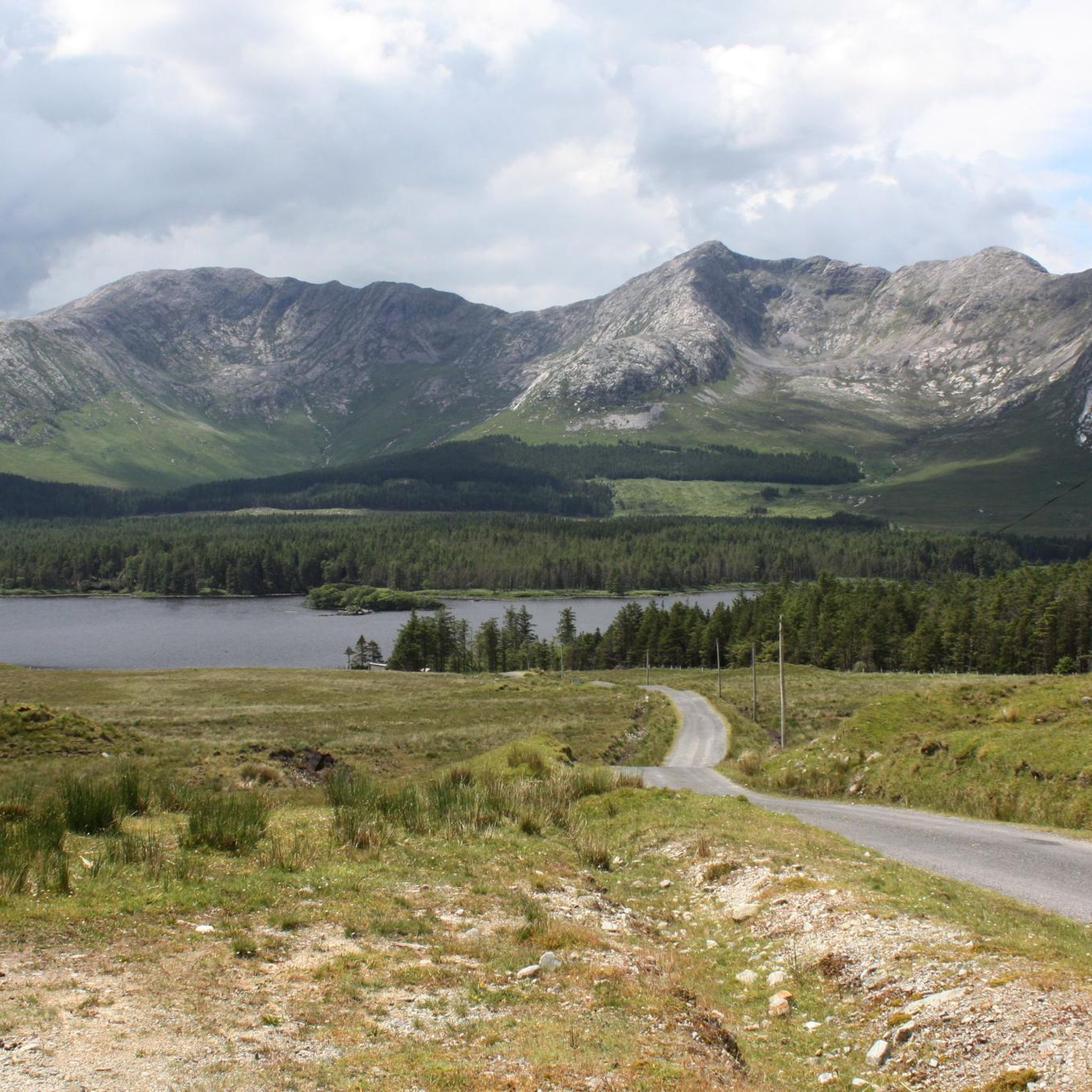
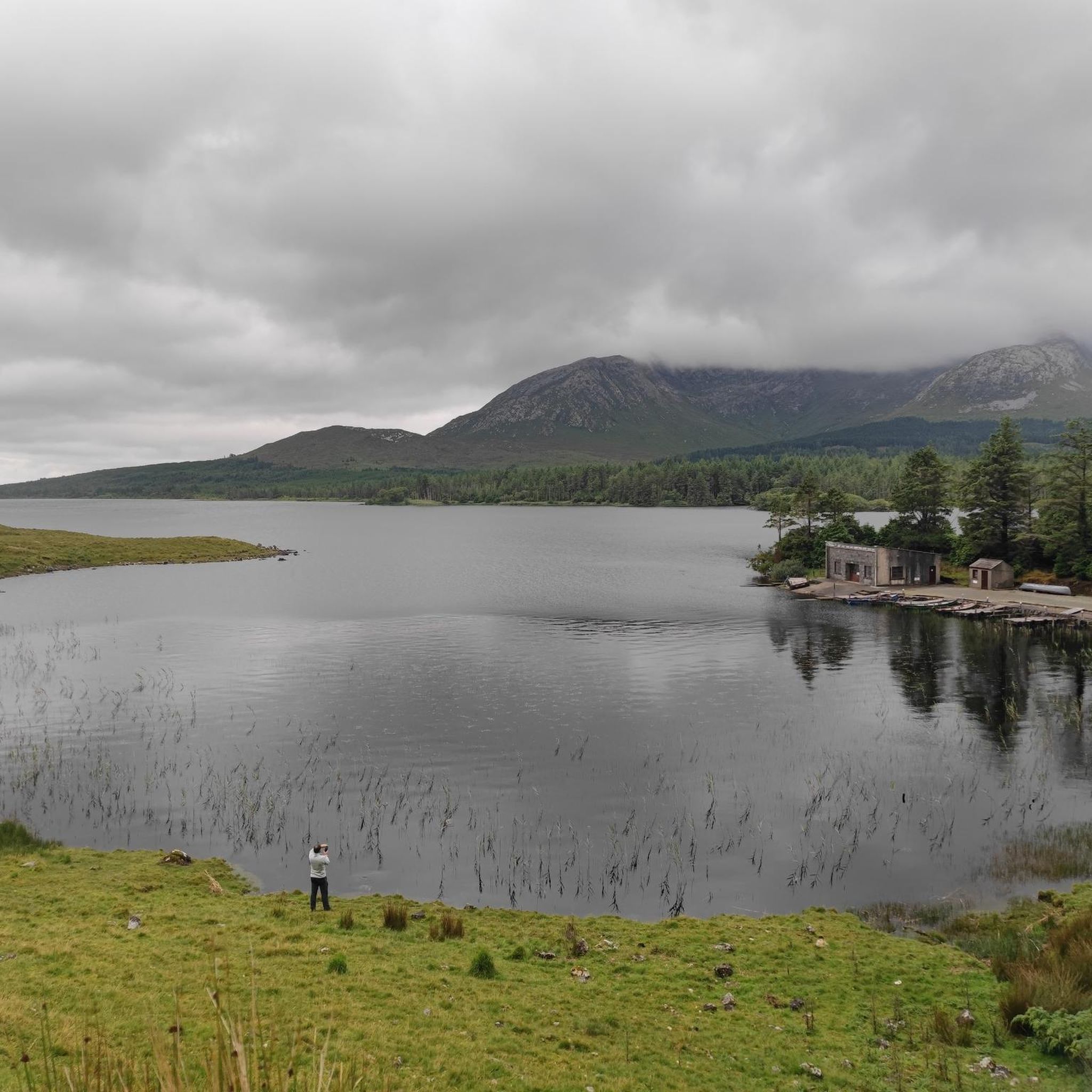
Road cycling routes around Lough Inagh traverse the scenic Inagh Valley, characterized by rugged mountains, serene lakes, and picturesque valleys. The region is framed by the majestic Twelve Bens and Maumturk Mountains, with Lough Inagh itself providing a tranquil centerpiece. Cyclists encounter varied terrain, including peatlands, grasslands, and woodlands, offering a dramatic backdrop for rides.
Best road cycling routes around Lough Inagh
- The most popular road cycling route is Pine Island, Letterfrack and Clifden loop — Connemara National Park,…
Last updated: July 12, 2026
33
riders
94.3km
03:50
560m
550m
Moderate road ride. Good fitness required. Mostly well-paved surfaces and easy to ride.
18
riders
19.5km
01:04
170m
170m
Easy road ride. Great for any fitness level. Mostly well-paved surfaces and easy to ride.

Sign up for free
4.5
(2)
38
riders
62.9km
02:48
670m
670m
Moderate road ride. Good fitness required. Mostly well-paved surfaces and easy to ride.
2
riders
31.0km
01:19
240m
240m
Easy road ride. Great for any fitness level. Mostly well-paved surfaces and easy to ride.
3.7
(3)
23
riders
62.1km
02:41
390m
390m
Moderate road ride. Good fitness required. Mostly well-paved surfaces and easy to ride.
Our route recommendations are based on thousands of hikes, rides, and runs completed by other people on komoot.
Start today with a free account
Your next adventure awaits.
Login or Signup
Popular around Lough Inagh
Tips from the Community

Wild Atlantic Way Discovery Point: The road through Doo Lough Valley is a quiet, narrow route with little traffic, allowing you to fully enjoy the wide views over the dark lake and surrounding mountain slopes. Along the shore are several photogenic spots where water, light, and landscape come together beautifully. This passage logically connects to Delphi Valley, the climb to Doolough Pass, and the understated 1849 memorial, making this stretch one of the most impressive links of the entire route.
4
0
The road through Doo Lough Valley is a quiet, narrow route with little traffic, allowing you to fully enjoy the wide views over the dark lake and the surrounding mountain slopes. Along the shore are several photogenic spots where water, light, and landscape come together beautifully. This passage logically connects to Delphi Valley, the climb to Doolough Pass, and the understated 1849 memorial, making this section one of the most impressive links of the entire route.
6
0
Killary Fjord (of Killary Harbour) is often called the only true fjord in Ireland, although technically it is one of the three glacial fjords on the island. This deep sea arm cuts 16 kilometres inland, forming the natural border between the counties of Galway and Mayo.
6
0
One of the most characteristic Connemara roads: narrow asphalt, slightly undulating, and constantly accompanied by water and low green ridges. Lough Fee lies elongated and open in the landscape. The road runs close to the banks, giving you almost continuous views of water, bog, and the surrounding hills. It feels remote and serene, with broad west coast air and an almost timeless tranquility.
7
0
Long, narrow mountain lake in the northwest of Connemara, formed in a glacial valley between the Mweelrea massif and the lower ridges towards Letterfrack. The water lies in a quiet, remote valley where peat, heather and rock alternate. The shores are largely uninhabited, giving the lake a distinctly wild and natural character.
1
0
One of the most beautiful beaches in the world: secluded, serene, stunning and all yours, for the afternoon. Occasionally a curragh drifts in with the tide, laden with the finest treats the sea has to offer, and then it's quiet again. A tangible reminder of the power of the sea. This enormous rusty anchor belonged to the Norwegian ship the 'Varity', which ran aground here in 1890 during a severe storm. The ship was en route from Canada to Belfast with a cargo of timber when it was wrecked near Aughris Beach. For cyclists on the Lower Sky Road, this is an impressive stop just 4 metres above sea level. As you gaze out over the white sands of Aughris Beach, you realise how untameable the Connemara coast can be.
5
0
This historic stone arch bridge marks the spectacular entrance to Clifden. From the bridge, you look down on the wild rapids of the Owenglin River, which thunders down here via a series of small waterfalls into the bay. The contrast between the crashing water, the old grey stone, and the colourful facades of the town further on is magnificent.
6
0
The Sint-Jacobuskerk (St. James's Church) in Cashel is an architectural gem that contrasts beautifully with the rugged Connemara landscape. This 19th-century Neo-Gothic church, built from local granite, is situated in a prominent position on the R340, majestically overlooking the inlets of Bertraghboy Bay. With the iconic peaks of the Twelve Bens as a backdrop, this building forms a serene and photogenic resting point along the coastal route. Whether you stop for the tranquil atmosphere of the graveyard or to admire the impressive granite details, this place embodies the spiritual and natural beauty of the Gaeltacht.
5
0
Frequently Asked Questions
What kind of terrain can I expect on road cycling routes around Lough Inagh?
Road cycling routes around Lough Inagh offer a diverse landscape. You'll encounter rugged mountains, serene lakes, and picturesque valleys, framed by the majestic Twelve Bens and Maumturk Mountains. The terrain includes expansive peatlands, heaths, grasslands, and woodlands, providing a dramatic and varied backdrop for your rides.
Are there routes suitable for beginners or those looking for an easier ride?
Yes, Lough Inagh offers routes for various ability levels. For an easier ride, consider the Lough Fee – Lough Fee loop from Killary Harbour, which is 12.1 miles (19.5 km) and offers views of Ireland's only fjord. Another easy option is the Pine Island loop from Ballinafad, covering 31.1 miles (31.1 km).
What are some notable natural features or landmarks to look out for while cycling?
The region is rich in natural beauty. You'll cycle through the stunning Inagh Valley, with the Twelve Bens and Maumturk Mountains providing a dramatic backdrop. Lough Inagh itself is a tranquil centerpiece, and you might spot small streams and sparkling waterfalls cascading into the lake. Keep an eye out for the Bronze Age Stone Row and 'Mans Island' at the northern end of Lough Inagh.
Can I find longer or more challenging road cycling routes in the area?
Absolutely. For a more extensive and moderately challenging ride, the Pine Island, Letterfrack and Clifden loop — Connemara National Park spans 58.6 miles (94.3 km) and connects to Connemara National Park. Another moderate option is the Doolough Valley – Doolough Valley loop from Gar's Glen, a 39.8 miles (64.0 km) trail through a dramatic valley with significant elevation gains.
What is the best time of year for road cycling around Lough Inagh?
The region's natural beauty is captivating year-round, but for road cycling, spring through autumn generally offers the most favorable weather conditions. Clear days provide stunning reflections of the mountains on Lough Inagh. It's always advisable to check local weather forecasts, as conditions in Connemara can change rapidly.
Are there any circular road cycling routes available?
Yes, many of the routes around Lough Inagh are designed as loops, allowing you to start and finish at the same point. Examples include the Lough Fee – Lough Fee loop from Killary Harbour and the Doolough Valley – Doolough Valley loop from Gar's Glen. The View of Ballynahinch Lake – Outlandish landscape loop from Recess also offers a scenic circular experience.
What do other road cyclists say about the routes in Lough Inagh?
The road cycling routes around Lough Inagh are highly rated by the komoot community, with an average score of 4.4 stars from over 10 reviews. Cyclists often praise the stunningly beautiful scenic routes, the quiet roads, and the dramatic mountain backdrops that make for a rewarding cycling experience.
Are there any attractions near the cycling routes that I can visit?
Yes, the Lough Inagh area is well-connected to other significant Connemara attractions. Cyclists can easily access places like Kylemore Abbey, a magnificent Gothic castle with beautiful gardens, or Connemara National Park, offering scenic mountains and woodlands. Killary Fjord, Ireland's only fjord, is also nearby, providing opportunities for scenic cycling along its shores.
Is there parking available for cyclists in the Lough Inagh area?
While specific parking areas for each route are not detailed, the R344 road, which meanders past Lough Inagh, is generally quiet. Many accommodations in the area cater to cyclists and can provide information on suitable parking options. It's advisable to check with local establishments or visitor centers for the most convenient parking spots.
Are there cafes or places to stop for refreshments along the routes?
The Lough Inagh area, being a popular destination, has amenities available. While specific cafes directly on every route are not listed, nearby towns and villages like Clifden, Roundstone, and Letterfrack, often incorporated into cycling itineraries, offer various options for refreshments, pubs, and accommodation.
Can I incorporate other activities like walking or exploring coastal areas into my cycling trip?
Absolutely. Lough Inagh is an excellent base for combining road cycling with other outdoor pursuits. Connemara National Park offers walking trails, and nearby coastal villages like Clifden and Roundstone provide access to beautiful sandy beaches such as Gurteen Beach and Dogs Bay, perfect for exploring on foot after a ride.
What is the overall difficulty level of road cycling in Lough Inagh?
The road cycling network around Lough Inagh offers a range of difficulties. You'll find easy loops suitable for all fitness levels, such as the Lough Fee – Lough Fee loop from Killary Harbour, as well as more challenging routes with significant elevation gains, like the Doolough Valley – Doolough Valley loop from Gar's Glen. This variety ensures there's something for every cyclist.
Most popular routes around Lough Inagh

Get inspired with the komoot mobile app


Explore more
Browse the best Road cycling routes in other regions.
