The best cycling routes around Doo Lough
4.9
(27)
261
riders
17
rides
Touring cycling routes around Doo Lough are set within a dramatic glacial valley in County Mayo, Ireland, characterized by its U-shaped landscape and deep, reflective lakes. The region is flanked by the Mweelrea Mountains and Sheeffry Hills, providing a rugged backdrop to the winding roads. These routes are an integral part of the Wild Atlantic Way, offering varied terrain from lakeside paths to more challenging mountain ascents. The area's geological history contributes to its distinctive appearance, making it a notable destination for outdoor activities.
Best touring cycling routes around Doo Lough
- The most popular touring cycling route is Cregganbaun Standing Stone – Doo Lough Lakeside Road loop from Bundorragha River, a 39.8 miles (64.1 km) trail that takes 3 hours 52 minutes to complete. This difficult route offers extensive views of the Doo Lough valley and its surrounding peaks.
- Another top favourite among local touring cyclists is View of Lettergesh Beach – Lough Fee loop from Killary Harbour, a moderate 24.3 miles (39.2 km) path. This route features coastal scenery and views of Lough Fee, often completed in about 2 hours 27 minutes.
- Local touring cyclists also love the Lough Fee – Lough Fee loop from Killary Harbour, a 16.4 miles (26.4 km) trail leading through the scenic area around Lough Fee, often completed in about 1 hour 49 minutes.
- Touring cycling around Doo Lough is defined by glacial valleys, towering mountains, and crystal-clear lakes. The network offers options for various ability levels, from moderate lakeside paths to difficult mountain ascents.
- The routes in Doo Lough are highly rated by the komoot community with an average score of 4.9 stars from over 25 reviews. More than 250 touring cyclists have used komoot to explore Doo Lough's varied terrain.
Last updated: June 27, 2026
5.0
(2)
17
riders
Hard bike ride. Very good fitness required. Mostly paved surfaces. Suitable for all skill levels.
4.7
(3)
20
riders
39.2km
02:27
360m
360m
Moderate bike ride. Good fitness required. Mostly paved surfaces. Suitable for all skill levels.

Sign up for free
10
riders
26.4km
01:50
240m
240m
Moderate bike ride. Good fitness required. Mostly paved surfaces. Suitable for all skill levels.
93.9km
05:43
780m
790m
Hard bike ride. Very good fitness required. Mostly paved surfaces. Suitable for all skill levels.
4.0
(1)
6
riders
51.3km
03:06
440m
440m
Moderate bike ride. Good fitness required. Mostly paved surfaces. Suitable for all skill levels.
Get access to more routes and recommendations from other explorers.
Sign up for free
Already have an account?
Our route recommendations are based on thousands of hikes, rides, and runs completed by other people on komoot.
Start today with a free account
Your next adventure awaits.
Login or Signup
Popular around Doo Lough
Tips from the Community

The Murrisk Standing Stones are a small group of prehistoric stones that have stood in the open field for centuries, with Croagh Patrick as an imposing backdrop. Their exact function is unknown, but they are often linked to ancient rituals or landscape markings. The simplicity of the stones is beautifully highlighted by their open location and the sightlines to the bay and the mountain.
6
0
The Cregganbaun Standing Stone is a solitary, prehistoric stone that has stood in the field for centuries, overlooking the hills and coastline of South Mayo. The stone likely marks an ancient route or boundary and forms a beautiful, quiet point in the open landscape. Due to its isolated location, the shape and height of the stone are particularly striking.
6
0
Tia Truck Café is a simple but cozy roadside stop along the Delphi–Doolough valley. You'll find coffee, snacks, and a warm, informal atmosphere — ideal as a short break spot amidst the rugged mountain scenery. The location is near the water and offers beautiful sightlines of the surrounding hills.
6
0
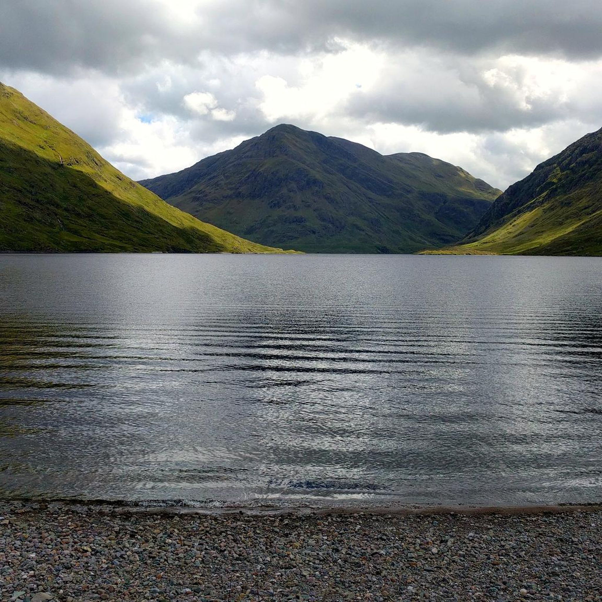
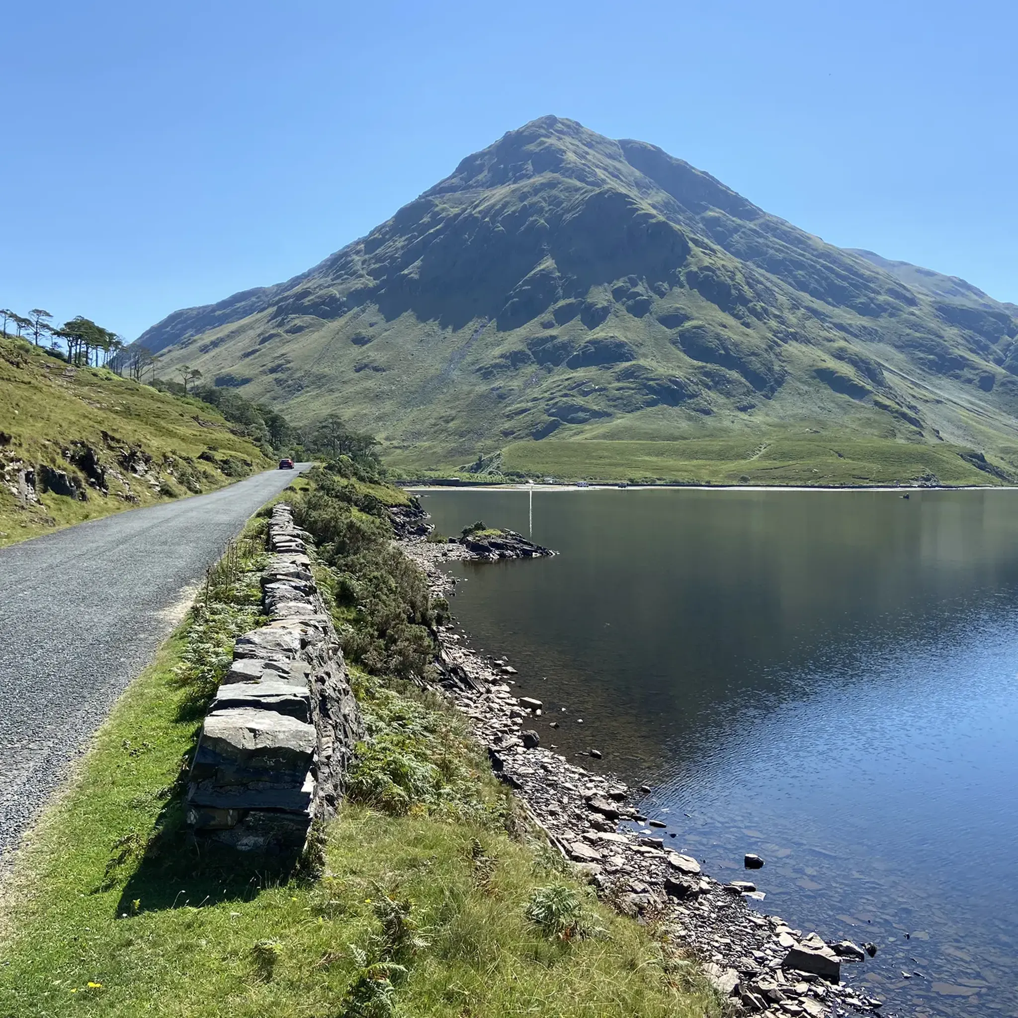
This road follows the shore of Doo Lough, a picturesque mountain lake nestled between the steep slopes of the Mweelrea range and the Sheeffry Hills. The landscape is desolate, rugged and impressively open, with constant views of the dark water of the lake. The road winds gently along the shore and feels remote, even though it remains very passable.
5
0
From this spot, you have an open, elevated view over Killary Fjord, with wide sightlines towards the steep flanks of Ben Gorm and Mweelrea. The fjord stretches out below you, clearly showing how the landscape opens up towards the ocean. In clear weather, you get deep contrasts between water and mountains; in fog, a typical Connemara atmosphere is created.
5
0
Killary Fjord (of Killary Harbour) is often called the only true fjord in Ireland, although technically it is one of the three glacial fjords on the island. This deep sea arm cuts 16 kilometres inland, forming the natural border between the counties of Galway and Mayo.
6
0
One of the most characteristic Connemara roads: narrow asphalt, slightly undulating, and constantly accompanied by water and low green ridges. Lough Fee lies elongated and open in the landscape. The road runs close to the banks, giving you almost continuous views of water, bog, and the surrounding hills. It feels remote and serene, with broad west coast air and an almost timeless tranquility.
7
0
Long, narrow mountain lake in the northwest of Connemara, formed in a glacial valley between the Mweelrea massif and the lower ridges towards Letterfrack. The water lies in a quiet, remote valley where peat, heather and rock alternate. The shores are largely uninhabited, giving the lake a distinctly wild and natural character.
1
0
Frequently Asked Questions
How many touring cycling routes are available in Doo Lough?
Doo Lough offers a selection of 17 touring cycling routes, catering to various skill levels. These routes traverse the dramatic glacial valley, providing extensive views of the surrounding mountains and lakes.
What kind of terrain can I expect when cycling in Doo Lough?
The terrain in Doo Lough is diverse, ranging from moderate lakeside paths to challenging mountain ascents. The Doolough Valley itself features an 8-kilometer stretch of winding roads with steep gradients, offering breathtaking views. You'll encounter U-shaped glacial valleys, towering mountains like Mweelrea, and crystal-clear lakes.
Are there any easy touring cycling routes for beginners or families in Doo Lough?
While many routes offer moderate to difficult challenges, there is 1 easy touring cycling route available in Doo Lough. For a moderate option that still provides stunning scenery, consider the View of Lettergesh Beach – Lough Fee loop from Killary Harbour, which is 39.2 km long.
Can I find circular touring cycling routes in Doo Lough?
Yes, many of the touring cycling routes in Doo Lough are circular. A popular difficult loop is the Cregganbaun Standing Stone – Doo Lough Lakeside Road loop from Bundorragha River, which covers 64.1 km. For a shorter, moderate option, the Lough Fee – Lough Fee loop from Killary Harbour is 26.4 km.
What are some notable natural features or landmarks to see while cycling in Doo Lough?
Doo Lough is rich in natural beauty and historical landmarks. You'll cycle through a dramatic glacial valley flanked by the imposing Mweelrea Mountains and Sheeffry Hills. The dark, reflective waters of Doo Lough, Fin Lough, and Glenullin Lough are prominent features. You can also visit the poignant Doolough Famine Memorial, a stone cross commemorating a historical event. Nearby, you might glimpse Killary Fjord, Ireland's only fjord, or Croagh Patrick, Ireland's holy mountain.
Is Doo Lough suitable for challenging touring cycling?
Absolutely. Doo Lough is an excellent destination for challenging touring cycling, with 7 difficult routes available. The region's winding roads, steep gradients, and mountainous backdrops provide a rigorous workout. A particularly challenging option is the Lough Corrib, Maam Cross & Killary Fjord loop from Leenuan, spanning nearly 94 km with significant elevation changes.
What is the best time of year to go touring cycling in Doo Lough?
The best time to cycle in Doo Lough is generally during the warmer, drier months, typically from late spring to early autumn (May to September). This period offers more stable weather conditions, though the region's weather can be unpredictable. Always be prepared for changing conditions, as the valley's dramatic landscape can experience sudden shifts.
Are there options for public transport to access cycling routes in Doo Lough?
Public transport options directly into the Doolough Valley are limited. It is often considered a more remote and unspoiled area. Access is primarily by car, with cyclists often driving to a starting point and then cycling the routes. Checking local bus services for nearby towns like Leenaun or Louisburgh and then cycling from there might be an option, but direct access to the valley's routes via public transport is not widely available.
Where can I park my car when visiting Doo Lough for cycling?
Parking is typically available at various points along the Doolough Valley Drive and near the start of popular routes. As it's a less crowded area, informal parking spots can often be found, especially near trailheads or points of interest. Always ensure you park responsibly and do not obstruct local traffic or access points.
Are there any cafes or places to stop for refreshments along the routes?
The Doolough Valley itself is quite remote, preserving its unspoiled nature, so amenities like cafes are not abundant directly along the routes. However, nearby villages such as Leenaun (Leenaun) or Louisburgh offer options for cafes, pubs, and accommodation where you can refuel before or after your ride. It's advisable to carry sufficient water and snacks for your journey through the valley.
What do other cyclists say about touring cycling in Doo Lough?
The touring cycling routes in Doo Lough are highly rated by the komoot community, with an average score of 4.9 stars from over 25 reviews. Cyclists often praise the 'magical landscape of bogs, mountains and lakes,' the dramatic scenery, and the sense of tranquility found in this unique glacial valley. Many highlight the challenging yet rewarding nature of the rides and the stunning views along the Wild Atlantic Way.
Can I bring my dog on touring cycling routes in Doo Lough?
While there are no specific restrictions against dogs on the public roads and trails in Doo Lough, it's important to be mindful of the local environment. The area is home to sheep, which often graze freely on roadsides. Always keep dogs on a lead, especially in rural and mountainous areas, to ensure their safety and to prevent disturbance to livestock and wildlife. Be prepared to carry out any waste.
Are there any less crowded touring cycling routes in Doo Lough?
Doo Lough is often considered a hidden gem along the Wild Atlantic Way, generally less crowded than more tourist-heavy areas. Most routes offer a sense of solitude and immersion in nature. For a moderate ride that still provides a peaceful experience, the Killary Fjord – View of Killary Fjord loop from Leenaun, at 51.9 km, offers stunning views with fewer crowds.
Most popular routes around Doo Lough
Most popular attractions around Doo Lough

Get inspired with the komoot mobile app


Explore more
Browse the best Cycling routes in other regions.
