The best road cycling routes around Myrtle Grove
97
riders
8
rides
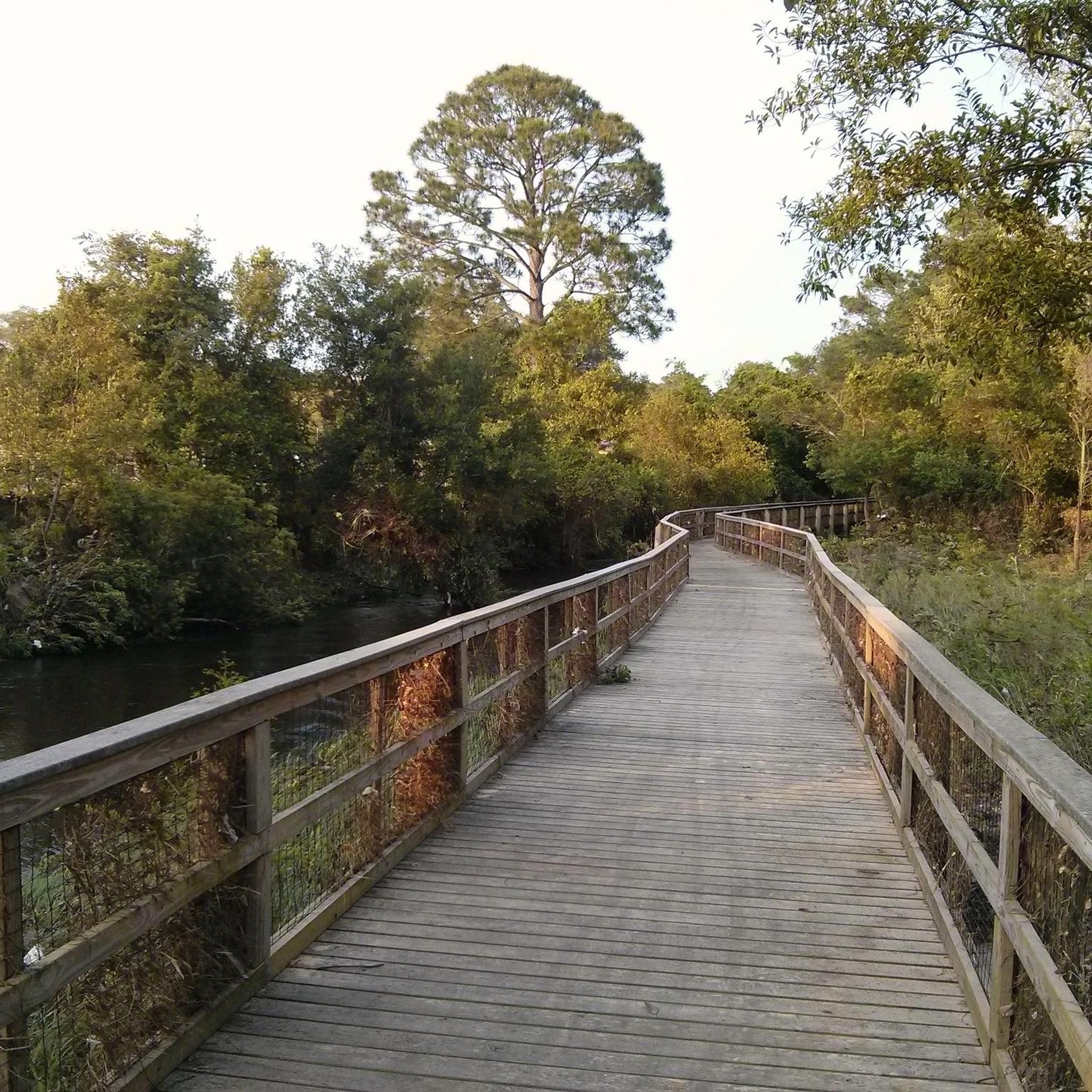
Road cycling around Myrtle Grove features predominantly flat to gently rolling terrain, characteristic of coastal regions. The landscape is defined by its proximity to various bayous and the expansive Pensacola Bay, offering routes with minimal elevation changes. Road cyclists can expect to navigate paths alongside waterways and through areas with low-lying vegetation, providing a consistent riding experience. The region's topography supports a range of road cycling routes, from shorter, easy rides to longer, moderate excursions.
Best road cycling routes around…
Last updated: July 9, 2026
41
riders
66.8km
03:02
70m
70m
Moderate road ride. Good fitness required. Mostly well-paved surfaces and easy to ride.
15
riders
13.9km
00:48
10m
10m
Easy road ride. Great for any fitness level. Mostly well-paved surfaces and easy to ride.

Sign up for free
8
riders
51.4km
02:05
100m
100m
Moderate road ride. Good fitness required. Mostly well-paved surfaces and easy to ride.
10
riders
72.4km
03:01
240m
240m
Moderate road ride. Good fitness required. Mostly well-paved surfaces and easy to ride.
5
riders
30.0km
01:17
60m
60m
Easy road ride. Great for any fitness level. Mostly well-paved surfaces and easy to ride.
Get access to more routes and recommendations from other explorers.
Sign up for free
Already have an account?
Our route recommendations are based on thousands of hikes, rides, and runs completed by other people on komoot.
Start today with a free account
Your next adventure awaits.
Login or Signup
Popular around Myrtle Grove

Tips from the Community

This bridge spans the Pensacola Bay, providing you with breathtaking panoramic views of the water, the city of Pensacola, and the Gulf of Mexico. The dedicated multi-use path is separated from vehicular traffic, ensuring a safe and enjoyable ride for cyclists of all levels.
0
0

Battery Payne was built in 1904 and was the western-most battery defending Fort Pickens. It had 3-inch rapid-fire guns and an igloo magazine built for storage, and it has stairs that lead to a tunnel and underground storage area. Today the guns are gone, but the battery and foundation can be explored and walked around.
0
0

Just a few meters of land give enough room for this promenade at the Gulf of Mexico's coast. Ideal on sunny days, the views of some sea life and the diverse services on the way are ideal to cruise on it. Wear sunscreen!
0
0
Battery Payne was built in 1904 and was the western-most defending Fort Pickens. It had 3-inch rapid-fire guns and an igloo magazine built for storage, and it has stairs that lead to a tunnel and underground storage area. Today the guns are gone, but the battery and foundation can be explored and walked around.
0
0
Battery Trueman, constructed in 1905, is a battery-mounted gun with two 3-inch rapid-fire guns. The idea behind having a battery here was to protect the fort from fast torpedo boats and minesweepers. Today the guns are gone, but you can see where they were once mounted on their platforms.
0
0
Fort Pickens was built to defend Pensacola Bay and the Pensacola Navy Yard and Depot from attacks. The fort could hold 1,000 soldiers during an attack and was equipped with cannons. To visit the areas of the Gulf Islands National Seashore where Fort Pickens is, there is an entry fee as it is a national park.
0
0
Frequently Asked Questions
What kind of terrain can I expect when road cycling around Myrtle Grove?
Road cycling routes around Myrtle Grove feature predominantly flat to gently rolling terrain. The landscape is characterized by its proximity to various bayous and the expansive Pensacola Bay, offering rides with minimal elevation changes. You'll navigate paths alongside waterways and through areas with low-lying vegetation, providing a consistent riding experience.
Are there many road cycling routes available in the Myrtle Grove area?
Yes, there are over 10 dedicated road cycling routes around Myrtle Grove. These routes cater to various skill levels, with 7 easy routes and 4 moderate options, ensuring there's something for every road cyclist.
Are there any easy road cycling routes suitable for beginners or families in Myrtle Grove?
Absolutely. Myrtle Grove offers several easy road cycling routes perfect for beginners or families. A great option is the Pensacola Bay loop from Pensacola, which is 8.6 miles (13.9 km) long and leads through urban and coastal areas, typically completed in under an hour.
What are some longer, more challenging road cycling routes in Myrtle Grove?
For those seeking a longer ride, the Star Lake – Bayou Texar loop from Greyhound - Pensacola, FL. is a moderate 45.0 miles (72.4 km) route with gentle undulations and views of the bayou system. Another excellent choice is the Fort Pickens loop, a moderate 41.5 miles (66.8 km) path offering extensive coastal scenery and flat stretches.
Are there any circular road cycling routes in Myrtle Grove?
Yes, many of the road cycling routes in Myrtle Grove are designed as loops, allowing you to start and end at the same point. Examples include the Fort Pickens loop, the Pensacola Bay loop from Pensacola, and the Davenport Bayou – Star Lake loop from Pensacola.
What scenic viewpoints or attractions can I see along the road cycling routes in Myrtle Grove?
Road cycling routes in Myrtle Grove often feature coastal scenery and bayou views. Along some routes, you can pass by historical sites like Fort Pickens, Battery Payne, and Battery 234 (1943). The Pensacola Lighthouse and Maritime Museum is also a notable landmark in the area.
What is the best time of year for road cycling in Myrtle Grove?
Given its coastal location, Myrtle Grove generally offers pleasant road cycling conditions for much of the year. Spring and fall typically provide the most comfortable temperatures, while summers can be warm and humid. Winters are usually mild, making year-round cycling possible, though checking local weather is always recommended.
Are there any road cycling routes that offer a mix of urban and natural scenery?
Yes, the Pensacola Bay loop from Pensacola is a great example, offering a blend of urban environments and coastal views. Many routes also take you alongside the bayous, providing a natural, waterside experience close to developed areas.
What are the typical distances and durations for road cycling routes in Myrtle Grove?
Routes vary significantly to suit different preferences. You can find shorter rides like the Pensacola Bay loop at 8.6 miles (13.9 km) taking about 48 minutes. Longer, moderate routes such as the Star Lake – Bayou Texar loop span 45.0 miles (72.4 km) and can take around 3 hours.
What do other road cyclists say about the routes in Myrtle Grove?
Over 100 road cyclists have used komoot to explore Myrtle Grove's varied terrain. Users frequently highlight the extensive coastal scenery and the flat stretches ideal for consistent pacing, particularly on routes like the Fort Pickens loop, and the picturesque bayou views found on routes such as the Star Lake – Bayou Texar loop.
Are there any hidden gem road cycling routes near Myrtle Grove that are less frequented?
While popular routes like the Fort Pickens loop are well-loved, exploring routes such as the Bayou Texar loop from Warrington can offer a slightly different perspective. This moderate 53.1 km route provides beautiful bayou scenery and a good workout, often with fewer crowds than the most prominent coastal paths.
Most popular routes around Myrtle Grove
Most popular attractions around Myrtle Grove

Get inspired with the komoot mobile app


Explore more
Browse the best Road cycling routes in other regions.
