The best walks and hikes around Härtsfeldsee
4.6
(1294)
4,698
hikers
351
hikes
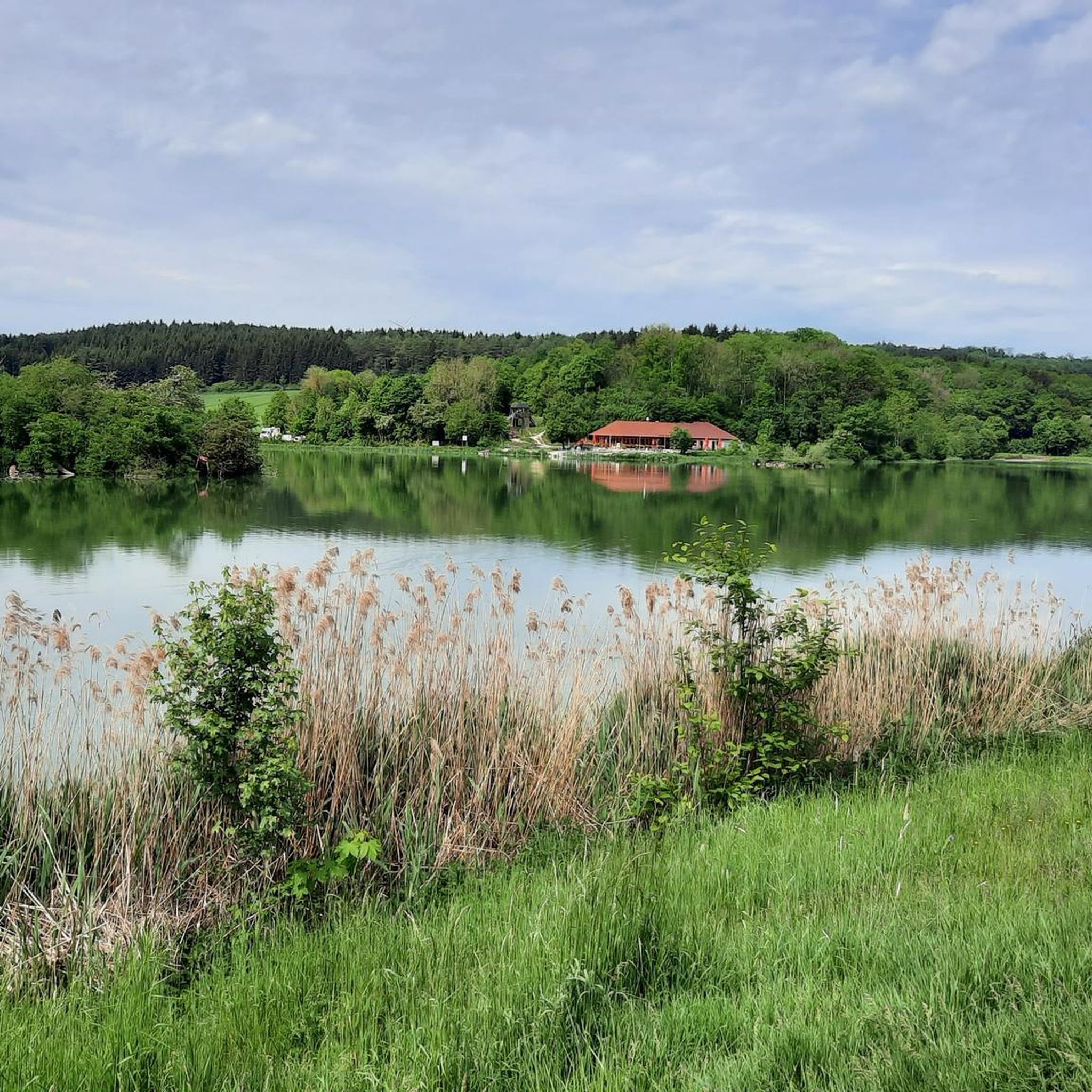
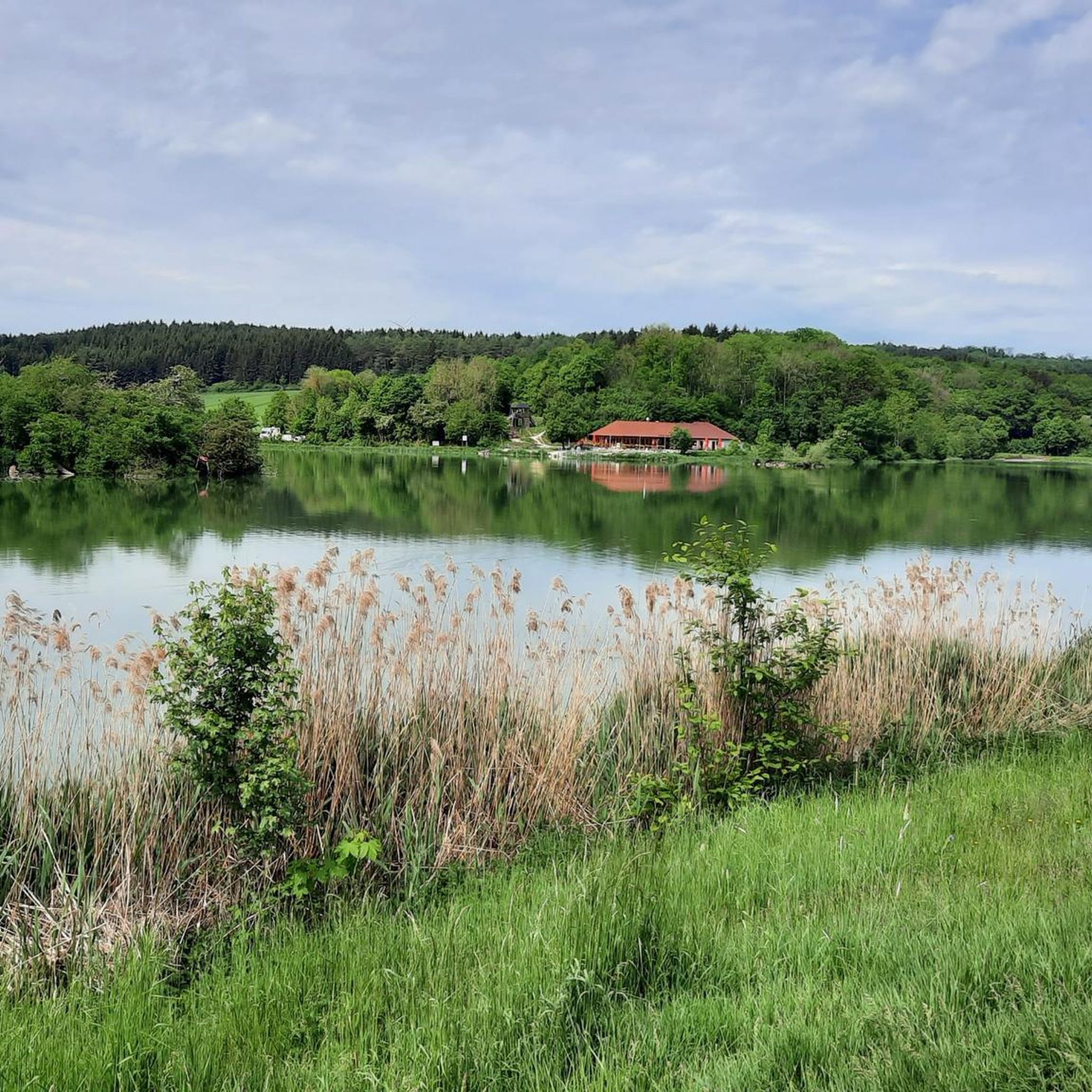
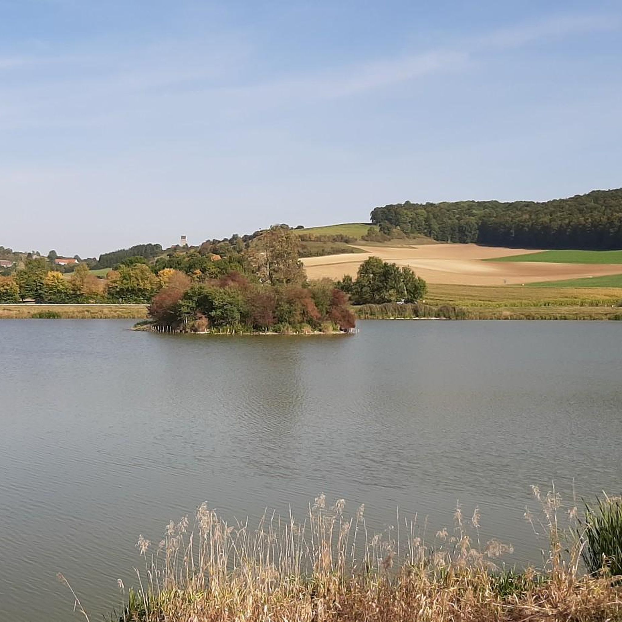
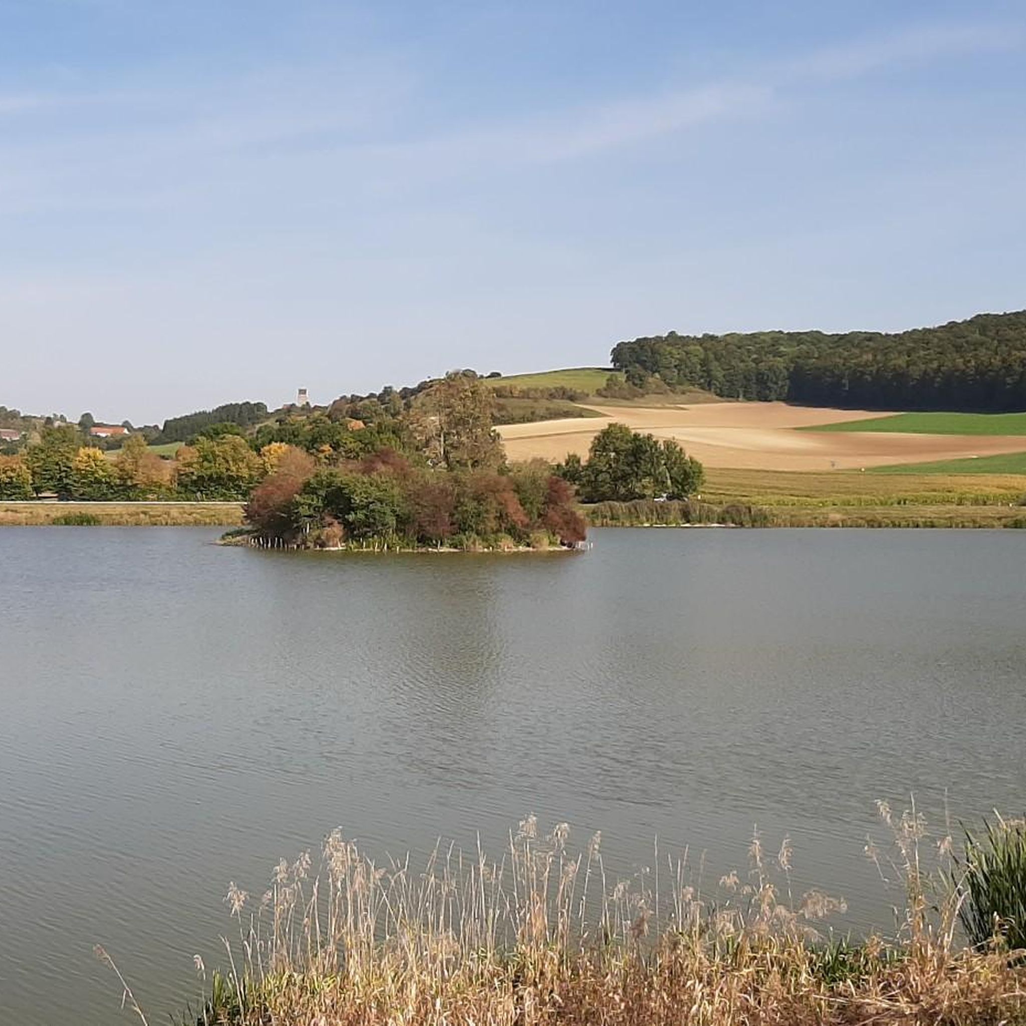
Hiking around Härtsfeldsee offers diverse terrain within the Härtsfeld plateau in Baden-Württemberg, Germany. The region is characterized by a Jurassic plateau featuring dry valleys and karst landscapes, including karst springs that feed the Egau river. The lake itself, an 11.5-hectare flood retention basin, is surrounded by accessible paths. Geologically, the area includes layers of White Jura Zeta and Epsilon, providing varied ground for exploration.
Best hiking trails around Härtsfeldsee
- The most popular hiking route is English Forest (Geopark Ries) –…
Last updated: June 26, 2026
4.7
(52)
190
hikers
Moderate hike. Good fitness required. Easily-accessible paths. Suitable for all skill levels.
4.7
(15)
57
hikers
11.6km
03:09
160m
160m
Moderate hike. Good fitness required. Easily-accessible paths. Suitable for all skill levels.

Sign up for free
4.6
(16)
75
hikers
Moderate hike. Good fitness required. Easily-accessible paths. Suitable for all skill levels.
4.7
(10)
64
hikers
2.33km
00:36
10m
10m
Easy hike. Great for any fitness level. Easily-accessible paths. Suitable for all skill levels.
4.9
(82)
253
hikers
Moderate hike. Good fitness required. Easily-accessible paths. Suitable for all skill levels.
Get access to more routes and recommendations from other explorers.
Sign up for free
Already have an account?
Our route recommendations are based on thousands of hikes, rides, and runs completed by other people on komoot.
Start today with a free account
Your next adventure awaits.
Login or Signup
Tips from the Community


Impressive monastery on the Härtsfeld
0
0

This is no longer just a kiosk, but a proper restaurant that deserves praise and recognition.
0
0

A lovely place to stop for a break along the cycle path from Härtsfeldsee to Neresheim. There are information boards here that provide information about the work of beekeepers. There's also a large "bee hotel" and a bee garden with all kinds of flowers and plants that the insects love to visit.
0
0

The English Forest is a must-see.
0
0

A lovely little hike, but dogs are prohibited from entering the entire castle grounds (including the outside). 😒 Unfortunately, the chapel above the castle is also closed.
0
0

I highly recommend everyone to visit the castle. You can also combine it with a circular hike.
0
0

The temporary terminus of the Schättere line is a great success. The association members are doing a tremendous job. A member of the association explained to me during a conversation that the railway will be extended to the former station in Dischingen. The station in Dischingen is also owned by the museum association.
0
0
Frequently Asked Questions
How many hiking trails are available around Härtsfeldsee?
There are over 360 hiking routes available around Härtsfeldsee, catering to various preferences. This includes approximately 175 easy trails, 169 moderate routes, and 19 more challenging options.
What kind of terrain can I expect when hiking in the Härtsfeldsee region?
The Härtsfeldsee region offers diverse terrain. You'll find accessible paths around the lake, forested sections, and the distinctive karst landscape of the Härtsfeld plateau, which includes dry valleys and karst springs. Geologically, the area features layers of White Jura Zeta and Epsilon.
Are there any easy, family-friendly hiking options around Härtsfeldsee?
Yes, the Härtsfeldsee area is very suitable for families. The circular path directly around the lake is approximately 4.7 kilometers, features even terrain, and is considered easy. It's perfect for a leisurely stroll with children. For a slightly longer easy option, consider the View of Katzenstein Castle – Kiosk at Lake Härtsfeld loop from Katzenstein, which is 7.1 km.
Are there circular hiking routes available in Härtsfeldsee?
Yes, circular routes are a prominent feature of hiking in Härtsfeldsee. The most well-known is the path directly around the lake. Other circular options include the English Forest (Geopark Ries) – Katzenstein Castle loop from Fliegenberg-Kahlhof or the Lake Härtsfeld – Juniper Hill, Zwing loop from Fliegenberg-Kahlhof, both offering moderate challenges.
What are some notable natural features or landmarks to look out for while hiking?
Beyond the lake itself, the Härtsfeld region is known for its unique karst landscape, featuring dry valleys and karst springs like the Judengumpen, which feed the Egau river. You might also spot the two islands in Härtsfeldsee, which serve as breeding grounds for local fauna. The broader region also offers views towards historic sites like Burg Katzenstein.
Is there parking available for hikers at Härtsfeldsee?
Yes, accessible parking facilities are available at Härtsfeldsee, making it convenient for hikers to start their tours.
What do other hikers say about the trails around Härtsfeldsee?
The trails around Härtsfeldsee are highly regarded by the komoot community, with an average rating of 4.6 stars from over 1,100 reviews. Hikers often praise the varied landscapes, from lakeside paths to forested sections and views of the surrounding plateau.
Are there any places to get refreshments or food near the hiking trails?
Yes, the Seehaus Kiosk am Härtsfeldsee is located directly along the circular path around the lake, offering a convenient spot for refreshments during or after your hike.
Can I combine hiking with other activities at Härtsfeldsee?
Absolutely. Härtsfeldsee is a popular local recreation area. Besides hiking, you can enjoy swimming, surfing, and boating on the lake. The surrounding natural landscape also provides opportunities for relaxation and exploration.
What is the longest moderate hike available in the Härtsfeldsee area?
One of the longer moderate hikes is the Katzenstein Castle – View of Katzenstein Castle loop from Fliegenberg-Kahlhof. This route spans approximately 17.1 kilometers and typically takes around 4 hours and 48 minutes to complete, offering extensive exploration of the area.
What are the typical elevations encountered on Härtsfeldsee hikes?
Hikes around Härtsfeldsee generally feature moderate elevation changes. For example, a route like the Lake Härtsfeld – Kiosk at Lake Härtsfeld loop from Fliegenberg-Kahlhof involves about 117 meters of ascent and descent. Longer routes, such as the Katzenstein Castle – View of Katzenstein Castle loop from Fliegenberg-Kahlhof, can have ascents and descents of over 340 meters.
Most popular routes around Härtsfeldsee
Most popular attractions around Härtsfeldsee

Get inspired with the komoot mobile app


Explore more
Browse the best Hikes in other regions.
