The best walks and hikes around Hunters Creek
4.4
(28)
749
hikers
54
hikes
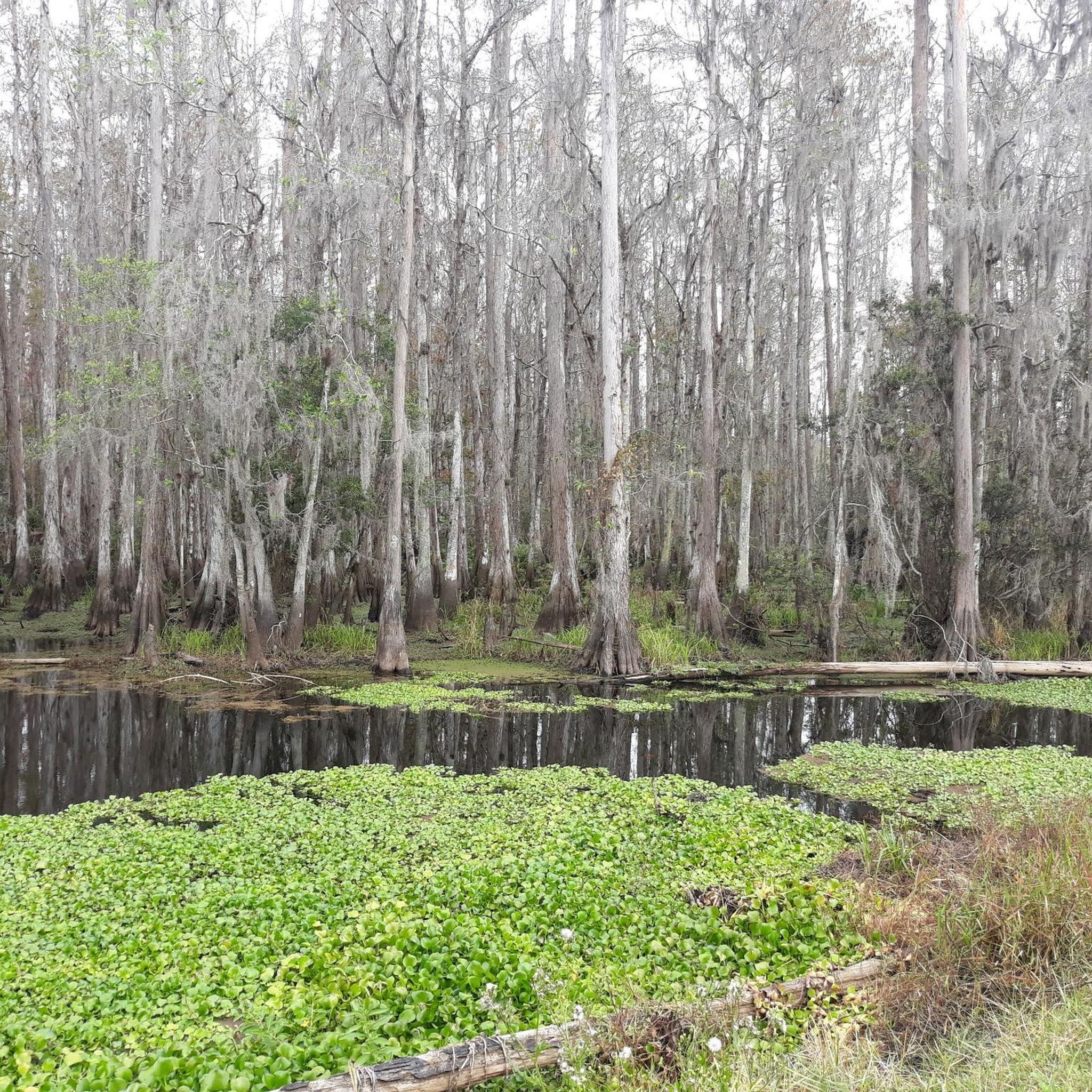
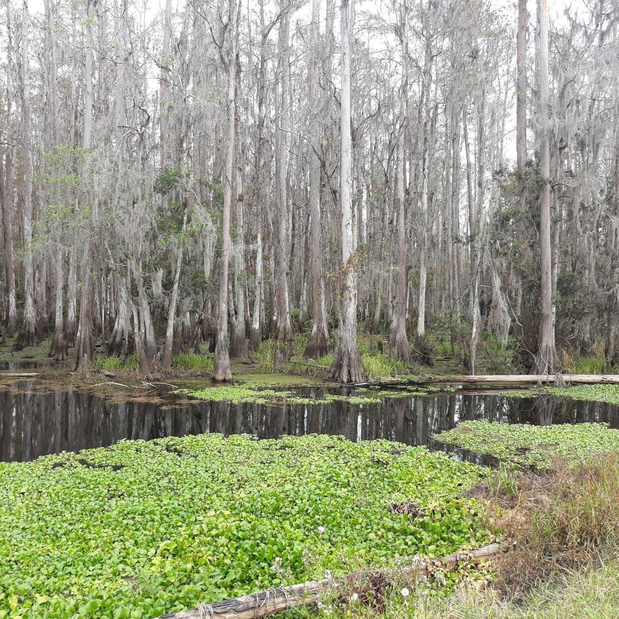
Hiking around Hunters Creek explores the northernmost headwaters of the Everglades ecosystem. The region features flat, accessible paths that wind through wetlands, pine and cypress forests, and along the banks of Shingle Creek. These trails offer a classic Central Florida hiking experience with minimal elevation change.
Best hiking trails around Hunters Creek
- The most popular hiking route is Pine Island East Loop Trail, a 3.9 miles (6.3 km) trail that takes around 1 hour 35 minutes to complete. This route winds through pine flatwoods, offering opportunities to spot diverse vegetation.
- Another top favourite among local hikers is Shingle Creek and Pioneer Village Trail, an easy 1.6 miles (2.6 km) path. This trail combines natural landscapes with historical elements near Kissimmee.
- Local hikers also love the Shingle Creek Trail: Pine Island East Loop, a 3.7 miles (5.9 km) trail leading through pine flatwoods, often completed in about 1 hour 29 minutes.
- Hiking around Hunters Creek is defined by wetland paths, pine and cypress forests, and trails along the meandering Shingle Creek. The network provides mostly easy and moderate options suitable for a range of fitness levels.
- The routes in Hunters Creek are highly rated by the komoot community with an average score of 4.5 stars from more than 20 reviews. More than 700 hikers have used komoot to explore Hunters Creek's varied terrain.
Last updated: October 10, 2026
4
hikers
6.31km
01:35
0m
10m
The Pine Island East Loop Trail offers a delightful escape into Central Florida's natural beauty, guiding you through serene woodlands and open fields with views of Shingle Creek. This easy 3.9-mile (6.3 km) hike, with only 15 feet (4 metres) of elevation gain, is a fantastic way to immerse yourself in diverse vegetation and spot local wildlife like deer, turkeys, and even alligators. The unpaved path provides a peaceful atmosphere, making it a popular route for a relaxed outing.
Planning your visit to the Pine Island East Loop Trail is straightforward, but a few tips will enhance your experience. The trail can be swampy after heavy rains, so check the weather and wear appropriate footwear. Since some sections are exposed to full sun, especially during the 1 hour and 35 minutes it takes to complete, bring plenty of water and sun protection. This trail is well-suited for hikers, runners, and mountain bikers looking for an accessible outdoor adventure.
Despite its proximity to developed areas, the Pine Island East Loop Trail feels like a true natural retreat, showcasing the rich ecosystem of the region. The trail is part of the larger Shingle Creek Trail system, known for its well-maintained paths and various loops. It is an excellent option for beginners or families, offering a chance to connect with nature and observe Florida's unique wildlife in a tranquil setting.
2.56km
00:39
0m
0m
Step onto the Shingle Creek and Pioneer Village Trail for a delightful blend of nature and history, perfect for an easy outing. You'll wander through shaded cypress swamps and oak hammocks, enjoying views of Shingle Creek and Lake Tohopekaliga from boardwalks and bridges. The path itself is a mix of paved and packed dirt, leading you through an urban oasis where you might spot alligators, turtles, and various bird species.
Accessing the trail is simple, with ample parking and amenities available at locations like Shingle Creek Regional Park. This multi-use trail is well-marked, making navigation easy for all. Given Florida's climate, planning your visit for the cooler parts of the day or during the milder seasons is advisable to ensure a comfortable 38-minute hike.
What truly sets this 1.6-mile (2.6 km) route with its minimal 8 feet (2 metres) of elevation gain apart is the immersive Pioneer Village. This outdoor museum features authentic, relocated buildings from early Osceola County, including an 1898 "Cracker house" and a 1900 general store. It offers a fascinating historical context to the natural beauty of Shingle Creek, which is also the northernmost waterway feeding the Everglades.

3
hikers
5.92km
01:29
0m
0m
The Shingle Creek Trail: Pine Island East Loop offers a delightful journey through Central Florida's natural beauty, immersing you in diverse vegetation and serene waterways. You'll hike on unpaved paths of packed dirt and grass, often crossing boardwalks and elevated berms that wind through pine flatwoods and past cypress swamps. It's a flat and easy route, perfect for a relaxing nature walk where you can truly soak in the Florida wilderness.
This 3.7-mile (5.9 km) hiking route is rated easy, with a minimal 5 feet (2 metres) of elevation gain, and typically takes about 1 hour and 28 minutes to complete. While the trailhead behind Hunter's Creek Middle School has restricted access during school hours, other entry points like the Marriott Trail entrance are available. It's a great option for families looking for an accessible outdoor adventure.
One of the biggest draws of this trail is the incredible opportunity for wildlife spotting; expect to see alligators, turtles, and a wide variety of birds, including roseate spoonbills. The area is also significant as the northernmost headwaters of the Everglades watershed, adding a unique ecological context to your hike. A picnic pavilion along the route provides a nice spot for a break.
4
hikers
2.12km
00:32
0m
0m
The Alligator Breeding Marsh Trail offers a truly unique immersion into Florida's wild wetlands, where you'll find yourself surrounded by cypress trees and lily pads on the water. This easy 1.3-mile (2.1 km) hike, with a negligible 1 foot (0 metres) of elevation gain, is less about strenuous effort and more about the thrill of close-up wildlife encounters, often putting you within a few feet of alligators and various bird species.
Planning your visit means preparing for potentially muddy sections and narrow paths with water on both sides, so wear old shoes or trail shoes. While the route only takes about 31 minutes to complete, staying vigilant is key, as alligators can be hidden in the brush. Consider visiting during the cooler parts of the day or during mating season for the most active wildlife.
What makes this trail truly notable is the unparalleled opportunity to observe alligators in their natural habitat, distinct from more commercial attractions. You'll likely see "alligator slides" where they enter the water and hear the sounds of the swamp, especially their roars during mating season, providing an authentic glimpse into Florida's wetland ecosystem.
8.29km
02:05
10m
10m
The Kissimmee Loop Trail offers a unique blend of urban exploration and natural beauty, making it one of the more popular routes for a relaxed outing in Osceola County. This moderate 5.1-mile (8.3 km) hike, with a gentle 29 feet (9 metres) of elevation gain, takes about 2 hours and 5 minutes to complete. You'll traverse paved surfaces, including asphalt paths and sidewalks, winding through tree-lined sections and past canals, with the impressive John Young Parkway Pedestrian Bridge serving as a visual highlight.
Planning your visit to the Kissimmee Loop Trail is straightforward, as its urban setting ensures easy accessibility for walkers, runners, and cyclists of all levels. While there are no specific permits or fees, it's wise to consider the Florida climate and plan your outing during cooler parts of the day, especially in summer. The trail's design emphasizes connectivity, linking various community points, so you can easily access it from different neighborhoods.
What truly sets the Kissimmee Loop Trail apart is its role as an urban connector, providing access from residential areas to Downtown Kissimmee, the Medical Arts District, and local amenities. It also offers a valuable connection to the Shingle Creek Regional Trail, allowing you to extend your adventure into more natural settings and potentially spot some local wildlife. This makes it a fantastic option for families or beginners looking for a varied and accessible outdoor experience.
Get access to more routes and recommendations from other explorers.
Already have an account?
Our route recommendations are based on thousands of hikes, rides, and runs completed by other people on komoot.
Start today with a free account
Your next adventure awaits.
Popular around Hunters Creek

Tips from the Community

Gatorland offers more than just alligators; you can also see some crocodiles in the area. You can tell the difference: crocodiles have lighter skin and a pointed snout, whereas alligators have a large, rounded nose. At this spot, you'll find Cuban and Saltwater Crocodiles.
0
0
This area is very popular for kayaking and offers guided nature tours along the creek. It provides stunning views of the water, making it a great spot to take a break and enjoy the surroundings.
0
0

Circle around the heart of the City of Kissimmee! Connecting residential neighborhoods with Downtown Kissimmee, the Kissimmee Medical Arts District, and the Shingle Creek Regional Trail. Explore canals, tree-lined pathways, forest covered areas, and the John Young Parkway Pedestrian Bridge.
0
0

Gatorland is technically a theme park and is known as "The Alligator Capital of the World". It includes 110 acres of boardwalks, viewing areas, and wildlife exhibits that anyone in the family can enjoy. There is a fee required to enter the property, but reservations aren't necessary.
1
0
In the heart of Shingle Creek Reserve lies the Shingle Creek Trail – a shared haven for cyclists and hikers. A family-friendly path embraced by nature's beauty, offering an optional connection to Pine Island East Loop Trail.
0
0
In the city's northern embrace lies the powerline corridor, a secret haven of nature's magnificence. Verdant wetland forests teeming with wildlife offer serenity and beauty, an undiscovered gem.
0
0

If you’re looking for a slice of nature in Orlando, head to the Shingle Creek Trail: Pine Island East Loop. This 3.4-mile loop trail takes you through a lush wetland forest that is home to many birds and wildlife. You’ll also enjoy views of the Shingle Creek. The trail is shared by hikers and bikers, so be courteous and watch out for others.
0
0
Don’t be fooled by the name - the powerline corridor is a hidden gem of natural beauty. Along the north edge, you’ll find a lush wetland forest that teems with wildlife and offers a tranquil escape from the city.
1
0
Frequently Asked Questions
Are dogs allowed on the trails in Hunters Creek?
Yes, dogs are generally welcome on the trails around Hunters Creek, especially in areas like Shingle Creek Regional Park. The wide, open paths are perfect for walking with your dog. Please keep them on a leash and be mindful of the local wildlife.
Are there any easy, family-friendly hikes in the area?
Absolutely. The region is known for its flat, accessible trails, making it ideal for families. Most of the 53 routes in the area are rated as easy. A great option is the Gatorland loop — Orlando, which is a short walk perfect for all ages and offers a unique glimpse of the local environment.
What are the wildlife viewing opportunities like?
Hunters Creek is a fantastic place for wildlife spotting as it's part of the Everglades headwaters. While hiking, you might see white-tailed deer, turkeys, and a wide variety of birds. Alligators are also present in the waterways, so always be aware of your surroundings, especially near the water's edge.
What are the trail conditions like in Hunters Creek?
The trails are typically flat and well-maintained, consisting of paved paths, boardwalks, and natural surfaces through wetlands and forests. Since the area is low-lying and contains wetlands, some sections can become wet or muddy, especially after heavy rain. It's always a good idea to wear waterproof footwear.
Is there an entrance fee for the parks or trails?
Most parks and trailheads in the Hunters Creek area, such as Shingle Creek Regional Park, are free to enter and use for hiking and biking. However, specific attractions nearby, like Gatorland, will have their own admission fees.
Are there any circular walks available?
Yes, there are several loop trails that allow you to start and end in the same place without retracing your steps. The Pine Island East Loop — Orlando, Florida is a popular choice that takes you through beautiful pine flatwoods.
Can I get to the trails using public transport?
While some trailheads are located in residential or accessible areas of Orlando and Kissimmee, public transport options may be limited. Driving is the most convenient way to reach most trail access points, and there is usually parking available at major trailheads like the one at Shingle Creek Regional Park.
Are there any waterfalls on the trails?
No, the landscape around Hunters Creek is characterized by flat terrain and wetlands. Due to the minimal elevation change, you will not find any waterfalls on the hiking trails in this region.
What is the best time of year to hike in Hunters Creek?
The best time to hike is from fall through spring (October to May) when the weather is cooler and less humid. Summer hikes are possible, but it's best to go early in the morning to avoid the intense afternoon heat, humidity, and potential thunderstorms. Always bring plenty of water, regardless of the season.
Are there longer trails for a more challenging hike?
While the area is mostly known for easy hikes, there are longer, moderately-rated options. The Kissimmee Trail — Shingle Creek Regional Park offers a more substantial walk, connecting residential areas with the regional park through a mix of tree-lined paths and forested sections.
What do other hikers think of the trails around Hunters Creek?
The trails are highly regarded by the komoot community, with an average rating of 4.5 stars. Hikers often praise the beautiful Floridian scenery, the well-maintained paths, and the abundant opportunities for bird and wildlife watching in the Everglades headwaters.
Are there other recreational activities besides hiking?
Yes, the multi-use trails in the area are also very popular for biking. Additionally, the waterways like Shingle Creek are great for kayaking and canoeing, offering a different perspective of the local ecosystem. Some larger parks, like Split Oak Forest, also offer trails for horseback riding.
Most popular attractions around Hunters Creek

Get inspired with the komoot mobile app


Explore more
Browse the best Hikes in other regions.
