The best road cycling routes around Altamonte Springs
4.8
(57)
1,003
riders
49
rides
Road cycling routes around Altamonte Springs are characterized by a network of extensive paved trails and green spaces. The terrain is generally flat, making it suitable for various fitness levels. The region features numerous lakes and waterways, contributing to scenic views along many routes.
Best road cycling routes around Altamonte Springs
- The most popular road cycling route is Lakes loop, a 26.8 miles (43.2 km) trail that takes 1 hour 50 minutes to complete. This easy route offers views of the area's numerous small lakes.
- Another top favourite among local road cyclists is Cross Seminole Trail loop, a moderate 65.9 miles (106.0 km) path. This route provides a longer ride through varied landscapes, including sections of the Seminole Wekiva Trail.
- Local road cyclists also love the Lake Monroe loop from Lockhart via Seminole Wekiva Trail, a 65.2 miles (105.0 km) trail leading through natural areas and along Lake Monroe, often completed in about 4 hours 23 minutes.
- Road cycling around Altamonte Springs is defined by extensive paved trails, lakes and waterways, and abundant green spaces. The network offers options for different ability levels.
- The routes in Altamonte Springs are highly rated by the komoot community with an average score of 4.6 stars from more than 50 reviews. More than 1,300 road cyclists have used komoot to explore Altamonte Springs's varied terrain.
Last updated: October 16, 2026
10
riders
43.1km
01:50
70m
70m
The Lakes loop offers a delightful and accessible road cycling experience through the Orlando area, perfect for a leisurely ride. You'll glide along mostly well-paved paths, enjoying views of Lake Baldwin Park and the wildlife-rich Lake Formosa. The route incorporates parts of the Orlando Urban Trail, including a scenic boardwalk section around Lake Formosa where you might need to dismount and walk your bike. It's a smooth, easy ride, making it a great option for all skill levels.
Planning your visit to this easy 26.8-mile (43.1 km) road cycling route is straightforward, as it typically takes about 1 hour and 50 minutes to complete with only 221 feet (67 metres) of elevation gain. Located in Eatonville, Florida, the trail is generally open year-round. It's a good idea to go during daylight hours, and while specific parking isn't detailed, you'll likely find options near the start point in Eatonville.
What sets this Lakes loop road cycling route apart is its gentle nature and urban-natural blend. It's a fantastic way to explore the local lakes and green spaces without encountering significant climbs or technical terrain. The presence of Lake Formosa, with its birds and wildlife, adds a touch of nature to this otherwise urban-adjacent ride, making it a pleasant escape for a quick workout or a relaxed tour.
2
riders
106km
04:16
170m
170m
The Cross Seminole Trail loop offers a fantastic opportunity for road cycling enthusiasts to explore a significant portion of Seminole County's multi-use trails. This moderate route spans 65.9 miles (106.0 km) and features a modest 558 feet (170 metres) of elevation gain, making it more about sustained effort than steep climbs. You'll pass by notable features like the Gee Creek Bridge and enjoy scenic views, particularly around the Cross Seminole Trail – Scenic Waterway View, providing a pleasant journey through Central Florida's landscape.
Planning your ride on this extensive loop is straightforward, with various parking access points along the trail. Given its length and the Florida climate, it's wise to start early, especially during warmer months, and carry ample hydration. The best cycling season for this route is typically during the cooler, drier months of fall, winter, and spring, allowing for a more comfortable 4 hours and 16 minutes on the saddle.
This loop is a prime example of Seminole County bicycle trails, connecting different communities and offering a consistent surface for road cyclists. Its relatively flat terrain and moderate difficulty level make it an excellent choice for those looking to build endurance or enjoy a long, uninterrupted ride away from vehicle traffic. It's a popular route for good reason, providing a comprehensive tour of the area's paved trail network.

2
riders
105km
04:23
210m
210m
This Lake Monroe loop from Lockhart via Seminole Wekiva Trail offers a fantastic road cycling route, blending the smooth, paved surfaces of the Seminole Wekiva Trail with the expansive, flat vistas around Lake Monroe. You'll experience a pleasant mix of suburban greenways and natural Florida wetlands, providing a varied backdrop for your ride. The route is a moderate 65.2-mile (105.0 km) journey, with a gentle 701 feet (214 metres) of elevation gain, making it an excellent choice for a longer, steady pace ride without demanding climbs.
Planning your visit for this Lake Monroe loop Lockhart Seminole Wekiva Trail road cycling route means preparing for a ride that typically takes around 4 hours and 23 minutes. While the Seminole Wekiva Trail sections are well-defined, connecting from Lockhart and around Lake Monroe will involve navigating local roads. Given the length, ensure you have enough water and consider an early start to make the most of cooler temperatures, especially if you're looking for cycling routes near Lockhart Florida.
This route stands out among cycling routes Lake Monroe Florida for its ability to combine two popular cycling components into one substantial journey. The Seminole Wekiva Trail is known for its multi-use popularity and smooth asphalt, while the Lake Monroe sections offer scenic views of the water and surrounding natural areas, including highlights like the Lake Monroe Park Boardwalk. It's a great way to experience a significant portion of central Florida's cycling landscape.
4.3
(3)
88
riders
Moderate road ride. Good fitness required. Mostly well-paved surfaces and easy to ride.
5.0
(2)
68
riders
Moderate road ride. Good fitness required. Mostly well-paved surfaces and easy to ride.
Get access to more routes and recommendations from other explorers.
Already have an account?
Our route recommendations are based on thousands of hikes, rides, and runs completed by other people on komoot.
Start today with a free account
Your next adventure awaits.
Popular around Altamonte Springs

Tips from the Community

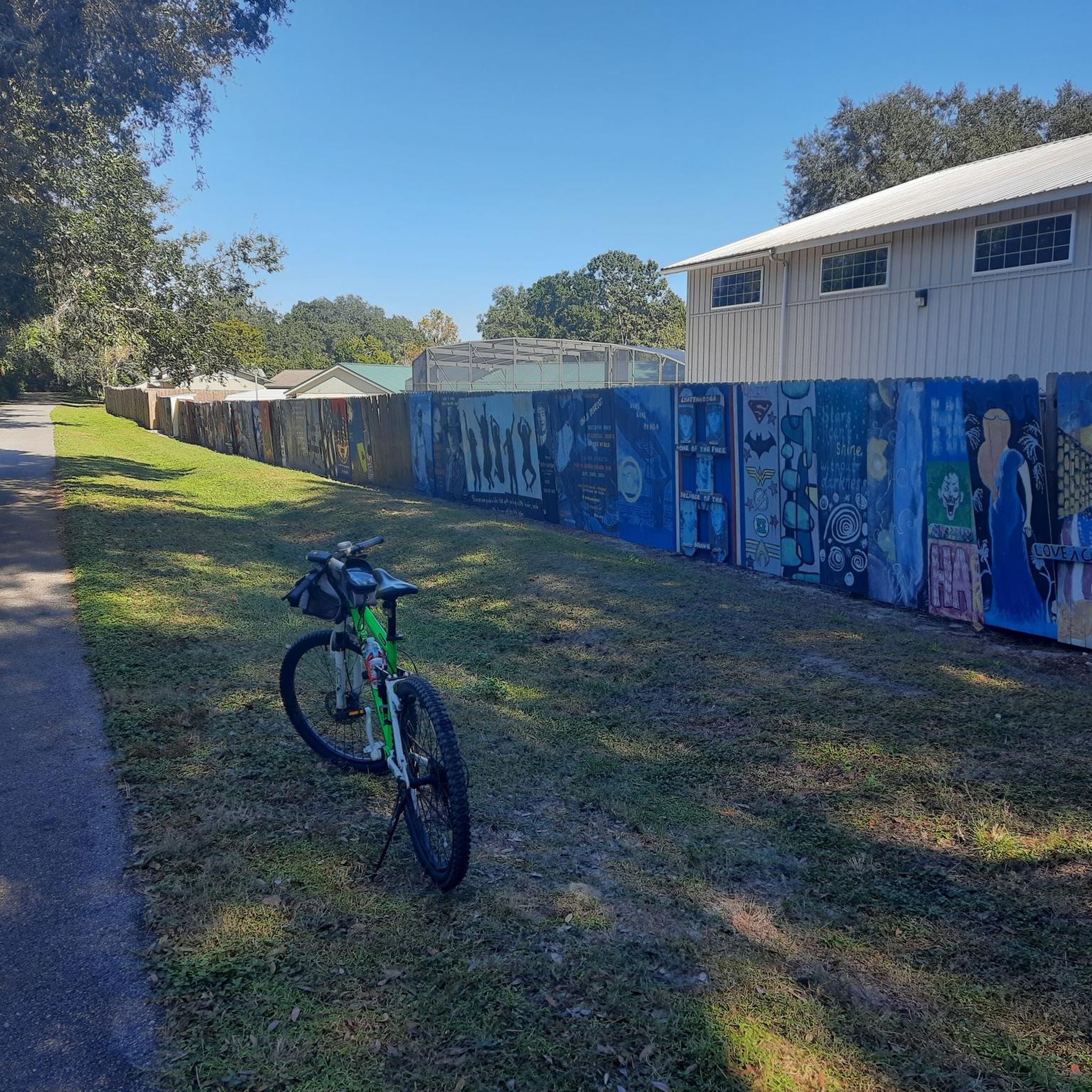
Update from March 2025: Many fences have now been replaced with new, unpainted ones. They had weathered or fallen victim to storms.
1
0

The Seminole Bridge takes cyclists and pedestrians safely over the Florida National Scenic Trail, also known in this part as the Seminole Trail. Pass over the busy highway 4 and enjoy Oval Park on the west end of the bridge.
0
0

Lake Monroe Park, one of Volusia County's oldest and most popular parks, offers a variety of outdoor activities such as camping, canoeing, fishing, and picnicking. Open daily from sunrise to sunset, the park provides free admission, with a $2 fee for boat launches. Amenities include a boardwalk, boat ramps, fishing docks, nature trails, a playground, and picnic pavilions. Renovated in 2004, the park also has upgraded restrooms and a trailhead for the Lake Monroe-Gemini Springs-DeBary Hall Trail. Camping fees are $25 per night for tents and $40 for RVs.
2
0

The Long Pond Road Trailhead for the Seminole Wekiva Trail is also known as the Jones Trailhead and features parking, a water fountain, and exercise equipment. This trailhead give access to the Seminole Wekiva Trail, a nearly 14-mile paved recreational path that is part of the Florida National Scenic Trail and the Florida Coast-to-Coast Trail.
0
0
Some of the works of art are a bit weathered, but that doesn't detract from the experience. Simply great 👏
2
0

The Seminole Wekiva Trail is a 14-mile multiuse trail. It is a fully paved trail and is part of the Florida National Scenic Trail. The trail is flat, so it is not a difficult ride. This section takes you into Lake Mary. It takes you next to some nice small lakes and ponds.
1
0

The Seminole Wekiva Trail is a 14-mile paved path that passes through Seminole County in Florida. The trail is great for moving through the city without having to bike on busy streets. It's a really flat trail, so everyone in the family can handle some miles of cycling.
0
0
This tunnel along the Seminole Wekiva Trail passes under the highway. There are a couple tight turns entering and exiting the tunnel, so make sure to control your speed and be aware of other trail users. Don't be surprised if your GPS jumps a bit, too!
0
0
Frequently Asked Questions
How many road cycling routes are available in Altamonte Springs?
Altamonte Springs offers a wide selection of road cycling routes, with over 50 options available. These routes cater to various skill levels, including easy, moderate, and a few more challenging rides.
What kind of terrain can I expect on road cycling routes in Altamonte Springs?
The road cycling routes in Altamonte Springs are generally flat, making them suitable for a wide range of fitness levels. You'll primarily encounter extensive paved trails, often winding through green spaces, alongside lakes, and through natural areas.
Are there any easy road cycling routes suitable for beginners or families in Altamonte Springs?
Yes, Altamonte Springs has several easy road cycling routes perfect for beginners or families. One popular option is the Lakes loop, an approximately 43 km (27 miles) trail that offers scenic views of the area's numerous small lakes and is generally completed in under two hours.
Which road cycling routes offer longer distances for more experienced riders?
For those seeking longer rides, Altamonte Springs provides several moderate routes. The Cross Seminole Trail loop is a popular choice, covering about 106 km (66 miles) through varied landscapes. Another excellent option is the Lake Monroe loop from Lockhart via Seminole Wekiva Trail, which is approximately 105 km (65 miles) and takes you through natural areas and along Lake Monroe.
What are some scenic attractions or landmarks I might see along the road cycling routes?
Many routes offer scenic views of the region's abundant lakes and green spaces. You might encounter unique public art installations, such as the Paint the Trail Artwork along the Seminole Wekiva Trail. Other natural highlights include Wekiwa Springs and Sand Lake within Wekiwa Springs State Park, which are accessible from some routes or nearby.
Are there any circular road cycling routes in Altamonte Springs?
Yes, many of the road cycling routes in Altamonte Springs are designed as loops, providing a convenient circular experience. Examples include the Lakes loop and the Cross Seminole Trail loop, allowing you to start and end at the same point without retracing your path.
What do other road cyclists say about the routes in Altamonte Springs?
The road cycling routes in Altamonte Springs are highly regarded by the komoot community, holding an average rating of 4.6 stars from over 50 reviews. Cyclists often praise the extensive paved trails, the flat and smooth riding experience, and the scenic views of lakes and green spaces.
Can I find routes that incorporate the Seminole Wekiva Trail?
Absolutely. The Seminole Wekiva Trail is a central feature of road cycling in the area. Routes like the Lake Monroe loop from Lockhart via Seminole Wekiva Trail and the Paint the Trail Artwork – Seminole Bridge loop from Altamonte Springs integrate sections of this popular paved path, offering a smooth and enjoyable ride.
Are there any road cycling routes that pass by lakes or waterways?
Given Altamonte Springs' name and natural features, many routes offer views of lakes and waterways. The Lakes loop is specifically designed to showcase the area's numerous small lakes. Additionally, the Lake Monroe loop takes you directly along the shores of Lake Monroe.
What is the best time of year for road cycling in Altamonte Springs?
Altamonte Springs offers pleasant road cycling conditions for much of the year. The mild winters are ideal, with comfortable temperatures. Summers can be hot and humid, so early morning or late afternoon rides are recommended during those months to avoid the peak heat.
Are there any road cycling routes that connect to other major trails?
Yes, the Seminole Wekiva Trail, a key component of many Altamonte Springs routes, is part of the larger Florida National Scenic Trail and the Florida Coast-to-Coast Trail. This allows for connections to other areas and opportunities for extended rides beyond the immediate Altamonte Springs vicinity.
Are there any routes that offer a mix of natural scenery and urban exploration?
Routes like the Howell Creek Fishing Pavilion – UCF Reflecting Pond loop from Altamonte Springs can offer a blend of natural areas and glimpses of more developed sections, providing a varied cycling experience. The extensive trail network often weaves through both green spaces and parts of the city.
Most popular routes around Altamonte Springs
Most popular attractions around Altamonte Springs

Get inspired with the komoot mobile app


Explore more
Browse the best Road cycling routes in other regions.
