The best cycling routes around Columbine Valley
4.4
(140)
2,500
riders
134
rides
Touring cycling around Columbine Valley, Colorado, offers diverse landscapes, extensive trail networks, and notable natural features. The region is characterized by a mix of urban connectivity and access to natural preserves and river corridors. Cyclists can find routes along the South Platte River, around Chatfield Reservoir, and through open spaces with views of the Rocky Mountain foothills. The area's interconnected trail system provides varied cycling experiences.
Best touring cycling routes around Columbine Valley
- The most popular touring cycling route is…
Last updated: June 28, 2026
2.0
(2)
24
riders
23.7km
01:49
80m
80m
This easy 14.7-mile touring bicycle loop along the High Line Canal and Lee Gulch trails offers varied terrain and scenic views near Denver.
4.0
(1)
22
riders
54.0km
04:15
220m
220m
Cycle the moderate 33.5-mile Chatfield State Park and High Line Canal Trail Loop, enjoying reservoir views and diverse terrain near Denver.

Sign up for free
4.5
(22)
142
riders
Easy bike ride. Great for any fitness level. Mostly paved surfaces. Suitable for all skill levels.
4.6
(8)
116
riders
57.9km
04:41
350m
350m
Moderate bike ride. Good fitness required. Mostly paved surfaces. Suitable for all skill levels.
48
riders
62.7km
04:15
1,030m
1,030m
Hard bike ride. Very good fitness required. Mostly paved surfaces. Suitable for all skill levels.
Get access to more routes and recommendations from other explorers.
Sign up for free
Already have an account?
Our route recommendations are based on thousands of hikes, rides, and runs completed by other people on komoot.
Start today with a free account
Your next adventure awaits.
Login or Signup

Tips from the Community

The "Waterton Canyon Recreation Area" trailhead sign here marks the Colorado Trail's Northern Terminus. It's a photo opportunity for thru-hikers continuing all the way south to Durango, a journey that stretches almost 500 miles.
0
0

This is the trail head for segment 1 of the Colorado Trail. There is a vault toilet and parking at the trail head.
0
0

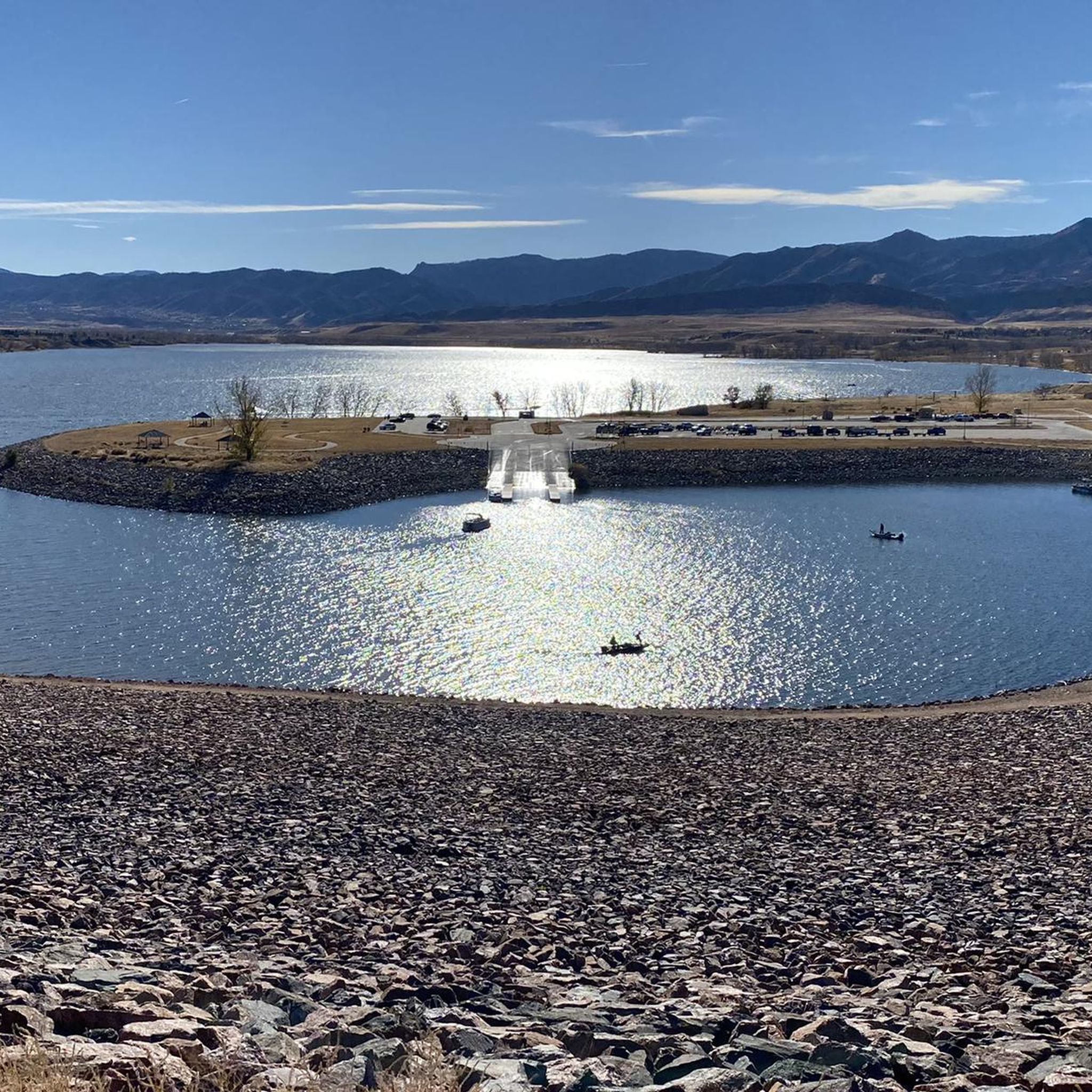
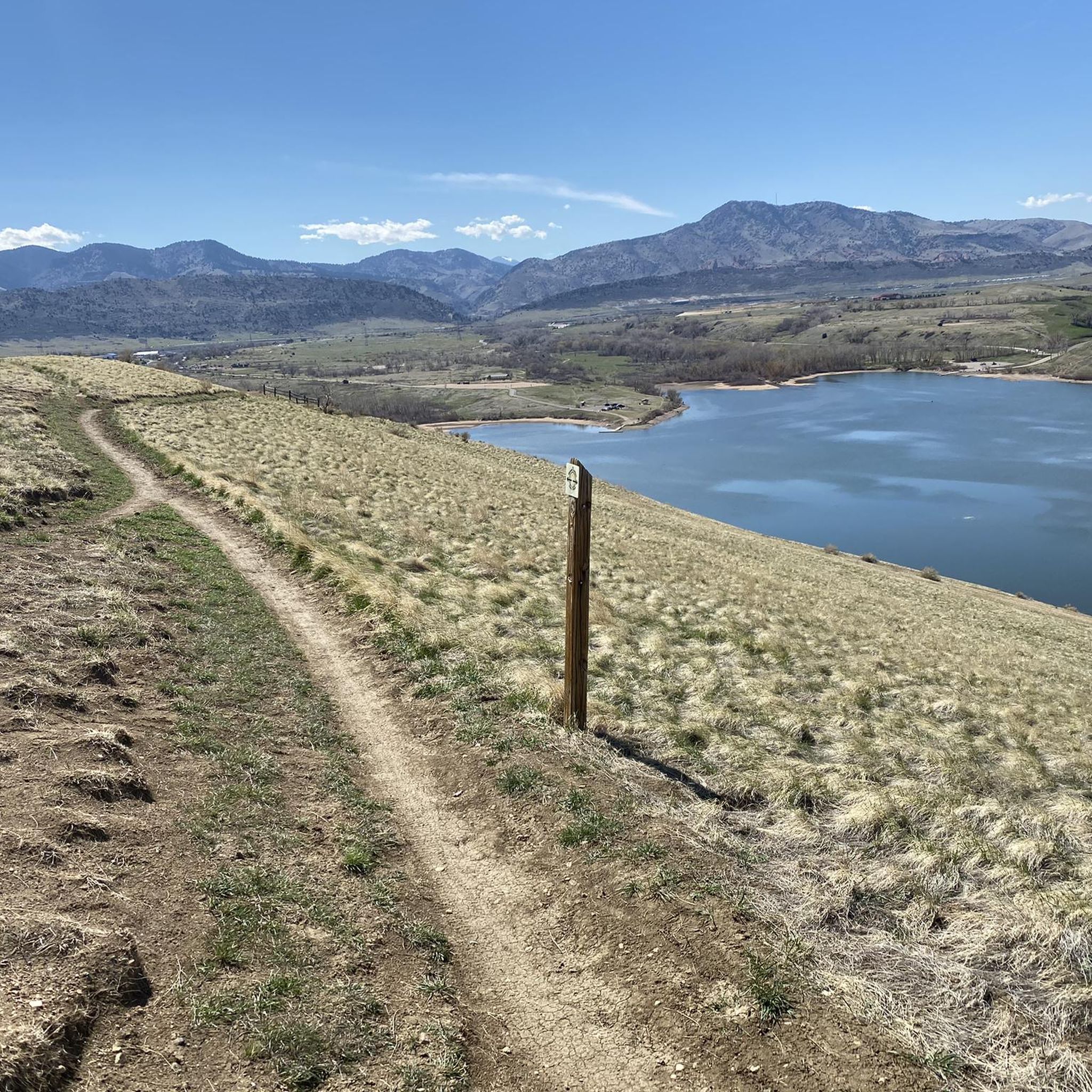
View from the gravel section of the Dam Trail. Nice views of the foothills and the suburbs from the Dam Trail.
0
0

Great stop on the Platte River Trail, good coffer, place to sit and relx
1
0

The South Platte River is one of the two main tributaries of the Platte River. The river starts in South Park and ends when it joins the North Platte River south of Ogallala, Nebraska.
0
0
Chatfield State Park is a state park that centers around the 1,423-acre South Platte River-fed Chatfield Reservoir. It offers biking and hiking trails, boating, fishing, and picnicking.
0
0
The South Platte River, originating in the mountains of central Colorado at the Continental Divide, flows a total distance of about 439 miles. The river is a hot spot for outdoor activities like fishing, kayaking, and wildlife watching. It flows through urban areas and the backcountry.
0
0
The South Valley Park South Trailhead is one end of the Coyote Song Trail. This area has maps, parking, and restrooms. The trailhead is a quick turnoff from W. Deer Creek Canyon Road and is very accessible.
0
0
Frequently Asked Questions
How many touring cycling routes are available in Columbine Valley?
Columbine Valley offers a wide selection of touring cycling routes, with over 120 options available. These routes cater to various preferences, from easy scenic rides to more challenging explorations.
What kind of terrain can I expect on touring cycling routes in Columbine Valley?
You'll find a diverse range of terrain. Routes often follow river corridors like the South Platte River, offer expansive views around Chatfield Reservoir, and traverse open spaces with glimpses of the Rocky Mountain foothills. The network includes both paved paths and soft-surface trails, such as those found in the Marjorie Perry Nature Preserve or the crushed concrete paths of the Columbine Open Space.
Are there touring cycling routes suitable for families in Columbine Valley?
Yes, Columbine Valley has several family-friendly options. Easy, paved paths are common, and the Columbine Open Space and Trail offers two wide loop trails, approximately 1.5 miles each, made of crushed concrete and small crusher fines, ideal for a relaxed family ride. An example of an easy route is the High Line Canal and Lee Gulch Trail Loop.
What are some notable natural features or landmarks I can see along the routes?
Many routes offer scenic views and pass by significant natural features. You can cycle along the South Platte River, enjoy the expansive Chatfield Reservoir, or explore the Marjorie Perry Nature Preserve. Other highlights include the Chatfield Dam Trail (Paved Section), offering mountain views, and the View of Hogback Hill Park.
Are there any good loop routes for touring cyclists in the area?
Absolutely. Many routes are designed as loops, allowing you to start and end at the same point. Popular options include the Chatfield State Park and High Line Canal Trail Loop, which is a moderate 33.5-mile ride, and the easier South Platte Reservoir – View from Chatfield Dam loop from Littleton - Mineral.
What is the best season for touring cycling in Columbine Valley?
While specific seasonal considerations can vary, the region generally offers pleasant cycling conditions through much of the year. Spring and fall often provide comfortable temperatures and beautiful scenery. Summer can be warm, so early morning or late afternoon rides are often preferred. Winter cycling is possible, but some trails may be affected by snow or ice.
Are there options for advanced touring cyclists looking for a challenge?
Yes, Columbine Valley offers routes for more experienced cyclists. For instance, the Mary Carter Greenway Trail – View from Chatfield Dam loop from Littleton - Mineral is a challenging 62.7-mile route with significant elevation changes, providing a demanding ride for advanced touring cyclists.
What do other touring cyclists enjoy most about cycling in Columbine Valley?
The area is highly rated by the komoot community, with an average score of 4.5 stars from over 100 reviews. Cyclists often praise the diverse landscapes, the extensive and interconnected trail networks, and the beautiful views of the Rocky Mountain foothills and river corridors.
Can I find less crowded touring cycling routes in Columbine Valley?
While popular trails can see significant use, especially on weekends, exploring routes that venture slightly further from central hubs or opting for rides during off-peak hours (early mornings, weekdays) can lead to a more serene experience. The Marjorie Perry Nature Preserve, for example, offers soft-surface trails through grasslands and wetlands, providing a quieter natural setting.
Are there any cafes or places to stop for refreshments along the touring cycling routes?
Columbine Valley is well-integrated into a larger regional system, and many trails connect to or pass near urban areas and parks. While specific cafes directly on every trail may vary, you'll find opportunities for refreshments in nearby towns and communities, especially along major routes like the High Line Canal Trail or the Mary Carter Greenway Trail, which are popular commuter paths.
What are the parking options for accessing touring cycling routes in Columbine Valley?
Parking is generally available at various access points for the extensive trail network. For example, Chatfield State Park offers parking for accessing trails around the reservoir. Many regional trails, such as the South Platte River Trail and the C-470 Bikeway, have designated parking areas at trailheads or nearby parks. It's advisable to check specific trailhead information for the route you plan to ride.
Are there any touring cycling routes that offer expansive views of the Rocky Mountains?
Yes, many routes in and around Columbine Valley provide excellent views of the Rocky Mountain foothills. Trails like the 6th Avenue Trail, and sections of routes around Chatfield Reservoir, offer dramatic backdrops of the mountains, enhancing the cycling experience.
Most popular attractions around Columbine Valley

Get inspired with the komoot mobile app


Explore more
Browse the best Cycling routes in other regions.
