The best road cycling routes around Golden
4.6
(70)
4,283
riders
66
rides
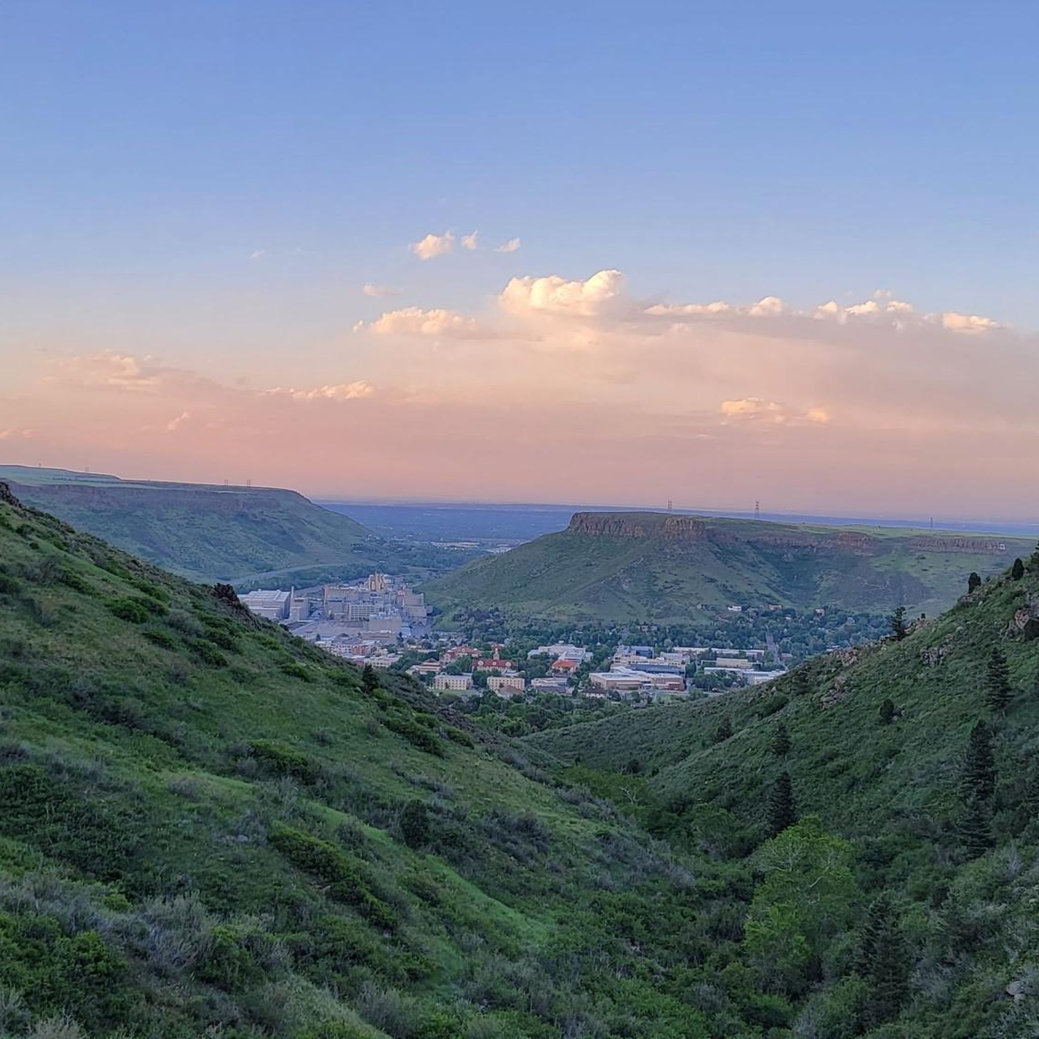
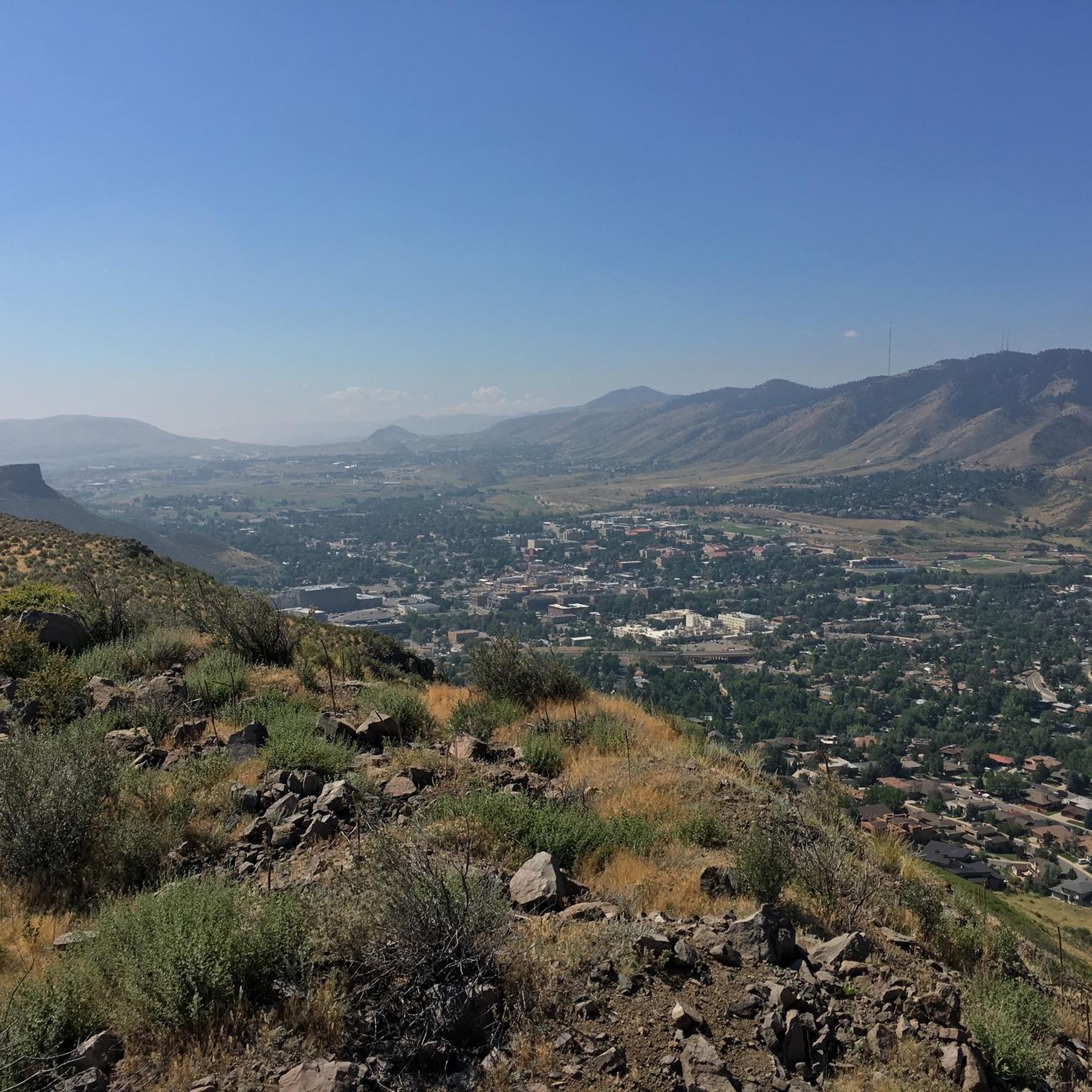
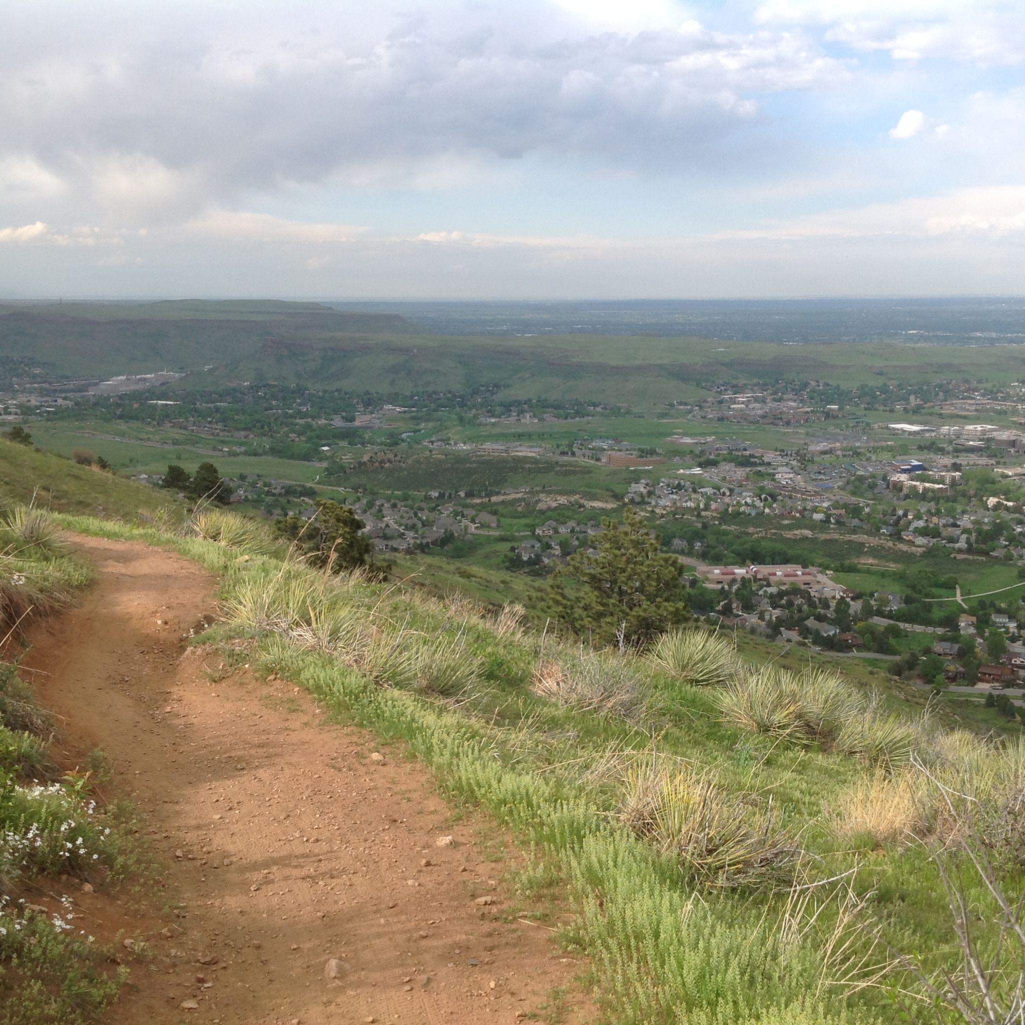
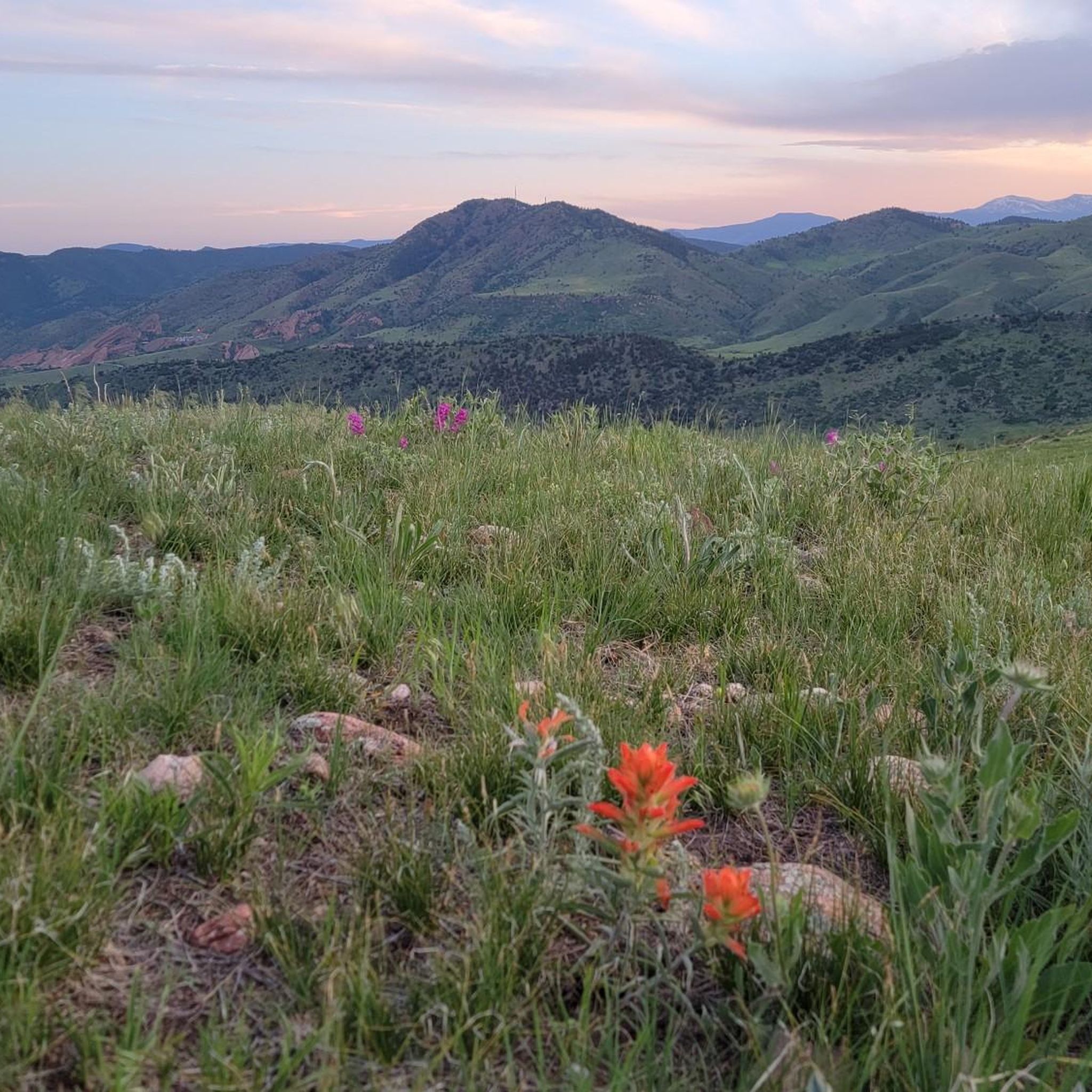
Road cycling routes around Golden, Colorado, are situated at the foothills of the Rocky Mountains, offering a diverse landscape for cyclists. The region features challenging mountain ascents, scenic canyon roads through dense forests, and gentler paved paths along Clear Creek. This varied terrain provides opportunities for different skill levels, from demanding climbs to more relaxed rides through natural areas.
Best road cycling routes in Golden
- The most popular road cycling route is Colorado Railroad Museum to Lookout Mountain Nature Preserve, a 20.9 miles (33.7 km) moderate trail that takes 1 hour 57 minutes to complete. This route features a significant climb up Lookout Mountain, offering panoramic views.
- Another top favourite among local road cyclists is Mount Vernon via Lookout Mountain, a moderate 19.5 miles (31.4 km) path. This route also includes the challenging ascent of Lookout Mountain, known for its winding roads and rewarding vistas.
- Local road cyclists also love the Mile High Stadium and Cherry Creek Trail, a 29.4 miles (47.3 km) trail leading through urban areas and along the Cherry Creek, often completed in about 2 hours 6 minutes.
- Road cycling around Golden is defined by mountain climbs, scenic canyons, and riverside paths. The network offers options for different ability levels, from challenging ascents to easier paved trails.
- The routes in Golden are highly rated by the komoot community with an average score of 4.4 stars from more than 50 reviews. More than 4000 road cyclists have used komoot to explore Golden's varied terrain.
Last updated: October 11, 2026
5.0
(6)
417
riders
33.7km
01:58
680m
680m
The road cycling route from the Colorado Railroad Museum to Lookout Mountain Nature Preserve offers a challenging yet incredibly rewarding experience. You'll navigate a diverse landscape, starting near the museum and gradually ascending towards the iconic Lookout Mountain. The climb itself is a highlight, featuring a consistent and demanding grade, with particularly steep sections near "The Pillars," and rewarding you with expansive views of North Table, South Table, Mount Galbraith, and the cityscapes of Golden and Denver as you gain elevation.
Planning your ride means preparing for a moderate 20.9-mile (33.7 km) journey with a substantial 2216 feet (676 metres) of elevation gain, typically completed in about 1 hour and 57 minutes. While mostly on well-paved surfaces, some segments might be unpaved and more challenging, so ensure your racebike is ready. Parking for road cycling near the Colorado Railroad Museum is available, but consider starting early, especially on busy days, and always check for Lookout Mountain road cycling seasonal considerations, as conditions can vary.
This route is more than just a ride; it's an iconic cycling destination and a "rite of passage" for many Colorado cyclists, known for its inclusion in the Lariat Loop National Scenic Byway. Lookout Mountain has even featured in professional cycling races, underscoring its challenging nature and appeal to serious riders. The unparalleled vistas from the summit, offering clear views of the Rocky Mountains and the Denver skyline, make this a premier outdoor activity.
4.0
(2)
236
riders
31.4km
01:49
710m
710m
The Mount Vernon via Lookout Mountain route offers a rewarding road cycling experience, transitioning from open plains to pleasant wooded areas as you climb. You'll gain 2319 feet (707 metres) over 19.5 miles (31.4 km), with the ascent up Lookout Mountain averaging a 5.4% grade. The reward for your effort is expansive views of downtown Denver and North Table Mountain, culminating in panoramic vistas from the Buffalo Bill Memorial viewing platform.
This moderate ride typically takes around 1 hour and 49 minutes to complete. The route is well-maintained and often rideable year-round, even after snow, making it a reliable option for cyclists. Starting points in Golden, Colorado, are very bike-friendly, and while the route is primarily paved, some "Mount Vernon" sections offer quieter dirt roads for those seeking a different surface.
Lookout Mountain is an iconic climb for local cyclists, known for its challenging yet accessible nature and its history in major bicycle races. The presence of the Buffalo Bill Museum and Grave near the summit adds a unique historical landmark to your ride. This route is a classic for a reason, offering a significant workout with high scenic payoff.

3.3
(3)
159
riders
47.3km
02:07
400m
400m
This road cycling route offers a fantastic blend of Denver's urban energy and natural beauty, making it a great option for a moderate ride. You'll experience diverse scenery, from the high plains grasslands and distant Rocky Mountain views along the South Platte River Trail near Mile High Stadium, to the serene creekside paths lined with cottonwoods and willows on the Cherry Creek Trail. The predominantly paved surfaces make for smooth riding, allowing you to enjoy the transition from cityscapes to natural prairie environments over its 29.4 miles (47.3 km).
Planning your ride is straightforward, as both the Cherry Creek Trail and the South Platte River Trail are easily accessible and serve as vital urban cycling arteries. Confluence Park in downtown Denver is a popular starting point, offering convenient access to both trails. These multi-use paths are designed for accessibility, providing a safe and car-free way to explore the city and its surrounding natural areas. The route involves 1322 feet (403 metres) of elevation gain and typically takes around 2 hours and 6 minutes to complete.
The Mile High Stadium and Cherry Creek Trail is notable for its extensive length and its ability to connect urban Denver with significant natural beauty and cultural landmarks like Empower Field at Mile High Stadium. It provides a dynamic backdrop for a cycling adventure, allowing you to roll past iconic city sights while also immersing yourself in natural prairie and riverside environments. This moderate route is perfect for those looking for a diverse cycling experience that showcases the best of Denver.
5.0
(2)
74
riders
61.8km
03:19
1,080m
1,080m
Prepare for a challenging road cycling adventure on the Evergreen to Genesee loop, starting from Golden. This difficult route covers 38.4 miles (61.8 km) and demands a significant 3532 feet (1077 metres) of elevation gain, typically taking around 3 hours and 19 minutes to complete. As you climb, you'll be rewarded with expansive views of the Colorado Front Range, including panoramic vistas of downtown Denver from the Buffalo Bill Memorial viewing platform on Lookout Mountain. Keep an eye out for American bison grazing in Genesee Park and enjoy the classic scenery surrounding Evergreen Lake; the diverse landscape makes every pedal stroke worthwhile.
To begin your ride, you'll find parking generally available in Golden, which serves as a convenient starting point for this popular loop. While the route is predominantly paved, be aware that some segments around Genesee Mountain may include unpaved dirt or gravel paths, so plan your tire choice accordingly. This loop is best enjoyed during daylight hours, allowing ample time to complete the challenging distance and elevation.
This route is a highlight of the iconic Lariat Loop Scenic and Historic Byway, offering a classic Colorado cycling experience. Beyond the stunning views of the Continental Divide, you'll be riding through an area rich in natural beauty and historical significance. It's a fantastic way to immerse yourself in the unique environment of the Front Range, combining a rigorous workout with memorable sights.
5.0
(1)
84
riders
46.3km
02:28
470m
470m
The Bear Creek and C-470 Trail Loop offers a diverse road cycling experience, transitioning from open, expansive views of the Colorado foothills and Front Range on the C-470 section to the serene, tree-lined corridors and meadows of the Bear Creek Trail. You'll pass by Big Soda Lake and might even spot some wildlife along the way, making for a varied and engaging ride. The C-470 portion, sometimes called a "paved path superhighway for bikes," features rolling hills and some challenging climbs, while Bear Creek is mostly flat.
This moderate 28.8-mile (46.3 km) loop with 1531 feet (467 metres) of elevation gain typically takes about 2 hours and 27 minutes to complete. Parking is readily available, with Bear Creek Lake Park being a convenient starting point. The trail benefits from significant safety improvements, including tunnels and pedestrian bridges at major road crossings, making for a smoother and safer journey.
What makes this route stand out is its ability to combine urban greenways with natural beauty, offering a unique blend of scenery. It also acts as a central connector to a wider network of trails, including the High Line Canal Trail and Cherry Creek Regional Trail, providing endless possibilities for longer adventures. Despite paralleling the C-470 highway, the route still manages to deliver impressive views and a sense of escape.
Get access to more routes and recommendations from other explorers.
Already have an account?
Our route recommendations are based on thousands of hikes, rides, and runs completed by other people on komoot.
Start today with a free account
Your next adventure awaits.
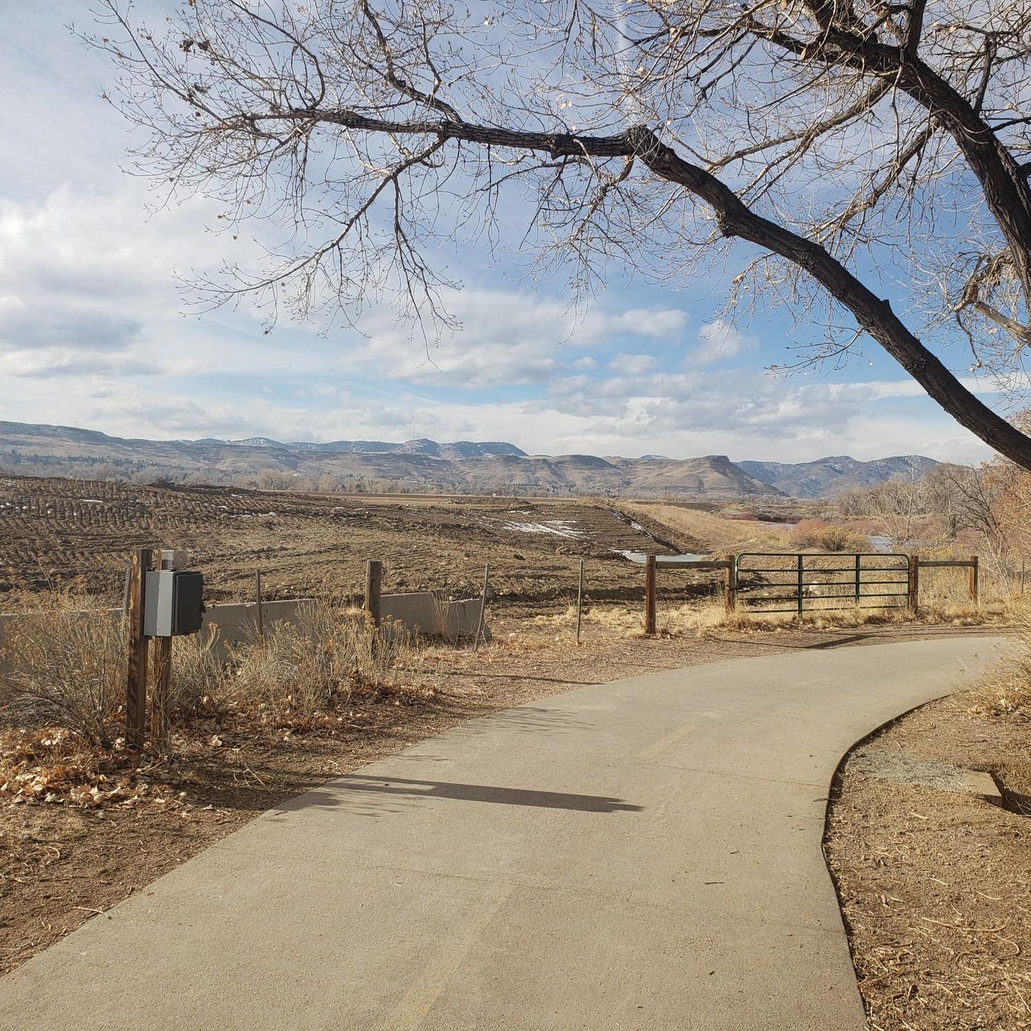
Tips from the Community

This is a nice overlook near Mt. Carbon, with expansive views of the Denver skyline, Bear Lake Park, and Mount Falcon Park in the background. Bear Creek Trail ends here, making it a great spot to pause, sit for a bit, and enjoy the views.
0
0

Lookout Mountain is a popular climb for local cyclists and visitors. Traffic is normally light and friendly, but the climb is steep at points. However, you are rewarded at the top by wonderful views of downtown Denver.
1
0

Empower Field at Mile High, often called Mile High Stadium, is Denver’s iconic sports venue and home to the NFL’s Denver Broncos. Located near downtown, the stadium sits 5,280 feet above sea level, giving it its name. Opened in 2001, it replaced the original Mile High Stadium and can accommodate over 76,000 fans. The stadium hosts football games, concerts, and other large-scale events and features panoramic views of Denver and the Rocky Mountains. Outside, the "Bucky the Bronco" statue symbolizes the team and its history.
1
0

Great place to check out the crazy history of railroads from Colorado's mining past. Lots of narrow-gauge trains, you can do rides, and the museum building is a replica of an 1880s-style railroad depot.
0
0

Enjoy looking out from the observation deck as you can see Denver and the perfectly straight Colfax Road that splits down the middle.
0
0

The museum has been founded in the late 1950s by a private association. Today you can explore more than 100 railroad engines (both steam and diesel electric) and wagons from over 120 years of Colorado's railroad history. Furthermore theres a running museum train, which takes you on a 15 minutes train ride all around the museum.
0
0


Confluence Park is located at the confluence of Cherry Creek and the South Platte River. It is located on both sides of Cherry Creek.
1
0
Frequently Asked Questions
How many road cycling routes are available in Golden?
Golden offers a diverse selection of road cycling routes, with over 50 options available on komoot. These routes cater to various skill levels, from challenging mountain climbs to more relaxed, scenic rides.
What are the difficulty levels of road cycling routes in Golden?
The road cycling routes in Golden range from easy to difficult. You'll find approximately 9 easy routes, 28 moderate routes, and 21 challenging routes, ensuring there's something for every cyclist. The region is particularly known for its demanding mountain ascents.
Are there any challenging climbs for experienced road cyclists in Golden?
Absolutely. Golden is renowned for its challenging climbs, especially the iconic Lookout Mountain. Routes like Evergreen to Genesee loop from Golden, a difficult 61.8 km route, feature significant elevation gains, offering a rewarding experience for seasoned riders. The climb up Lookout Mountain itself is considered a 'rite of passage' for many cyclists.
What are some easier, family-friendly road cycling options in Golden?
For a less strenuous ride, the Clear Creek Trail is a popular choice. This paved path follows Clear Creek, offering a beautiful and easy ride shaded by trees. While specific komoot routes are often more challenging, the general area around Clear Creek provides a gentler experience suitable for families.
Are there scenic routes with notable landmarks or viewpoints?
Yes, many routes offer breathtaking views and pass by significant landmarks. The climb up Lookout Mountain, for instance, provides panoramic views of Golden, Denver, and the plains. At the summit, you can visit the Green Mountain Peak. The Golden Gate Canyon Loop also takes you through dense forests and offers views of the Continental Divide.
Can I find loop trails for road cycling in Golden?
Yes, Golden offers several excellent loop trails. A notable example is the Bear Creek and C-470 Trail Loop, a moderate 46.3 km route. The Golden Gate Canyon Loop is another scenic option, taking you through diverse landscapes in a circular fashion.
What is the best time of year for road cycling in Golden?
The best time for road cycling in Golden is generally from spring through fall. The fall season is particularly beautiful, as the aspen groves in areas like Golden Gate Canyon State Park turn a brilliant gold. While some trails are clear in winter, the region's elevation means colder temperatures and potential snow, especially on mountain routes.
What do other cyclists say about the road cycling experience in Golden?
The road cycling routes in Golden are highly rated by the komoot community, with an average score of 4.4 stars from over 50 reviews. Cyclists frequently praise the challenging mountain climbs, the rewarding panoramic views, and the diverse terrain that caters to various preferences.
What kind of terrain can I expect on Golden's road cycling routes?
You can expect a wide variety of terrain. Routes often feature challenging mountain ascents with winding roads, scenic canyon roads through dense forests and rocky peaks, and gentler paved paths along Clear Creek. This mix provides opportunities for both intense workouts and relaxed rides.
Are there any attractions near the road cycling routes in Golden?
Yes, several attractions are close to the cycling routes. On Lookout Mountain, you can visit the Buffalo Bill Museum and Grave. Along Clear Creek, the Clear Creek White Water Park offers a pleasant environment. For historical interest, the Walker House Ruins are also nearby. Additionally, you can find natural features like Bear Creek Lake and Big Soda Lake.
Is Golden considered a bike-friendly city?
Yes, Golden has been recognized as a 'Bicycle Friendly Community' by the League of American Cyclists. The city boasts an extensive network of dedicated bike lanes and shared-use trails throughout the town, making it an excellent destination for two-wheeled enthusiasts.
Where can I find information about local cycling infrastructure or bike lanes in Golden?
For detailed information on Golden's local cycling infrastructure, including bike lanes and shared-use trails within the city, you can consult the official City of Golden website. Visit cityofgolden.gov for more resources.
Are there any routes that offer a mix of urban and natural scenery?
Yes, some routes provide a blend of urban and natural environments. The Mile High Stadium and Cherry Creek Trail is a good example, leading through urban areas and then along the scenic Cherry Creek, offering a varied cycling experience.
Most popular routes around Golden
Most popular attractions around Golden

Get inspired with the komoot mobile app


Explore more
Browse the best Road cycling routes in other regions.
