The best running trails around Poncha Springs
266
runners
47
runs
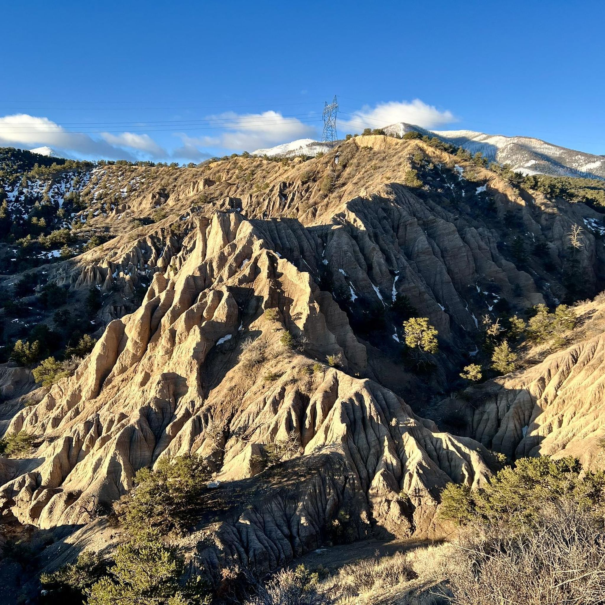
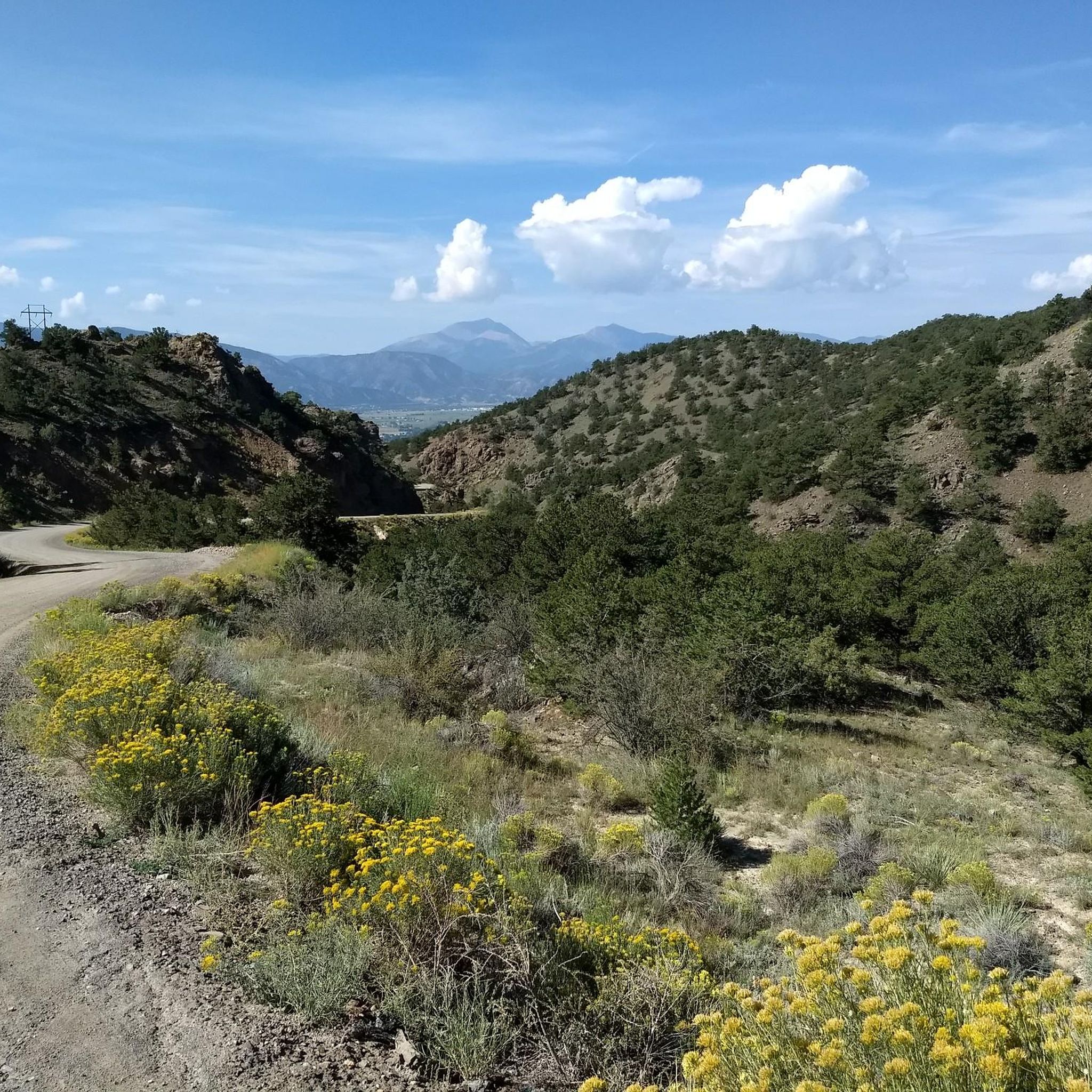
Jogging around Poncha Springs offers diverse terrain at an elevation of 7,464 feet, providing a unique high-altitude running experience. The region is characterized by its location amidst the Sawatch Range and surrounded by national forests like San Isabel National Forest, offering extensive trail systems. Jogging routes often follow picturesque creeks such as Poncha Creek and Starvation Creek, or provide access to the expansive San Luis Valley.
Best jogging routes around Poncha Springs
- The most popular jogging route is Salida River…
Last updated: June 25, 2026
12
runners
6.88km
00:49
40m
40m
Jog the moderate 4.3-mile Salida River Trail to Frantz Lake for scenic river views, a turquoise lake, and wildlife spotting.
29
runners
9.61km
01:12
150m
150m
Hard run. Good fitness required. Sure-footedness, sturdy shoes and alpine experience required.

Sign up for free
22
runners
9.50km
01:18
160m
160m
Hard run. Good fitness required. Sure-footedness, sturdy shoes and alpine experience required.
21
runners
11.2km
01:15
150m
150m
Moderate run. Good fitness required. Mostly paved surfaces. Suitable for all skill levels.
17
runners
7.07km
00:55
110m
110m
Hard run. Good fitness required. Sure-footedness, sturdy shoes and alpine experience required.
Get access to more routes and recommendations from other explorers.
Sign up for free
Already have an account?
Our route recommendations are based on thousands of hikes, rides, and runs completed by other people on komoot.
Start today with a free account
Your next adventure awaits.
Login or Signup

Tips from the Community

Salida is a beautiful mountain town located in the heart of the Rockies in central Colorado. This little gem has a lot to keep you busy: no matter if you are an artistic mind or an outdoor enthusiast.
0
0

While enjoying the river banks, you can see the small mount "spiral drive" and are not too far from the vibrant city either.
1
0
Downtown Salida is listed on the National Register of Historic Places. Due to the cool summers and relatively mild winters, the area around Salida is nicknamed the "banana belt" of Colorado. As the city is attractive, you will also find in addition to the historical buildings many art galleries. The old town is located on the edge of the Arkansas, which makes it particularly pleasant.
1
0
The view from S-Mountain ist absolutely fantastic. In the background you can spot several 14ers.
0
0
This is the perfect spot to watch people whitewater rafting.
0
0
Salida is a beautiful mountain town located in the heart of the Rockies in central Colorado. This little gem has a lot to keep you busy: no matter if you are an artistic mind or an outdoor enthusiast.
3
0
Frequently Asked Questions
How many running routes are available around Poncha Springs?
There are over 45 dedicated running routes around Poncha Springs, catering to various skill levels. You'll find a mix of easy, moderate, and challenging trails, with 2 easy, 12 moderate, and 31 difficult options to explore.
What kind of terrain can I expect on the jogging trails in Poncha Springs?
Jogging around Poncha Springs offers diverse terrain, from high-altitude singletrack and forested mountain slopes to picturesque riverside paths. The region is situated at an elevation of 7,464 feet, providing a unique high-altitude running experience amidst the Sawatch Range and national forests.
Are there any easy or beginner-friendly running routes in the area?
Yes, for those looking for an easier run or to adjust to the elevation, the Salida River Trail to Frantz Lake is a popular choice. This 4.3-mile route follows the Arkansas River, offering scenic riverside paths with minimal elevation gain.
Where can I find scenic running routes with great views near Poncha Springs?
For breathtaking views, consider routes that venture towards higher elevations. The Poncha Pass area offers sweeping valley views, while sections of the Rainbow Trail provide picturesque routes. For a high-altitude workout with spectacular Rockies viewpoints, the Monarch Crest Trail is highly recommended.
Are there any loop running trails around Poncha Springs?
Yes, several loop options are available. A local favorite is the Little Rainbow Trail loop from KVRH-FM (Salida), a 4.4-mile trail through the foothills of Methodist Mountain. Another challenging loop is the Historic Downtown Salida – Tenderfoot Hill loop from Salida, which includes significant elevation changes.
What natural features or landmarks can I see while running in Poncha Springs?
The region is rich in natural beauty. You can run alongside picturesque creeks like Poncha Creek and Starvation Creek, or explore trails within the San Isabel National Forest. Notable landmarks include the Poncha Pass and the Monarch Pass Climb East, offering stunning mountain vistas. The Historic Downtown Salida also offers a charming backdrop for runs.
Are there any long-distance running routes for endurance training?
For longer runs, the Tenderfoot Hill – Along the Arkansas River loop from Salida offers an 11.2 km (7 miles) route. Additionally, the Starvation Creek Trail, an out-and-back option, can be extended into an 11-mile loop by connecting with a dirt road, providing a substantial distance for endurance training.
What is the best time of year to go running in Poncha Springs?
Poncha Springs offers running opportunities throughout much of the year. Spring, summer, and fall generally provide the most favorable conditions for exploring the diverse trails. In the fall, the Starvation Creek drainage is known for its variety of mushrooms and vibrant foliage. Winter running is possible, but some high-altitude trails may be snow-covered and require appropriate gear.
Are there any less crowded running paths for a more peaceful experience?
While popular routes can see more activity, exploring trails within the extensive national forests like San Isabel National Forest often provides a more secluded experience. The North Backbone Trail and sections of the Rainbow Trail might offer quieter stretches, especially during off-peak hours.
What do other runners enjoy most about jogging in Poncha Springs?
The komoot community frequently praises the diverse high-altitude terrain, from singletrack to riverside paths, and the stunning natural beauty of the surrounding national forests. Runners appreciate the variety of routes available, catering to different fitness levels, and the opportunity to experience the unique 'Crossroads of the Rockies' landscape.
Are there any routes that pass through historic areas?
Yes, the Historic Downtown, Salida – Historic Downtown Salida loop from Salida is a great option. This 9.7 km (6 miles) route allows you to combine your run with exploring the charming Historic Downtown Salida, offering a blend of exercise and cultural sightseeing.
Most popular attractions around Poncha Springs

Get inspired with the komoot mobile app


Explore more
Browse the best Running Trails & Routes in other regions.
