The best cycling routes around Soda Springs
72
riders
10
rides
Touring cycling around Soda Springs offers routes through a landscape characterized by high-altitude lakes, river valleys, and forested areas. The region features varied terrain, including gentle slopes around water bodies and more challenging ascents towards higher elevations. This environment provides diverse cycling experiences, from leisurely lakeside paths to routes that traverse the foothills of the Sierra Nevada.
Best touring cycling routes around Soda Springs
- The most popular touring cycling route is South Yuba River to Donner Ski Ranch loop, a 6.9 miles (11.1 km) trail that takes 56 minutes to complete. This easy route follows the South Yuba River and passes by the Donner Ski Ranch.
- Another top favourite among local touring cyclists is Serene Lakes loop, an easy 4.9 miles (7.9 km) path. This route circles the Serene Lakes, offering views of the water and surrounding forests.
- Local touring cyclists also love the Serene Lake, a 2.1 miles (3.5 km) trail leading through a lakeside environment, often completed in about 11 minutes.
- Touring cycling around Soda Springs is defined by scenic lakes, river corridors, and forested hills. The network offers options for easy, moderate, and difficult routes, catering to various ability levels.
- The guide includes highly-rated routes that showcase the best of the region's landscape. More than 60 touring cyclists have used komoot to explore Soda Springs's varied terrain.
Last updated: July 8, 2026
3.45km
00:12
10m
10m
Embark on an easy touring bicycle ride around the tranquil Serene Lakes, where you can enjoy pleasant views of the water and the surrounding natural landscape. This smooth route covers 2.1 miles (3.5 km) with a gentle elevation gain of just 41 feet (13 metres), making it a quick 11-minute spin perfect for a peaceful outing.
This route is located within the Tahoe National Forest, close to Truckee, California. You will generally find parking available in the area, which makes accessing the start point straightforward. Always remember to check local conditions before you head out, especially during spring and autumn, as weather can influence your ride.
While the name might suggest a rugged mountain path, this specific touring cycling route offers a very smooth experience. You can look forward to a calm atmosphere and beautiful reflections on the lake's surface as you pedal along, making it a delightful escape in the region.
11.1km
00:56
110m
110m
The South Yuba River to Donner Ski Ranch loop offers a delightful and easy touring cycling experience, perfect for a relaxed day out. You'll pedal along mostly paved surfaces, enjoying the tranquil flow of the South Yuba River before passing by the historic Donner Ski Ranch. This 6.9-mile (11.1 km) route is a gentle introduction to the area's beauty, with minimal climbing and a smooth ride throughout.
Planning your visit to this scenic loop cycling near Truckee is straightforward. The route is an easy 56-minute ride, making it ideal for a quick escape. While specific parking information for this exact starting point isn't detailed, the general area around the South Yuba River and Donner Ski Ranch provides ample access. It's a great option for a casual spin without needing extensive preparation.
This particular route provides a taste of the diverse cycling opportunities in the region, contrasting with the more challenging climbs found on nearby Donner Pass Road. It's a fantastic choice for family friendly cycling in the South Yuba River area, allowing you to soak in the natural surroundings without significant effort. The 349 feet (107 metres) of elevation gain is very manageable, ensuring an enjoyable outing for all.

Sign up for free
7.90km
00:37
120m
120m
The Serene Lakes loop is an easy 4.9-mile (7.9 km) touring bicycle route that offers a peaceful escape into nature. You'll pedal around the tranquil Serene Lakes, enjoying pleasant views of the water and the surrounding forests, with a modest 403 feet (123 metres) of elevation gain. This route is a true gem, often called a "best-kept secret" of the Sierras, providing a serene atmosphere and natural beauty away from more crowded spots. It's a relaxed ride that typically takes about 37 minutes to complete.
This specific Serene Lakes cycling loop is graded as easy and is ideal for beginners and families looking for a gentle outing. The terrain consists of mostly paved surfaces and well-maintained unpaved paths, making it perfect for a touring bike. When planning your visit, remember that this route is distinct from more challenging mountain bike or strenuous hiking trails that share a similar name in the area.
Historically, the Serene Lakes area was an important Native American fishing spot and later a source of commercial ice blocks, adding a layer of rich history to its natural charm. The route also features the South Yuba River, enhancing the picturesque views of high-altitude lakes, river valleys, and forested areas. It's a wonderful option for family friendly cycling, offering beautiful natural features without demanding too much effort.
8.76km
00:51
180m
180m
This difficult 5.4-mile (8.8 km) touring cycling loop in Royal Gorge Cross Country Ski Resort offers a challenging ride past Serene Lakes.
25
riders
11.7km
00:43
70m
70m
Easy bike ride. Great for any fitness level. Mostly paved surfaces. Suitable for all skill levels.
Get access to more routes and recommendations from other explorers.
Sign up for free
Already have an account?
Our route recommendations are based on thousands of hikes, rides, and runs completed by other people on komoot.
Start today with a free account
Your next adventure awaits.
Login or Signup
Tips from the Community

The Emigrant Trail Museum of Donner Memorial State Park is a memorial park and museum. In the 1840s, immigrants came over to this area to seek a better life on the west coast. The Donner Party was trapped in these mountains during a horrible winter and were starving. Rumors have it they resorted to cannibalism, though the museum claims "no real evidence was found".
0
0

A small stretch of sand with privileged views of Donner Lake and the surrounding forest. The beach is easily accessible from the road, making it a great spot to check out, or even take a refreshing dip.
0
0
China Cove is a sandy cove on the southern shore of Donner Lake, perfect for a quick break during your ride. It’s quieter than the main beach, with calm water and nice views. There’s limited parking, but if you’re on two wheels, it’s easy to pull over and soak in the stillness before heading back on the road.
0
0

Serene Lakes are more off-the-beaten-path, so they tend to not be crowded with tourists. Historically, these were Native American fishing spots around trading routes. Obsidian arrowheads and petroglyphs have been found in this area. Mark Twain has visited these lakes, and they were a source of commercial ice blocks that were once used before refrigeration was invented.
0
0
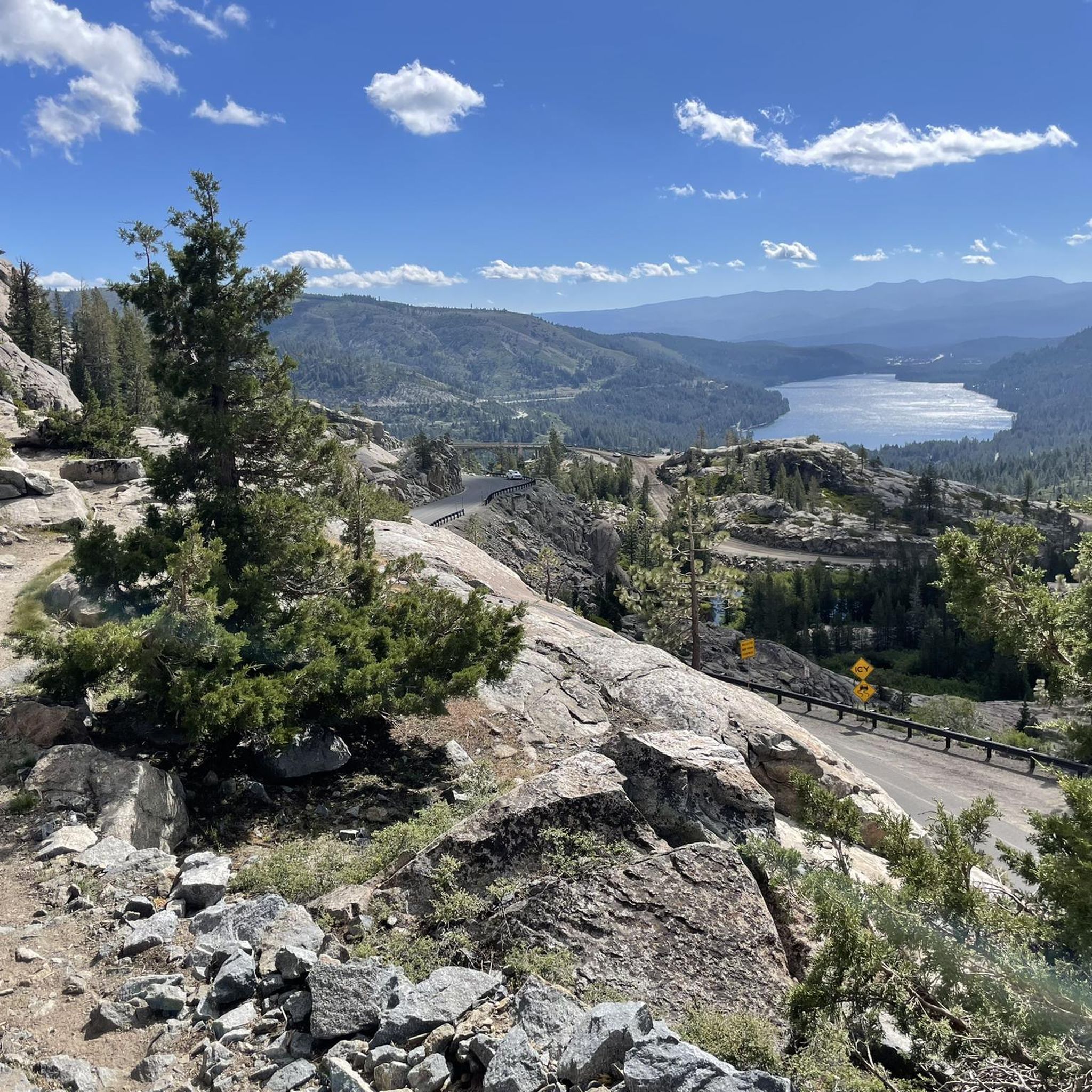
Donner Lake, situated at an elevation of 5,936 feet and with a depth of 328 feet, is fed by Summit Creek and Gregory Creek and drained by Donner Creek. The lake got its name from the ill-fated Donner Party, a group of pioneers who found themselves stranded in the harsh winter of 1846. Donner Lake today has 30 public docks, a State Park, 4 beaches, and lots of amenities.
0
0
The West Shore of Donner Lake is a public beach and park with a 12-acre day-use beach and American Red Cross-certified lifeguards. They are on the go during the summer, watching swimmers, kayakers, and stand-up paddle boarders. This is a concession stand open seven days a week during the summer.
0
0
China Cove is a sandy cove on Donner Lake. This is a quieter and more relaxed one on the southern part of the lake. There is limited parking in the area.
0
0
China Cove is a sandy cove on Donner Lake. This is a quieter and more relaxed one in the southern part of the lake. There is limited parking in the area. Stopping here on a run is a great way to enjoy the tranquility of the cove.
0
0
Frequently Asked Questions
How many touring cycling routes are available around Soda Springs?
There are 10 touring cycling routes available around Soda Springs, offering a variety of experiences through high-altitude lakes, river valleys, and forested areas.
Are there easy touring cycling routes suitable for beginners or families?
Yes, Soda Springs offers several easy touring cycling routes. For a gentle ride, consider the Serene Lakes loop, which is 4.9 miles (7.9 km) and circles the scenic lakes. Another accessible option is the Serene Lake route, a shorter 2.1 miles (3.5 km) lakeside path.
What are some scenic viewpoints or landmarks I can see while cycling in Soda Springs?
The region is rich with natural beauty and historical points. Along your rides, you might encounter highlights such as Castle Pass, the historic Donner Pass Summit, and the Roller Pass Overlook, which offers expansive views. The routes often feature high-altitude lakes and river valleys.
Are there any loop routes for touring cyclists in Soda Springs?
Yes, many routes in Soda Springs are designed as loops for convenience. Popular options include the South Yuba River to Donner Ski Ranch loop, an easy 6.9-mile ride, and the Serene Lakes loop, which is 4.9 miles. For a more challenging loop, consider the Serene Road via Bogus Basin loop.
What is the best time of year for touring cycling in Soda Springs?
Given Soda Springs' high-altitude location in the Sierra Nevada foothills, the best time for touring cycling is typically from late spring through early autumn (May to October) when the weather is mild and trails are clear of snow. Winter cycling is possible but requires specialized gear and awareness of snow conditions.
Are there any more challenging or advanced touring cycling routes in the area?
For experienced touring cyclists seeking a challenge, the Serene Road via Bogus Basin loop is classified as difficult. This 8.8 km route features more significant elevation changes, traversing towards higher elevations and offering a more strenuous ride.
What should I bring for a touring cycling trip in Soda Springs?
When touring cycling in Soda Springs, it's advisable to bring layers of clothing due to potential temperature changes at higher altitudes, plenty of water, snacks, a repair kit for your bike, and navigation tools. Sun protection is also crucial, as many routes are exposed.
Are there any less crowded touring cycling routes in Soda Springs?
While specific crowd levels can vary, exploring routes slightly off the main thoroughfares or during off-peak hours can offer a quieter experience. The region has a good mix of popular and lesser-known paths. Consider the Donner Lake – Lake View Canyon Road loop from Donner Lake for a potentially less frequented option, offering views around Donner Lake.
Can I find places to eat or get coffee near the cycling routes?
Soda Springs and the surrounding communities offer various amenities. While specific cafes directly on every route might be limited, you'll find options in the main town areas or nearby villages. Planning your route to pass through these areas or packing your own refreshments is recommended.
What kind of terrain can I expect on touring cycling routes in Soda Springs?
The terrain around Soda Springs is varied, characterized by high-altitude lakes, river valleys, and forested areas. You can expect a mix of gentle slopes around water bodies and more challenging ascents as routes climb towards higher elevations in the Sierra Nevada foothills. Surfaces can range from paved roads to well-maintained gravel paths.
What do other touring cyclists enjoy about cycling in Soda Springs?
The komoot community frequently praises the diverse cycling experiences available, from leisurely lakeside paths to routes that traverse the foothills of the Sierra Nevada. Cyclists appreciate the scenic beauty of the high-altitude lakes and river corridors, as well as the variety of routes catering to different ability levels.
Most popular attractions around Soda Springs

Get inspired with the komoot mobile app


Explore more
Browse the best Cycling routes in other regions.
