Attractions and Places To See around San Antonio Heights - Top 18
Best attractions and places to see around San Antonio Heights, a census-designated place in San Bernardino County, California, are nestled in the foothills of the San Gabriel Mountains. This area offers a blend of natural beauty and a rural atmosphere, adjacent to the Angeles National Forest. It is known for its abundant trees and distinctive residential character, providing scenic views and access to outdoor activities. The region is located at the mouth of San Antonio Canyon, offering a gateway to mountain exploration.
Best attractions and places to see around San Antonio Heights
- The most popular attractions is Glendora Ridge Road, a mountain pass that offers scenic views and challenging hills. This road ride is located on the boundary of San Bernardino and Los Angeles counties.
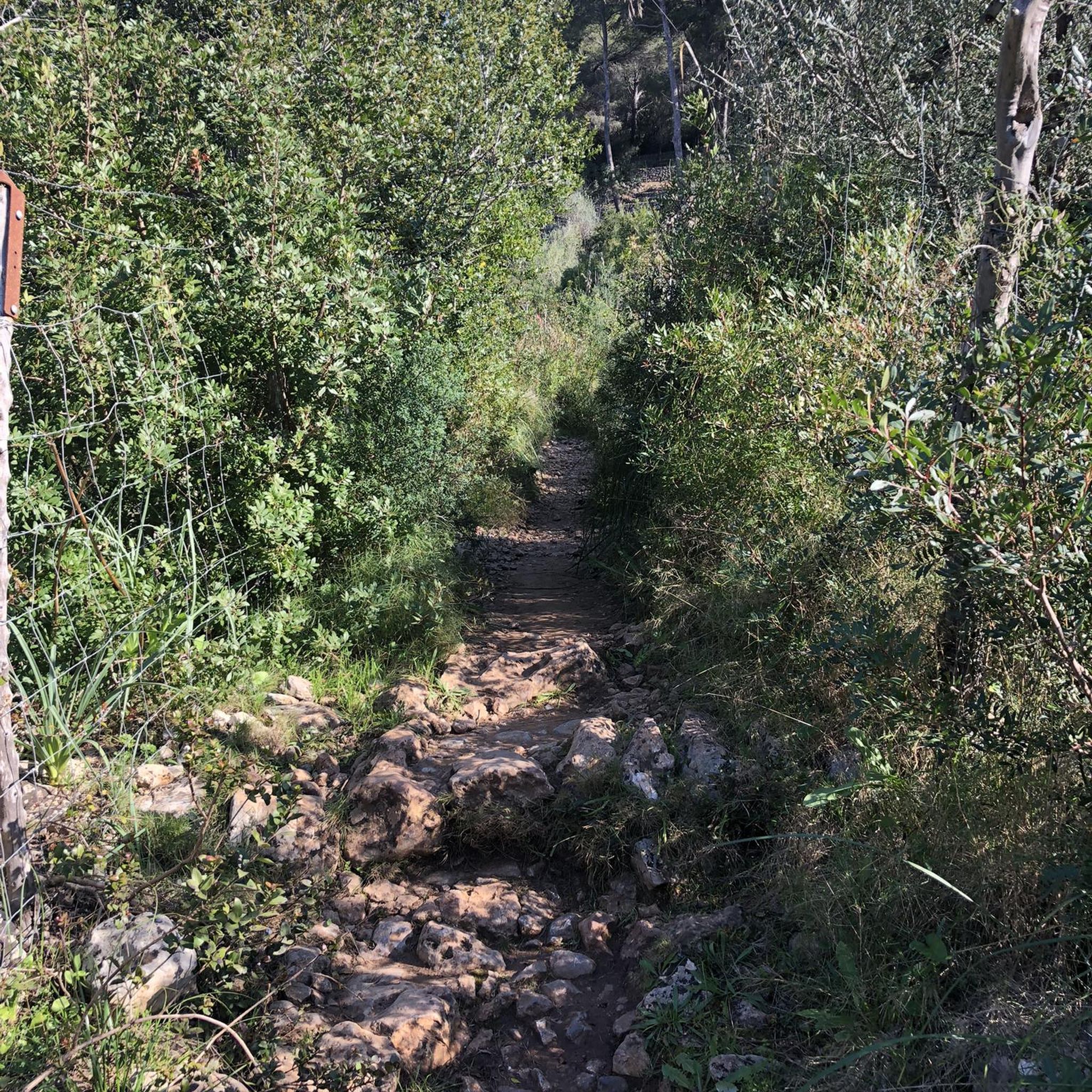
- Another must-see spot is Marshall Canyon Trail, a trail known for its oak tree cover and lush terrain. It features significant climbing, particularly deeper into the canyon.
- Visitors also love Bear Canyon Trail, a trail with steep segments, a creek, and views. The first part of the trail allows hikers to hear the creek for about a mile.
- San Antonio Heights is known for its trails, viewpoints, and summits. The area offers a variety of attractions to see and explore, from challenging mountain routes to scenic cycle paths.
- The attractions around San Antonio Heights are appreciated by the komoot community, with 9 upvotes and 3 photos shared.
Last updated: July 6, 2026
Marshall Canyon Trail
Highlight (Segment) • Trail
Tip by

Route 66 cycle path
Highlight (Segment) • Cycleway
Tip by

Sign up now to discover places like this
Get recommendations on the best single tracks, peaks, & plenty of other exciting outdoor places.
Sign up for free
Glendora Ridge Road
Highlight (Segment) • Mountain Pass
Tip by

Bear Canyon Trail
Highlight (Segment) • Trail
Tip by

Cucamonga Peak
Highlight • Summit
If you hike from the Icehouse Canyon Trailhead please obtain your wilderness permit from the Angeles National Forest, Baldy Ranger Station. If you prefer ascending via Middle Fork Trail, you can obtain the permit from the San Bernardino National Forest, Lytle Creek Ranger Station.
Tip by

Sign up for free to discover even more attractions around San Antonio Heights.
Sign up for free
Already have an account?
Start today with a free account
Your next adventure awaits.
Login or Signup



Tips from the Community

The Marshall Canyon Trail is in La Verne, CA, starts at Oak Mesa Park and features 1,310 feet of climbing, reaching a max elevation of 2,424 feet. Known for its oak tree cover and lush terrain, it’s often referred to as "Sherwood Forest" due to its green, shady environment. The lower section is relatively flat, with more climbing occurring deeper into the canyon. For mountain bikers, there are many variations off the main trail that can add both milage and elevation to your ride. Adding the Claremont Loop, for example, can extend the ride by 4-5 miles and 800 vertical feet. The trail and surrounding area provides a refreshing NorCal feel, with shaded trails and a creek, contrasting with the typically hot and dry surrounding hills.
0
0

Glendora Mountain or Glendora Ridge Road is a very scenic mountain road located on the boundary of San Bernardino and Los Angeles counties. It is a great road ride with views and hills that will take your breath away.
0
0

Cucamonga Peak rises up to 8,862 feet and is one of the most popular peaks that you can access from the Icehouse Canyon Trail. You get an awesome view of the San Gabriel range from the peak, which you should only attempt to run up in the dry season.
0
0

Wonderful bike trail, most of which runs off-road parallel to the original Route 66 through the suburbs of Los Angeles. Very relaxed driving. Cafes, restaurants, bike shops, markets, etc. in the immediate vicinity or even directly on the trail.
1
0

The bear canyon trail is one of the best in the area, bringing you steep segments, a bit of snow, and incredible views. The first part of the trail is also special as you can hear the creek for about a mile. You might even end up crossing small streams.
1
0


Reaching the summit of Cucamonga you know you worked hard! But look around and enjoy the majestic views over the San Gabriel mountains from one of the highest peaks within the mountain range. Bring appropriate gear if you hike in winter conditions. If you hike from the Icehouse Canyon Trailhead please obtain your wilderness permit from the Angeles National Forest, Baldy Ranger Station. If you prefer ascending via Middle Fork Trail, you can obtain the permit from the San Bernardino National Forest, Lytle Creek Ranger Station.
1
0

Bear Canyon Trail—also called the Old Mt. Baldy Trail—offers some of the finest scenery and rewarding views in the San Gabriel Mountains high country. The first 1.8 miles to Bear Flat delightfully travels a superb single-track trail adorned with fern under a rich canopy of live oak, bay, and bigcone Douglas-fir. The lively creek gurgles, bubbles, splashes, and cascades down this enchanting canyon. Beyond Bear Flat the trail begins to steeply climb the chaparral-covered southeast flank of Mt. Baldy's great south ridge. You're rewarded with expanding views of Ontario Ridge, Icehouse Canyon, the "Three T's" and Baldy Notch. You'll then enter an open conifer forest with wide-reaching views toward the expansive San Gabriel Mountains to the west. Even without achieving a grand mountain summit, this hike is sure to provide a fulfilling outing for even a diehard peak bagger. http://www.simpsoncity.com/hiking/bearflat.html
0
0
Frequently Asked Questions
What are some unique natural features to explore near San Antonio Heights?
San Antonio Heights is nestled in the foothills of the San Gabriel Mountains and is adjacent to the Angeles National Forest. You can explore the natural beauty of the Bear Canyon Trail, which features steep segments, a lively creek, and incredible views. The area is also at the mouth of San Antonio Canyon, offering a gateway to mountain exploration.
Are there any historical landmarks or sites in San Antonio Heights?
While primarily residential, San Antonio Heights has historical significance. The area is a historic residential subdivision with a unique curvilinear street system dating back to 1886. You can find properties like the San Antonio Heights Grove House, recognized for its historical importance related to the area's citrus growing past and unique architecture. Additionally, the community is known for the distinctive Star House, which displays an enormous illuminated star during the holiday season.
What kind of outdoor activities can I do around San Antonio Heights?
The region offers a variety of outdoor activities, particularly hiking and cycling. You can find challenging mountain routes like the Glendora Ridge Road, popular for scenic road cycling with breathtaking views. For hiking, consider trails like Marshall Canyon Trail, known for its lush, oak-covered terrain, or the challenging ascent to Cucamonga Peak for majestic views.
Are there family-friendly outdoor options near San Antonio Heights?
Yes, for a more relaxed family outing, the Route 66 cycle path offers a wonderful, mostly off-road bike trail that runs parallel to the historic Route 66. It's a very relaxed ride through the suburbs of Los Angeles, with cafes and restaurants nearby, making it suitable for families.
What are some challenging hikes in the area?
For challenging hikes, consider reaching the summit of Cucamonga Peak. This ascent provides majestic views over the San Gabriel Mountains. Hikers should obtain a wilderness permit from either the Angeles National Forest (if starting from Icehouse Canyon Trailhead) or the San Bernardino National Forest (if using the Middle Fork Trail).
Where can I find hiking trails near San Antonio Heights?
You can find numerous hiking opportunities in the area. Popular trails include Bear Canyon Trail, known for its steep segments and creek, and Marshall Canyon Trail, often called 'Sherwood Forest' due to its lush, green, and oak-covered terrain. For more options, explore the Hiking around San Antonio Heights guide.
Are there good cycling routes in San Antonio Heights?
Absolutely. The Glendora Ridge Road is a very scenic mountain road popular for cycling, offering breathtaking views and challenging hills. Another option is the Route 66 cycle path, which provides a relaxed, mostly off-road experience. For more cycling routes, check out the Road Cycling Routes around San Antonio Heights guide.
What is the best time of year to visit San Antonio Heights for outdoor activities?
San Antonio Heights experiences a hot-summer Mediterranean climate. While outdoor activities are possible year-round, the spring and fall months generally offer more moderate temperatures for hiking and cycling. The area receives more rainfall than many other parts of Metro Los Angeles due to its foothill location, so checking weather conditions is advisable, especially during winter when higher elevations might experience snow.
What kind of terrain can I expect on trails in San Antonio Heights?
The terrain varies significantly. Trails like Bear Canyon Trail feature steep segments and opportunities to cross small streams. Marshall Canyon Trail is known for its lush, green, and oak-covered environment with significant climbing deeper into the canyon. Higher elevation trails leading to Cucamonga Peak can be challenging and may involve winter conditions requiring appropriate gear.
Are there any specific permits required for hiking in the San Gabriel Mountains near San Antonio Heights?
Yes, if you plan to hike to Cucamonga Peak, you will need a wilderness permit. If you start from the Icehouse Canyon Trailhead, obtain your permit from the Angeles National Forest, Baldy Ranger Station. If you prefer ascending via the Middle Fork Trail, you can get the permit from the San Bernardino National Forest, Lytle Creek Ranger Station.
What makes San Antonio Heights unique as a community?
San Antonio Heights is known for its rural atmosphere, abundant trees, and a strong sense of community. Residents pride themselves on a close-knit environment, fostering social activities like a monthly backyard produce exchange and an annual community meeting. The area's historic residential subdivision with its unique curvilinear street system also contributes to its distinctive character.
Most popular attractions around San Antonio Heights

Get inspired with the komoot mobile app


Explore more
Still not found the Highlight you’re looking for? See guides of the top attractions in other regions:
