The best road cycling routes around Running Springs
5.0
(1)
142
riders
7
rides
Road cycling routes around Running Springs are situated within the San Bernardino Mountains, offering a diverse terrain of pine forests and rugged peaks. The region's high elevation provides significant climbs and expansive views across the landscape. Cyclists encounter varied surfaces, from well-paved roads around lakes to challenging mountain passes. This area serves as a gateway to larger mountain resorts, integrating natural features like lakes and summits into its cycling network.
Best road cycling routes around Running Springs
- The most popular…
Last updated: October 16, 2026
5.0
(1)
92
riders
85.6km
04:02
1,140m
1,140m
Hard road ride. Very good fitness required. Mostly well-paved surfaces and easy to ride.
4
riders
54.8km
02:59
1,030m
1,030m
Hard road ride. Very good fitness required. Mostly well-paved surfaces and easy to ride.

3
riders
79.4km
04:39
1,820m
1,820m
Hard road ride. Very good fitness required. Mostly well-paved surfaces and easy to ride.
12
riders
24.3km
01:28
440m
440m
Moderate road ride. Good fitness required. Mostly well-paved surfaces and easy to ride.
21
riders
67.6km
03:21
940m
940m
Hard road ride. Very good fitness required. Mostly well-paved surfaces and easy to ride.
Get access to more routes and recommendations from other explorers.
Already have an account?
Our route recommendations are based on thousands of hikes, rides, and runs completed by other people on komoot.
Start today with a free account
Your next adventure awaits.
Popular around Running Springs
Tips from the Community

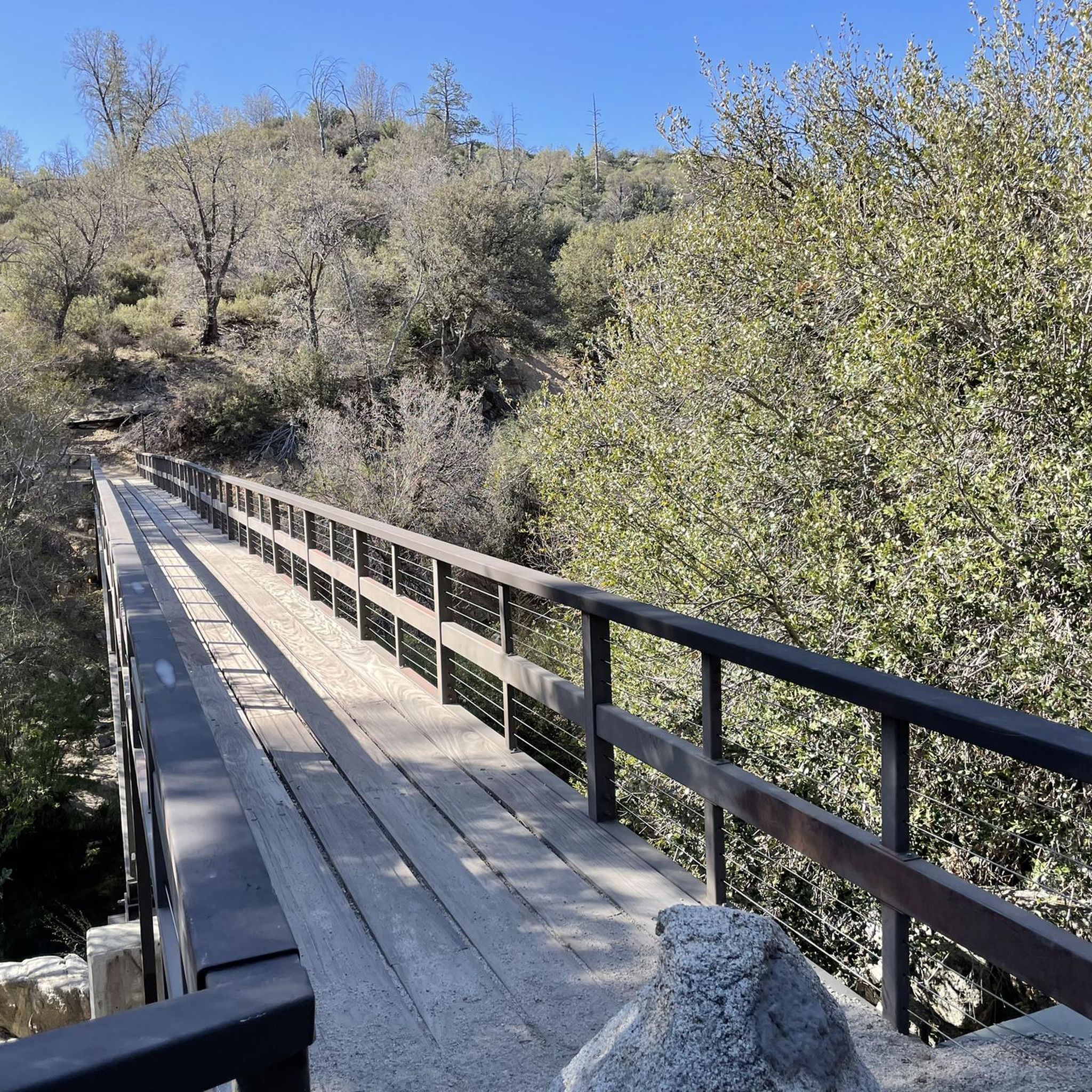
From this bridge, you can enjoy a privileged view of Big Bear Lake, nestled between mountains. You'll be treated to panoramic views of the sparkling lake, surrounded by pine forests and rugged peaks. You can refuel in Big Bear Village or pack a picnic to enjoy by the lakeshore.
1
0

The Alpine Pedal Path is a 3-mile paved path along the north shore of Big Bear Lake. The path is popular with cyclists, as well as walkers and runners.
0
0

Here you can ride your bike or walk along the footbridge on Big Bear Boulevard.
1
0

The Stanfield Marsh Boardwalk is a lovely 1.6-mile path along Baker's Pond, located at Stanfield Marsh and Wildlife Preserve. This peaceful boardwalk offers fantastic wildlife-watching opportunities, with views of birds such as ducks, geese, herons, and even Bald Eagles. The preserve, situated at the intersection of Stanfield Cutoff and Big Bear Boulevard, features easy access with parking available at the corner or along the bridge. The boardwalk is also dog-friendly, but biking is not allowed. You can lock your bikes at the parking area, take a break from the saddle, and stroll down the boardwalk.
1
0

A great viewpoint to stop at and take a break from your bike ride. This spot is one of the nicest along the Rim of the World Scenic Byway.
0
0
This lightly trafficked, stunning road lined with alpine trees leads from Highway CA 18 up to the small town of Green Valley, where there's a beautiful lake. If you're heading up to the lake, be prepared for a climb of over 1,000 feet. It's fairly steep, but the views make it well worth the effort. Alternatively, the ascent offers an enjoyable experience as well.
0
0
Green Valley Lake sits at 7,000 feet, higher than both Lake Arrowhead and Big Bear. It's secluded, about four miles from State Highway 18, surrounded by National Forest. This small, scenic lake is uncrowded and ideal for a peaceful retreat.
0
0
Keller Peak sits at an elevation of 7,882 feet. At the top there is the Keller Peak Fire Lookout, which is the oldest fire tower still standing in San Bernardino National Forest.
0
0
Frequently Asked Questions
What kind of terrain can I expect on road cycling routes around Running Springs?
Road cycling routes in Running Springs are set within the San Bernardino Mountains, offering a diverse terrain. You'll encounter pine forests, rugged peaks, and significant elevation changes. Surfaces vary from well-paved roads around lakes to challenging mountain passes, providing a mix of experiences for cyclists.
Are there road cycling routes suitable for beginners in Running Springs?
Yes, there are routes suitable for beginners. For an easier ride, consider the Lake Arrowhead Village loop from Lake Arrowhead. This 11.2-mile trail features mostly well-paved surfaces and offers scenic lake views, typically taking about an hour to complete.
What are some of the most challenging road cycling routes in Running Springs?
Running Springs offers several challenging routes with significant climbs. The Lake Arrowhead, Lake Gregory, Running Springs, and Keller Peak loop is a difficult 49.3-mile path with substantial elevation gains and panoramic views from Keller Peak. Another demanding option is the Snow Valley to Onyx Summit via Big Bear Lake, a 53.2-mile route featuring challenging climbs and picturesque alpine scenery, leading to Onyx Summit, the highest paved pass in Southern California.
What scenic viewpoints can I expect on road cycling routes near Running Springs?
Many routes offer breathtaking views. From the Lake Arrowhead, Lake Gregory, Running Springs, and Keller Peak loop, you can enjoy panoramic vistas from Keller Peak, which also hosts the oldest fire tower in the San Bernardino National Forest. The route to Onyx Summit also provides picturesque alpine scenery. You might also encounter other viewpoints like Lookout Point and Donald S. Wieman Vista Point.
Are there any notable natural attractions or landmarks along the road cycling routes?
Yes, the area is rich with natural beauty. Many routes pass by or offer views of significant lakes like Lake Arrowhead, Lake Gregory, and Big Bear Lake. You might also encounter Bluff Lake Reserve, a pristine mountain marsh, or pass by Keller Peak, a prominent summit. The region itself is within the San Bernardino National Forest, providing a backdrop of pine forests and rugged peaks.
What is the best time of year for road cycling in Running Springs?
Running Springs, at approximately 6,000 feet elevation, offers a cooler climate. The best time for road cycling is typically during the warmer months, from late spring through early fall, when mountain passes are clear of snow and the weather is most favorable. Always check local weather conditions before heading out, especially for higher elevation routes.
Are there any loop trails for road cycling in Running Springs?
Yes, several routes are designed as loops. A popular option is the Lake Arrowhead, Lake Gregory, Running Springs, and Keller Peak loop. Another is the Lake Arrowhead Village loop from Lake Arrowhead, which is a shorter, easier option.
What do other road cyclists enjoy most about road cycling in Running Springs?
The road cycling routes around Running Springs are highly rated by the komoot community, with an average score of 5.0 stars. Cyclists often praise the challenging climbs, the stunning panoramic views from high elevations like Keller Peak and Onyx Summit, and the picturesque alpine scenery, especially around Big Bear Lake and Lake Arrowhead.
Are there any road cycling routes that connect to other major mountain resorts?
Yes, Running Springs serves as a gateway to larger mountain resorts. Routes like the Snow Valley to Onyx Summit via Big Bear Lake connect you to the Big Bear Lake area, offering extensive cycling opportunities and scenic views of the lake.
Are there any road cycling routes that pass through Green Valley Lake?
Yes, you can find routes that include Green Valley Lake. For instance, the route From Blue Jay to Green Valley Lake offers challenging climbs through the San Bernardino National Forest, leading you to this picturesque area.
What is the longest road cycling route available in the Running Springs area?
One of the longest road cycling routes in the area is the Big Bear Lake – Shelter Cove loop from Lake Arrowhead. This route spans approximately 100 kilometers (62 miles) and features significant elevation gain, offering a substantial challenge for experienced cyclists.
Where can I find information about parking for road cycling routes in Running Springs?
While specific parking areas for each route are not detailed here, many routes start from or pass through towns like Running Springs, Lake Arrowhead, or Snow Valley, where public parking facilities are generally available. It's advisable to check local regulations or specific starting points for parking options before your ride.
Most popular routes around Running Springs
Most popular attractions around Running Springs

Get inspired with the komoot mobile app


Explore more
Browse the best Road cycling routes in other regions.
