The best road cycling routes around Millerton
5.0
(5)
125
riders
5
rides
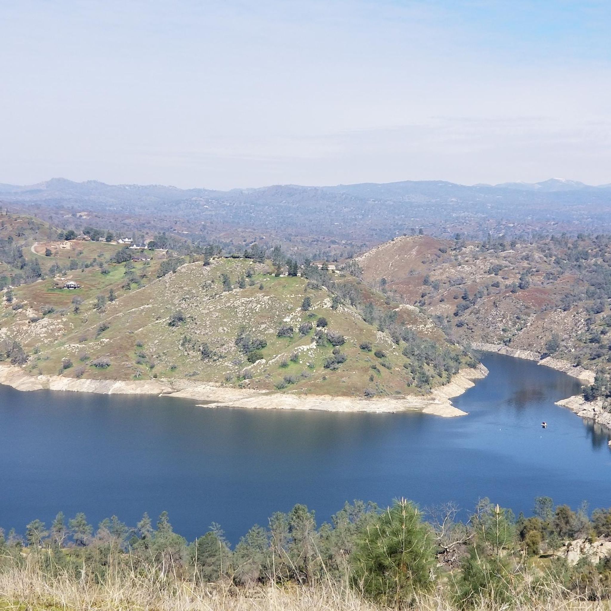
Road cycling around Millerton offers routes characterized by rolling terrain and views of Millerton Lake. The area features established bike paths, parkland, and routes that traverse near water bodies like Dry Creek and Friant Dam. Elevations are generally moderate, with some routes including sustained climbs. The landscape provides a mix of open stretches and areas near natural features.
Best road cycling routes around Millerton
- The most popular road cycling route is Fresno to Millerton Lake loop, a 52.4 miles…
Last updated: July 8, 2026
28
riders
26.5km
01:07
100m
100m
Easy road ride. Great for any fitness level. Mostly well-paved surfaces and easy to ride.
5.0
(2)
35
riders
42.1km
01:53
280m
280m
Easy road ride. Great for any fitness level. Mostly well-paved surfaces and easy to ride.

Sign up for free
20
riders
32.9km
01:23
110m
110m
Easy road ride. Great for any fitness level. Mostly well-paved surfaces and easy to ride.
5
riders
108km
05:27
1,550m
1,550m
Hard road ride. Very good fitness required. Mostly well-paved surfaces and easy to ride.
1
riders
85.3km
04:30
1,590m
1,590m
Hard road ride. Very good fitness required. Mostly well-paved surfaces and easy to ride.
Our route recommendations are based on thousands of hikes, rides, and runs completed by other people on komoot.
Start today with a free account
Your next adventure awaits.
Login or Signup
Popular around Millerton

Tips from the Community

The Lewis S. Eaton Bike Trail is a popular multiuse trail that runs through Fresno. It is very popular with runners, walkers and cyclists, so there is a good chance that you will encounter others out on the trail.
0
0

The Parkway Trust/Caglia is part of the San Joaquin River Parkway and Conservation Trust, which has the Lewis S. Eaton Bike Trail in the east. The San Joaquin River runs to the west side of this green space as well.
0
0
The Lewis S. Eaton Bike Trail is a 5-mile paved bike path that runs through Woodward Park. It is a great place for a traffic free bike ride with the family.
0
0

Auberry Road provides good riding between the central valley & Sierra Nevada Mountains. With more gradual elevation changes than its neighbor Tollhouse Road, Auberry is a slightly more route into the mountains. Though that doesn't take anything away as it's still a great ride and makes for a great loop with Tollhouse.
0
0
Are you in the mood for a grueling climb or an exhilarating downhill bomb? Depending on which way you tackle it Tollhouse Road, which for runs 71 miles between the central valley & Huntington Lake, can offer you some of the best riding the Sierra Nevada have to offer. With tight, hairpin turns and majestic views the entire way your efforts will be well rewarded.
2
0
Woodward Park is a park in Northern Fresno. The park has many lakes and ponds with numerous birds and lovely bridges, a Japanese Garden, gazebos and picnic benches. It is a great place for a break.
0
0
Lost Lake Park is home to a primitive nature study area and a 38-acre lake. The park has restrooms and picnic shelters and is a great spot for bird watching.
0
0
Lost Lake Park is home to a primitive nature study area and 38 acre lake. The park has restrooms and picnic shelters and is a great spot for bird watching.
0
0
Frequently Asked Questions
How many road cycling routes are available around Millerton?
There are 7 dedicated road cycling routes around Millerton listed on komoot, offering a variety of experiences for different skill levels.
Are there road cycling routes suitable for beginners in Millerton?
Yes, Millerton offers at least one easy road cycling route. The Lost Lake Park – View of Friant Dam loop from Ledger Island is an excellent option, covering 26.1 miles (42.1 km) through parkland with views of Friant Dam.
What kind of terrain can I expect on road cycling routes near Millerton?
Road cycling around Millerton is characterized by rolling terrain, established bike paths, and scenic views of Millerton Lake. Routes often traverse near water bodies like Dry Creek and Friant Dam, with generally moderate elevations, though some include sustained climbs.
Are there any long-distance road cycling routes in the Millerton area?
For those seeking a longer ride, the Lost Lake Park – Lost Lake Park loop from Ledger Island is a challenging option, spanning nearly 67 miles (108 km) with significant elevation gain. Another substantial route is the Fresno to Millerton Lake loop, which is 52.4 miles (84.4 km) long.
What are some scenic viewpoints or attractions along the road cycling routes?
Many routes offer views of Millerton Lake, a prominent feature of the region. You can also enjoy scenery around Dry Creek and views of Friant Dam. The Lewis S. Eaton Bike Trail is a notable highlight, and the area features natural attractions like Millerton Lake itself.
Are there any loop trails for road cycling around Millerton?
Yes, many of the road cycling routes around Millerton are designed as loops. Popular examples include the Fresno to Millerton Lake loop, the Dry Creek Path – Millerton Lake loop from Glorietta, and the Lost Lake Park – View of Friant Dam loop from Ledger Island.
What do other road cyclists enjoy most about road cycling in Millerton?
The road cycling routes in Millerton are highly rated by the komoot community, with an average score of 5.0 stars. Cyclists often praise the varied terrain, the established bike paths, and the beautiful lake views, particularly around Millerton Lake.
Are there any advanced or difficult road cycling routes in Millerton?
Yes, for experienced cyclists, there are 2 difficult routes available. The Lost Lake Park – Lost Lake Park loop from Ledger Island is a challenging option with significant elevation gain, providing a demanding ride.
Are there family-friendly road cycling routes in Millerton?
While specific 'family-friendly' designations aren't always explicit, routes with lower difficulty and established paths are generally suitable. The easy-rated Lost Lake Park – View of Friant Dam loop from Ledger Island could be a good choice for families looking for a less strenuous ride.
What is the best time of year for road biking in Millerton?
Given the region's climate, spring and fall generally offer the most pleasant temperatures for road cycling in Millerton, avoiding the intense heat of summer and potential chill of winter. Always check local weather conditions before heading out.
Are there paved bike trails near Millerton?
Yes, the area features established bike paths, such as sections of the Dry Creek Path and the Lewis S. Eaton Bike Trail, which are typically paved and offer smooth riding surfaces for road cyclists.
Where can I find parking for road bike trails in Millerton?
Many routes originate from areas with public access points. For example, routes like the Dry Creek Path – Millerton Lake loop from Glorietta start near Glorietta, and the Lost Lake Park – View of Friant Dam loop from Ledger Island begins near Ledger Island, suggesting parking availability at or near these trailheads. It's advisable to check specific route details for precise parking information.
Most popular routes around Millerton
Most popular attractions around Millerton

Get inspired with the komoot mobile app


Explore more
Browse the best Road cycling routes in other regions.
