The best road cycling routes around Mesa Vista
5.0
(4)
330
riders
15
rides
Road cycling around Mesa Vista features a diverse landscape characterized by significant elevation changes and scenic routes through mountainous terrain. The region offers challenging climbs over passes and loops around natural features like lakes and trails. Road cyclists can expect varied gradients and expansive views across the area's natural environment.
Best road cycling routes around Mesa Vista
- The most popular road cycling route is Monitor Pass Climb loop from Markleeville Guard Station, a 61.8 miles (99.6 km) trail that…
Last updated: July 8, 2026
60
riders
99.6km
05:43
2,360m
2,360m
Hard road ride. Very good fitness required. Mostly well-paved surfaces and easy to ride.
47
riders
86.8km
04:25
1,470m
1,470m
Hard road ride. Very good fitness required. Mostly well-paved surfaces and easy to ride.

Sign up for free
5.0
(2)
44
riders
66.4km
03:34
1,290m
1,290m
Hard road ride. Very good fitness required. Mostly well-paved surfaces and easy to ride.
5.0
(2)
37
riders
44.5km
02:10
550m
550m
Moderate road ride. Good fitness required. Mostly well-paved surfaces and easy to ride.
38
riders
54.3km
03:09
1,220m
1,220m
Hard road ride. Very good fitness required. Some segments of this route may be unpaved and difficult to ride.
Get access to more routes and recommendations from other explorers.
Sign up for free
Already have an account?
Our route recommendations are based on thousands of hikes, rides, and runs completed by other people on komoot.
Start today with a free account
Your next adventure awaits.
Login or Signup
Popular around Mesa Vista
Tips from the Community


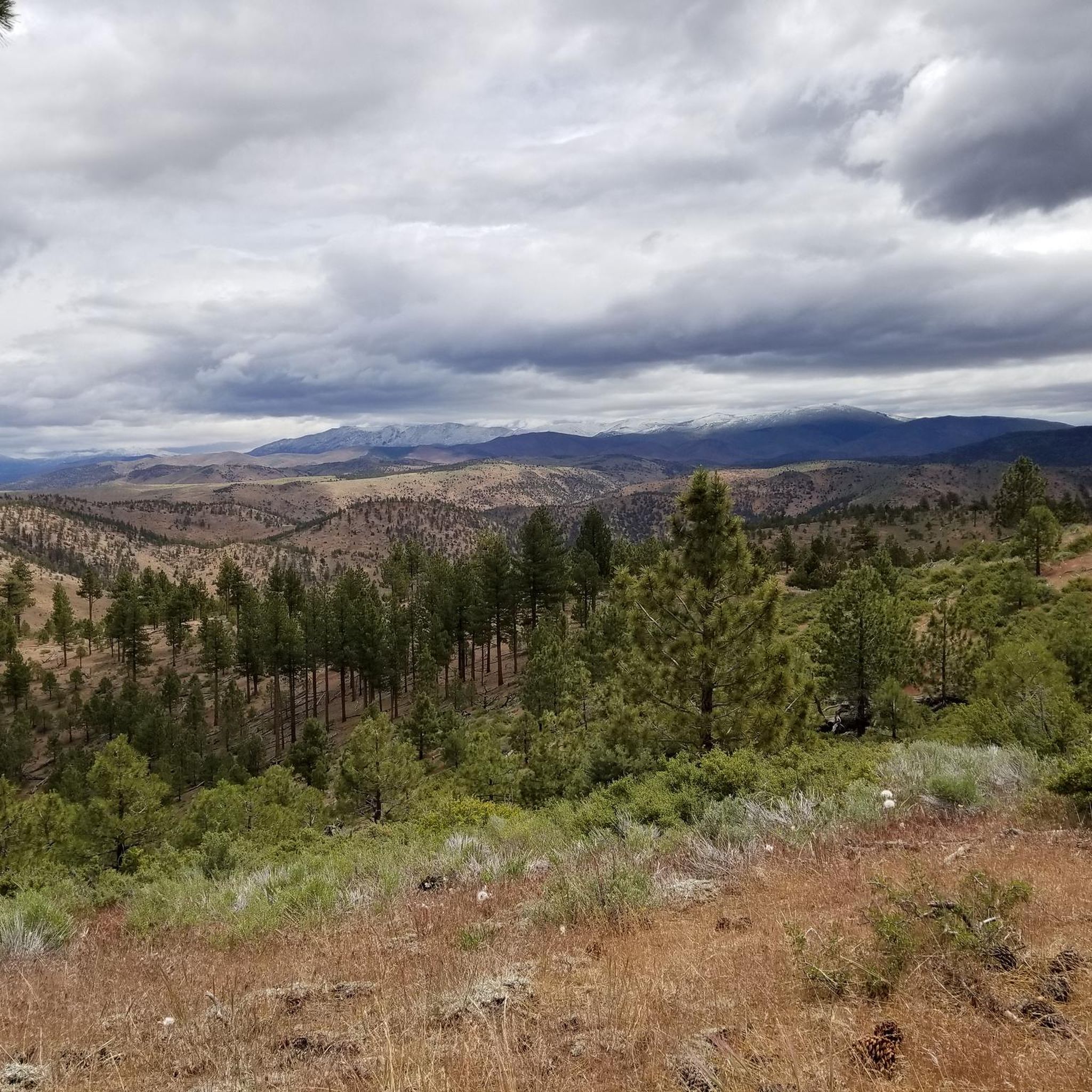
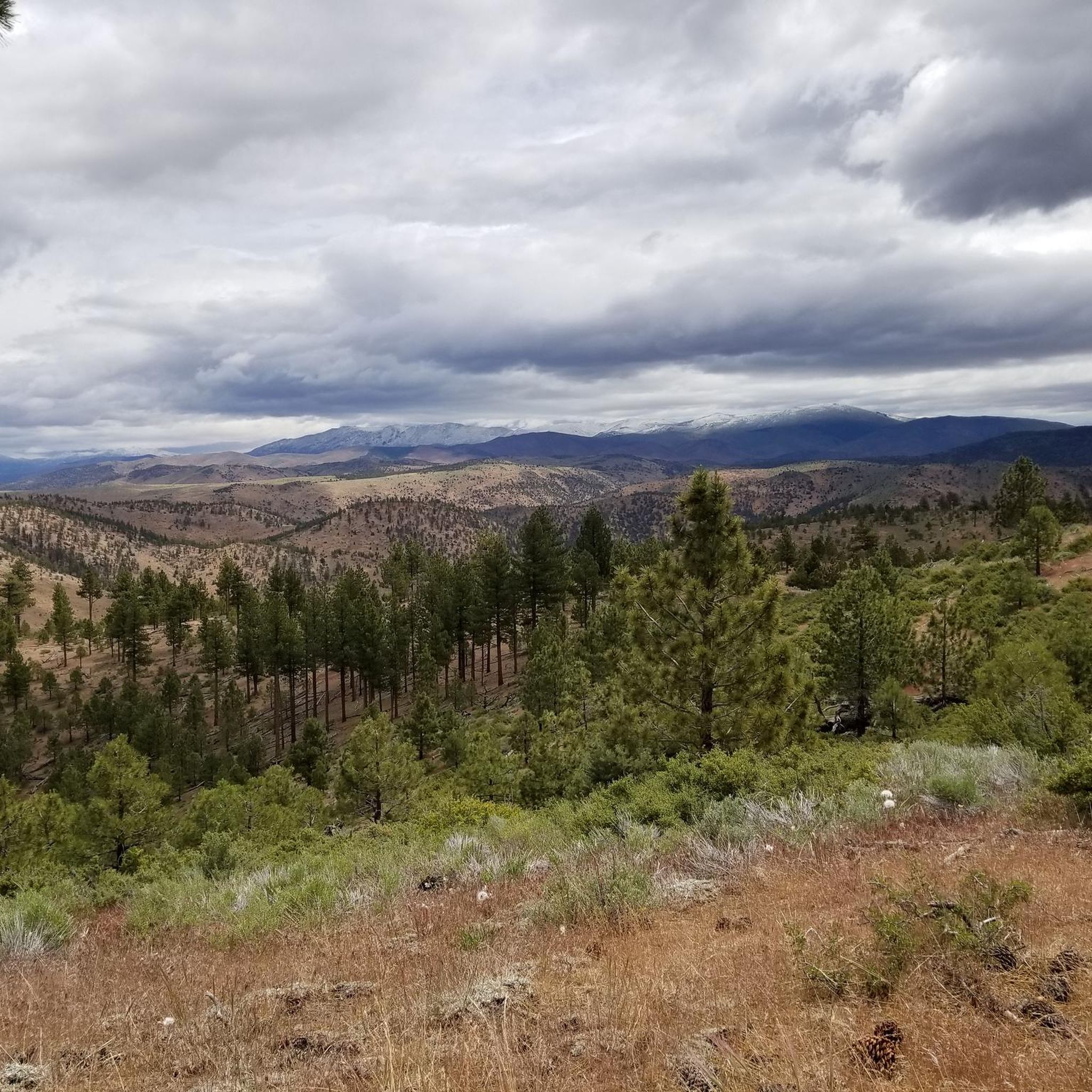
It's quite a grind to get up here, at an elevation of 8,736 feet or 2,663 m, but sometimes you just have to play road biker for the views.
0
0

CA-89 takes you over the West Fork Carson river as you ride across the heart of this absolutely stunning valley.
0
0

Cycling along Emigrant Trail Road next to Mesa Vista reveals stunning mountain vistas. The majestic peaks, including the Sierra Nevada Range, stand as a breathtaking backdrop. Riders are treated to the grandeur of the landscape, offering a scenic journey through the rugged beauty of the surrounding mountains.
0
0
Cycling past Curtz Lake on Airport Rd offers a picturesque view, with the lake reflecting the surrounding landscape. The appeal to stop for a break lies in the tranquility of the setting, inviting cyclists to relax by the water, enjoy the scenery, and take a peaceful pause during their journey.
0
0

Monitor Pass stands at 8,314 feet (2,534 meters) high in California's Sierra Nevada on State Route 89. This pass is an excellent challenge for cyclists with amazing panoramic views of the area, but be aware that it is only open during the warmer months (the dates of closure vary, but it's generally closed between late November and early April).
0
0

At 8,700 feet, Ebbetts Pass is a spectacular high mountain pass that is the fulcrum point between two state parks namely Calaveras Big Trees and Grover Hot Springs. It is also a cross over point for the Pacific Crest Trail. It sits just below imposing Ebbetts Peak at 9,160 feet which is just a short easy hike away.
0
0

Where the casinos stop California begins. The cities of Stateline & South Lake Tahoe make up the largest population center around Lake Tahoe and hence, the busiest area for traffic and tourists. If you need anything for your ride this is a good place to get it, as any direction you head from here won't be as well stocked with amenities until you reach the North Shore of the lake.
1
0
Frequently Asked Questions
What types of road cycling routes can I expect in Mesa Vista?
Mesa Vista offers a diverse landscape for road cycling, characterized by significant elevation changes and scenic routes through mountainous terrain. You'll find challenging climbs over mountain passes, loops around natural features like lakes, and trails with varied gradients, providing expansive views across the area's natural environment.
Are there road cycling routes suitable for beginners in Mesa Vista?
While Mesa Vista is known for its challenging mountain passes, there are options for various ability levels. Out of the 14 available road cycling routes, 3 are classified as easy, offering a gentler introduction to the region's scenic beauty.
What are the typical distances and durations for road cycling routes in Mesa Vista?
Road cycling routes in Mesa Vista vary in length and duration. For example, the Ebbets Pass – Ebbetts Pass loop from Turtle Rock Park Tennis Courts is 41.2 miles (66.4 km) and typically takes about 3 hours 33 minutes. Longer routes, such as the Monitor Pass Climb loop from Markleeville Guard Station, span 61.8 miles (99.6 km) and can take around 5 hours 42 minutes to complete.
Where can I find parking for road cycling routes in Mesa Vista?
Many road cycling routes in Mesa Vista start from established locations that often provide parking. Look for starting points like Markleeville Guard Station, Alpine Village, Turtle Rock Park Tennis Courts, Fay-Luther Trail Head, or Curtz Lake Trailhead, which are common access points for cyclists.
Are there family-friendly road cycling routes in Mesa Vista?
Given the region's characteristic significant elevation changes and challenging mountain passes, most road cycling routes in Mesa Vista are geared towards moderate to difficult skill levels. However, there are 3 easy routes available that might be more suitable for families or those seeking a less strenuous ride.
What are some less crowded road cycling paths in Mesa Vista?
While specific crowd levels can vary, exploring routes that are not the most popular can offer a quieter experience. Consider routes like the Emigrant Trail mountain views loop from Fay-Luther Trail Head, which offers moderate difficulty and scenic views, potentially providing a more serene ride away from the busiest trails.
What can I see along the road cycling routes in Mesa Vista?
Mesa Vista's road cycling routes offer access to stunning natural attractions. You might encounter beautiful lakes like Star Lake, or enjoy expansive vistas from viewpoints such as the Lake Tahoe Overlook. The region also features unique natural monuments like the Carson River Hot Springs ♨.
Are there any circular road cycling routes in Mesa Vista?
Yes, many of the road cycling routes in Mesa Vista are designed as loops, allowing you to start and end at the same point. Examples include the Stateline-South Lake Tahoe loop from Alpine Village and the Curtz Lake loop from Curtz Lake Trailhead, which offer extensive views and challenging terrain.
What do other road cyclists enjoy the most about road cycling in Mesa Vista?
The road cycling experience in Mesa Vista is highly rated by the komoot community, with an average score of 5.0 stars from over 6 reviews. Reviewers often praise the challenging mountain passes, scenic lake loops, and the significant elevation gains that define the region's diverse terrain.
What is the best time of year for road cycling in Mesa Vista?
Given the mountainous terrain and high passes, the best time for road cycling in Mesa Vista is typically from late spring through early autumn (roughly May to October). During these months, the weather is generally more favorable, and mountain passes are usually clear of snow, offering optimal conditions for challenging rides and scenic views.
Are there advanced road cycling routes for experienced riders in Mesa Vista?
Absolutely. Mesa Vista is well-suited for experienced road cyclists seeking a challenge. The region features 6 difficult routes, characterized by substantial climbing over mountain passes and significant elevation gains. These routes provide an exhilarating experience for advanced riders.
Are there any cafes or pubs along the road cycling routes in Mesa Vista?
While specific establishments vary by route, many starting points and towns along the more popular routes, such as Alpine Village or areas around South Lake Tahoe, often have amenities like cafes or pubs where cyclists can refuel and relax. It's always a good idea to check local listings for specific services along your chosen route.
Most popular routes around Mesa Vista
Most popular attractions around Mesa Vista

Get inspired with the komoot mobile app


Explore more
Browse the best Road cycling routes in other regions.
