The best road cycling routes around Markleeville
5.0
(2)
247
riders
10
rides
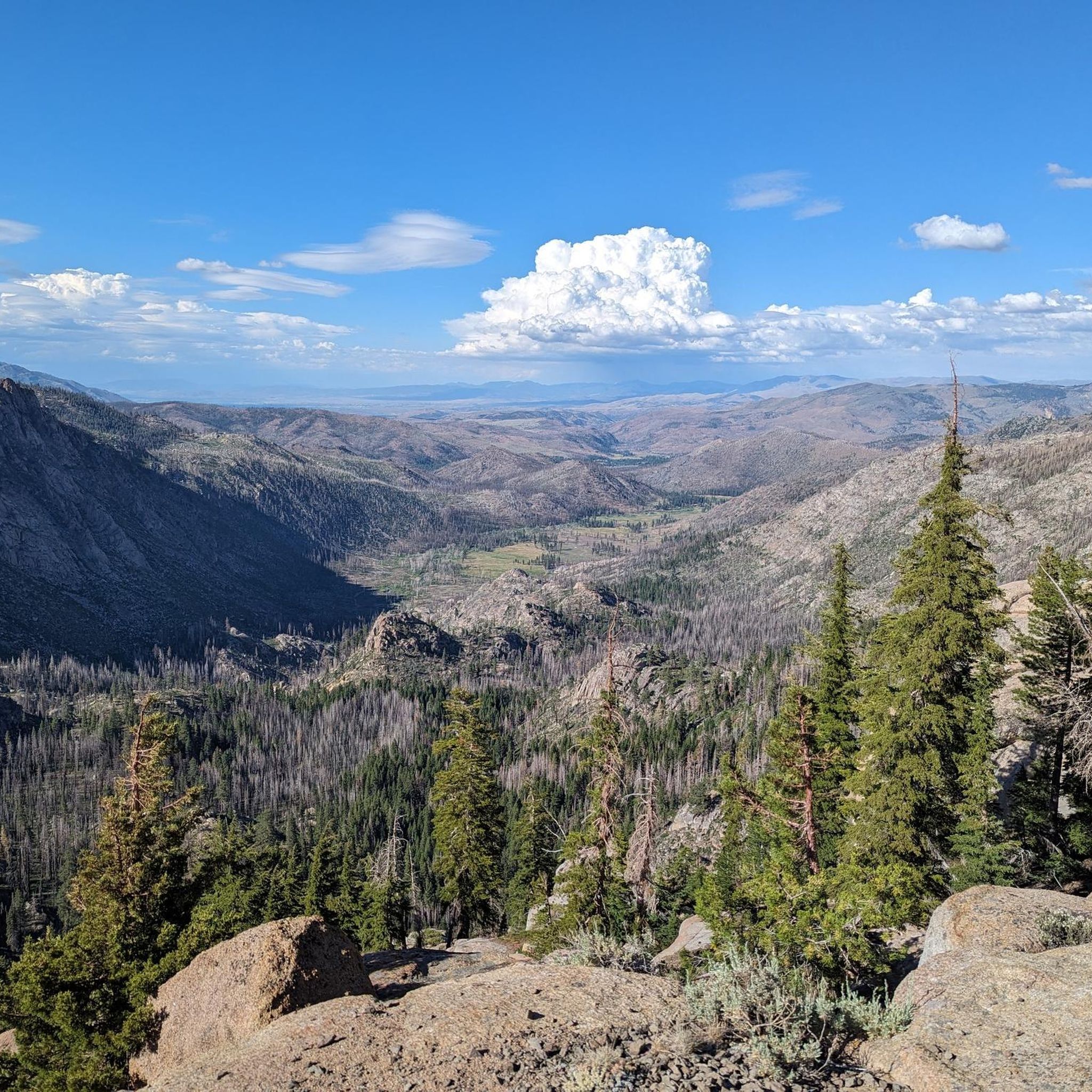
Road cycling routes around Markleeville are situated in the Sierra Nevada mountains, offering high-altitude adventures. The region is characterized by dramatic mountain passes and significant elevation gains, making it a destination for challenging road cycling. Cyclists encounter varied terrain, from rigorous climbs to rewarding descents, across well-paved roads. The landscape features towering pines and scenic vistas.
Best road cycling routes around Markleeville
- The most popular road cycling route is Monitor Pass Climb loop from Markleeville Guard Station, a 61.9 miles (99.6 km) trail that takes 5 hours 42 minutes to complete. This route features substantial elevation gains through mountain terrain.
- Another top favourite among local road cyclists is Stateline-South Lake Tahoe loop from Alpine Village, a difficult 53.9 miles (86.7 km) path. This route offers a demanding ride with significant climbing and scenic views.
- Local road cyclists also love the Ebbets Pass – Ebbetts Pass loop from Turtle Rock Park Tennis Courts, a 41.3 miles (66.4 km) trail leading through the iconic Ebbetts Pass, often completed in about 3 hours 33 minutes.
- Road cycling around Markleeville is defined by high mountain passes, significant elevation changes, and Sierra Nevada landscapes. The network offers options for different ability levels, from moderate climbs to very difficult ascents.
- The routes in Markleeville are highly rated by the komoot community with an average score of 5.0 stars from 4 reviews. More than 290 road cyclists have used komoot to explore Markleeville's varied terrain.
Last updated: October 11, 2026
72
riders
99.6km
05:43
2,360m
2,360m
Hard road ride. Very good fitness required. Mostly well-paved surfaces and easy to ride.
49
riders
86.8km
04:25
1,470m
1,470m
Hard road ride. Very good fitness required. Mostly well-paved surfaces and easy to ride.

5.0
(2)
38
riders
66.4km
03:34
1,290m
1,290m
Hard road ride. Very good fitness required. Mostly well-paved surfaces and easy to ride.
31
riders
54.3km
03:09
1,220m
1,220m
Hard road ride. Very good fitness required. Some segments of this route may be unpaved and difficult to ride.
9
riders
18.5km
00:58
210m
210m
Easy road ride. Great for any fitness level. Mostly well-paved surfaces and easy to ride.
Get access to more routes and recommendations from other explorers.
Already have an account?
Our route recommendations are based on thousands of hikes, rides, and runs completed by other people on komoot.
Start today with a free account
Your next adventure awaits.
Popular around Markleeville

Tips from the Community


It's quite a grind to get up here, at an elevation of 8,736 feet or 2,663 m, but sometimes you just have to play road biker for the views.
0
0

CA-89 takes you over the West Fork Carson river as you ride across the heart of this absolutely stunning valley.
0
0

Cycling past Curtz Lake on Airport Rd offers a picturesque view, with the lake reflecting the surrounding landscape. The appeal to stop for a break lies in the tranquility of the setting, inviting cyclists to relax by the water, enjoy the scenery, and take a peaceful pause during their journey.
0
0

Monitor Pass stands at 8,314 feet (2,534 meters) high in California's Sierra Nevada on State Route 89. This pass is an excellent challenge for cyclists with amazing panoramic views of the area, but be aware that it is only open during the warmer months (the dates of closure vary, but it's generally closed between late November and early April).
0
0

At 8,700 feet, Ebbetts Pass is a spectacular high mountain pass that is the fulcrum point between two state parks namely Calaveras Big Trees and Grover Hot Springs. It is also a cross over point for the Pacific Crest Trail. It sits just below imposing Ebbetts Peak at 9,160 feet which is just a short easy hike away.
0
0

Where the casinos stop California begins. The cities of Stateline & South Lake Tahoe make up the largest population center around Lake Tahoe and hence, the busiest area for traffic and tourists. If you need anything for your ride this is a good place to get it, as any direction you head from here won't be as well stocked with amenities until you reach the North Shore of the lake.
1
0

If you pull off Highway 4 at this spot you will be able to see and visit the historic Silver Mountain City stone jail ruins. Silver Mountain City was founded by Scandinavian miners in the late 1850s, today only the jail ruins remain.
0
0
Frequently Asked Questions
How many road cycling routes are available around Markleeville?
Markleeville offers a diverse selection of over 10 road cycling routes. These routes cater to various skill levels, including 1 easy, 4 moderate, and 6 difficult options, ensuring there's a ride for every cyclist.
What is the best time of year for road cycling in Markleeville?
The ideal time for road cycling in Markleeville is generally during the warmer months, from late spring through early autumn. Spring brings vibrant wildflower displays, while summer offers warm days perfect for high-altitude rides. Always check local weather and road conditions, especially for mountain passes, as they can be affected by snow well into late spring.
What kind of terrain can I expect on road cycling routes near Markleeville?
Road cycling around Markleeville is characterized by dramatic Sierra Nevada mountain landscapes, featuring significant elevation gains and challenging mountain passes like Monitor Pass and Ebbetts Pass. While roads are generally well-paved, some longer routes may include unpaved segments. Expect rigorous climbs, rewarding descents, and stunning scenic vistas throughout the region.
Are there challenging climbs for experienced road cyclists in Markleeville?
Absolutely. Markleeville is renowned for its demanding climbs, being a key part of the annual 'Death Ride' event. Routes like the Monitor Pass Climb loop from Markleeville Guard Station and the various Ebbetts Pass loops offer substantial elevation gains and are considered difficult, providing a true test for experienced riders.
Are there any easier or moderate road cycling routes in Markleeville?
Yes, while Markleeville is known for its challenging passes, there are also options for less strenuous rides. You can find moderate routes that offer a good workout without the extreme elevation of the major passes. For example, some shorter rides with gentler climbs can be found leading towards areas like Grover Hot Springs.
What natural attractions can I see while road cycling near Markleeville?
The region around Markleeville is rich in natural beauty. While cycling, you might pass by or be near attractions such as Grover Hot Springs State Park, the expansive Mokelumne Wilderness, or the scenic East Fork Carson River. The routes often provide breathtaking views of the Sierra Nevada mountains, towering pines, and dramatic peaks.
What do other road cyclists enjoy the most about road cycling in Markleeville?
The road cycling experience in Markleeville is highly rated by the komoot community, with an average score of 5.0 stars. Cyclists frequently praise the dramatic mountain passes, significant elevation changes, and the stunning Sierra Nevada landscapes. The challenging nature of routes like the Ebbetts Pass – Ebbetts Pass loop from Turtle Rock Park Tennis Courts is a particular draw for those seeking a rigorous and rewarding ride.
Are there loop routes available for road cycling around Markleeville?
Yes, many of the road cycling routes around Markleeville are designed as loops, allowing you to start and finish in the same location. Examples include the Monitor Pass Climb loop from Markleeville Guard Station and the Ebbetts Pass – Ebbetts Pass loop from Turtle Rock Park Tennis Courts, offering comprehensive tours of the area's scenic and challenging terrain.
Where can I find parking for road cycling routes in Markleeville?
Markleeville and its surrounding areas offer various parking options convenient for cyclists. For instance, routes like the Monitor Pass Climb loop can be accessed from the Markleeville Guard Station, and the Ebbetts Pass – Ebbetts Pass loop starts near Turtle Rock Park Tennis Courts, both of which typically have parking available for visitors.
Are there any cafes, pubs, or accommodation options in Markleeville that are cyclist-friendly?
Markleeville, as a hub for outdoor enthusiasts, offers various amenities. You'll find local cafes and restaurants where you can refuel, and several lodging options cater to visitors. It's advisable to check with specific establishments for cyclist-specific services or amenities, especially during peak cycling season.
Can I bring my dog on road cycling routes in Markleeville?
While many outdoor areas in the Sierra Nevada are dog-friendly, specific regulations can vary for paved roads and state parks. It's always best to check the rules for individual routes or attractions, such as Grover Hot Springs State Park, regarding pets. Generally, dogs should be kept on a leash and their waste properly disposed of.
Are there any road closures that might affect cycling in Markleeville?
Mountain passes in the Markleeville area, such as Monitor Pass and Ebbetts Pass, are subject to seasonal closures due to snow, typically from late autumn through late spring. It is crucial to check current road conditions and closures before planning your ride, especially outside of summer months. For official updates, you can refer to resources like Caltrans District 10 news, which often provides information relevant to the 'Death Ride' area.
Most popular routes around Markleeville
Most popular attractions around Markleeville

Get inspired with the komoot mobile app


Explore more
Browse the best Road cycling routes in other regions.
