The best road cycling routes around Los Alamos
5.0
(2)
411
riders
14
rides
Road cycling around Los Alamos is characterized by its high-altitude setting on the Pajarito Plateau, offering diverse volcanic landscapes. The region features mesa top 'fingers' separated by rugged canyons, providing significant elevation changes and panoramic views. Nestled within the Jemez Mountains, the area includes extensive scenic roads and access to the Valles Caldera National Preserve, presenting varied terrain for road cyclists.
Best road cycling routes around Los Alamos
- The most popular road cycling route is Drum Canyon Loop, a…
Last updated: July 1, 2026
81
riders
73.2km
03:41
870m
870m
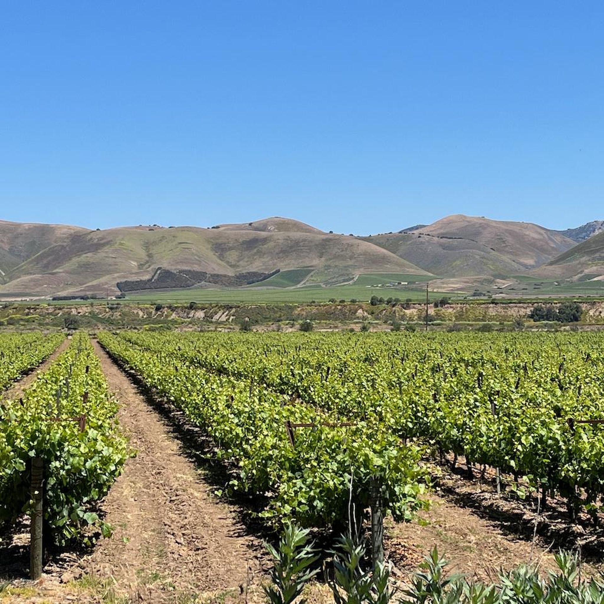
This moderate 45.5-mile road cycling loop through Foxen and Drum Canyons offers scenic wine country views near Solvang, California.
80
riders
79.9km
03:44
860m
860m
Moderate road ride. Good fitness required. Mostly well-paved surfaces and easy to ride.

Sign up for free
5.0
(1)
45
riders
94.7km
04:41
1,140m
1,140m
Hard road ride. Very good fitness required. Mostly well-paved surfaces and easy to ride.
42
riders
115km
05:16
1,140m
1,140m
Hard road ride. Very good fitness required. Mostly well-paved surfaces and easy to ride.
47
riders
82.4km
04:06
940m
940m
Hard road ride. Very good fitness required. Mostly well-paved surfaces and easy to ride.
Get access to more routes and recommendations from other explorers.
Sign up for free
Already have an account?
Our route recommendations are based on thousands of hikes, rides, and runs completed by other people on komoot.
Start today with a free account
Your next adventure awaits.
Login or Signup
Popular around Los Alamos
Tips from the Community

It would be nice to time it with a morning rocket launch! Check out space launch schedule (monkey) app for schedule at Vandenberg.
0
0

This winery is in a fantastic location with beautifully landscaped gardens, a lovely outdoor patio and a large grassy area where visitors are welcome to bring a picnic lunch and unwind beneath the trees. After a long ride, it’s an ideal spot to enjoy a relaxing wine-tasting session and enjoy the views.
0
0

We stop in Solvang and immediately feel like we are in Denmark, as the picturesque town is full of Danish culture, delicious cuisine and scenic scenery. Solvang, California (population 5,286) is nestled in the Santa Ynez Valley wine region on California's central coast. The town's name means "sunny fields" in Danish. Solvang was founded in 1911 when a group of Danish Americans bought 9,000 acres of the former Jonata Ranch. To preserve and promote Danish culture, the founders built Atterdag College in 1914 and Bethania Lutheran Church in 1928.
3
0
We stop in Solvang and immediately feel like we are in Denmark, as the picturesque town is full of Danish culture, delicious cuisine and scenic scenery. Solvang, California (population 5,286) is nestled in the Santa Ynez Valley wine region on California's central coast. The town's name means "sunny fields" in Danish. Solvang was founded in 1911 when a group of Danish Americans bought 9,000 acres of the former Jonata Ranch. To preserve and promote Danish culture, the founders built Atterdag College in 1914 and Bethania Lutheran Church in 1928.
3
0


Going north to south it starts with a short step climb (about 9~10% at times) and then has a long descent towards Los Olivos. At its northern end it intersects with the Foxen Canyon Rd going past some wineries towards Sisquoc, and the Zaca Station Rd that would take you back to CA154 and Los Olivos.
0
0
From the intersection of Foxen Canyon Rd and Zaca Station Rd the road does a steady climb up past Koehler Winery and Fess Parker Winery. The summit is shortly before reaching Zaca Mesa Winery. 6km long and 170m elevation (3.7mi and 570ft). Average is 3% with some sections 5~6%.
0
0

This is an awesome road to ride on! It's really peaceful, and you get to enjoy mountain and vineyard views while following the Santa Ynez river.
1
0
Frequently Asked Questions
What kind of terrain can I expect on road cycling routes around Los Alamos?
Road cycling around Los Alamos offers a unique high-altitude experience on the Pajarito Plateau. You'll encounter diverse volcanic landscapes, including mesa top 'fingers' separated by rugged canyons, leading to significant elevation changes and panoramic views. Routes often feature rolling hills, gentle climbs, and some challenging ascents through the Jemez Mountains.
Are there challenging road cycling routes in Los Alamos?
Yes, Los Alamos is known for its challenging high-altitude road cycling. Many routes feature substantial elevation gains. For example, the Alisos Canyon Loop is a difficult 71.3-mile trail with over 1,100 meters of elevation gain, and the Foxen Canyon Loop is another difficult option covering nearly 95 kilometers with similar elevation. The region offers 7 difficult routes out of 13 total road cycling tours.
What are some scenic viewpoints or natural features to look out for while road cycling?
Los Alamos offers stunning views of the Jemez Mountains, the Pajarito Plateau, and dramatic canyons. Key scenic overlooks like Anderson Overlook and Overlook Park in White Rock provide expansive views of the Sangre de Cristos and Rio Grande Valley. The Drum Canyon Loop is known for its scenic vistas, and the Jemez Mountains Trail National Scenic Byway, accessible from Los Alamos, offers highly picturesque road cycling opportunities.
Are there any family-friendly or easier paved road cycling options in Los Alamos?
While many routes offer elevation challenges, there are easier paved options suitable for families or those seeking a less strenuous ride. The Canyon Rim Loop is an easier, mostly paved option spanning 7.9 miles with moderate elevation gain. The Pueblo Canyon view – Acid Canyon Trail loop also features mostly paved surfaces and is suitable for all skill levels. These routes often provide beautiful canyon views without extreme difficulty.
What is the best time of year for road cycling in Los Alamos?
The best time for road cycling in Los Alamos is typically during the spring, summer, and fall months when the weather is mild and roads are clear. The high-altitude setting means cooler temperatures than lower elevations, making summer rides pleasant. Winter can bring snow and ice, impacting road conditions, especially on higher elevation routes.
What attractions can I visit near the road cycling routes?
Los Alamos is surrounded by significant attractions. You can explore Bandelier National Monument, which protects ancient cliff dwellings and pueblo remnants in Frijoles Canyon, or visit Tsankawi for volcanic tuff formations. The Los Alamos Nature Center offers insights into local flora and fauna, and Ashley Pond Park in downtown Los Alamos is a historic community space. These sites provide excellent opportunities to combine cycling with cultural and natural exploration.
How long are the road cycling routes around Los Alamos?
The road cycling routes around Los Alamos vary significantly in length. You can find shorter loops like the Canyon Rim Loop at 7.9 miles, or longer, more challenging rides. For instance, the Alisos Canyon Loop is 71.3 miles (114.8 km), while the Drum Canyon Loop is 49.7 miles (79.9 km). The guide features routes ranging from moderate to difficult, offering options for various endurance levels.
Are there any loop trails for road cycling in Los Alamos?
Yes, many of the road cycling routes in Los Alamos are designed as loops, allowing you to start and end at the same point. Popular loop options include the Drum Canyon Loop, the Foxen Canyon & Drum Canyon Road loop, and the Alisos Canyon Loop. The region also features the South Mesa Loop and the Canyon Rim Loop, providing diverse loop experiences.
What is the general difficulty level of road cycling in Los Alamos?
Road cycling in Los Alamos generally ranges from moderate to difficult, largely due to the high-altitude setting and the region's volcanic topography. Out of the 13 road cycling tours in this guide, 6 are rated as moderate and 7 as difficult. While there are some easier paved options, many routes involve significant elevation changes and challenging climbs.
Can I find cafes or accommodation near the road cycling routes in Los Alamos?
Los Alamos has a town center with various amenities, including cafes, restaurants, and accommodation options. Many routes are accessible from or pass near the town, making it convenient to find places to refuel or stay overnight. Ashley Pond Park, a central community space, is also located downtown and can serve as a good starting point for rides with nearby services.
What makes road cycling in Los Alamos unique compared to other regions?
The uniqueness of road cycling in Los Alamos stems from its high-altitude setting at 7,400 feet on the Pajarito Plateau. This provides a distinct challenge and offers breathtaking views of volcanic landscapes, deep canyons, and the Jemez Mountains. The combination of challenging climbs, scenic byways, and access to natural wonders like the Valles Caldera National Preserve creates an unparalleled cycling experience.
Are there permits required for road cycling on trails or roads in Los Alamos?
Generally, permits are not required for road cycling on public roads in Los Alamos. However, if your route takes you into specific areas like Bandelier National Monument or Valles Caldera National Preserve, standard entrance fees or passes may apply for vehicle access or certain activities. It's always advisable to check the specific regulations for any national parks or preserves you plan to enter. For general outdoor access information, you can consult the National Park Service's Los Alamos Outdoors page.
Most popular routes around Los Alamos

Get inspired with the komoot mobile app


Explore more
Browse the best Road cycling routes in other regions.
