The best road cycling routes around Leona Valley
74
riders
9
rides
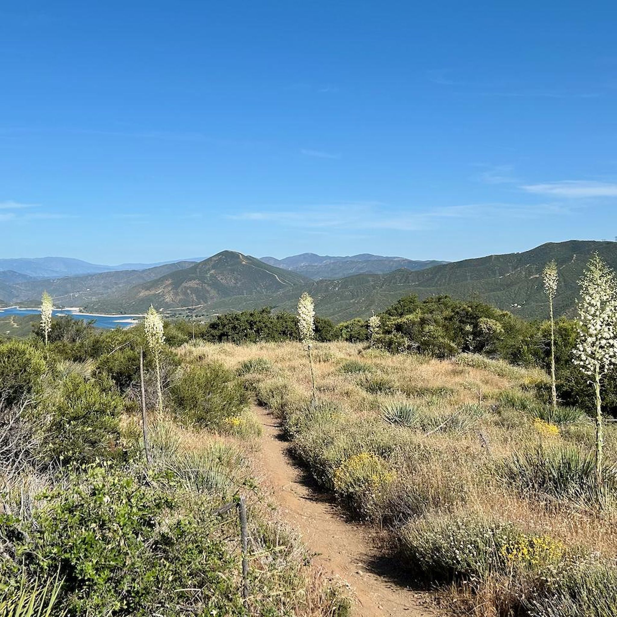
Road cycling routes around Leona Valley are situated in northeastern Los Angeles County, California, within the Sierra Pelona Mountains and adjacent to the Angeles National Forest. The region features varied topography, with elevations ranging between 2,932 and 3,800 feet, surrounded by higher hills and mountains. This landscape provides a diverse backdrop for road cyclists, characterized by rolling hills and winding roads through canyons. Many routes offer well-paved surfaces suitable for road cycling.
Best road cycling routes around Leona Valley
- The…
Last updated: July 13, 2026
21
riders
118km
05:32
1,450m
1,450m
Hard road ride. Very good fitness required. Mostly well-paved surfaces and easy to ride.
19
riders
96.1km
04:40
1,330m
1,330m
Hard road ride. Very good fitness required. Mostly well-paved surfaces and easy to ride.

Sign up for free
10
riders
75.1km
03:10
430m
430m
Moderate road ride. Good fitness required. Mostly well-paved surfaces and easy to ride.
5
riders
70.0km
03:45
1,300m
1,300m
Hard road ride. Very good fitness required. Mostly well-paved surfaces and easy to ride.
7
riders
68.8km
04:55
630m
630m
Moderate road ride. Good fitness required. Some segments of this route may be unpaved and difficult to ride.
Get access to more routes and recommendations from other explorers.
Sign up for free
Already have an account?
Our route recommendations are based on thousands of hikes, rides, and runs completed by other people on komoot.
Start today with a free account
Your next adventure awaits.
Login or Signup
Popular around Leona Valley

Tips from the Community

While only open on the weekends the Elyze Clifford Interpretive Center, is an excellent resource for those visiting the preserve. Named after a local environmentalist, this interpretive center has many hand on displays for kids and adults alike to learn about the local geology, biology, and human history of the area.
0
0
WIthin this 120-acre park you'll find three miles of well maintained trails, taking you through a microcosm of desert landscapes. Though small, this nature preserve is home a wide array of plants and animals that are well adapted to the desert climate. As you hike around the park keep your eyes open for jack rabbits, and cottontails darting between Juniper and Joshua Trees. Or find a lizard sunbathing on a rock or one of the many bird species that circle in the skies above. The city of Lancaster has an excellent video with a few of their Park Rangers walking and talking you through the park so you know what to expect: https://www.youtube.com/watch?v=LDSlaCE1pyo
0
0

From this spot just off of the San Francisquito Creek Trail in Santa Clarita, CA, you get fantastic open views down the valley across the grasslands and of the powerlines. This is a nice place to stop and sip some water or snap a photo before continuing on your ride.
0
0

The San Francisquito Creek Trail travels through various parks and across different bridges on the banks of the Santa Clara River and San Francisquito Creek. The path is completely paved and goes on both sides of the creek, giving you the chance to run or cycle a loop depending on what trailhead you start at.
0
0

At about 84 miles long, the Santa Clara River is the largest natural river system in southern California remaining in a relatively undeveloped state. Along its length there is the 8 mile long Santa Clara River Trail, which is a paved bicycle and walking path in the city of Santa Clarita.
0
0
Central Park is often considered Santa Clarita's “crown jewel.” There is a 5k cross country running trail that is also open to bikers, dogs, and walkers when there aren't meets being held. There are also gardens and sporting fields at the main upper entrance of the park.
0
0
The San Francisquito Creek Trail travels through various parks and across different bridges on the banks of the Santa Clara River and San Francisquito Creek. The path is completely paved and goes on both sides of the creek, giving you the chance to run a loop depending on what trailhead you start at.
0
0

The Iron Horse Bridge is an old railway bridge that has now been turning into a pedestrian bridge. It is part of the South Fork River Trail and takes users over the Santa Clara River.
1
0
Frequently Asked Questions
What kind of terrain can I expect when road cycling in Leona Valley?
Leona Valley offers a diverse landscape for road cyclists, characterized by its position within the Sierra Pelona Mountains and adjacent to the Angeles National Forest. You'll find varied topography, with elevations ranging from approximately 2,932 to 3,800 feet, surrounded by higher hills. This means routes can include rolling hills, winding roads through canyons, and opportunities for significant climbs. Many of the popular routes feature well-paved surfaces, ensuring a smooth road cycling experience.
Are there road cycling routes suitable for different fitness levels in Leona Valley?
Yes, Leona Valley's varied terrain accommodates a range of fitness levels. While some routes offer moderate rides with elevation gains suitable for many cyclists, others present challenging climbs with substantial elevation gains, requiring very good fitness. For example, the West Lancaster Boulevard – Lake Elizabeth loop from Lancaster is a moderate option, whereas routes like the Iron Horse Bridge – Santa Clara River loop from Santa Clarita involve significant elevation changes.
What are some notable scenic roads for cycling in the Leona Valley area?
Several roads in the Leona Valley area are highly regarded for their scenic beauty and cycling opportunities. San Francisquito Canyon Road is a popular choice, known for its historical significance and challenging loops with considerable elevation gain. Bouquet Canyon Road also offers a picturesque ride, and the area around Lake Elizabeth provides a scenic loop with mostly well-paved surfaces.
Are there any interesting landmarks or natural features to see along the road cycling routes?
Yes, the Leona Valley area, situated near the San Andreas Fault, offers unique geological features and natural beauty. While cycling, you might encounter various trailheads and natural points of interest. For instance, you can find the Lake Hughes Rd - PCT Trailhead & water cache or the Pacific Crest Trail Trailhead – San Francisquito Canyon Road, which are popular spots for hikers and offer scenic views.
What is the typical distance and elevation gain for road cycling routes in Leona Valley?
Road cycling routes in Leona Valley vary significantly in distance and elevation. You can find routes ranging from around 40 miles (65 km) to over 70 miles (117 km). Elevation gains can also differ greatly, from moderate climbs of a few hundred meters, such as the West Lancaster Boulevard – Lake Elizabeth loop from Lancaster with about 426 meters of ascent, to challenging routes like the Iron Horse Bridge – Santa Clara River loop from Santa Clarita, which features over 1450 meters of elevation gain.
Are there any loop routes for road cycling in Leona Valley?
Yes, Leona Valley offers several excellent loop routes for road cyclists. Popular options include the Iron Horse Bridge – Santa Clara River loop from Santa Clarita, the San Francisquito Canyon Road – Spunky Canyon loop from Santa Clarita, and the West Lancaster Boulevard – Lake Elizabeth loop from Lancaster. These loops provide diverse scenery and varying levels of challenge.
What do other road cyclists say about cycling in Leona Valley?
The road cycling routes around Leona Valley are well-regarded by the komoot community, with over 80 road cyclists having explored the area. Cyclists often praise the region's varied terrain, the challenge of its climbs, and the well-paved surfaces that make for an enjoyable ride through the scenic canyons and mountainous surroundings.
Can I find family-friendly road cycling options in Leona Valley?
While many routes in Leona Valley involve significant elevation changes, some sections or shorter loops might be more suitable for families or those seeking a less strenuous ride. The West Lancaster Boulevard – Lake Elizabeth loop from Lancaster is generally considered a moderate route with mostly well-paved surfaces, which could be a good starting point for families looking for a scenic ride without extreme climbs.
Are there any specific roads known for challenging climbs in Leona Valley?
For cyclists seeking a challenge, roads like San Francisquito Canyon Road and Spunky Canyon Road are known for their substantial climbs and demanding terrain. Routes incorporating these roads, such as the San Francisquito Canyon Road – Spunky Canyon loop from Santa Clarita, can feature over 1300 meters of elevation gain, providing a rigorous workout.
What is the general surface quality of road cycling routes in Leona Valley?
Many of the popular road cycling routes in the Leona Valley area are described as having mostly well-paved surfaces. This ensures a relatively smooth and comfortable experience for road cyclists, allowing for good speeds and enjoyable rides through the scenic landscape.
Are there any specific points of interest related to the Pacific Crest Trail near Leona Valley cycling routes?
Yes, the Leona Valley area is close to several access points for the Pacific Crest Trail (PCT). Cyclists might pass by or start near trailheads such as the Pacific Crest Trail Trailhead – San Francisquito Canyon Road or the PCT Trailhead at Bouquet Canyon Rd. These spots offer a glimpse into the famous long-distance hiking trail and can be interesting stops during a ride.
How many road cycling routes are available in the Leona Valley area?
There are approximately 9 road cycling routes available for exploration in the Leona Valley area. These routes offer a mix of moderate and difficult challenges, catering to various cycling preferences and fitness levels.
Most popular routes around Leona Valley
Most popular attractions around Leona Valley

Get inspired with the komoot mobile app


Explore more
Browse the best Road cycling routes in other regions.
