The best walks and hikes around Kings Beach
4.8
(64)
1,370
hikers
92
hikes
Hikes around Kings Beach explore the north shore of Lake Tahoe, offering access to the forests and granite outcrops of the Sierra Nevada. The area's trails are characterized by ascents through Jeffrey pine forests to viewpoints overlooking the lake. Many routes provide direct access to segments of the Tahoe Rim Trail, which circumnavigates the entire lake basin.
Best hiking trails around Kings Beach
- The most popular hiking route is Picnic Rock via Tahoe Rim Trail — Lake Tahoe Basin Management Unit, a 2.9 mile (4.6 km) trail that takes about 1 hour 30 minutes to complete. This route climbs to a granite outcrop with panoramic views of Lake Tahoe.
- Another top favourite among local hiking enthusiasts is Mount Baldy via Tahoe Rim Trail — Lake Tahoe Basin Management Unit, a moderate 6.5 mile (10.5 km) path. The trail follows a section of the Tahoe Rim Trail to a summit with 360-degree views of the lake and surrounding mountains.
- Local hiking enthusiasts also love the North Tahoe Regional Park loop — Tahoe Vista, a 1.9 mile (3.0 km) trail leading through forested terrain, often completed in about 55 minutes.
- Hiking around Kings Beach is defined by forested trails, granite rock formations, and scenic view hikes with expansive lake vistas. The trail network provides options for various ability levels, from short park loops to more demanding ascents.
- The routes in Kings Beach are highly rated by the komoot community with an average score of 4.8 stars from more than 30 reviews. More than 900 hikers have used komoot to explore Kings Beach's varied terrain.
Last updated: October 10, 2026
5.0
(2)
18
hikers
2.45km
00:48
210m
0m
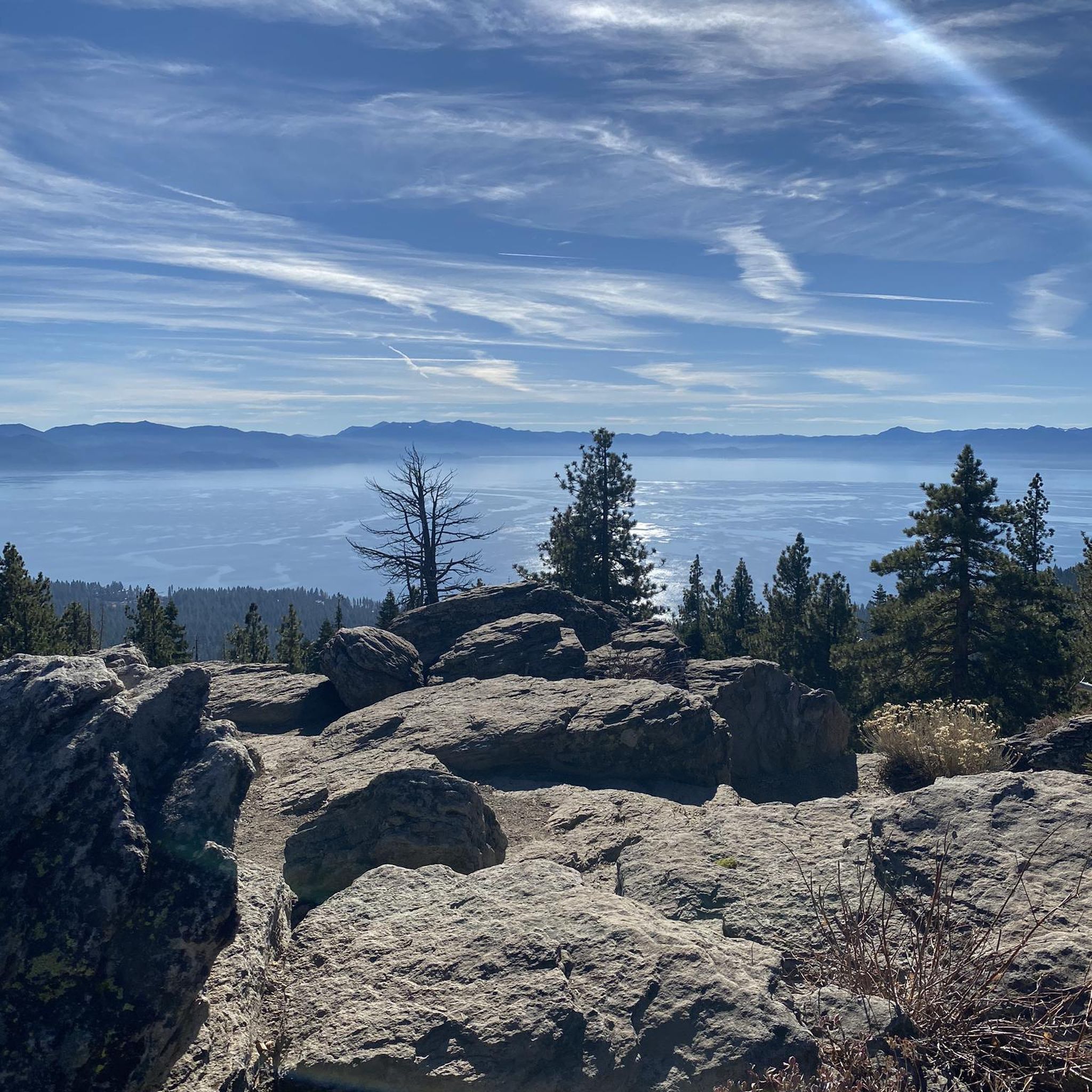
Embark on an easy hike along the Tahoe Rim Trail to Picnic Rock Viewpoint, a route that covers 1.5 miles (2.4 km) with a steady ascent. You will gain 686 feet (209 metres) in elevation, a journey that typically takes around 48 minutes to complete. As you make your way up, you'll pass through dense forests filled with mixed pines and unique granite formations, gradually leaving the sounds of the road behind for a peaceful natural setting. The highlight is reaching Picnic Rock, a prominent outcropping that offers expansive 360-degree panoramic views of Lake Tahoe, Kings Beach, and the surrounding Sierra Nevada mountains. It's an ideal spot to take a break and soak in the vast scenery. This trail is a rewarding short hike for anyone looking to experience the beauty of the region without a strenuous effort. You can enjoy the trail year-round, but be mindful that conditions can become quite slippery during winter months or after heavy rainfall. Parking is conveniently available at the Brockway Summit trailhead, making access straightforward for your visit. The route is both family-friendly and welcoming to dogs, provided they remain on a leash. This particular section of the Tahoe Rim Trail is renowned for its accessible yet spectacular views, making it a popular choice for visitors to the Lake Tahoe Basin. The unique geology of the granite outcropping at Picnic Rock provides a natural vantage point that truly sets this trail apart from others in the area. It offers a quick escape into nature with a grand payoff, showcasing the stunning natural environment of the Sierra Nevada.
14
hikers
7.59km
02:15
220m
270m
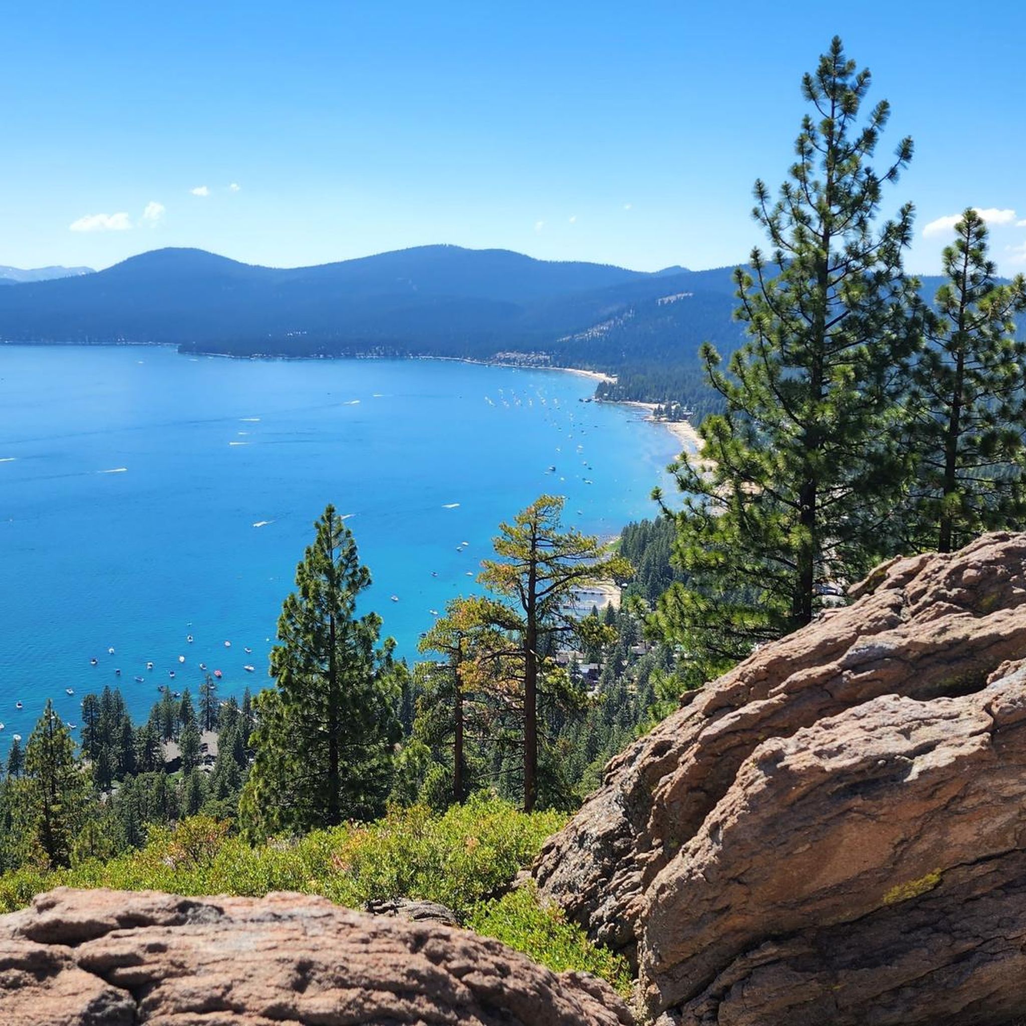
Embark on a moderate hike along the Beaver Tail Trail and Rise and Shine Loop, a 4.7-mile (7.6 km) journey that gains 707 feet (216 metres) in elevation. This route typically takes about 2 hours and 14 minutes to complete. You will wind through several small valleys, often hiking alongside a babbling creek, before ascending via stacked switchbacks that reveal progressively better views of the landscape.
Planning your visit is straightforward, as parking is generally available near the trailhead, providing convenient access to begin your adventure. This is a multi-use trail, so be prepared to share the path with mountain bikers and equestrians, ensuring a respectful and enjoyable experience for everyone.
What makes this loop unique is its combination of the Beaver Tail Trail's distinctive "flow trail" design with the Rise and Shine Loop's evolving vistas. This blend creates a dynamic hiking experience where the scenic progression is a significant highlight, offering new perspectives as you move through the varied terrain.

7
hikers
10.7km
03:13
430m
190m
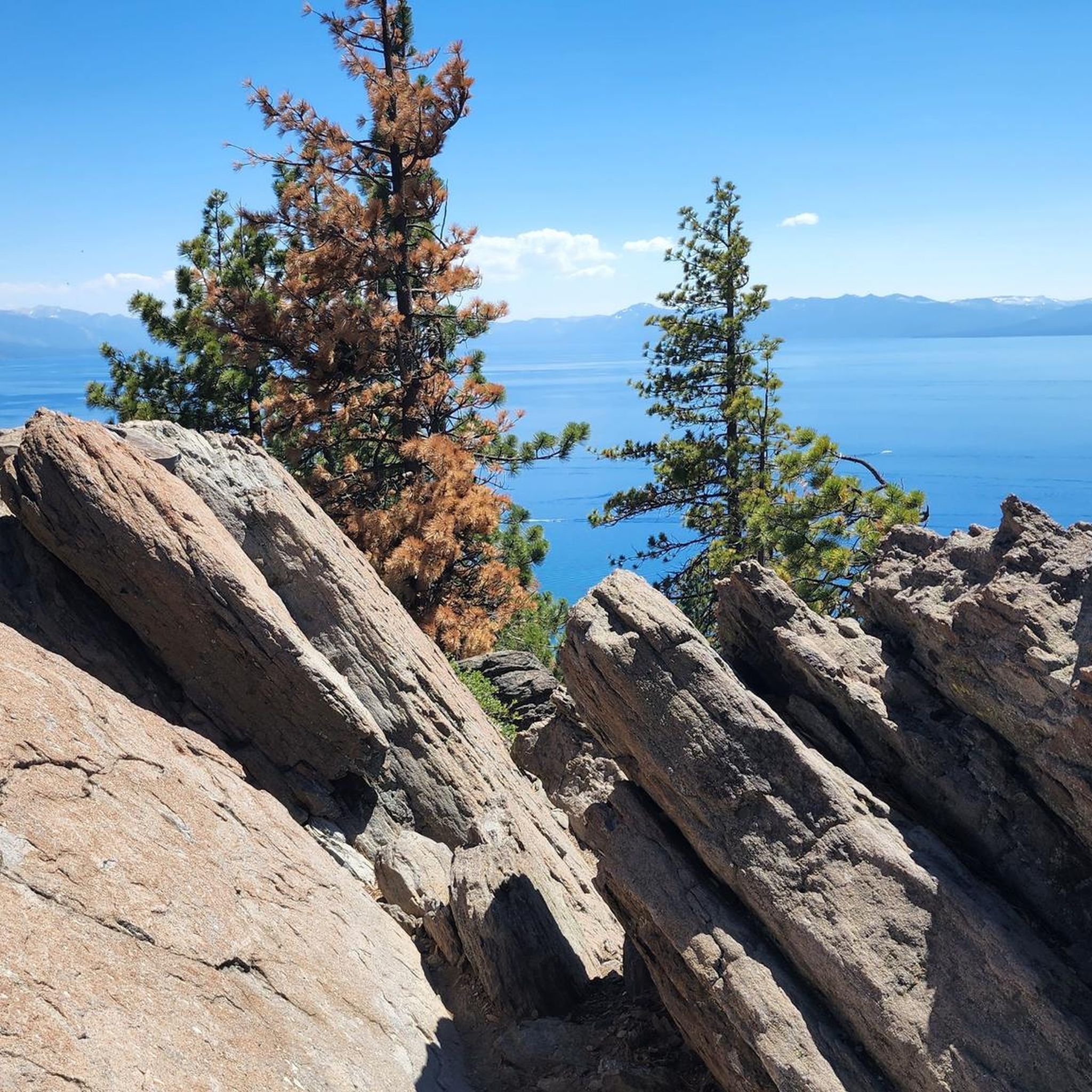
Embark on a moderate hike along the Tahoe Rim Trail, covering 6.6 miles (10.7 km) with a rewarding 1409 feet (429 metres) of elevation gain. This journey, typically taking around 3 hours and 12 minutes, leads you through a landscape of dense white fir and Jeffrey pine forests. You'll encounter rolling terrain and some rocky sections, offering a varied hiking experience. A highlight is a short spur trail that opens up to spectacular, unobstructed views of Lake Tahoe, especially Carnelian Bay, from a prominent rock pile.
When planning your visit, remember this section between Brockway Summit and Watson Lake is considered dry, so carry enough water for your entire hike. Watson Lake itself serves as the primary water source along the route. The trail is multi-use, shared with mountain bikers and equestrians, so be prepared to yield as needed. Parking is generally available at the Brockway Summit trailhead, making access straightforward.
This segment of the Tahoe Rim Trail offers more than just views; it immerses you in diverse natural settings. Beyond the pine forests, you will pass through open areas and wildflower meadows, which are particularly vibrant during spring and early summer. The route culminates at the marshy, secluded Watson Lake, providing a peaceful natural endpoint to your adventure.
4.0
(2)
6
hikers
1.71km
00:31
90m
20m
The Stateline Lookout trail offers a truly rewarding experience, guiding you through peaceful forests of Jeffrey and Ponderosa pines before opening up to breathtaking panoramic views of Lake Tahoe. This easy hiking route covers 1.1 miles (1.7 km) with a gentle 294 feet (90 metres) of elevation gain, making it a perfect quick outing for stunning scenery. You'll find yourself gazing across the shimmering blue waters of Lake Tahoe from the Stateline Overlook, a truly spectacular vantage point.
Planning your visit is straightforward, as the trail is known for being family-friendly and dog-friendly (leashed dogs are welcome). While parts of the trail are a well-maintained old forest road, some sections can be rocky, so sturdy shoes are a good idea. The route is accessible for most, but remember that winter can bring snow, so check conditions if you're planning a cold-weather hike. It's a great choice for a clear day to maximize those expansive views.
Beyond the incredible vistas, the Stateline Lookout holds historical significance as the site of a former California fire lookout, built in 1936. You can explore its base and learn about its past, as well as the natural history of the North Shore of Lake Tahoe through interpretive signs along the way. The trail also uniquely straddles the California-Nevada state line, adding a geographical curiosity to your hike.
4
hikers
19.2km
06:26
760m
600m
Hike the challenging Brockway Summit to Mount Baldy Loop for 11.9 miles of panoramic Lake Tahoe views and varied forest terrain.
Get access to more routes and recommendations from other explorers.
Already have an account?
Our route recommendations are based on thousands of hikes, rides, and runs completed by other people on komoot.
Start today with a free account
Your next adventure awaits.


Other adventures around Kings Beach

Tips from the Community

Lots of mosquitos during the summer, Good amount of shade and places to sit off the ground, however no water. There was some cellular service here though. (on AT&T)
0
0

One of many stunning views of the lake along the TRT (Tahoe Rim Trail).
0
0

Just south of Brockway Summit, a trailhead for the Tahoe Rim Trail and Picnic Rock.
0
0

As you round the corner, you'll get great views of Lake Tahoe from the north. It's the perfect spot to take a pause.
1
0
A great view of Lake Tahoe below along the Tahoe Rim Trail (TRT).
0
0

Great viewpoint above Crystal Bay with a number of plaques with info about Tahoe. It can get busy in the summer, but if you get here early you'll beat the crowds.
0
0

Great view of Lake Tahoe and the surrounding valley. The viewpoint is located down a short trail off the Tahoe Rim Trail.
1
0

From Picnic Rock, we have an incredible view of Lake Tahoe! It's a really nice spot, perfect for a short break.
0
0
Frequently Asked Questions
Are there many dog-friendly hiking trails near Kings Beach?
Yes, many trails in the Kings Beach area are welcoming to dogs, but it's always best to keep them on a leash and check local regulations. The trails around the North Tahoe Regional Park are a popular choice for dog walkers, offering a variety of paths through the forest.
What are some good family-friendly or easy hikes in the area?
For an easy and highly-regarded walk with great views, the trail to the Historic Stateline Fire Lookout is an excellent option. It's a relatively short, paved path that is manageable for most ages and offers incredible panoramic vistas of Lake Tahoe. The trail is a local favorite for a quick and rewarding outing.
Where can I find a hike with the best panoramic views of Lake Tahoe?
For a stunning perspective of the lake, the Panoramic view of Lake Tahoe loop from Kingswood is an excellent choice. This 7.6-mile (12.3 km) loop provides expansive views as it climbs through the hills above the north shore, making the effort well worth it.
How can I access the Tahoe Rim Trail from Kings Beach?
You can easily access a segment of the famous Tahoe Rim Trail from the Brockway Summit Tahoe Rim Trail Trailhead, just a short drive from Kings Beach. This trailhead is a popular starting point for both short out-and-back hikes and longer treks along the rim, offering beautiful forest scenery and lake views. Be sure to arrive early as parking can be limited.
What is the best time of year to hike around Kings Beach?
The prime hiking season is from late spring through fall, typically May to October, when the trails are free of snow. Summer offers warm, sunny weather perfect for enjoying the lake views. Spring is particularly beautiful, with wildflowers like mule ears often blooming on trails such as the one to Mount Baldy. Fall provides cooler temperatures and fewer crowds.
Are there any circular hiking routes available?
Yes, there are several great loop trails. For a moderately challenging circular hike, consider the Hiking loop from Kingswood. This 5.7-mile (9.2 km) route takes you through the forest above Kings Beach and brings you back to your starting point without needing to retrace your steps.
What should I know about the hike to Monkey Rock?
The hike to Monkey Rock is a popular short but steep climb that rewards you with unique views of the lake and the iconic rock formation. The trailhead is located in Incline Village, a short drive from Kings Beach. While the main trail is straightforward, there are several paths with sharp inclines, so be prepared for a quick workout on your way to the top.
How many hiking trails are there around Kings Beach?
There are over 60 designated hiking routes in the Kings Beach area, offering a wide range of options for all abilities. You can choose from 28 easy trails, 30 moderate routes, and 5 difficult hikes for those seeking a challenge.
What do other hikers enjoy about the trails in Kings Beach?
The area is highly rated by the komoot community, with an average score of 4.8 stars. Hikers frequently praise the stunning panoramic views of Lake Tahoe from trails like the Tahoe Rim Trail and the accessibility of trails that lead from forested paths to dramatic granite outcrops.
What kind of gear should I bring for a day hike in Lake Tahoe?
It's wise to hike prepared. Wear sturdy hiking shoes with good grip. The weather can change quickly, so dress in layers and bring a waterproof jacket. The sun is strong at this altitude, so sunscreen, a hat, and sunglasses are essential. Always carry plenty of water and some snacks.
Are there any hiking trails within Kings Beach State Recreation Area?
Kings Beach State Recreation Area is primarily known for its large sandy beach and water activities. While it's a great place for a leisurely stroll along the shoreline, it does not feature dedicated hiking trails. For structured hiking, nearby trailheads like those for the Tahoe Rim Trail or North Tahoe Regional Park are your best bet.
Most popular attractions around Kings Beach

Get inspired with the komoot mobile app


Explore more
Browse the best Hikes in other regions.
