The best road cycling routes around Descanso
5.0
(8)
278
riders
7
rides
Road cycling routes around Descanso are situated within the Central Mountain Subregion of San Diego County, offering diverse terrain for cyclists. The area features significant elevation gains, with routes often exceeding 1,000 feet and some reaching over 3,000 feet. This region is characterized by its mountainous landscape, including access to the Laguna Mountains and Cleveland National Forest, providing a challenging environment for road cyclists. Many routes are well-paved, though some may include unpaved segments.
Best road cycling routes around Descanso
- The most popular road cycling route is Skyline Truck Descent – Sweetwater River loop from Matkwatay, a 51.7 miles (83.2 km) trail that takes 4 hours 13 minutes to complete. This difficult route features substantial elevation gain through scenic mountain terrain.
- Another top favourite among local road cyclists is Pine Valley Park – Lake Cuyamaca loop from Alpine Heights, a difficult 81.7 miles (131.5 km) path. This challenging route includes significant climbs and offers views around Lake Cuyamaca.
- Local road cyclists also love the Lake Cuyamaca – Jess Martin Park loop from Alpine Heights, a 56.2 miles (90.4 km) trail leading through the Lake Cuyamaca area, often completed in about 4 hours 52 minutes.
- Road cycling around Descanso is defined by its mountainous terrain, access to Cuyamaca Rancho State Park, and the Cleveland National Forest. The network offers options for challenging rides with significant elevation changes.
- The routes in Descanso are highly rated by the komoot community with an average score of 4.9 stars from more than 5 reviews. More than 250 road cyclists have used komoot to explore Descanso's varied terrain.
Last updated: October 13, 2026
4.8
(5)
190
riders
83.2km
04:14
1,410m
1,410m
Hard road ride. Very good fitness required. Mostly well-paved surfaces and easy to ride.
5.0
(1)
41
riders
130km
06:52
2,290m
2,290m
Hard road ride. Very good fitness required. Mostly well-paved surfaces and easy to ride.

5.0
(1)
18
riders
90.8km
04:56
1,510m
1,510m
Hard road ride. Very good fitness required. Mostly well-paved surfaces and easy to ride.
13
riders
72.0km
03:53
1,390m
1,390m
Hard road ride. Very good fitness required. Mostly well-paved surfaces and easy to ride.
5.0
(1)
8
riders
66.1km
03:57
1,280m
1,280m
Hard road ride. Very good fitness required. Some segments of this route may be unpaved and difficult to ride.
Get access to more routes and recommendations from other explorers.
Already have an account?
Our route recommendations are based on thousands of hikes, rides, and runs completed by other people on komoot.
Start today with a free account
Your next adventure awaits.
Tips from the Community

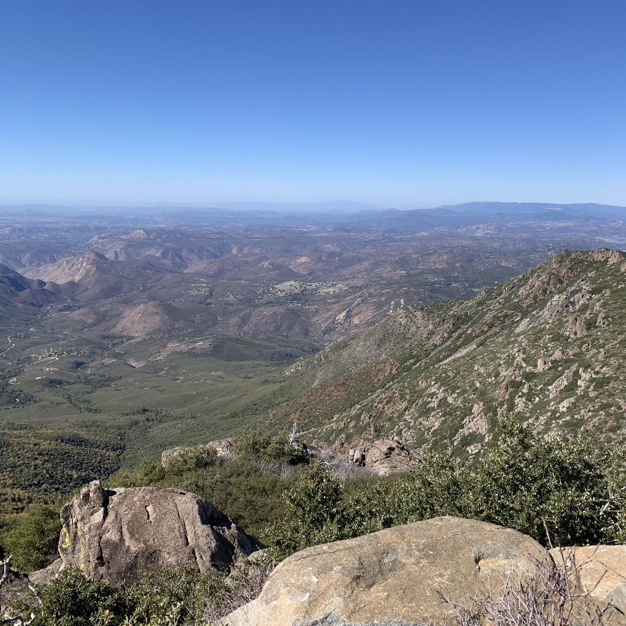
A quick and easy stop with big views for minimal effort. Inspiration Point sits right off Highway 79, just south of Julian. From the overlook, you get sweeping views over the desert below and the distant peaks beyond—especially dramatic in the late afternoon light.
0
0
One of the classic photo stops along Sunrise Highway. After the steady climb, this open viewpoint offers wide, unobstructed views over the rolling, vegetation-covered hills. A great place to take a break, refuel, and soak in how far you’ve come.
0
0

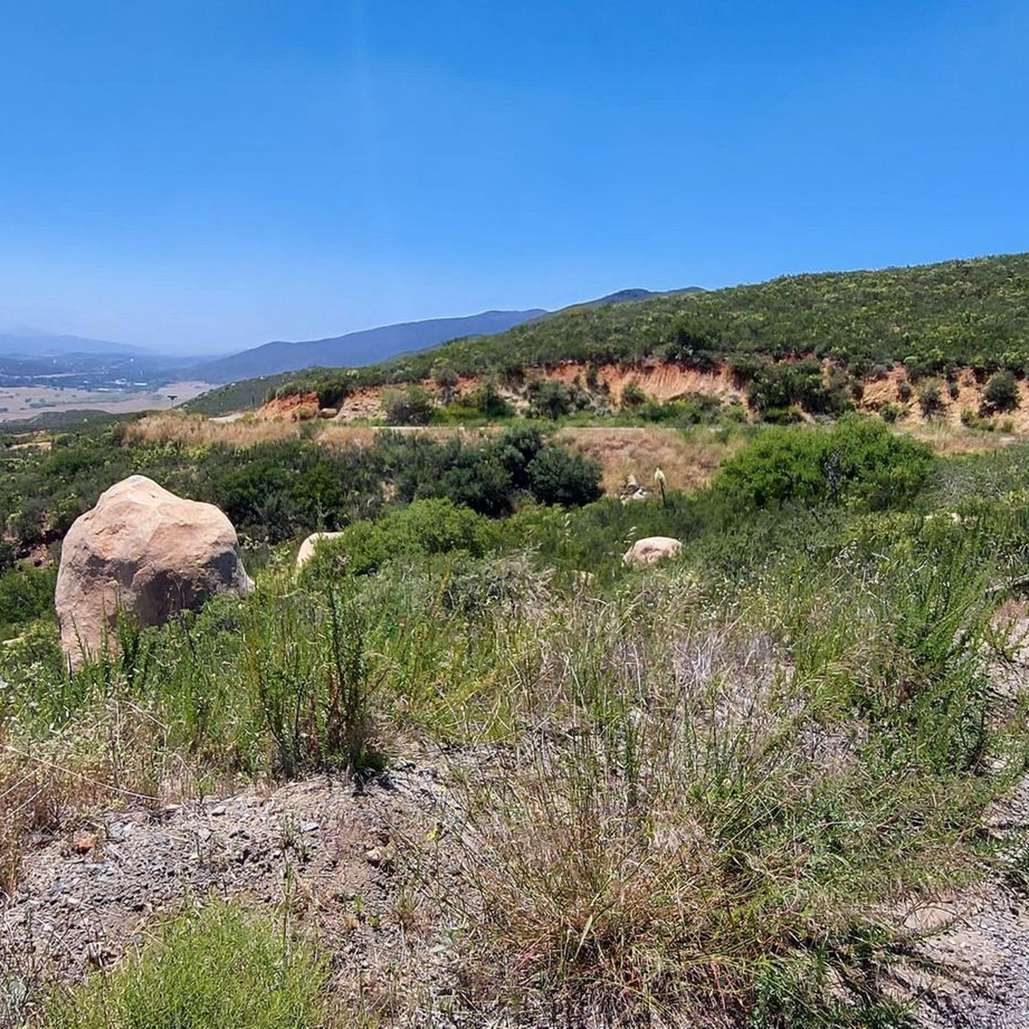
The Sweetwater River is a small year-round stream that flows 55 miles from the Cuyamaca Mountains to the San Diego Bay.
1
0

The Sweetwater River flows from Loveland Dam passing through Lake Emma, where the river bends west and runs parallel to Dehesa Road. The lake is fenced off and access is limited. At the western end of the lake is a golf club.
0
0
Laguna Summit is a prominent mountain pass along Sunrise Highway (State Route 79). As one of the highest points along this scenic route, it offers panoramic views of the surrounding landscapes, including the Anza-Borrego Desert to the east and the Pacific Ocean to the west.
0
0
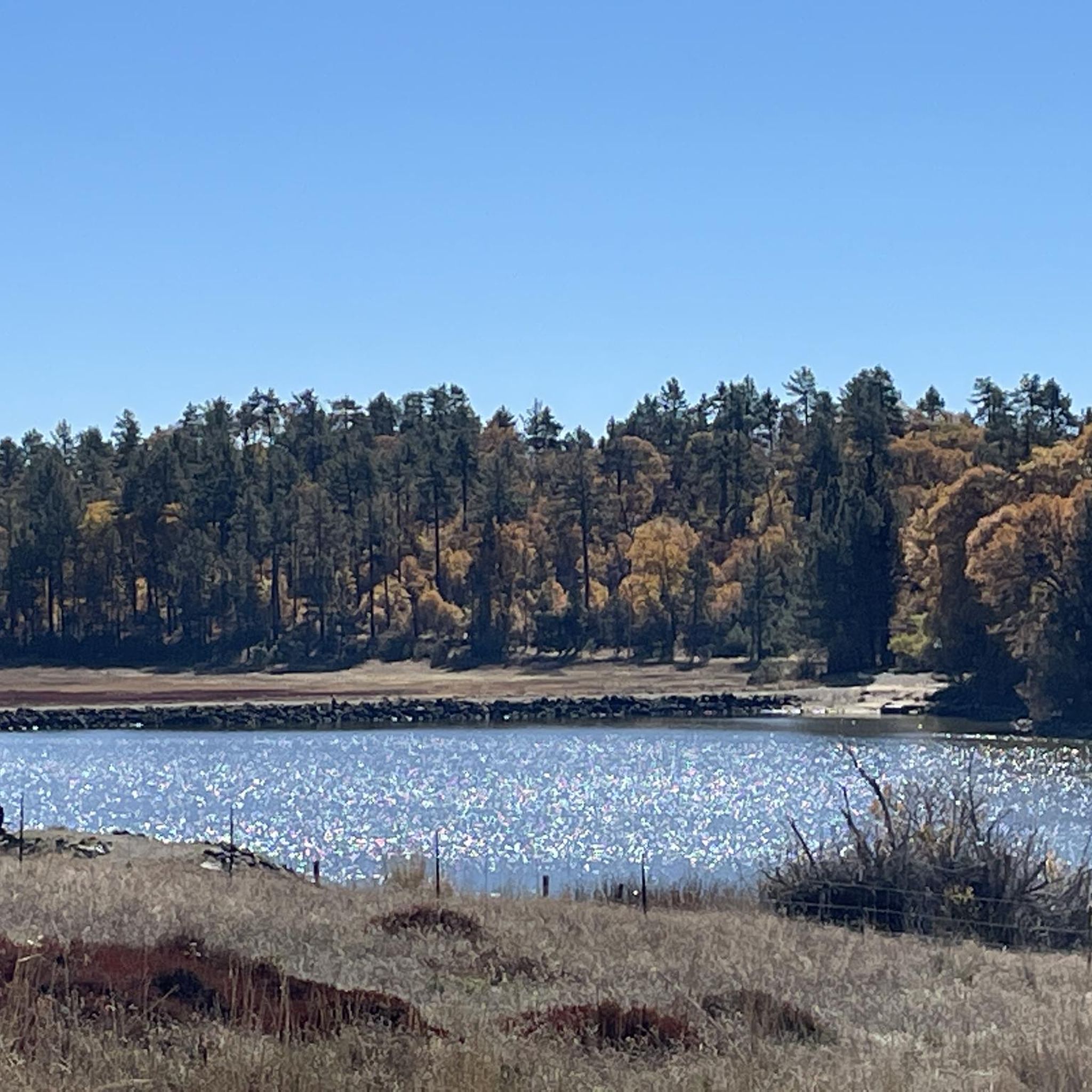
Lake Cuyamaca is a picturesque 110-acre reservoir nestled in the Cuyamaca Mountains. Created in the 1880s to supply water to the city of San Diego, it now serves as a recreational haven for fishing, boating, and picnicking.
0
0

This is a great first stop entering the Cleveland National Forest or Mount Laguna area. You can find helpful maps and information to plan your day hikes here. You can also buy an adventure pass here, which is handy since you need to display either a National Parks pass or an adventure pass to park at most of the trailheads in this area.
0
0

This is one of the three campsites available at Lake Cuyamaca. You can choose between RV or tent camping, and they provide electric and water hookups, as well as bathrooms and hot showers. Whether you're planning a day trip or an extended stay of up to two weeks, be sure to make a reservation if you plan to stay overnight. https://www.campspot.com/book/lakecuyamaca
0
0
Frequently Asked Questions
What kind of terrain can I expect on Descanso's road cycling routes?
Road cycling routes around Descanso are primarily characterized by mountainous terrain within the Central Mountain Subregion of San Diego County. While many routes are well-paved, some may include unpaved segments, offering a diverse and often challenging environment for cyclists. You'll find yourself amidst beautiful pine and oak forests, meadows, and streams, particularly around areas like Cuyamaca Rancho State Park and the Laguna Mountains.
Are the road cycling routes around Descanso challenging in terms of elevation?
Yes, road cycling in Descanso is known for significant elevation gains. Routes often exceed 1,000 feet, with some longer rides reaching over 3,000 feet. For example, the Pine Valley Park – Lake Cuyamaca loop from Alpine Heights features an impressive 2,294 meters of elevation gain, making it a challenging ride.
What scenic views and natural features can I expect to see while cycling in Descanso?
Descanso offers stunning natural beauty. Cyclists can enjoy panoramic views from Cuyamaca Peak, which overlooks Cuyamaca Rancho State Park and extends into Anza-Borrego Desert State Park. The routes often pass through picturesque pine and oak forests, alongside meadows, and near streams. The Laguna Mountains and Cleveland National Forest also provide a scenic backdrop for your rides.
Are there many paved road cycling routes in Descanso?
Many of Descanso's road cycling routes are well-paved, providing a smooth riding experience. However, some routes, like the Descanso - Boulder Creek - Lake Cuyamaca loop, are noted to include significant unpaved segments, which might require wider tires or good fitness. Always check the route details for specific surface information.
Are there many loop trails available for road cycling in Descanso?
Yes, Descanso features several notable loop trails for road cycling. Popular options include the Skyline Truck Descent – Sweetwater River loop from Matkwatay, the Pine Valley Park – Lake Cuyamaca loop from Alpine Heights, and the Lake Cuyamaca – Jess Martin Park loop from Alpine Heights, all offering substantial distances and elevation.
What is the best time of year for road cycling in Descanso?
The Descanso area, being in San Diego County's Central Mountain Subregion, generally offers favorable conditions for road cycling for much of the year. However, given the significant elevation, it's advisable to check local weather forecasts, especially during winter months for potential colder temperatures or in summer for heat, to ensure comfortable and safe riding conditions.
What do other cyclists say about road cycling in Descanso?
The road cycling routes in Descanso are highly rated by the komoot community, with an average score of 4.9 stars from more than 5 reviews. Cyclists often praise the challenging mountainous terrain, the significant elevation changes, and the access to beautiful natural areas like Cuyamaca Rancho State Park and Cleveland National Forest.
Which road cycling routes in Descanso offer the most significant challenge?
For those seeking a significant challenge, routes like the Pine Valley Park – Lake Cuyamaca loop from Alpine Heights stand out. This route covers 131.5 km with over 2,290 meters of elevation gain. Other difficult options include the Skyline Truck Descent – Sweetwater River loop from Matkwatay, which is 83.2 km with 1,410 meters of ascent.
Are there any family-friendly road cycling routes in Descanso?
The road cycling routes directly around Descanso tend to be quite challenging, with significant elevation gains and longer distances, making them generally more suitable for experienced cyclists. There are no routes classified as 'easy' in the immediate guide data. For family-friendly options, you might consider exploring trails within Cuyamaca Rancho State Park, which offers over 100 miles of trails, some of which may be more suitable for a leisurely family ride, though specific road cycling suitability would need further investigation.
How accessible are Descanso's road cycling routes by public transport?
Public transport access directly to the starting points of road cycling routes in Descanso can be limited. The area is more rural, and while some routes might start near towns like Alpine, it's generally recommended to plan for personal vehicle transport to reach the trailheads, especially if you're bringing your bike.
Are there cafes or amenities along the road cycling routes in Descanso?
While Descanso itself is a small community, some routes pass through or near towns like Julian, which is known for its historic charm and famous apple pies, offering opportunities for cafes and amenities. It's always a good idea to check the specific route details and plan your stops in advance, as services can be sparse on more remote sections.
Are there bike-friendly accommodation options in Descanso?
Descanso and the surrounding areas offer various accommodation options, from campgrounds within Cuyamaca Rancho State Park and Cleveland National Forest to lodges and inns in nearby historic Julian. While specific 'bike-friendly' certifications might vary, many establishments in outdoor-oriented regions are accustomed to accommodating cyclists. It's best to inquire directly with your chosen accommodation about bike storage and other amenities.
Most popular routes around Descanso
Most popular attractions around Descanso

Get inspired with the komoot mobile app


Explore more
Browse the best Road cycling routes in other regions.
