Routes

Planner

Features

Updates

App

Login or Signup

Get the App

Login or Signup

Routes
Road cycling routes
United States
California
Santa Cruz County

Davenport

The best road cycling routes around Davenport

4.1

(9)

1,506

riders

29

rides

If you've ever tried to plan road cycling around Davenport, you know how quickly the options can become overwhelming. With so many paths and routes, it's tough to tell which ones are genuinely worth your time and effort. That's where we come in: our komoot community has ridden, mapped, and reviewed these routes, so this guide is your curated shortlist of the best road cycling routes in Davenport, saving you the guesswork.

Road cycling around Davenport is defined by the mighty Mississippi River, offering stunning waterfront views and flat, scenic stretches, contrasted with the rolling terrain and countryside that provide more challenging climbs. You'll find everything from easy paved paths along Duck Creek to routes with significant elevation changes. The area truly offers a diverse experience, blending urban connectivity with natural landscapes.

If you're looking for a route that delivers a big payoff for your effort, we'd start with the Swanton Pacific Ranch loop from Santa Cruz, a moderate 33.9 miles (54.5 km) ride with varied landscapes. For those seeking a more demanding day in the saddle, the Wilder Ranch Loop, at 42.1 miles (67.8 km), offers substantial elevation and varied terrain. With more than 1,500 road cyclists having explored Davenport with komoot, you can trust these routes are worth your legs.

Last updated: May 28, 2026

5.0

(3)

182

riders

#1.

Swanton Pacific Ranch loop from Santa Cruz

54.5km

02:24

460m

460m

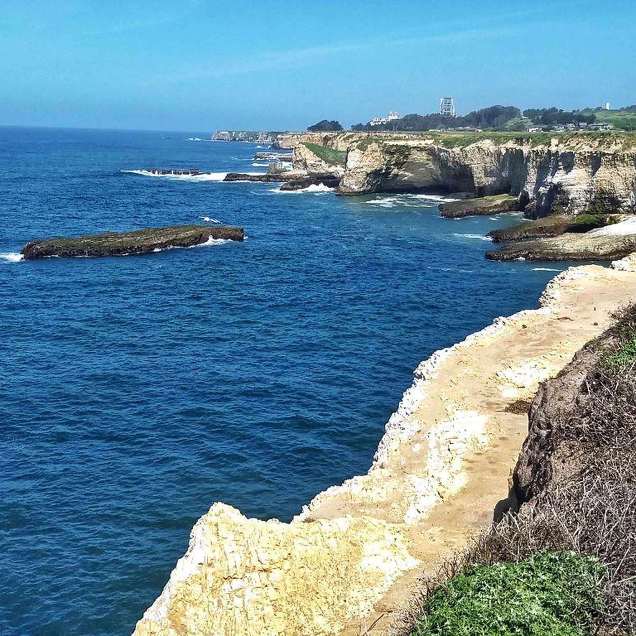
The Swanton Pacific Ranch loop from Santa Cruz offers a captivating road cycling experience, transitioning from the vibrant agricultural fields of artichokes and Brussels sprouts to expansive ocean vistas. You'll ride past iconic coastal viewpoints like the Davenport Pier Overlook and Shark Fin Cove, with redwood-covered slopes providing a lush backdrop. The route delivers a diverse journey through Santa Cruz County's varied environments.

This moderate 33.9-mile (54.5 km) loop, with 1501 feet (458 metres) of elevation gain, typically takes around 2 hours and 23 minutes. An early start, ideally before 10 AM, is recommended, especially between November and August, to avoid strong afternoon headwinds. The route is well-paved and features a generally wide shoulder along Highway 1, making it accessible for a range of fitness levels.

What makes this route stand out is its blend of accessibility and natural beauty, providing a rewarding ride without the extreme demands of steeper mountain roads. From the top of Swanton Road, you can even spot AΓ±o Nuevo Island, known for its elephant seal population. It's considered one of the most popular road cycling routes in the area, offering a comprehensive taste of the Santa Cruz region's charm.

Navigate with device

Send to Phone

Save

Moderate

The Bonny Doon & California Coastal National Monument loop from Santa Cruz offers a truly dynamic road cycling experience, transitioning from sweeping Pacific Ocean views to the cool, dense redwood forests of the Santa Cruz Mountains. You'll find yourself pedaling along the coast, then plunging into the quiet solitude of areas like Ice Cream Grade, where towering trees create a natural canopy. This route is a fantastic way to experience the diverse landscapes of the region, providing both challenging climbs and rewarding descents.

This moderate road cycling route covers 33.1 miles (53.3 km) with a significant 2802 feet (854 metres) of elevation gain, typically taking around 2 hours and 50 minutes to complete. It's a demanding ride that requires good fitness, especially for the strenuous sections of Bonny Doon Road. Starting from Santa Cruz, it's easily accessible, but be prepared for the substantial climbing involved. Ensure your bike is in good condition and you carry plenty of water for the duration.

This loop is famous in the cycling world, having been a proving ground for professional cyclists in the Tour of California, solidifying its reputation as one of the best road bike rides in the Santa Cruz area. The Bonny Doon climb itself is a notable feature, known for its challenging grades. While the California Coastal National Monument primarily refers to offshore features, the coastal segments of this loop provide continuous ocean views and connect you to the diverse onshore environments.

Moderate
guide_signup
Let us show you the way with the komoot mobile app
With aΒ free komoot account, you can easily find, customize, and navigate endless outdoor adventures.

Sign up for free

5.0

(1)

41

riders

67.8km

03:22

980m

980m

The Wilder Ranch Loop is a demanding 42.1-mile (67.8 km) road cycling route that promises a diverse and challenging experience, climbing 3225 feet (983 metres) over approximately 3 hours and 22 minutes. You'll traverse everything from packed dirt roads to technical singletrack, winding through coastal bluffs, open fields, and even redwood-timbered drainages. The route offers breathtaking ocean views, particularly along the Ohlone Bluff Trail, where you can gaze at white sand beaches and dramatic cliff faces, but be ready for a difficult ride that's better suited for gravel or mountain bikes than traditional road bikes.

Planning your visit to the Wilder Ranch Loop means preparing for varied terrain; some sections feature steep descents, tree roots, and rocky patches, so check trail conditions beforehand. Parking is available at Wilder Ranch State Park, and arriving early, especially on weekends, is a good idea to secure a spot. While there are no specific permit requirements, carrying ample water is essential, particularly on sunny coastal stretches.

What makes the Wilder Ranch Loop truly stand out is its incredible variety of landscapes packed into one park, offering a unique blend of coastal vistas and inland forests. While it's a difficult route for road cycling, it's a fantastic option for those seeking an advanced road cycling adventure on a more robust bike. For a less technical ride, you can explore the Highway 1 Bike Path nearby or stick to the smoother fire roads within the park.

Hard

The Wilder Ranch Bike Path – Shark Fin Cove Beach loop from Swift Halt is a fantastic road cycling route that truly showcases the diverse beauty of the Santa Cruz coastline. You'll pedal through coastal grasslands, past oak woodlands, and even catch glimpses of redwood forests, all while enjoying expansive views of the Pacific and Monterey Bay. The iconic Shark Fin Cove, with its distinctive natural arch, is a visual highlight that makes this 57.1-mile (91.8 km) journey particularly memorable.

This moderate route, which typically takes around 4 hours and 9 minutes to complete with 2938 feet (895 metres) of elevation gain, is best tackled with a gravel bike or a road bike with wider, more durable tires. While the Wilder Ranch Bike Path itself is a smooth, paved section, be aware that other parts of the loop can be unpaved, rocky, and bumpy, potentially requiring you to walk your bike on some uphill sections. Planning your visit for a clear day will maximize your enjoyment of the stunning ocean views.

Beyond the natural beauty, the route offers a glimpse into California's ranching past as it passes through Wilder Ranch State Park. Here, you can explore historic ranch buildings, including an 1897 Victorian home and an 1859 Gothic Revival farmhouse, adding a cultural layer to your ride. This blend of challenging terrain, historical insight, and breathtaking coastal scenery makes it one of the best road cycling loops near Santa Cruz for those seeking adventure.

Moderate

The Santa Cruz Boardwalk – Shark Fin Cove Beach loop from Beach Station (Santa Cruz) is a challenging road cycling adventure that showcases the best of the California coast. You'll pedal past the iconic Santa Cruz Boardwalk, then head north along the dramatic coastline, with continuous ocean views leading to the unique Shark Fin Cove. Expect a demanding ride, especially on Cloverdale Road, which features sustained climbs, but the reward is truly breathtaking scenery.

This difficult 71.4-mile (115.0 km) loop, with 3285 feet (1001 metres) of elevation gain, typically takes around 5 hours and 9 minutes to complete. Starting from Beach Station, it's a great option for those seeking popular road cycling routes Santa Cruz. While mostly paved, a few short unpaved sections might require dismounting, so come prepared for a varied terrain.

This route is a favorite among experienced cyclists for its combination of physical challenge and stunning natural beauty, including coastal bluffs and glimpses of redwood stands. It's one of the best road cycling loops Santa Cruz California has to offer, providing a memorable journey from the lively boardwalk to the serene, geological wonder of Shark Fin Cove.

Hard
Sign up for free to see 25 more rides around Davenport.

Get access to more routes and recommendations from other explorers.

Sign up for free

Already have an account?

Our route recommendations are based on thousands of hikes, rides, and runs completed by other people on komoot.

Start today with a free account

Your next adventure awaits.

Login or Signup
Popular around Davenport

Hiking around Davenport

MTB Trails around Davenport

Cycling around Davenport

Running Trails around Davenport

Tips from the Community

David B. Davis
August 30, 2025, Wilder Ranch Bike Path

What's special about this path is that it takes you from Santa Cruz to the Wilder Ranch Park without using Route 1. Once there, you have multiple dirt path choices to ride around up into the park.

0

0

Northern entrance to the coastal park from Delaware Ave. The trailhead is pedestrian and biker only, The former road goes straight to the beach, while smaller trails turn east into the Monarch Butterfly Natural Preserve, and West into the upper portions of the State Beach Park.

1

0

The Santa Cruz Beach Boardwalk is California's oldest surviving amusement park. This 24-acre park was founded in 1907 and offers old-fashioned carnival games and food booths.

0

0

Manoj
October 14, 2023, Downtown Pescadero

Stage road is blocked due to road work

0

0

From the Parking area a trail leads down to the water, while a great overlook with a bench is just ahead a few steps up.

0

0

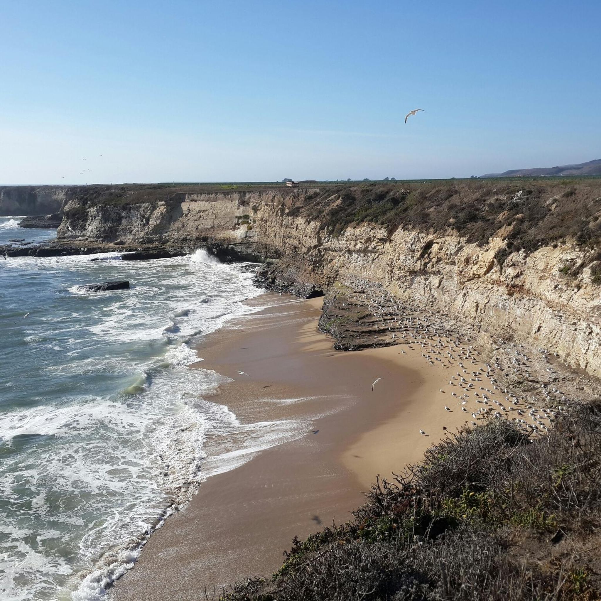
Scenic trails on the edge of the tall cliffs. Great views of the beach below.

0

0

Traveler
June 9, 2021, Davenport

Lovely little coastal town with great eateries and clifftop views

0

0

Long sandy beach at the mouth of Waddell Creek. Vault toilets an the parking area

0

0

Frequently Asked Questions

How many road cycling routes are available around Davenport?

Davenport offers a wide selection of road cycling routes, with over 25 different tours available. These routes cater to various skill levels, including 1 easy, 9 moderate, and 17 difficult options.

Are there easy road cycling routes in Davenport suitable for beginners or families?

Yes, Davenport has easy road cycling options. The Shark Fin Cove Beach – Wilder Ranch Bike Path loop from Swift Halt is a moderate route that can be enjoyed, offering a good balance for those seeking a less strenuous ride. The Duck Creek Parkway is also known for its paved, family-friendly sections.

What are some long-distance road cycling options near Davenport?

For longer rides, consider routes like the Downtown Pescadero – Shark Fin Cove Beach loop from Rincon, which spans over 77 miles (124 km). The region is also part of the American Discovery Trail and Great River Trail, offering extensive long-distance cycling opportunities.

Are there road cycling routes with scenic views of the Mississippi River?

Absolutely. The Mississippi River forms Davenport's eastern border, and many routes offer stunning river views. The Riverfront Trail, including a loop around Credit Island, provides excellent scenic vistas. You can even experience crossing the Mississippi River via the I-74 Bridge, which has dedicated bike access.

Can I find routes with varied terrain or hills in Davenport?

While Iowa is often perceived as flat, the Quad Cities area, including Davenport, features plenty of rolling hills and varied terrain. Routes like the Bonny Doon & California Coastal National Monument loop from Santa Cruz offer significant climbing and diverse landscapes, providing a good challenge for cyclists.

Are there any loop road bike trails in Davenport?

Yes, many road cycling routes in Davenport are designed as loops. For example, the Swanton Pacific Ranch loop from Santa Cruz is a popular option, offering a circular journey through varied landscapes.

What kind of attractions or landmarks can I see along the road cycling routes?

While cycling, you can explore various natural and historical landmarks. Highlights include the unique Fremont Tree and the striking Needle Rock. The Shark Fin Cove Beach is also a notable natural monument accessible from some routes. Additionally, the historic Vander Veer Botanical Park offers a peaceful escape with beautiful gardens.

What do other cyclists say about road cycling in Davenport?

The road cycling routes around Davenport are highly rated by the komoot community, with an average score of 4.0 stars from 8 reviews. Over 1,400 road cyclists have used komoot to explore the area, often praising the diverse terrain and scenic riverfront paths.

When is the best time of year for road biking in Davenport?

The spring, summer, and fall months generally offer the most pleasant conditions for road biking in Davenport. These seasons provide comfortable temperatures and vibrant scenery, especially along the Mississippi River and Duck Creek Parkway. Always check local weather forecasts before heading out.

Are there advanced or challenging road cycling routes in the Quad Cities area?

Yes, for experienced cyclists seeking a challenge, Davenport and the wider Quad Cities area offer several difficult routes. The Wilder Ranch Loop, for instance, is a difficult 42.1-mile trail with substantial elevation gain, providing a rigorous workout.

What natural features can I explore while cycling in Davenport?

Davenport's cycling routes allow you to experience diverse natural features. You can ride along the majestic Mississippi River, wind through the urban and natural landscapes of the Duck Creek Parkway, and encounter the unique ecosystem of Nahant Marsh, the largest urban wetland on the upper Mississippi River.

Where can I find parking for road cycling routes in Davenport?

Many of Davenport's parks and trailheads offer convenient parking for cyclists. For example, the Duck Creek Parkway passes through multiple parks like Emeis Park, Marquette Park, and Duck Creek Park, which typically have parking facilities. Credit Island Park also provides parking for accessing its riverfront trails.

Most popular routes around Davenport

Easy hikes around Davenport

Most popular attractions around Davenport

Places to see

Store rating

Get inspired with the komoot mobile app

With aΒ free komoot account, you can easily find, customize, and navigate endless outdoor adventures.

or

Join komoot Now

Store rating

Explore more

Browse the best Road cycling routes in other regions.

Santa CruzNeary Lagoon Wildlife RefugeTwin LakesNatural Bridges State ParkRockview Drive County ParkParadise ParkCoast Dairies State ParkWilder Ranch State ParkMoore Creek Upland Open Space PreservePasatiempoAptosScott Creek Beach And Bluffs County ParkSeacliffPogonip Open Space PreservePajaro DunesCapitolaHenry Cowell Redwoods State ParkLong Ridge Open Space PreserveThe Forest Of Nisene Marks State ParkLompicoFreedomSoquelDay ValleyCastle Rock State ParkLive OakAptos Hills-Larkin ValleyLa Selva BeachBonny DoonGlenwood Open Space PreservePleasure PointFeltonLoch Lomond Recreation AreaScotts ValleyCalifornia Coastal National MonumentEllicott Slough National Wildlife RefugeLodato Open Space PreservePace Family Wilderness ParkMount HermonBen LomondRio Del MarZayanteInterlakenBig Basin Redwoods State ParkAmestiWatsonvilleBig Creek ForestsCorralitosSan Lorenzo Valley Water DistrictBrookdaleBoulder CreekSoquel Demonstration State ForestWest Waddell Creek State Wilderness

Nearby adventure guides

Things to Do in California Coastal National Monument

background

Get ready to conquer new peaks

Sign up for Free

Explore
RoutesRoute plannerFeaturesHikesMTB TrailsRoad cycling routesBikepackingSitemap
Download the app
Follow Us on Socials

Β© komoot GmbH

Privacy Policy