The best road cycling routes around Coronita
5.0
(3)
107
riders
10
rides
Road cycling routes around Coronita are characterized by diverse terrain, including the foothills of the Santa Ana Mountains and the Santa Ana River. The region offers a blend of urban and natural landscapes, providing varied cycling experiences. Numerous regional parks serve as access points to routes that feature both challenging ascents and scenic, flatter sections. The area's topography supports a range of road cycling options, from shorter loops to longer, more demanding rides.
Best road cycling routes around Coronita
- The…
Last updated: July 10, 2026
34
riders
42.0km
02:32
390m
390m
Moderate road ride. Good fitness required. Mostly well-paved surfaces and easy to ride.
5.0
(1)
24
riders
60.2km
03:05
540m
540m
This moderate 37.4-mile (60.2 km) road cycling loop, taking about 3 hours and 5 minutes with 1785 feet (544 metres) of elevation gain, offers a fantastic ride along the Santa…

Sign up for free
10
riders
54.6km
02:22
310m
310m
Moderate road ride. Good fitness required. Mostly well-paved surfaces and easy to ride.
9
riders
This road cycling loop offers a diverse ride, blending the well-maintained paths of the Santa Ana River Trail with the elevated vistas near Mountain Gate Park. You'll pedal past the…
5.0
(1)
7
riders
102km
04:32
490m
490m
Moderate road ride. Good fitness required. Some segments of this route may be unpaved and difficult to ride.
Get access to more routes and recommendations from other explorers.
Sign up for free
Already have an account?
Our route recommendations are based on thousands of hikes, rides, and runs completed by other people on komoot.
Start today with a free account
Your next adventure awaits.
Login or Signup


Other adventures around Coronita

Tips from the Community

This smooth, paved, two-lane multi-use path takes you through the heart of Hidden Valley. The views from this part of the park are quite special.
0
0

Bring plenty of water. There only are water fountains midway in Anaheim.
0
0

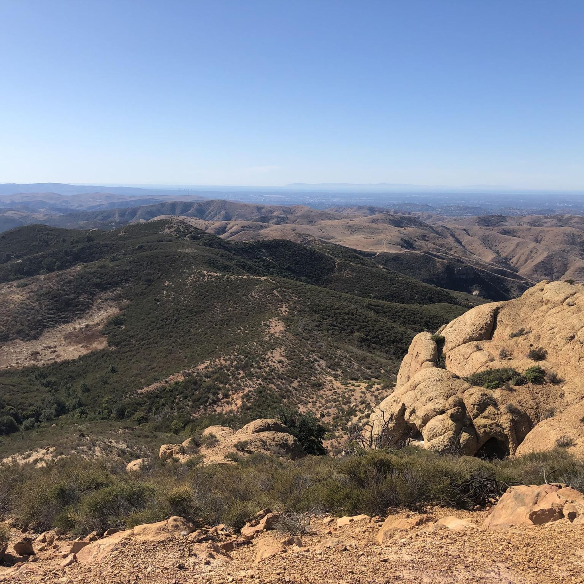
This view of Sierra Peak showcases one of the highest and most easily identifiable peaks in northern Orange County. It stands at 3,045 feet above sea level.
1
0

Nice wooden bridge along the Santa Ana River Trail. It takes you over the river and gives you a good view of the water.
1
0

Set along the edge of the Santa Ana Canyon this park offers visitors a variety of amenities such as sports fields, picnic & BBQ areas, fishing, playgrounds, and more. The Santa Ana Trail runs along the edge of the park and allows you to access other nearby areas as well.
0
0

At Hidden Valley Viewpoint, you'll find a shaded tree, an observation area, and useful maps. The trail to the viewpoint is unpaved, so you might need to hop off your bike and push it. Please proceed with caution. It's a great place to take a break in the shade.
1
0
This is a quiet and scenic stretch of the Santa Ana River Trail. The northern section closely follows the natural channel as it flows from the mountains. The trail runs alongside the river and offers a peaceful atmosphere with nice views of the surrounding area.
1
0
There is lots of parking here, and as you head away from the highway you have access to the paved two-lane Santa Ana River trail which stretches (nearly) all the way from San Bernardino to the Pacific Ocean. If you head west along the river trail you will come to Coal Canyon and can access the trails south of the highway.
1
0
Frequently Asked Questions
How many road cycling routes are available around Coronita?
There are 7 road cycling routes detailed in this guide for the Coronita area, offering a variety of experiences for different skill levels. The region's diverse terrain, including the Santa Ana Mountains foothills and the Santa Ana River, provides a range of options.
Are there beginner-friendly road cycling routes in Coronita?
While the routes in this guide are generally rated as moderate, the Roadbike loop from Santa Ana River Trail Parking is a shorter option at 14.6 miles (23.6 km) with less elevation gain, making it a good choice for those looking for a less strenuous ride. The Santa Ana River Bicycle Path, which forms part of several routes, also offers generally flatter sections suitable for less experienced riders.
What are some challenging road cycling routes in Coronita?
For a more challenging ride, consider routes that venture into the foothills of the Santa Ana Mountains. The Madrugada Trail loop from California Institution for Women, for example, features varied terrain with notable elevation gain over its 26.1 miles (42.0 km). Routes with segments like the 'Mt. Rubidoux KOM' or 'Foothill (Lincoln to Border) climb' mentioned in regional research will also offer significant ascents.
What kind of terrain can I expect on road cycling routes in Coronita?
Road cycling routes in Coronita offer a mix of terrain. You'll find flatter sections along the Santa Ana River, such as the Santa Ana River Trail Bridge – Angel Stadium loop, which provides diverse scenery. Other routes will take you into the rolling foothills of the Santa Ana Mountains, featuring more challenging ascents and descents with picturesque views.
Are there loop routes available for road cycling in Coronita?
Yes, many of the road cycling routes in Coronita are designed as loops, allowing you to start and end at the same point. Examples include the popular Santa Ana River Trail Bridge – Angel Stadium loop and the Roadbike loop from Santa Ana River Trail Parking, providing convenient circular journeys.
Where can I find parking for road cycling routes in Coronita?
Many routes in Coronita utilize regional parks as starting points, which often provide dedicated parking facilities. For example, the Santa Ana River Trail Bridge – Angel Stadium loop and the Roadbike loop from Santa Ana River Trail Parking both indicate starting from Santa Ana River Trail Parking, suggesting available spots there. Other parks like Corona Regional Park or Corona Hills Regional Park also serve as access points.
What are some scenic viewpoints or attractions to see along the road cycling routes?
While cycling, you can enjoy views of the Santa Ana Mountains and the Santa Ana River. For specific points of interest, consider routes that pass near highlights such as Sierra Peak Summit for panoramic vistas, or areas near Black Star Falls for a natural wonder. The View of Sierra Peak – Santa Ana River loop from Corona–West is specifically named for its scenic outlooks.
What do other road cyclists say about the routes in Coronita?
The road cycling routes around Coronita are highly regarded by the komoot community, holding an average rating of 4.3 stars from over 5 reviews. More than 300 road cyclists have explored the area using komoot, often praising the varied terrain and scenic beauty along the Santa Ana River and towards the Santa Ana Mountains.
What is the best time of year for road biking in Coronita?
Coronita, being in Southern California, generally offers good road cycling conditions year-round. However, spring and fall provide the most pleasant temperatures, avoiding the hotter summer months and potential winter rains. Always check the local weather forecast before heading out.
Are there any routes that follow the Santa Ana River?
Yes, the Santa Ana River is a prominent feature of road cycling in Coronita. The Santa Ana River Trail Bridge – Angel Stadium loop is a prime example, following the river and offering diverse scenery. Another option is the Hidden Valley Viewpoint – Santa Ana River Trail loop from Norco College, which also incorporates sections along the river.
Can I find routes that offer views of Sierra Peak?
Absolutely. The View of Sierra Peak – Santa Ana River loop from Corona–West is specifically designed to showcase views of Sierra Peak, a notable landmark in the Santa Ana Mountains. This route combines river sections with elevated perspectives.
Most popular routes around Coronita
Most popular attractions around Coronita

Get inspired with the komoot mobile app


Explore more
Browse the best Road cycling routes in other regions.
