The best cycling routes around Black Point-Green Point
4.8
(51)
444
riders
52
rides
Touring cycling around Black Point-Green Point features a network of pathways and loops that traverse diverse natural areas. The region is characterized by its proximity to waterways, including creeks and a bay, offering routes that often follow these natural features. Terrain typically includes flat sections along pathways and some gentle ascents, providing varied cycling experiences. Preserved natural areas and open spaces are common along many routes.
Best touring cycling routes around Black Point-Green Point
- The most popular touring cycling route…
Last updated: July 8, 2026
4
riders
25.7km
01:41
180m
180m
Cycle the moderate 16.0-mile Old Town Novato & Rush Creek Preserve loop, exploring urban areas and scenic wetlands in 1 hour and 41 minutes.
4
riders
18.9km
01:26
160m
160m
Explore the Rush Creek and Bahia Trail Loop, a moderate 11.7-mile touring cycling route near Novato, featuring marsh and oak landscapes.

Sign up for free
8.99km
00:32
30m
30m
Easy 5.6-mile touring cycling loop around Scottsdale Pond and along the SMART Pathway, with 111 feet of elevation gain.
28
riders
16.3km
01:15
110m
110m
Easy bike ride. Great for any fitness level. Mostly paved surfaces. Suitable for all skill levels.
22
riders
22.5km
01:49
120m
120m
Easy bike ride. Great for any fitness level. Mostly paved surfaces. Suitable for all skill levels.
Get access to more routes and recommendations from other explorers.
Sign up for free
Already have an account?
Our route recommendations are based on thousands of hikes, rides, and runs completed by other people on komoot.
Start today with a free account
Your next adventure awaits.
Login or Signup

Tips from the Community

This is a small park with a 10-acre pond and some trails along the shore. There are usually quite a few birds around, you might even spot a large pelican from time to time.
0
0

Miwok Park is a beautiful 22-acre area with a creek running through bay laurels and redwoods. It is named for local Indigenous people and serves as the home to the Museum of the American Indian. A replica of a traditional Miwok home is located outside of the museum, along with a garden containing plants that were important to the Miwok. There are two bocce courts, a playground, a picnic area, and an expansive grassy lawn, making it a nice place to stop and stretch your legs.
0
0
Atherton Avenue connects downtown Novato to Highway 37 and is a popular shortcut road for cars and bicycles. It has a nice wide bike lane, offering a safe, direct passage without worrying about heavy traffic and a longer route on Highway 101.
0
0
This is a nice small neighborhood park with an open space lawn area next to a lovely playground surrounded by paved pathways perfect for cycling. There are benches, picnic tables and a drinking fountain with a water bottle filler.
1
0
This path is a nice paved multi-use route lined with trees and shrubbery. It is part of the SMART Pathway system and divides into multiple segments for easy cycling access across downtown and the valley. This portion runs parallel to the commuter rail line south of downtown Novato for 0.9 miles and passes by Slade Park before ending on Rowland Way.
0
0
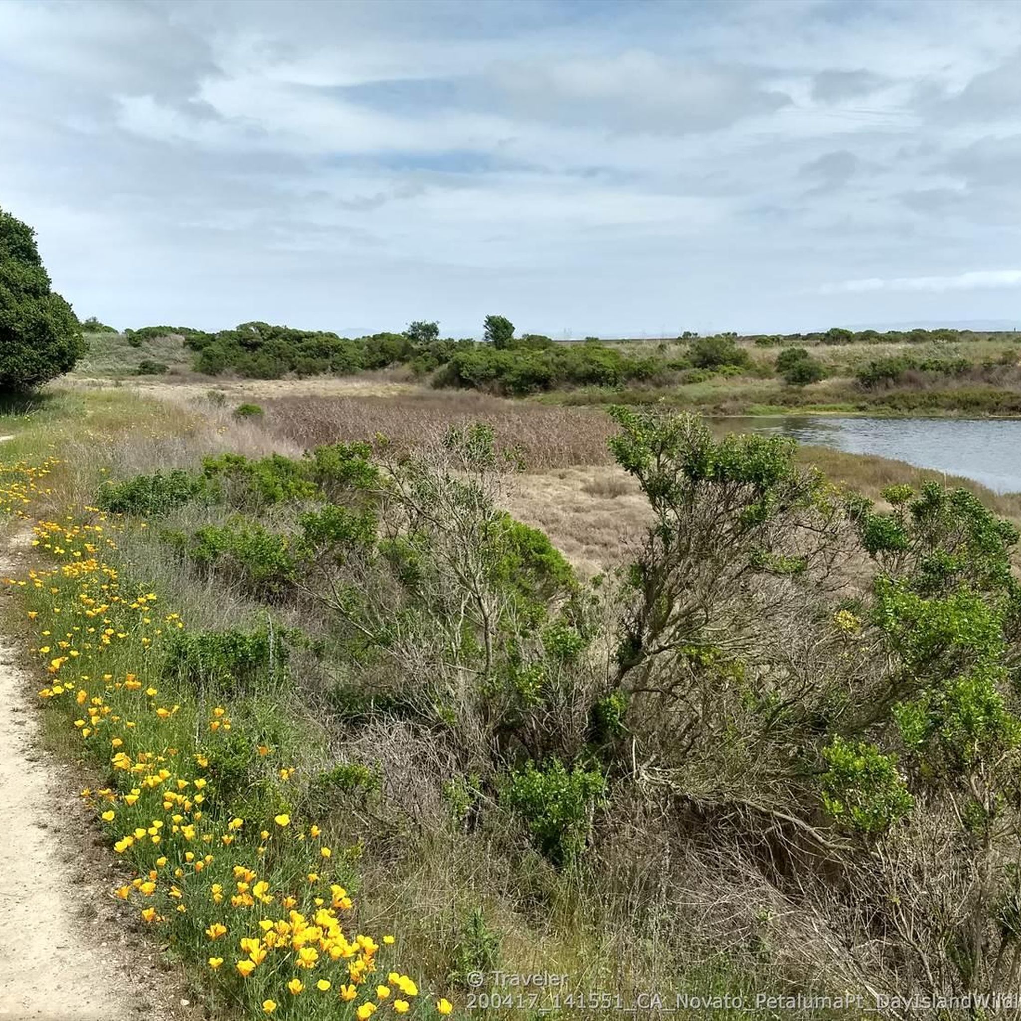
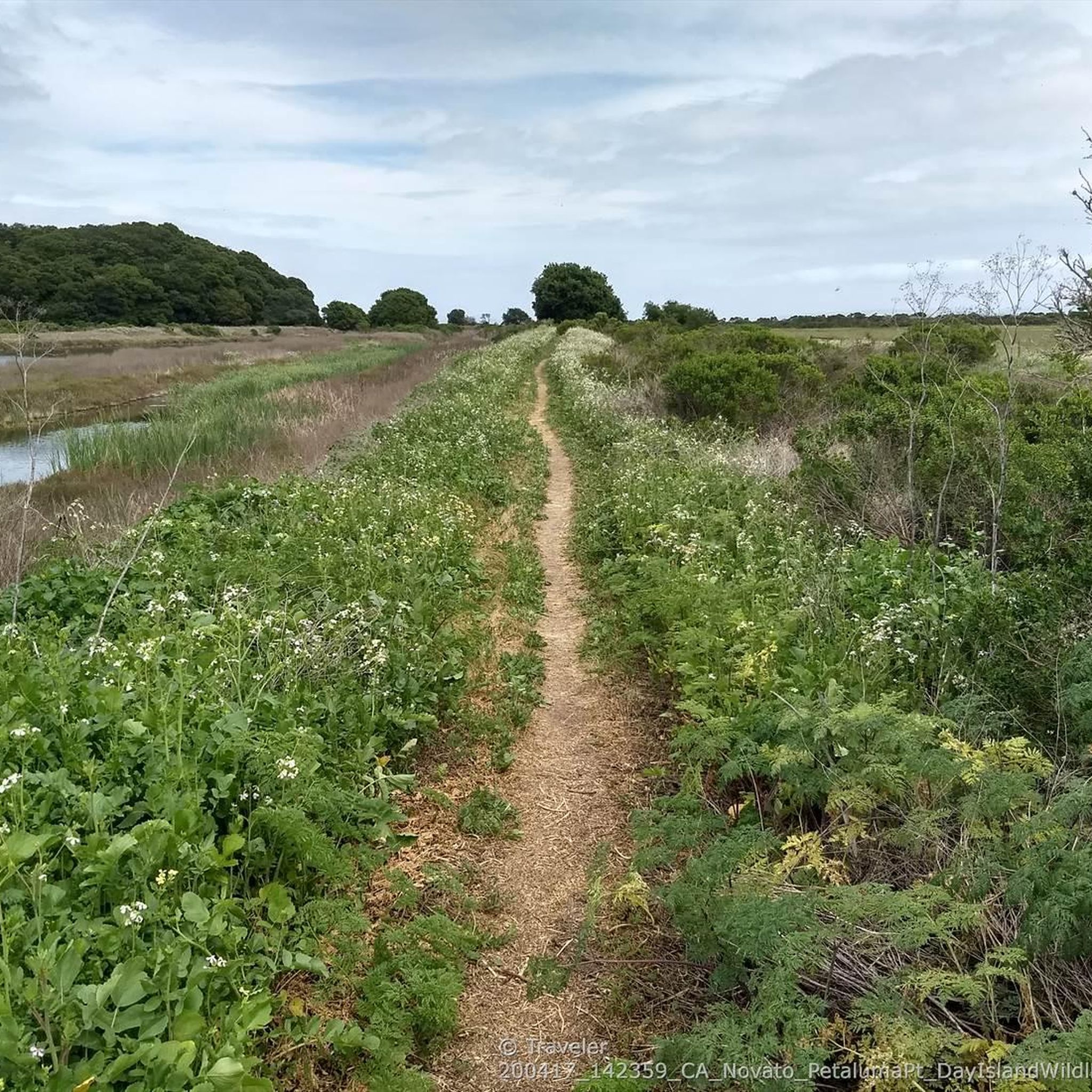
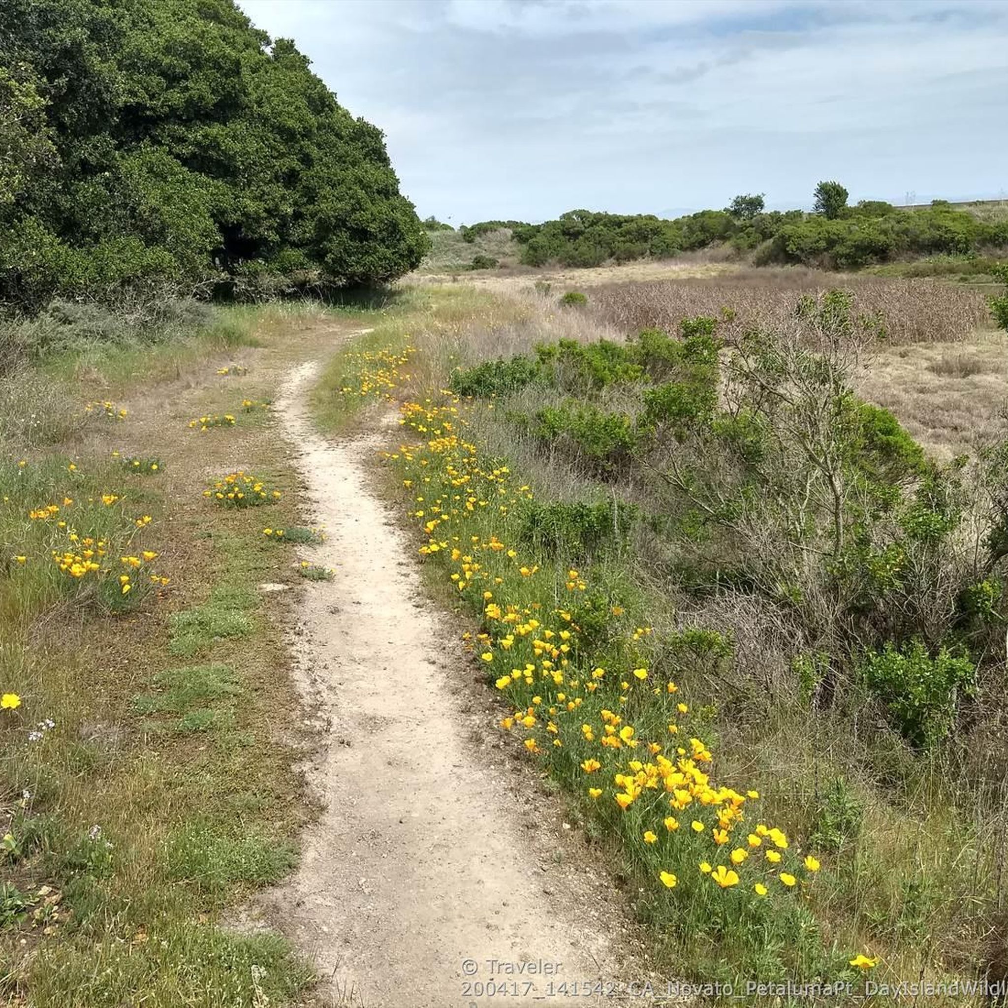
This trail runs along the edge of the Petaluma River wetlands and is a popular multi-use trail, so keep an eye out for others on the trail. The wetlands are an important area for wildlife, and are currently undergoing habitat restoration to improve conditions for native plants & animals.
0
0

The downtown area of Novato stretches along Grant Avenue, with the Old town from the Train Station west to Redwood Boulevard, and more recent development a couple blocks further west.
0
0
The position of this vintage 1960s station wagon at the remote and roadless northern side of the Bahia is a fascinating mystery that can motivate creative story telling. The most plausible explanation might be that it was driven to the top of Bahia ridge when the preserve was still a mostly grass-covered ranchland, and somehow rolled down the hill and crashed. The trees that grew around it after grazing ended seem to be lifting the wreck up as they grow and grab the metal in various places with their bark.
1
0
Frequently Asked Questions
How many touring cycling routes are available in Black Point-Green Point?
There are over 45 touring cycling routes in the Black Point-Green Point area, offering a wide range of options for different skill levels and preferences.
What do other touring cyclists enjoy about the routes in Black Point-Green Point?
The touring cycling routes in Black Point-Green Point are highly rated by the komoot community, with an average score of 4.5 stars from over 40 reviews. Cyclists often praise the diverse natural areas, the proximity to waterways like creeks and the bay, and the well-maintained dedicated pathways.
Are there easy touring cycling routes suitable for beginners in Black Point-Green Point?
Yes, Black Point-Green Point offers a good selection of easy touring cycling routes, with 20 routes categorized as easy. An excellent option for a relaxed ride is the Scottsdale Pond and SMART Pathway Loop, which is 5.6 miles (9.0 km) long and leads through pond areas and along a dedicated pathway.
Are there challenging touring cycling routes for experienced cyclists?
For experienced cyclists seeking a challenge, Black Point-Green Point has 11 difficult touring cycling routes. Consider the Enfrente Pathway – Nicasio Reservoir loop from Novato San Marin, a demanding 35.2 miles (56.6 km) route with significant elevation gain, or the Historic Dixie Schoolhouse – Big Rock Ridge loop from Novato Downtown, which covers 28.7 miles (46.2 km) and features over 1,100 meters of ascent.
Can I find circular touring cycling routes in the Black Point-Green Point area?
Many touring cycling routes in Black Point-Green Point are designed as loops, allowing you to start and end at the same point. Examples include the popular Rush Creek and Bahia Trail Loop and the Old Town Novato & Rush Creek Preserve loop.
What kind of terrain can I expect on touring cycling routes in Black Point-Green Point?
The terrain in Black Point-Green Point typically features flat sections along dedicated pathways, creekside paths, and some gentle ascents. Routes often traverse preserved natural areas and open spaces, providing a varied cycling experience with views of waterways and natural scenery.
What natural attractions or landmarks can I explore while cycling?
While cycling in Black Point-Green Point, you can explore several natural attractions and landmarks. Highlights include Stafford Lake Park, the scenic The Big Rock - Skywalker Ranch, and the Mount Burdell Open Space Preserve. Many routes also follow dedicated cycleways like the Terra Linda to Ignacio Bike Path and the Novato Lake Dam Bike Trail.
Are there touring cycling routes accessible by public transport?
Many routes in the Black Point-Green Point area are designed to be accessible, and the region's dedicated pathways, such as sections of the SMART Pathway, often connect to urban areas where public transport options might be available. It's advisable to check local transit schedules and bike-on-board policies for specific starting points.
Are there touring cycling routes with parking available?
Yes, many touring cycling routes in Black Point-Green Point have designated parking areas at their trailheads or nearby. Routes that start near parks or urban centers typically offer convenient parking facilities. It's recommended to check specific route details on komoot for parking information at your chosen starting point.
What is the best time of year to go touring cycling in Black Point-Green Point?
The Black Point-Green Point area generally offers pleasant cycling conditions during spring and fall, when temperatures are mild and the weather is often clear. Summer can also be enjoyable, though it may be warmer, while winter might bring more rain. Always check the local weather forecast before heading out.
Are there family-friendly touring cycling routes in Black Point-Green Point?
Yes, the region has several family-friendly options, particularly among its 20 easy routes. The dedicated pathways and relatively flat sections make them suitable for families. The Scottsdale Pond and SMART Pathway Loop is a great choice for families due to its manageable distance and scenic, safe environment.
Most popular routes around Black Point-Green Point
Most popular attractions around Black Point-Green Point

Get inspired with the komoot mobile app


Explore more
Browse the best Cycling routes in other regions.
