The best walks and hikes around Bass Lake
4.6
(21)
139
hikers
23
hikes
If you've ever tried planning hiking around Bass Lake, you know how quickly the options can feel overwhelming. With so many trails to choose from, it's hard to tell which ones are genuinely worth your time and effort, and which are just filler. That's where we come in. Our komoot community has explored, mapped, and reviewed these routes, so we've curated a shortlist of the very best to save you the guesswork.
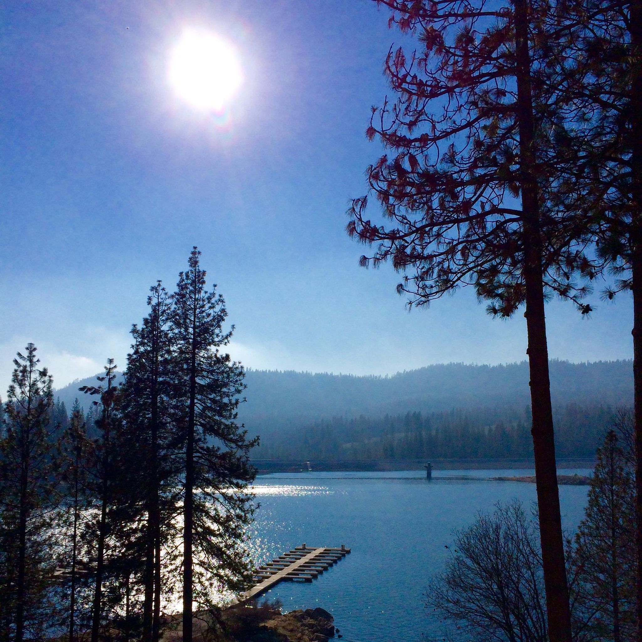
Hiking around Bass Lake means immersing yourself in the beautiful Sierra National Forest. You'll find everything from gentle lakeside strolls to more challenging ascents that reward you with sweeping views. The terrain is a mix of pine woodlands and granite outcroppings, with the lake itself often serving as a stunning backdrop. If you're visiting in spring, expect the waterfalls to be particularly vibrant thanks to the snowmelt.
For a rewarding challenge with incredible payoffs, we'd start with the Goat Mountain Loop Trail, a moderate 9.5 miles (15.2 km) route that takes you to a fire lookout with panoramic views. If you only have time for one, this is it. For something shorter and family-friendly, the Willow Creek Trail is an easy 1.3 miles (2.1 km) walk leading to beautiful cascades. Ready to explore? Dive into our komoot collection and discover your next favorite trail.
Last updated: May 10, 2026
5.0
(2)
17
hikers
8.91km
02:44
320m
320m
The Angel Falls and McCleod Flat Loop offers a refreshing escape into the Sierra National Forest, tracing Willow Creek through woodlands and over polished granite. You'll discover multiple waterfalls along the way, including the impressive Angel Falls with its unique natural pools, and the striking Devil's Slide. The trail provides a dynamic landscape, blending shaded paths with open granite slabs, making for a varied and engaging experience.
This moderate 5.5-mile (8.9 km) loop involves 1051 feet (320 metres) of elevation gain and typically takes about 2 hours and 44 minutes. It's best hiked between May and October when conditions are most favorable, but be prepared for potentially slippery granite sections, especially after rain. Good hiking shoes are essential, and trekking poles can be helpful for stability on the uphill climbs.
Part of the larger Willow Creek Trail system, this loop is notable for its concentration of aquatic features and diverse terrain near Bass Lake. The combination of waterfalls and granite formations creates a distinct natural environment, offering a rewarding outing for those seeking a scenic hike without an extreme challenge. Remember to stay on designated paths and avoid climbing on or around the waterfalls due to slick rocks and dangerous conditions.
5.41km
01:50
450m
10m
The Goat Mountain Trail in Sierra National Forest offers a rewarding journey through a mixed coniferous forest, eventually revealing sweeping panoramic views of the High Sierra and Bass Lake. You'll navigate singletrack sections, sharing the path with mountain bikers, as you steadily climb towards the viewpoints. In spring, the route comes alive with snowmelt streams and distant glimpses of snow-capped peaks, providing a dynamic natural experience.
This moderate 3.4-mile (5.4 km) hike involves 1475 feet (450 metres) of elevation gain, typically taking around 1 hour and 50 minutes to complete. It's accessible year-round, but if you plan to visit in the off-season, be prepared for snow and consider bringing microspikes or snowshoes. Parking is usually available at the trailhead, though an early start is recommended on busier days.
Beyond its scenic beauty, the Goat Mountain Trail is a great option for those seeking a solid workout without committing to an all-day trek. Its year-round accessibility and varied terrain, from dense forest to open vistas, make it a versatile choice for experiencing the natural features of the Sierra Nevada, whether you're looking for spring wildflowers or a winter adventure.

5.0
(2)
4
hikers
1.36km
00:26
60m
60m
The Willow Creek Trail offers a delightful, brief escape into nature, culminating in the serene Angel Falls. This easy hiking route is perfect for those seeking a quick dose of natural beauty without a strenuous climb. You'll find yourself on a straightforward path, making it accessible for most hikers looking for a scenic reward.
Planning your visit to this Madera County gem is simple. The trail is short, so you won't need extensive preparation, but always bring water. Parking information isn't detailed, so arrive early during peak seasons to secure a spot. It's a great option for a spontaneous outing or to complement a day spent exploring the Bass Lake area.
This particular Willow Creek Trail, located in California's Madera County, stands out as an easy, family-friendly option to experience a waterfall. Its short 0.8-mile (1.4 km) length and minimal 205 feet (62 metres) of elevation gain mean you can reach Angel Falls in just about 26 minutes. It's a fantastic choice for beginner hiking or for those with limited time, offering a peaceful natural feature without the commitment of a longer trek.
3.0
(1)
2
hikers
2.10km
00:39
80m
80m
The Willow Creek Trail is a delightful, easy hike that guides you through a serene riparian landscape, often accompanied by the gentle murmur of the creek. You'll traverse shaded forested areas, keeping an eye out for local wildflowers, before reaching the charming Angel Falls, a perfect spot for a peaceful break. This 1.3-mile (2.1 km) route, with its modest 256 feet (78 metres) of elevation gain, is a fantastic option for a quick nature fix, typically taking around 39 minutes.
Planning your visit to the Willow Creek Trail is straightforward; parking is usually available at the trailhead, but it's wise to arrive early on busy days to ensure a spot. This trail is generally accessible year-round, though checking current conditions is always recommended, especially during seasonal changes. Remember to bring water, even for this short outing, to stay hydrated.
Willow Creek Trails are often celebrated for their diverse ecosystems, making them excellent locations for wildlife viewing, including various bird species. This particular route offers a high reward for minimal effort, providing a tranquil escape into nature without requiring a full day's commitment. It's a great choice for families or anyone seeking an accessible and scenic outdoor experience.
1
hikers
15.2km
04:44
590m
590m
If you're looking for a rewarding day hike in the Sierra National Forest, the Goat Mountain Loop Trail offers a great experience. This moderate 9.5-mile (15.2 km) route takes you through diverse landscapes, from tranquil forests to open areas with expansive views. You'll encounter the peaceful Bass Lake along the way, providing a scenic spot to pause before continuing your ascent. The trail's varied terrain keeps things interesting, making it a good choice for hikers who appreciate a mix of scenery and a consistent workout.
To make the most of your trip, plan to start your hike early, especially if you're visiting on a busy day, to ensure you find a good parking spot at the trailhead. The trail is well-suited for spring and fall when the weather is most pleasant, but always bring enough water, as the 4 hours and 44 minutes duration and 1938 feet (591 metres) of elevation gain can be demanding. Check local conditions before you go, especially regarding weather and any potential seasonal considerations.
The Goat Mountain Loop Trail is notable for its continuous climb to the Goat Mountain Lookout, offering hikers a sense of accomplishment and panoramic vistas of the surrounding Madera County landscape. While not as dramatic as some of the volcanic trails in the Pacific Northwest, this Sierra National Forest gem provides a classic California hiking experience. It's a solid option for those seeking a moderate challenge and beautiful natural features without the extreme difficulty of some other Goat Mountain trails.
Get access to more routes and recommendations from other explorers.
Already have an account?
Our route recommendations are based on thousands of hikes, rides, and runs completed by other people on komoot.
Start today with a free account
Your next adventure awaits.
Popular around Bass Lake

Tips from the Community

This is a nice trail along the creek that passes a few waterfalls and has some shaded spots to get out of the sun. The water level is highest during the spring melt season, then the wildflowers pop out for some extra eye candy.
0
0

Great lookout point onto Bass Lake and the Sierra National Forest. There is a fire lookout at the top, that was originally built in 1934. Currently, the site is only used as a radio relay site and not for fire detection.
0
0

Goat Mountain got its name when Bass Lake was created. Goats would be brought in to stamp down the dirt in the lake, when the goats were released they migrated to the mountain. The goats have since been eradicated, so you won't find them today.
0
0

Angel Falls is one of two waterfalls in this area. The Willow Creek cascades over some slick rock, carving a little gorge into the rock. Another waterfall is Devil's Slide further north of here. Ultimately, Willow Creek flows into Bass Lake.
2
0
The first version of the fire lookout was built in the early 20th century and up until today, the rebuilt tower from mid 20th century overlooks Bass Lake and is a popular hiking destination.
1
0
Bass Lake is a great area for recreation. You can hike, go fishing or biking. It is an artificial lake that was created by building the Crane Valley Dam across Willow Creek which is a tributary to the wild San Joaquin River.
2
0
Frequently Asked Questions
Are there any dog-friendly hiking trails near Bass Lake?
Yes, many trails in the Sierra National Forest around Bass Lake are dog-friendly, but your dog must be on a leash. The trails offer a great opportunity for you and your canine companion to explore the lakeside and forest scenery together. Always check specific trailhead regulations before you start.
What are the best trails for seeing waterfalls?
For waterfalls, the area around Willow Creek is your best bet. The Angel Falls loop is a short, rewarding hike that leads to a series of beautiful cascades. The water flow is most impressive in the spring and early summer, and the pools at the base of the falls are popular spots for a refreshing dip on warm days.
Are there any easy, family-friendly hikes in the area?
Absolutely. The Way of the Mono Trail is a great option for families. It's a short, 0.6-mile loop that offers fantastic views from a rocky outcrop and provides a glimpse into the history of the Mono people. It's an easy walk with a bit of elevation that makes it feel like a small adventure.
What is the best time of year to hike around Bass Lake?
Spring and fall offer the most pleasant hiking conditions with mild temperatures and fewer crowds. Spring is particularly beautiful with flowing waterfalls and blooming wildflowers. Summer is also popular, especially for hikes that include opportunities for swimming, as temperatures can get quite warm. Winter can bring snow, making some trails suitable for snowshoeing.
Do I need a permit to hike at Bass Lake?
For day hiking on most trails around Bass Lake within the Sierra National Forest, you typically do not need a permit. However, permits are required for overnight backpacking trips into wilderness areas. Campfire permits are also required if you plan to have a fire or use a camp stove. Always check the official Sierra National Forest website for the most current regulations before your trip.
Are there any challenging hikes with rewarding views?
Yes, for a more strenuous hike with a big payoff, consider the Goat Mountain from Bass Lake trail. This route involves a significant climb up to a historic fire lookout, rewarding you with panoramic views of Bass Lake and the surrounding Sierra Nevada landscape.
What do other hikers enjoy most about the trails around Bass Lake?
The area is highly rated by the komoot community. Reviewers often praise the stunning lake views, the well-maintained forest trails, and the variety of hikes available, from easy lakeside strolls to more challenging mountain ascents. The accessibility of beautiful natural features like Angel Falls is also a frequently mentioned highlight.
Is it possible to hike from Bass Lake to Yosemite National Park?
While Bass Lake is only a 30-minute drive from Yosemite's south entrance, there are no direct, established hiking trails that connect the two. The most practical way to experience both is to use Bass Lake as your basecamp and drive into the park for day hikes.
What should I pack for a day hike at Bass Lake?
You should bring plenty of water, especially during the warm summer months. Sunscreen, a hat, and sunglasses are essential for sun protection. Wear sturdy hiking shoes, as some trails can be rocky. It's also wise to pack snacks, a small first-aid kit, and a map of the area or have your route downloaded for offline use.
Are there any circular hikes available?
Yes, there are several loop trails. The Bass Lake loop from Bass Lake is a popular moderate option that takes you on a 5.3-mile (8.5 km) circuit through the Sierra National Forest, offering varied scenery without having to backtrack.
Where can I find parking for the trails?
Most major trailheads, such as the Willow Creek Trailhead, have designated parking areas. However, these can fill up quickly, especially on weekends and during the summer. It's best to arrive early to secure a spot. Some trail access points may be along roadsides, so be sure to park legally and safely.
How many hiking trails are there around Bass Lake?
There are over 15 designated hiking routes around Bass Lake featured on komoot. These trails range from easy, short walks perfect for families to more moderate climbs, ensuring there's a path for nearly every skill level.
Most popular attractions around Bass Lake

Get inspired with the komoot mobile app


Explore more
Browse the best Hikes in other regions.
